Hurricane Agnes
-
Posts
9,264 -
Joined
Content Type
Profiles
Blogs
Forums
American Weather
Media Demo
Store
Gallery
Everything posted by Hurricane Agnes
-
That 2nd band is getting close to me now. Will see how it manifests as the snow here through the event, has been generally light to moderate (haven't had any whiteout conditions yet). I'm also curious how far east that lake effect popcorn snow is going to get and if it reaches here.
-
I remember when they changed the tone (key) of the hour/half hour time beep and eventually got so much bad feedback that they changed it back. So maybe one day... one day. Dry air continues to ooze in and my dp is now down to 20 (temp still 27).
-
Currently in the lull between bands. Temp is 27 and dp continues to drop and is at 22.
-
Radio anchor at KYW was just reporting earlier that "visibility was poor" downtown where they are (the studio is up in one of the buildings at 24th and Market - I think the Aramark building).
-
Ack. It's hard to travel in the winter. Supposed to have a low of 37 down in Clearwater tonight but should warm up tomorrow (perhaps to Philly area "warm" in 60s vs Florida "warm") and even warmer the rest of the week.
-
Here comes the colder air. Getting some really gusty winds and finer SN with blowing. Temp down to 27 with dp down to 23.
-
Getting dark here again and now getting some light snow. Temp is 30 with dp 24.
-
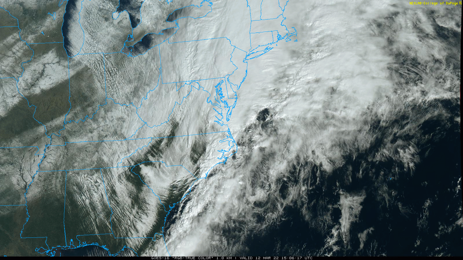
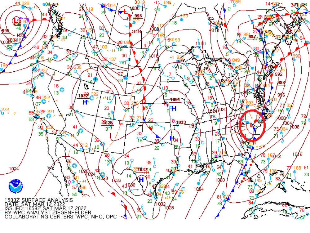
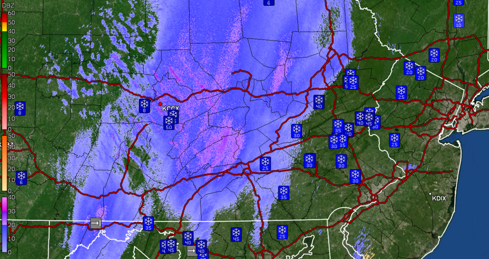
Here is a recent WPC surface analysis showing that "other" low (circled) that is apparently feeding that incoming band. You can see the main low off the coast of LI.
-
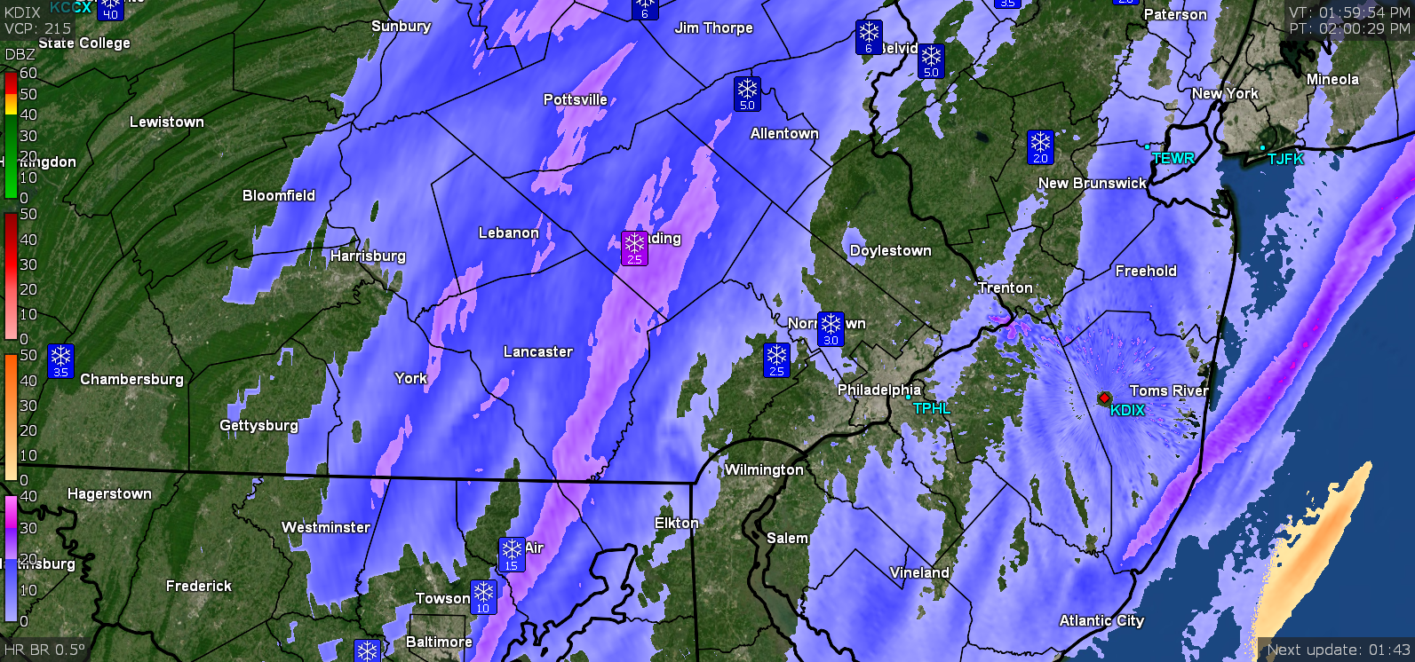
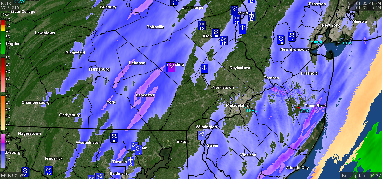
This is just wild - the lake effect snow is not blowing over PA from Lake Erie but is coming all the way from Lake Michigan.
-
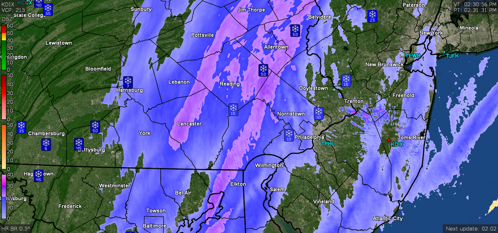
Currently overcast and still 31 but the dp continues to drop and is down to 24. Will see if that heavier band holds together as it moves west.
-
Was trying to point and click to it but finally got to the SPS that was issued for the area -
-
Currently overcast with temp still below freezing but creeping up (heat of the day). Temp is 31 with dp 25 (which has been creeping down). Will see if that band out west holds together. I expect a cold blast behind it regardless.

-
There was an initial PNS and LSR that issued around the 1 pm timeframe and KPHL didn't report for either of those. I expect they might for the next one. I saw where a spotter in Willow Grove report ZR.
-
It wasn't really progged to have as much S/E even with the latest guidance and was originally expected to be mostly rain with some tail-end switchover as the cold front came through as the precipitation moved away (assuming one ignored the clown maps and maybe looked at the snow depth). So any snow that did happen was a bonus (at least for those who like snow). We have been under a WWA - and some of that was due to an upcoming flash freeze to happen later. The latest from Mt. Holly for us quislings in the SE -
-
I am "in PHL" although not at the airport and have at least an inch at last measurement (there is a little new stuff on the part of the board I cleared). Want to see if a round 2 comes to fruition or gets shredded coming over the mountains.
-
It does look just like that! It is moving westward. Will see if there is any oomph left to it if it makes it this far.
-
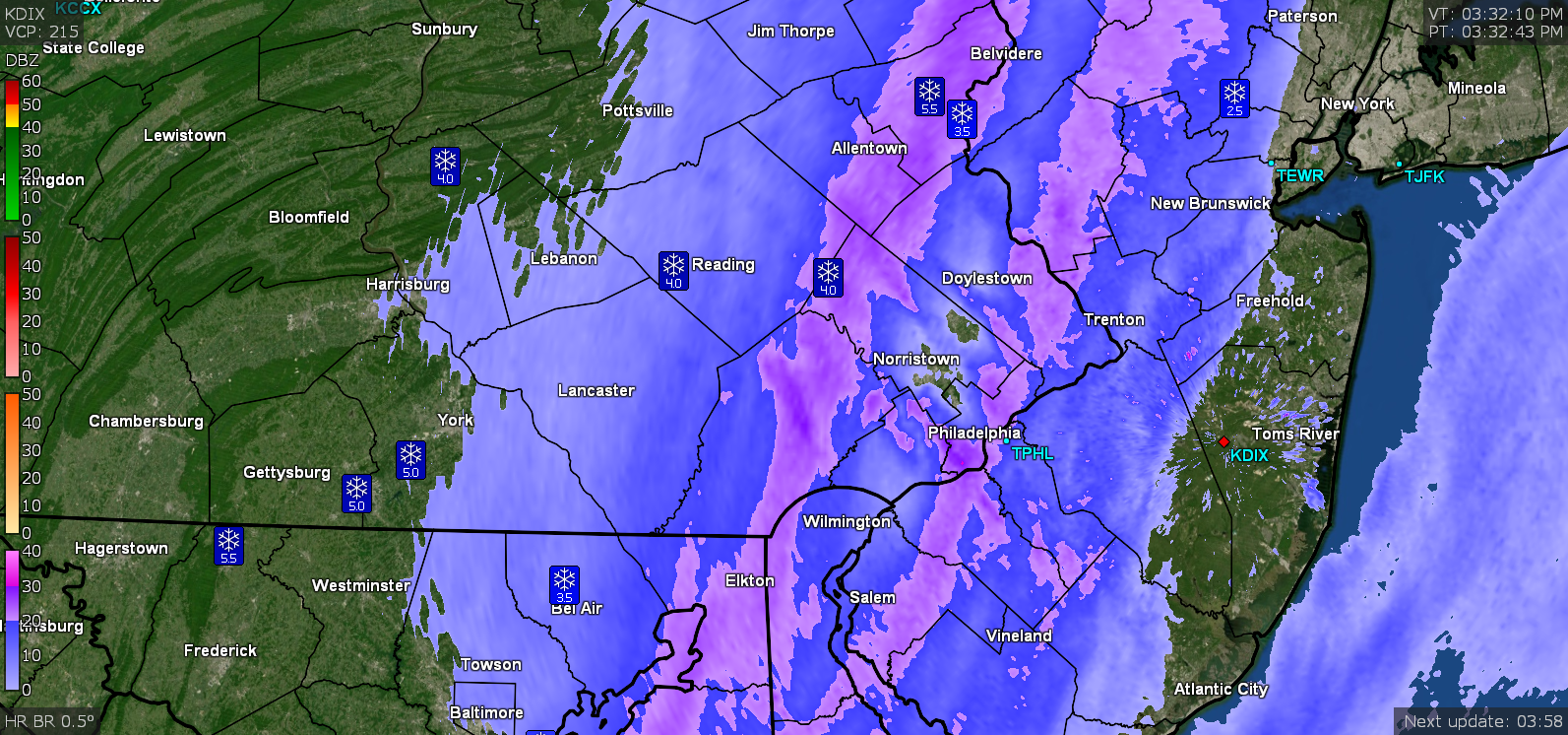
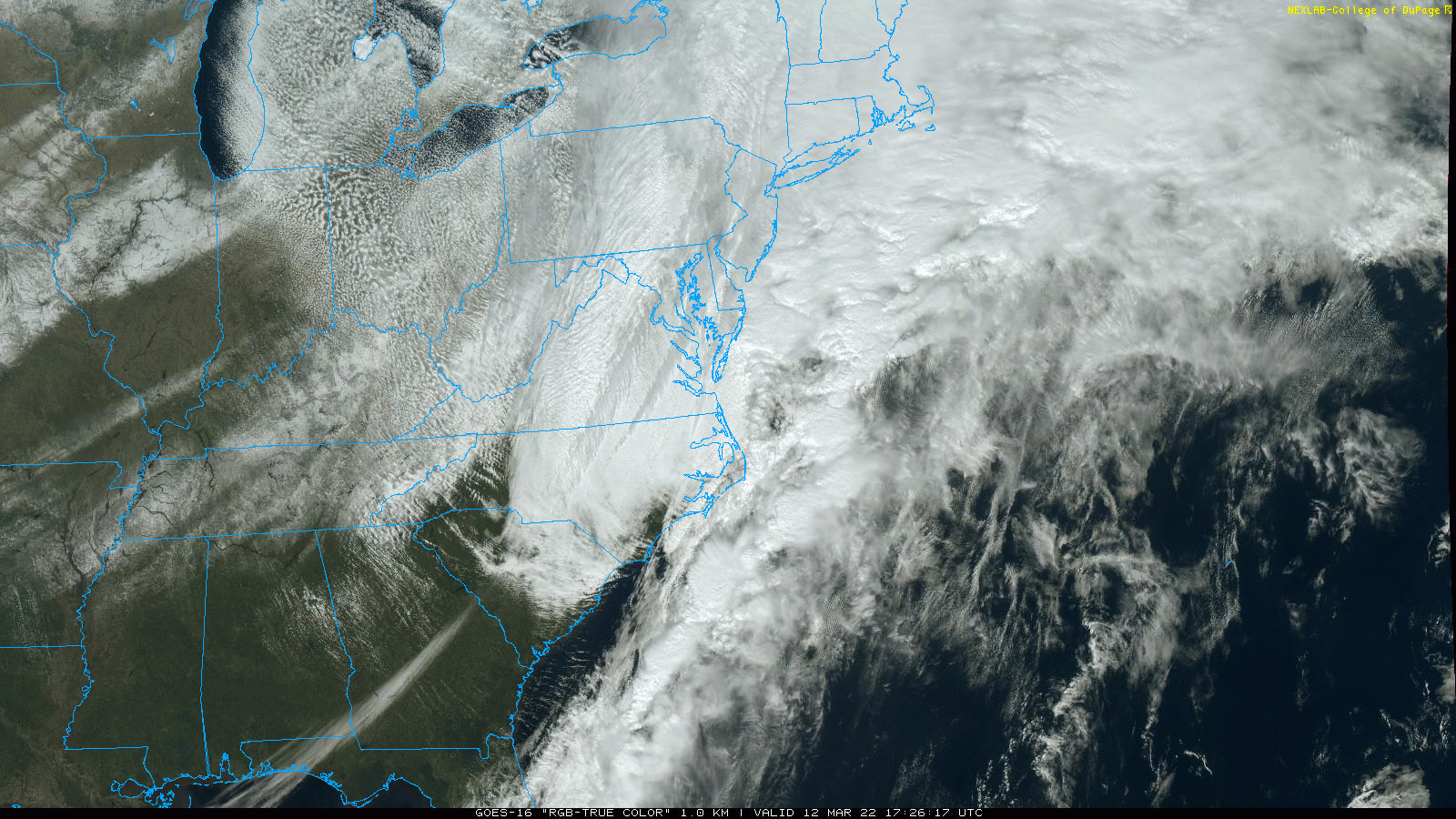
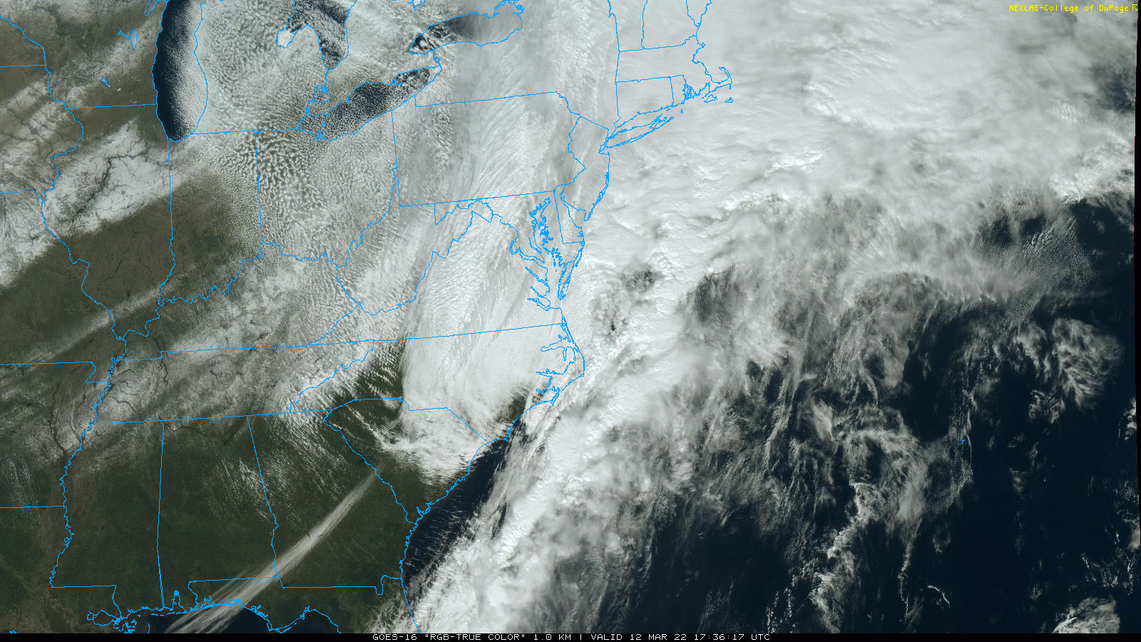
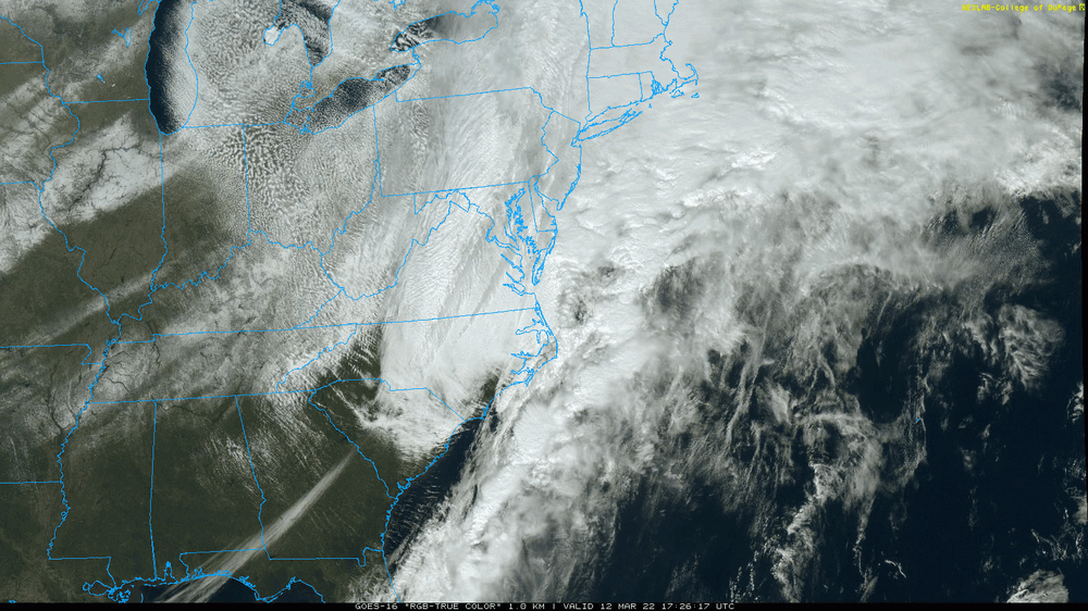
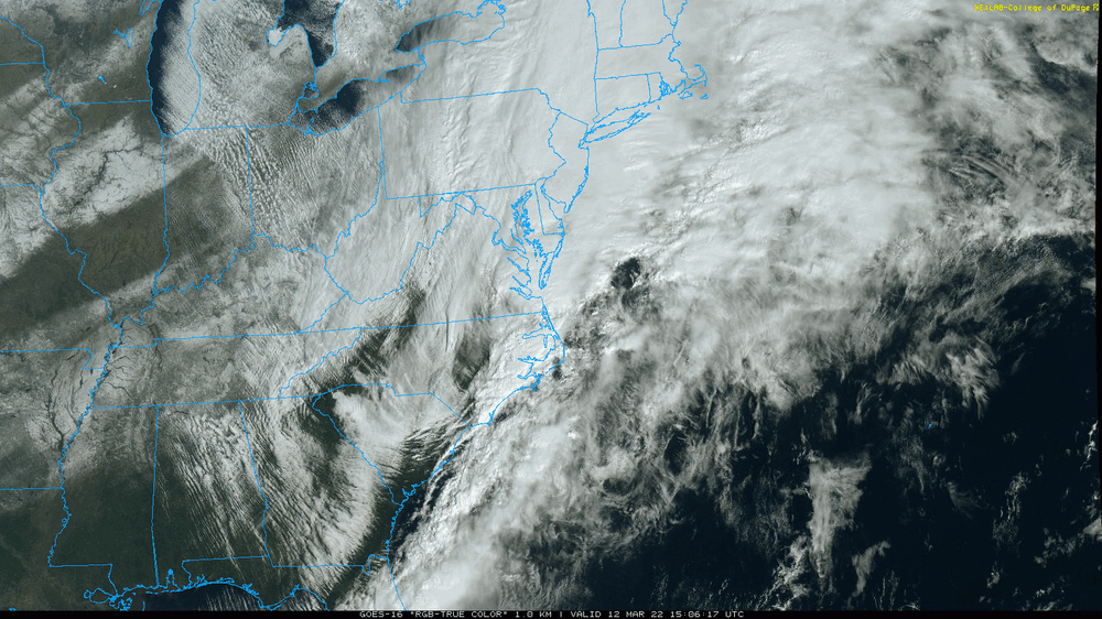
Sat image shows the NW/SE middle finger dry slot over the area.
-
And that's the only thing that matters!
-
You did get your WSW.
-
Still getting some snow, mainly SN- but with bigger flakes. Temp is 29 with dp 27.
-
Yes - the MA folks (that you referenced earlier) have switched it up and are now talking about the back-building. For the snow lovers, anything like this in mid-March after a winter of despair, should be considered a bonus!
-
Went out and measured what was on the board and have 1" snow/sleet (compacted). Currently 29 with dp 28 and SN-.
-
The models had been hinting at some low forming off the Carolina coast and if that happens and is close enough, there could be some wrap-around. What is cool is the massive lake-effect snow blowing off of Lake Michigan and I know over that way, it was in the -10s to -20s below 0 earlier this morning.
-
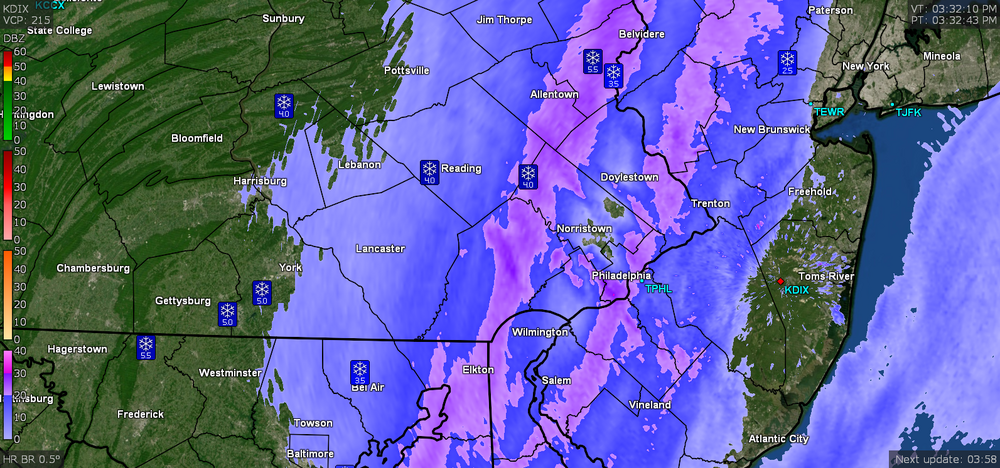
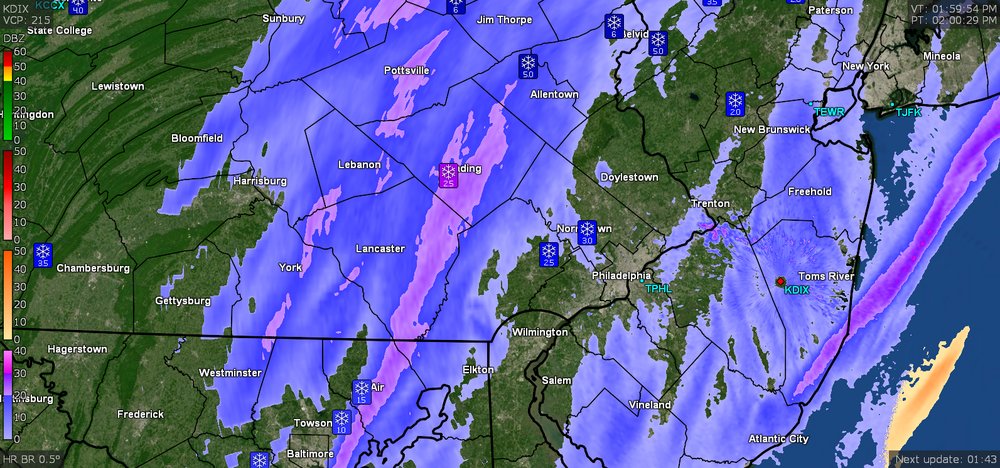
Here is State College's radar -
-
I was wondering where you were. Temp down to 29 with dp 28 and getting SN- fine flakes and blowing snow.