Hurricane Agnes
-
Posts
9,264 -
Joined
Content Type
Profiles
Blogs
Forums
American Weather
Media Demo
Store
Gallery
Everything posted by Hurricane Agnes
-
E PA/NJ/DE Spring 2022 OBS Thread
Hurricane Agnes replied to Hurricane Agnes's topic in Philadelphia Region
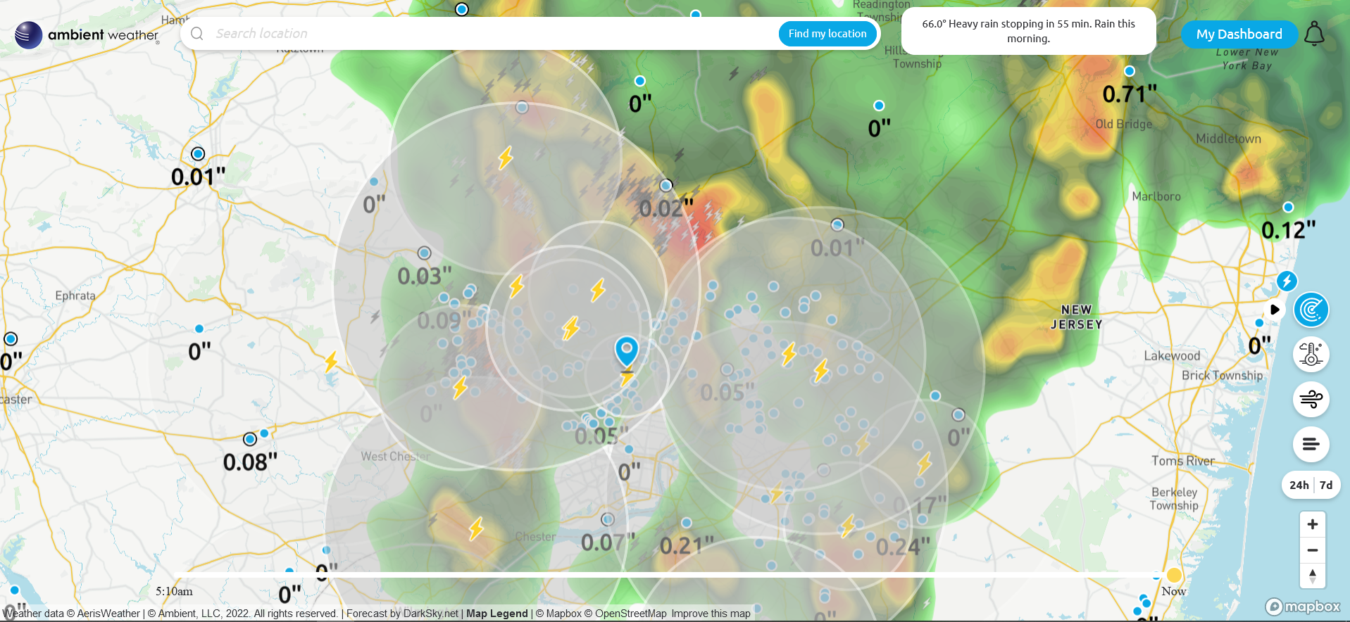
Lots of convection (guessing cloud-to-cloud) going on with these segments. Finally getting a little round 2 of rain and currently 65 with dp 64.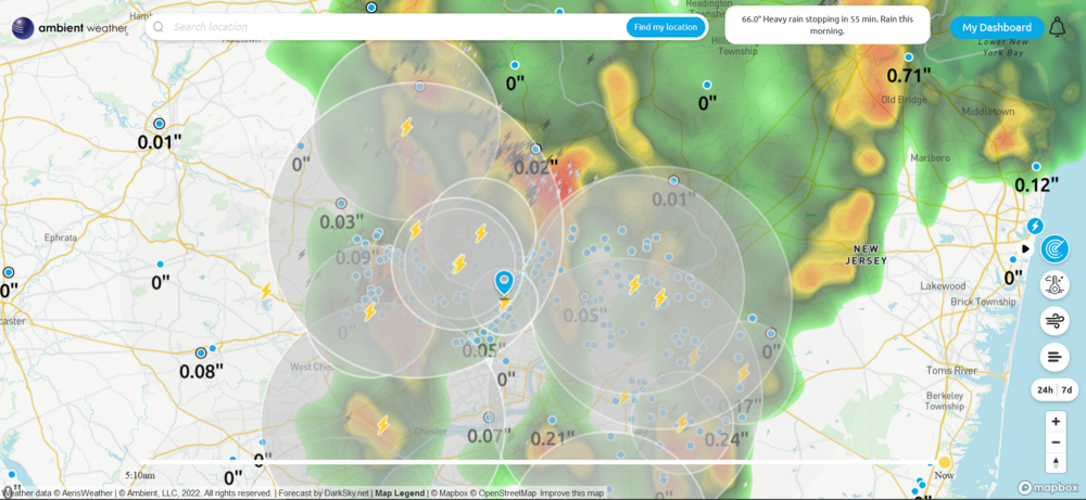
-
E PA/NJ/DE Spring 2022 OBS Thread
Hurricane Agnes replied to Hurricane Agnes's topic in Philadelphia Region
Got 0.11" from the initial round and there are returns over me bu not getting any measurable precip from it yet except possible some drizzle. There has been convection (plus a thunder). Temp is 64 with dp 63. -
E PA/NJ/DE Spring 2022 OBS Thread
Hurricane Agnes replied to Hurricane Agnes's topic in Philadelphia Region
Getting under some broken lines of showers with about a 1/3" per hr rate. Currently 66 with dp 62 and 0.07" in the bucket.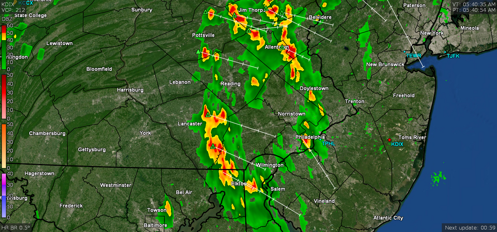
-
E PA/NJ/DE Spring 2022 OBS Thread
Hurricane Agnes replied to Hurricane Agnes's topic in Philadelphia Region
After a 62 low this morning, I managed to make it up to 88 as a high. The dews have been running in the low - mid-60s and was right on the edge of uncomfortable. It's currently partly sunny with lots of odds and ends cirrus, and dp 64. -
E PA/NJ/DE Spring 2022 OBS Thread
Hurricane Agnes replied to Hurricane Agnes's topic in Philadelphia Region
Ended up with 0.09" from that round and the temp briefly "plunged" from the low 70s to 63 and finally to 62 as my low. The odds and ends pieces that may be associated with the MCV moved on out, the sun came out, the temp recovered, and it's mostly sunny much of the day. Temp is currently at 82 with dp 59. -
E PA/NJ/DE Spring 2022 OBS Thread
Hurricane Agnes replied to Hurricane Agnes's topic in Philadelphia Region
Getting a shower from the line with about 1/3rd" per hr rates. Temp is down to 67 with dp 59. Currently have 0.07" in the bucket. -
E PA/NJ/DE Spring 2022 OBS Thread
Hurricane Agnes replied to Hurricane Agnes's topic in Philadelphia Region
Had a little gust front come through. Temp is 70 with dp 57. ETA now getting some light rain.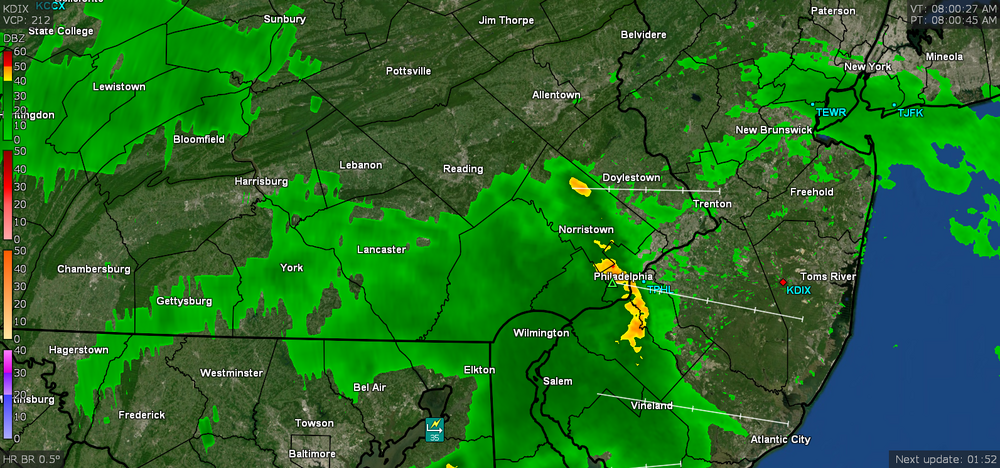
-
E PA/NJ/DE Spring 2022 OBS Thread
Hurricane Agnes replied to Hurricane Agnes's topic in Philadelphia Region
Looks like an incoming line although I will say that the cold front dried out the humidity quite nicely and it's currently overcast and 71 with dp down to 53 this morning. Will see if that survives.
-
E PA/NJ/DE Spring 2022 OBS Thread
Hurricane Agnes replied to Hurricane Agnes's topic in Philadelphia Region
Had a high of 89 today with a dp that at one point, got as high as 74. It's currently clear and 82 with dp 69. I ended up with 0.04" from the little pop-up storm early this morning, despite all the sound and fury of it. -
E PA/NJ/DE Spring 2022 OBS Thread
Hurricane Agnes replied to Hurricane Agnes's topic in Philadelphia Region
Well for a little cell that bubbled up and ran over MBY, it was a noisy one! Only got 0.03" of rain from it but lots of close-by lightning and thunder. Currently overcast and 68 with dp 68.
-
E PA/NJ/DE Spring 2022 OBS Thread
Hurricane Agnes replied to Hurricane Agnes's topic in Philadelphia Region
The sun and warm front eventually shot the temp up to 80 here for my high and now what may be round 2 (even if it becomes isolated pop-ups) is moving this way, and it has clouded up again. Current temp is 76 with dp 68. -
E PA/NJ/DE Spring 2022 OBS Thread
Hurricane Agnes replied to Hurricane Agnes's topic in Philadelphia Region
Sun is starting to bust out here and temp is up to 74 with dp 68. That might juice it up some. SPC SWDY1 has us as "Marginal" with the last update - -
E PA/NJ/DE Spring 2022 OBS Thread
Hurricane Agnes replied to Hurricane Agnes's topic in Philadelphia Region
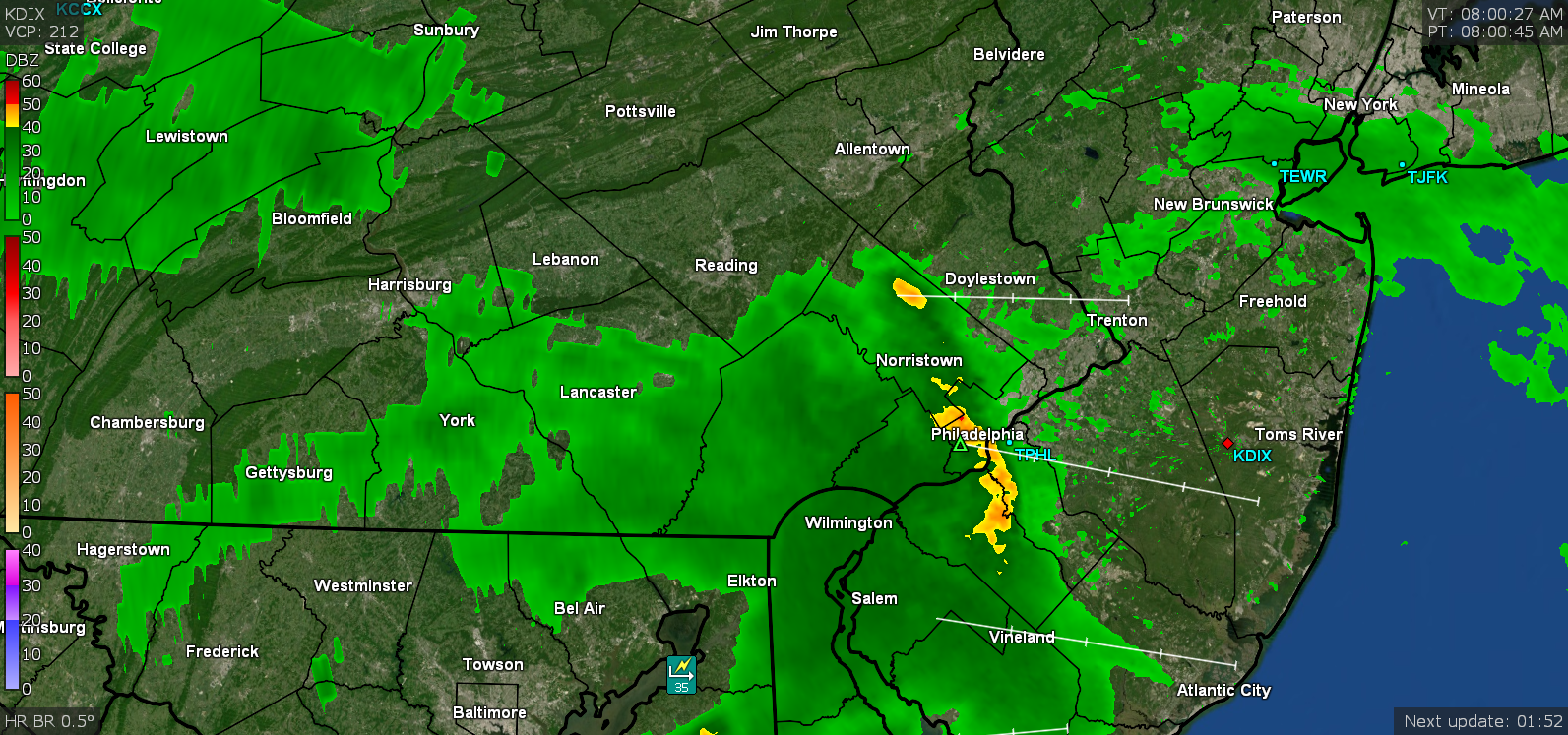
So far with this (possible) round 1, I ended up with 1.39". Currently overcast and 72 with dp 69. -
E PA/NJ/DE Spring 2022 OBS Thread
Hurricane Agnes replied to Hurricane Agnes's topic in Philadelphia Region
Flood Warning up for part of the area including NE Philly - -
E PA/NJ/DE Spring 2022 OBS Thread
Hurricane Agnes replied to Hurricane Agnes's topic in Philadelphia Region
Flood Advisory for parts of the CWA (although for some reason missing my part of the city despite my now 1.30" of rain so far) - Currently 63 with moderate rain and dp 62. -
E PA/NJ/DE Spring 2022 OBS Thread
Hurricane Agnes replied to Hurricane Agnes's topic in Philadelphia Region
Have been getting some convection over the past half hour and just heard a thunder from it. Currently have light rain and 62 with dp 62 and 0.35" in the bucket so far. -
E PA/NJ/DE Spring 2022 OBS Thread
Hurricane Agnes replied to Hurricane Agnes's topic in Philadelphia Region
Made it up to 71 as a high yesterday after a low of 60. What was different yesterday was that there was the uncomfortable humidity. Am currently getting a heavy shower with >1"/hr rates and have 0.22" in the bucket so far at post time. Temp is 63 with dp 61.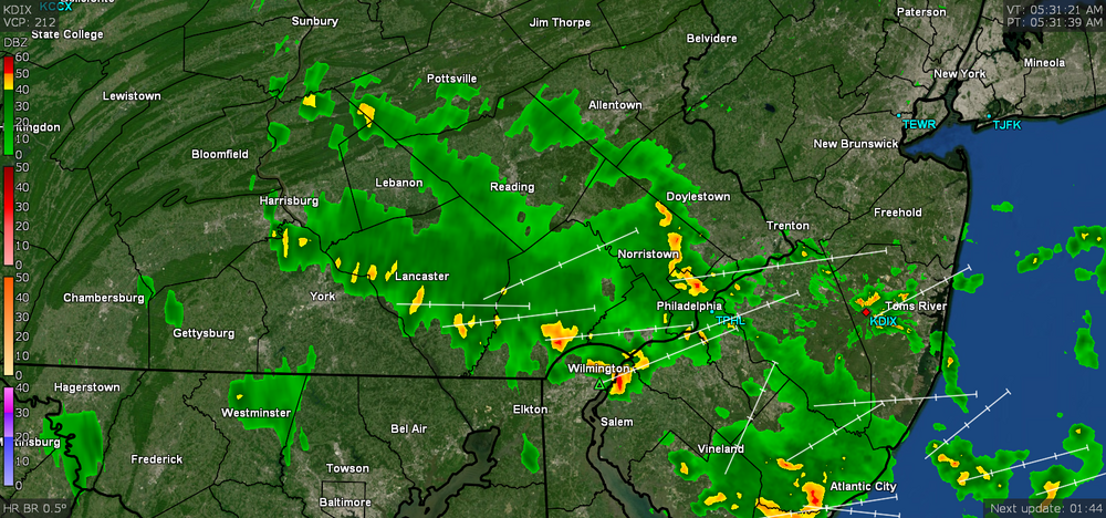
-
E PA/NJ/DE Spring 2022 OBS Thread
Hurricane Agnes replied to Hurricane Agnes's topic in Philadelphia Region
Another "Chamber of Commerce Day" this morning as I ran to the supermarket. Almost fallish cool breeze. Currently mostly sunny and 74 with lots of cirrus, and dp 55. -
E PA/NJ/DE Spring 2022 OBS Thread
Hurricane Agnes replied to Hurricane Agnes's topic in Philadelphia Region
About 10 minutes before sunrise it's currently clear and 60 with dp 53. -
E PA/NJ/DE Spring 2022 OBS Thread
Hurricane Agnes replied to Hurricane Agnes's topic in Philadelphia Region
That seems to have been a pattern where it's like downsloping off the Piedmont into the relatively flat coastal plane as it crosses the river and then boom! -
E PA/NJ/DE Spring 2022 OBS Thread
Hurricane Agnes replied to Hurricane Agnes's topic in Philadelphia Region
Had a feeling that was near someone here. Am surprised at the EF1. Saw some pics of the damage from it. -
E PA/NJ/DE Spring 2022 OBS Thread
Hurricane Agnes replied to Hurricane Agnes's topic in Philadelphia Region
Ha! I saw that but then have been seeing other "new" names and forgot about Ray (time flies). -
E PA/NJ/DE Spring 2022 OBS Thread
Hurricane Agnes replied to Hurricane Agnes's topic in Philadelphia Region
Thanks for that update! Agree that tornado alley has been moving east and especially on your side of the river! -
E PA/NJ/DE Spring 2022 OBS Thread
Hurricane Agnes replied to Hurricane Agnes's topic in Philadelphia Region
Mt. Holly confirmed an EF1 tornado in Blackwood, NJ this morning - I think that might be the first for the season in the CWA. After a low of 68 this morning, I made it up to 83 and with the frontal passage, the humidity has definitely dropped from earlier. It's currently 79 and mostly cloudy with peaks of sun, and dp 59. -
E PA/NJ/DE Spring 2022 OBS Thread
Hurricane Agnes replied to Hurricane Agnes's topic in Philadelphia Region
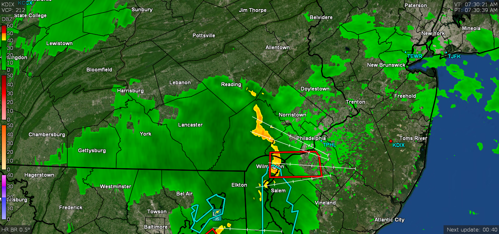
The line has cleared the coast and the sun is out with some puffy cumulus left in the storm's wake. It's currently 73 with dp 71. Final total from that round of rain was 0.85" and with the overnight 0.21", I have 1.06" for the 2-day event.