SolidIcewx
-
Posts
1,577 -
Joined
-
Last visited
Content Type
Profiles
Blogs
Forums
American Weather
Media Demo
Store
Gallery
Everything posted by SolidIcewx
-
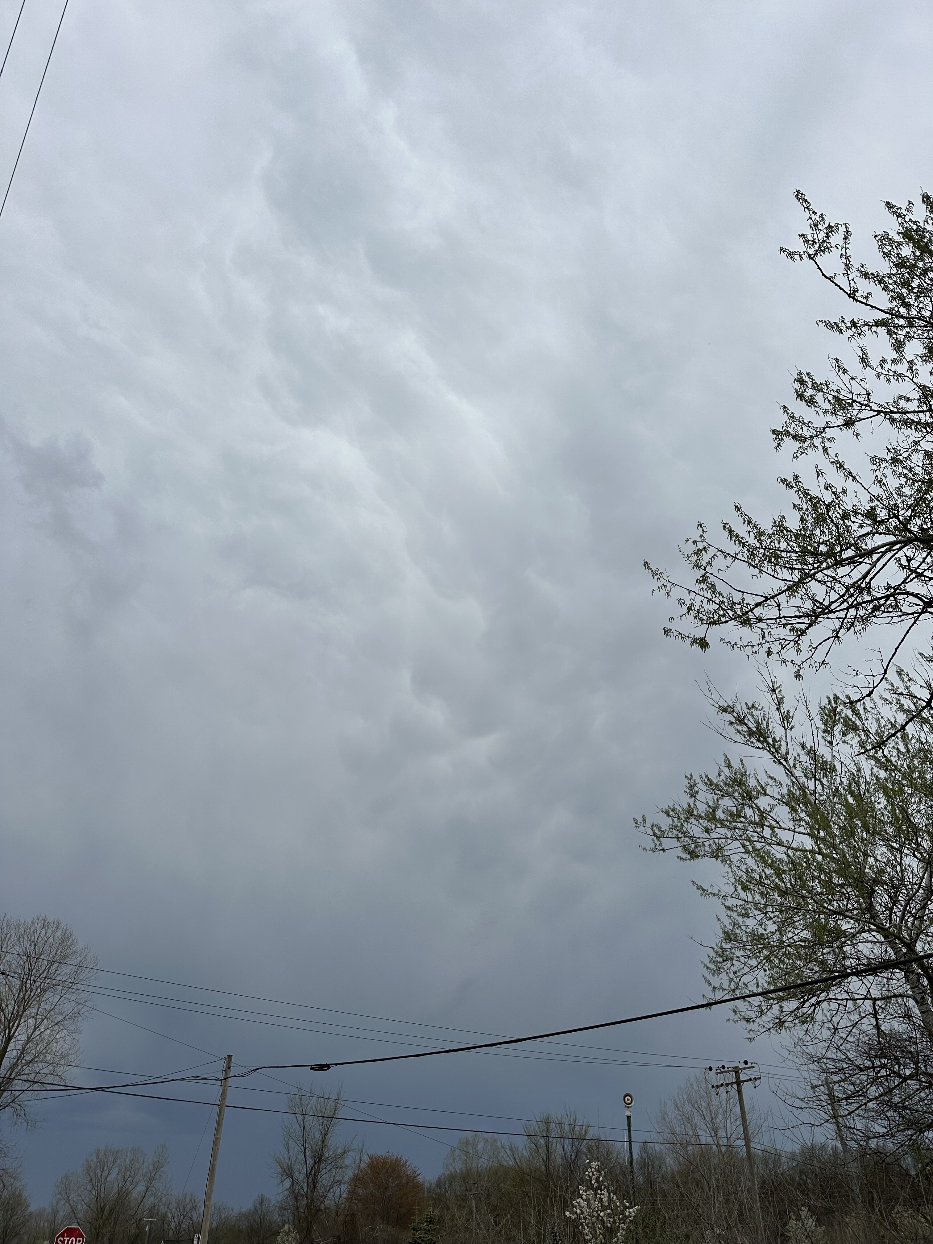
Some pretty interesting clouds as the warm front approaches

-
Might be a tad late but here..
-
Oh hail naw
-

Spring 2023 Medium/Long Range Discussion
SolidIcewx replied to Chicago Storm's topic in Lakes/Ohio Valley
I’m sure we will have that heat wave in may with our first dose of real summer humidity not long after this current pattern shifts -
All I gotta say is that river is scary when she’s mad. I remember being down in Missouri helping family then volunteered to help sandbag in the Winfield area. The floods of 2019 was epic. Went to Alton also and seen the water line not far from the 93 season. It’s definitely shaping up to be a significant season. I wonder if the lower Mississippi will have issues as well. I know when the mighty miss gets angry I can’t help to wonder about the Old River Control Structure down in Louisiana holding the Mississippi back from changing course still
-
Spring 2023 Medium/Long Range Discussion
SolidIcewx replied to Chicago Storm's topic in Lakes/Ohio Valley
Now if any of that verifies it would end up being quite the event. I’d be down for some of that snow. Definitely worth my time that’s for sure, then have 80 degrees within a week after lol. Should bring some of the snow weenies out -
If it’s going to be cold it mind as well snow imo. Glad it wasn’t all a cold white rain this morning in south Rockwood
-
I think I can speak for most of us when I say today is some ugly bullshit lol. (Yes I know it’s that time of year to go on rollarcoaster rides)
-
That’s definitely a mind fk. I had this experience when I went to Missouri a few years ago. Quite amazing how the snow can stick even with prolonged warmth
-
Spring 2023 Medium/Long Range Discussion
SolidIcewx replied to Chicago Storm's topic in Lakes/Ohio Valley
Come back up for a visit tomorrow. Will make the 60s look like a heat wave lol -
Depending on the lake and if it’s close to shore or not yeah. I use it to check water temps before I go to Lake Huron
-
https://seagull.glos.org/landing
-
Nice pop up storms firing in central Michigan
-
Great Lakes Derecho coming to your home town summer 2023 check back for further updates of the summers best show!
-
That’s what I was telling my fiancé. This would have been fantastic post cold front summer weather. My house gets really hot so there I have turned my AC on when I’m cooking dinner then turn it off not long after. The windows stay open and it’s gets so cool. The rapid temp drop offs at night is neat
-
76/49 here imby definitely more moisture in the air today
-
Spring 2023 Medium/Long Range Discussion
SolidIcewx replied to Chicago Storm's topic in Lakes/Ohio Valley
What goes up must come down -
That’s what I’ve noticed too all the late bloomers around here are sprouting. It’s been a very rapid green up just for a shock to the system soon
-
Yeah working today the heat was getting to me a bit. Drinking water and electrolytes as-well. Hands kept getting dry also. Felt like roadkill for a little while lol caught me off guard. Really nice nonetheless
-
I definitely notice the warmth since winds are light and variable right now. Going to definitely be warm outside today
-
I seen a bit of that this morning as I was getting ready for work. Temp swings are just as fascinating at other weather aspects. Even tho it was 49 when I arrived as soon as the sun hit I was warm
-
Yeah that’s the thing we got a whole lotta spring left still. Pattern can go to stormy once we roll into may. 2008 definitely saw a lot of rain end of spring like you said
-
The crazy temp swings are of interest to me. It’s always neat to see a sharp drop or a sharp warm up
-
This dry warm air definitely making me drink twice the water I normally do outside lol. Gotta love working outdoors
-
77 already where I’m working. Calling for 80 but I believe it will overachieve like yesterday. Less wind this time and it’s a little warm without AC in my work truck lol. Probably will be tempted to jump into the Huron river by 3pm. Definitely my northern blood being thick and just coming off of winter has something to do with it