Iceresistance
-
Posts
4,187 -
Joined
-
Last visited
Content Type
Profiles
Blogs
Forums
American Weather
Media Demo
Store
Gallery
Posts posted by Iceresistance
-
-
Ice Storm Warning for Northern Lower Michigan
-
1 hour ago, Quincy said:
Shear vectors look close to parallel to the boundary once again, but those forecast wind fields are nothing to snooze on. I’d expect a similar outcome to the last event, but possibly a bit more widespread in terms of wind damage. Tornado potential, not much confidence beyond the QLCS threat, but it only takes one. (Remember New Orleans…)
Yes, all it takes is one
-
That wind right now is something else . . .
-
@weatherboIt looks like that your area may get a foot of snow from this storm system. That's what the NBC-6 (WLUC-TV) from Marquette said.
-
3 minutes ago, nwohweather said:
Regardless, I'm not nearly as bullish as the SPC here. Definitely looks like a major damaging wind event though, soundings show plenty of wind transferring down to the surface. We could even see a High Wind Warning as well for the area
Yes, wind gusts could reach Hurricane Force in the OV, & Thunderstorm gusts could reach 100 mph, that's why they've put up a very large Hatched area & Moderate risk for that, they may need to upgrade to a High Risk for destructive wind gusts between 90 & 100 mph.
-
 1
1
-
-
Damaging Wind event appears very possible for the Ohio Valley & Southward tomorrow, wind gusts maybe as close as Hurricane Force.
-
31 minutes ago, nwohweather said:
Might as well call this the new Tornado Alley at this point. I'm just not sold on a legit QLCS tornado outbreak, very atypical despite awesome parameters. I saw this a lot while living in the Great Lakes, we'd have some powerhouse low roll through with out of this world dynamics, yet at the end of the day a line is a line. We'd get a ton of wind reports, but so often the tornado threat would lack considerably.
The New Tornado Alley? This area is already a tornado alley. It's named Dixie Alley, & Dixie Alley has characteristics that are way different compared to Tornado Alley.
-
2
-
-
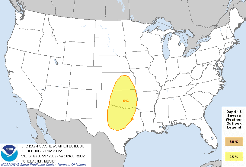
Slight Risk extended into Missouri, there's an update for it at 12:30 PM CDT.
The SPC is thinking it's going to become linear very quickly.
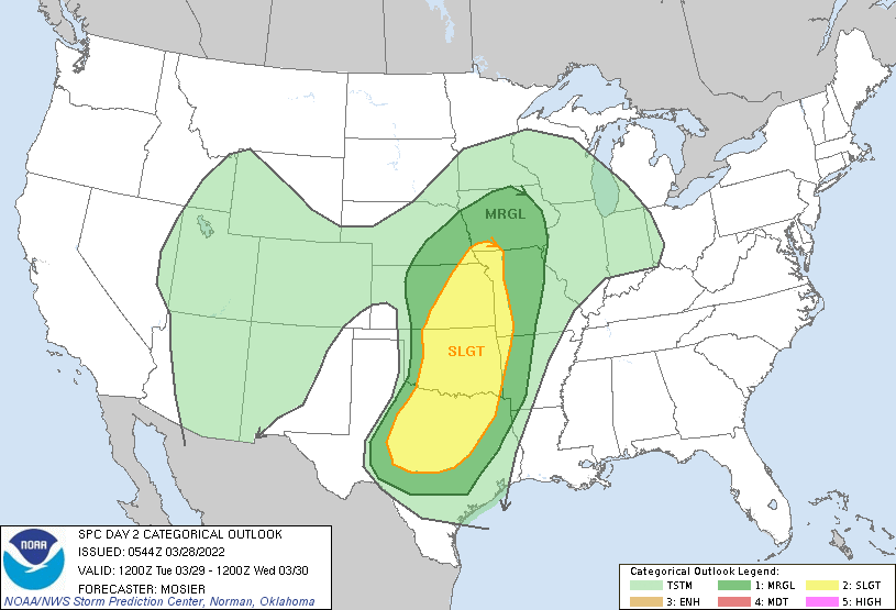
And here's the new D3 Severe Weather Forecast
-
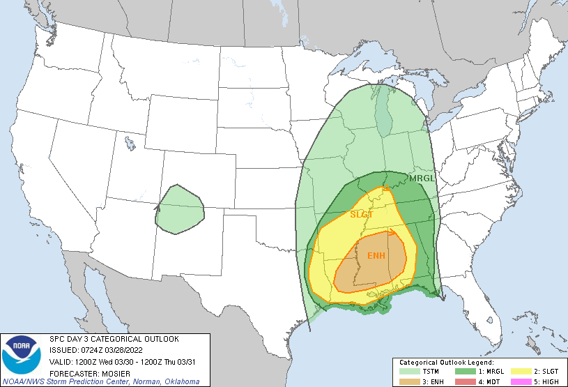
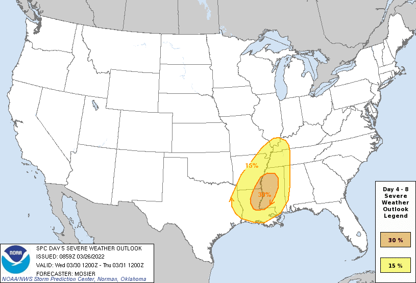
No change in placement of the Slight Risk since Yesterday, this is the SPC Discussion on this:
Broad cyclonic flow is expected to be in place across the CONUS on D4/Thursday morning. Several shortwave troughs will be embedded within this larger upper trough, with the lead wave expected to move from the upper OH Valley northeastward through the Mid-Atlantic and Northeast early during the day. Another wave will follow quickly in the wake of the first, moving across the OH Valley and Mid-Atlantic. The evolution of this second wave will encourage the eastward progression of a cold front through the Mid-Atlantic. Modest buoyancy and strong wind fields support the potential for damaging wind gusts with storms along and ahead of this front.-
 1
1
-
-
Spring is coming up on Y'all, & fast!
On Thursday/Day 5, a severe risk will likely continue eastward into the Mid-Atlantic/Southeast States, including the potential for fast-moving low-topped storms capable of wind damage in the Mid-Atlantic region.-
1
-
-
3 hours ago, yoda said:
Uh oh
Day 4-8 Convective Outlook CORR 1
   NWS Storm Prediction Center Norman OK
   0434 AM CDT Sun Mar 27 2022

   Valid 301200Z - 041200Z

   CORRECTED FOR WORDING

   ...SEVERE WEATHER OUTBREAK POSSIBLE ON D4/WED...

   ...DISCUSSION...
   An appreciable severe-weather risk appears increasingly likely
   across the Lower Mississippi Valley and Middle Gulf Coast region on
   Wednesday/Day 4. This includes the potential for widespread damaging
   winds and tornadoes, including the possibility of a regional tornado
   outbreak including strong (EF2+) tornadoes.

   On Wednesday, an increasingly moist air mass is expected across the
   region ahead of an upper-level trough that will take on an
   increasingly negative tilt, with very strong deep-layer/low-level
   winds coincident with a modestly unstable air mass. The potential
   for extensive early day precipitation/cloud cover ahead of the cold
   front casts some uncertainty in terms of destabilization details,
   particularly with northward extent into the Tennessee and Ohio River
   Valleys. Regardless, the extremely strong wind fields are concerning
   for the potential for long-lived supercells/fast-moving bowing
   segments where modest destabilization does occur. The
   most-concerning severe-favorable ingredients currently appear most
   probable across sizable portions of Louisiana, Mississippi, and
   Alabama.
Very strong wording from the SPC


-
BIG Enhanced risk in place for Dixie Alley on D4, very strong wording from the SPC
 ...SEVERE WEATHER OUTBREAK POSSIBLE ON D4/WED...

   ...DISCUSSION...
   An appreciable severe-weather risk appears increasingly likely
   across the Lower Mississippi Valley and Middle Gulf Coast region on
   Wednesday/Day 4. This includes the potential for widespread damaging
   winds and tornadoes, including the possibility of a regional tornado
   outbreak including strong (EF2+) tornadoes.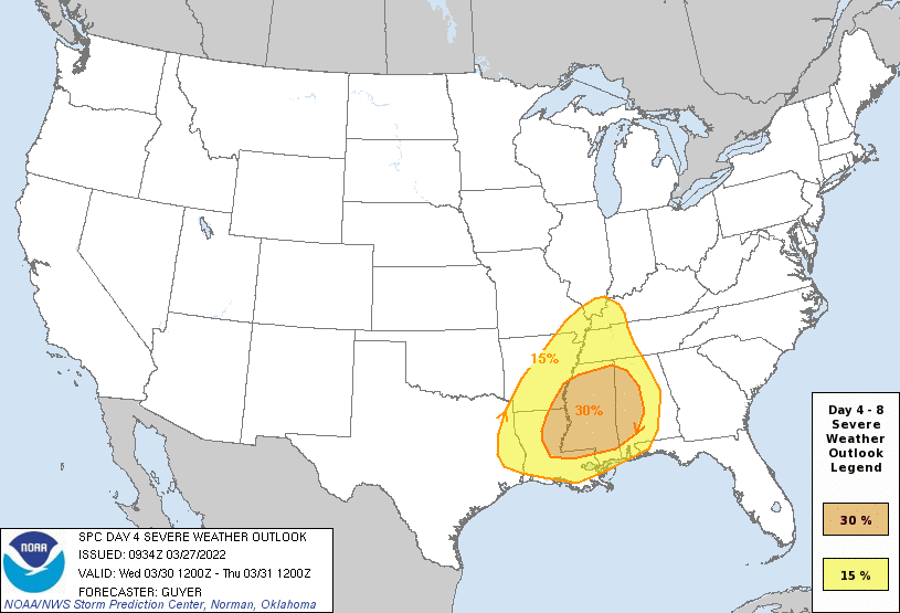
-
@yodaYou beat me to it by 3-4 hours
-
28 minutes ago, yotaman said:
Why? There is already a severe weather thread. Don't need one for a "slight" risk.
This one is unique, it's not common to have a D6 Slight Risk, let alone the Mid-Atlantic.
-
1
-
-
Going to start a Severe Weather forum because the SPC has put out a Slight Risk of Severe Storms for North Carolina & Virginia on D6
-
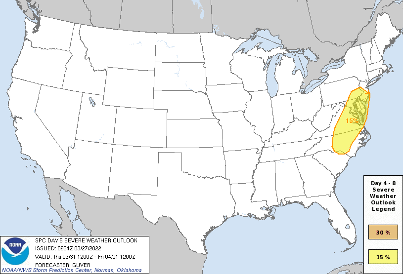
D4 is a very large Slight Risk, D5 is now Enhanced.
-
I forgot to post it, but my Aunt's relatives were affected by the Kingston, OK Tornado (EF-2), they're fine, but their friends to the east was struck by the Tornado, they are also fine, but they've lost their homes.
-
SPC introduces Slight Risks on D5 & D6.
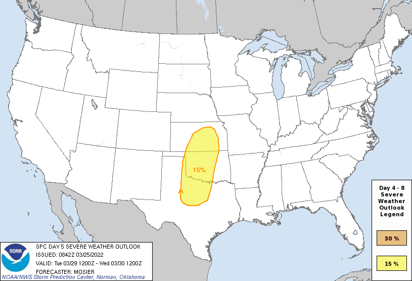
D5 is a classic setup for the Great Plains.
.gif.c396c5dbba4cc8cbd727627075d1683d.gif)
While D6 is a Dixie Alley setup.
-
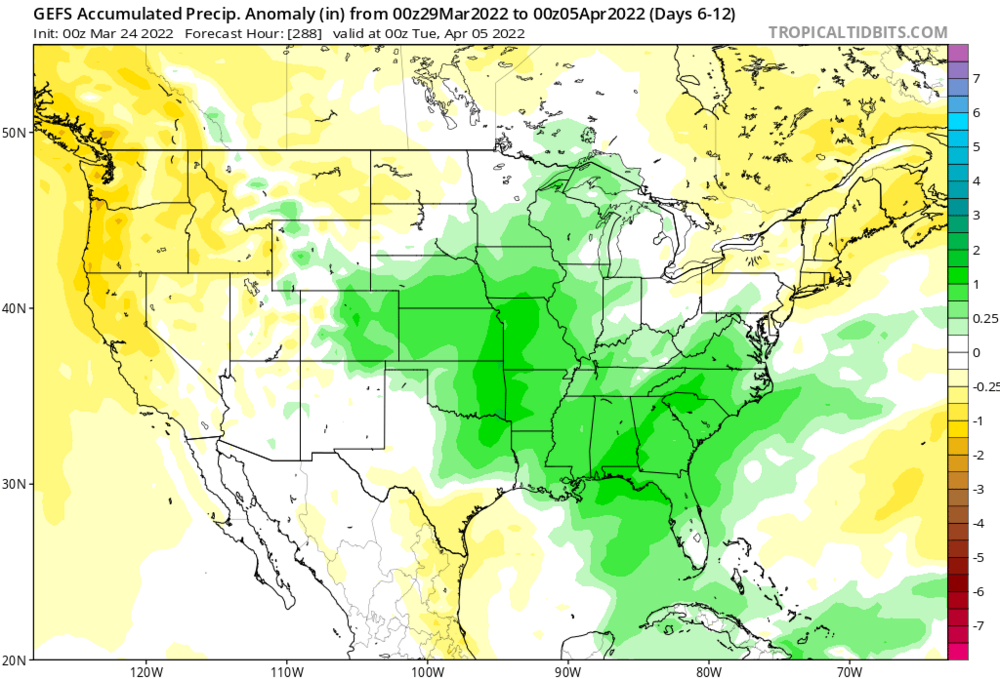
More consistency with the models to have it start the Severe Weather setups on the 29th, even the WPC is showing good rainfall for the Southern Plains on the 30th as well.
-
Already a potential rainmaker for the Southern Plains
-
Ventrice has this (Treating the forecast with a grain of salt)
-
The GFS has been abnormally consistent with this storm, & Mike Ventrice has his concerning forecast for those areas March 29th & 30th.
Some models are having trouble with the exact dates, but there is strong consistency of the event ending on March 30th, so I've put down March 27th-30th until we get a better visual on this.
-
2
-
-
Based on the tornado videos, this is likely a EF3/EF4 Tornado, I'm shocked that there are no deaths right now, even though that's likely going to go up.

-
 1
1
-
-
Tornado Reports in Mississippi have EXPLODED! It looks like that Edwards & Goodman got hit.
March 30th & 31st Severe Weather for Southern Plains & Dixie Alley, Very Dangerous Nighttime Outbreak ongoing in Alabama
in Central/Western States
Posted
I saw one that had 90 mph wind gusts.