Iceresistance
-
Posts
4,187 -
Joined
-
Last visited
Content Type
Profiles
Blogs
Forums
American Weather
Media Demo
Store
Gallery
Posts posted by Iceresistance
-
-
Warm Sector storms are already developing in Louisiana
-
1 hour ago, sojitodd said:
Well thank God it looks like nobody was killed. Hope the same holds out for today.
That red truck video was insane. They just kept going...how? I would have been too stunned and in shock to do anything.
Got word that one has died in Grayson County on the Texas Side of Lake Texhoma, this was confirmed by a Mod on a different forum.

-
 1
1
-
-
9 hours ago, Tallis Rockwell said:
What about Houston?
Parameters are looking good over here.
Houston does not look good at all for Severe Weather. (You're in Houston, which is in the Central & Western States forum)
-
 1
1
-
-
Enhanced risk has been expanded into DFW, & so has the Hatched area for Tornadoes.
-
3 minutes ago, TexMexWx said:
Yeah this definitely caught my attention. Just don't like how it's trending up for us and how the general threat is expected to unfold along the I-35 corridor during rush hour
It's the Nightmare Scenario, I'm thinking that Schools will go virtual because of this, on the May 2019 High Risk Day, my School shut down because they don't want a Moore 2013 Repeat.
-
1 minute ago, Powerball said:
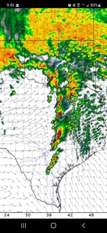
The radar's already been posted above.
Here's the sounding:

The sounding may be contaminated, but the storms there may recommend a Enhanced risk for DFW if the other Mesoscale models follow suit
-
Just now, SmokeEater said:
.
Sent from my SM-S901U using Tapatalk

-
16 minutes ago, Powerball said:
00z HRRR is really ominous for DFW tomorrow evening, including a PDS Tornado sounding.
Can I see a photo for that.

-
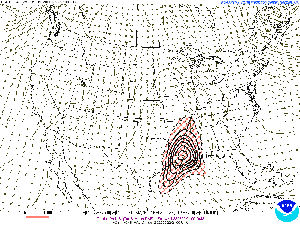
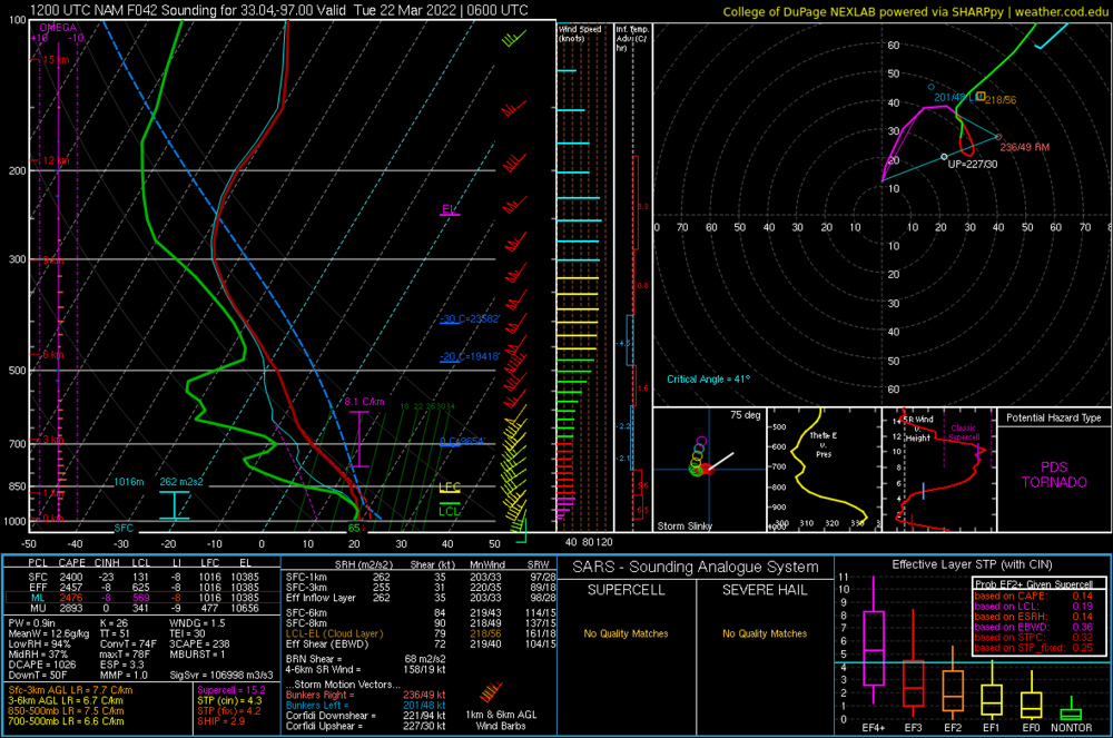
This is the largest 90% STP contour I've ever seen!
-
2
-
-
1 hour ago, cheese007 said:
Decline of the internet forum and all that
I don't think that, today is Sunday & it's usually the lowest number online per day average.
-
 2
2
-
-
Slight risk expanded to DFW for Tomorrow
-
Something is with the NAM model, it keeps trending North with the STP & Supercell composite. Found this sounding west of DFW
-
-
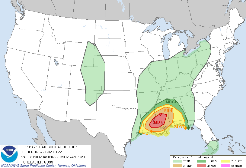
Rare Moderate risk in place for Mississippi & Louisiana on the D3 Outlook
-
2
-
-
-
56 minutes ago, WishingForWarmWeather said:
Why is that?
You can experience the craziest weather (My Grandmother had to use the AC, then the Heater during the same day), have mostly rural views, & most of the time, you can see tornadoes coming from miles away.
And also, if you lived in Oklahoma long enough, your gut will tell you if really nasty storms are coming
-
1
-
-
1 minute ago, WishingForWarmWeather said:
Thank you! I had put it as that when I was living in Oklahoma, there were so many ice and snow storms the one winter and all I could do was wish for some warmer weather.
After that, I moved to Texas and answered my own prayers for warm weather, haha. Only two seasons there - summer and football.
Now I'm in Tennessee with all 4 seasons, including snow again! Back to wishing for the warm weather. But, it is nice to have fall again!
I wished you stayed in Oklahoma . . .
-
2 hours ago, Tallis Rockwell said:

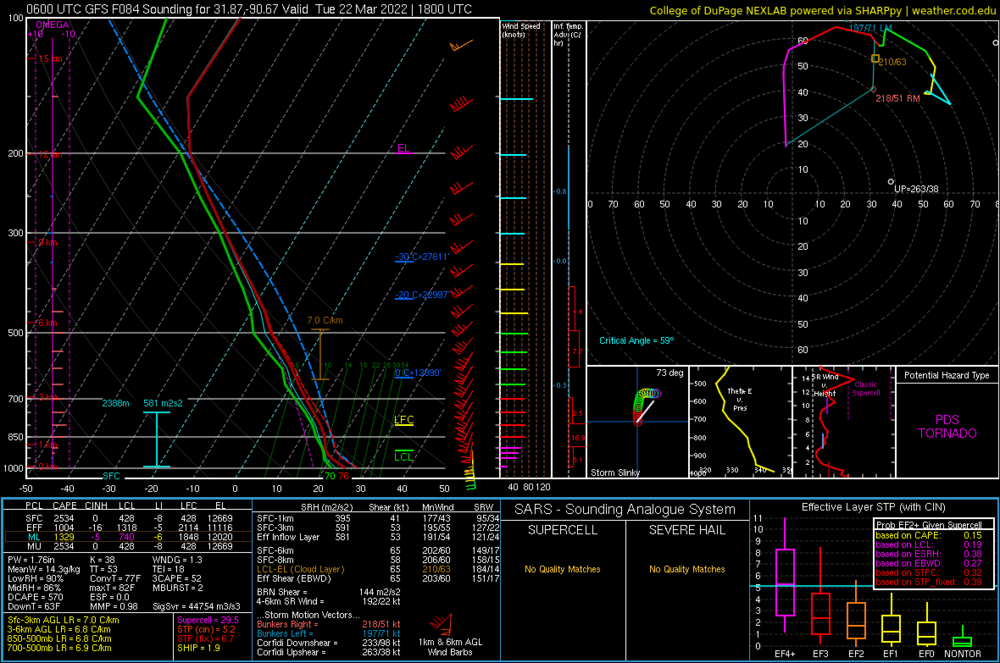
NAM showing insane levels of Helicity over Northern LA...
This is a contaminated sounding, note the red bars shooting off to the right.
-
The Day 4 discussion is really scary for Mississippi from the SPC, but this Model sounding over SE Mississippi justifies the worry from the SPC.
-
3 hours ago, cheese007 said:
In addition to the frighteningly large D3 hatched, the D4 wording is pretty gnarly as well. Already talk of SigTors:
I've seen bigger than that
-
1
-
-
KFOR has 'Heavy Rainfall' possible for Next Monday.
-
7 minutes ago, Chreeyiss said:
Agreed, there doesn't seem to be as much of an overlap between that extremely favorable shear and sufficient instability on these more recent runs. Looks more like a broad brushed slight with a pocket of enhanced in central Texas to me, if these trends hold.
Southern & Eastern Texas is in western Dixie Alley & is really close to the GoM, it could really trend towards a more dangerous setup in the next few days, that's why that a high risk is currently possible.
-
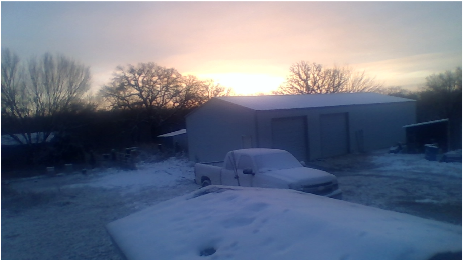
Got .5 inch of rain from last night's storms
-
A rare day 5 ENHANCED risk has been issued for Central & Eastern Texas for Next Monday, when was the last time this happened?
-
3
-


3/17/2022, 3/21/2022 & 3/22/2022 Severe Weather, Major Tornado Damage in New Orleans
in Central/Western States
Posted
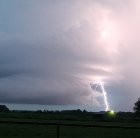
Radar is showing the Squall line appearing to break into discrete Supercells