

Mount Joy Snowman
-
Posts
4,760 -
Joined
-
Last visited
Content Type
Profiles
Blogs
Forums
American Weather
Media Demo
Store
Gallery
Everything posted by Mount Joy Snowman
-

Central Pa. Summer 2024
Mount Joy Snowman replied to mahantango#1's topic in Upstate New York/Pennsylvania
I was just going to say that I don't think I saw that mentioned anywhere. Kind of snuck up on us. Today's record of 104 is probably out of reach, although the latest HRRR still wants to throw up a 103 at MDT. It's been pretty consistent with that. We shall see. Off to the races. -
Central Pa. Summer 2024
Mount Joy Snowman replied to mahantango#1's topic in Upstate New York/Pennsylvania
Low of 72 but maybe a touch less humidity. Let’s see how high we can go today. -
Central Pa. Summer 2024
Mount Joy Snowman replied to mahantango#1's topic in Upstate New York/Pennsylvania
18z HRRR says both MDT and LNS hit 103 tomorrow. Let's hope that's overdone. -
Central Pa. Summer 2024
Mount Joy Snowman replied to mahantango#1's topic in Upstate New York/Pennsylvania
Most of the disparity seems to be driven by the presence of storms, rather than the front pushing through, so I would still lean towards some part of the day getting above 90 if I were a betting man. -
Central Pa. Summer 2024
Mount Joy Snowman replied to mahantango#1's topic in Upstate New York/Pennsylvania
For 18z Wednesday at MDT CMC has 84, UK has 89, and Euro 83. -
Central Pa. Summer 2024
Mount Joy Snowman replied to mahantango#1's topic in Upstate New York/Pennsylvania
GFS has MDT at 83 at 2pm on Wednesday and 86 at 5pm. -
Central Pa. Summer 2024
Mount Joy Snowman replied to mahantango#1's topic in Upstate New York/Pennsylvania
ICON has MDT at 84 at 2pm on Wednesday. Has more precip in the area, with LNS 88 at the same time. -
Central Pa. Summer 2024
Mount Joy Snowman replied to mahantango#1's topic in Upstate New York/Pennsylvania
Thanks mate. It really did turn out perfect. One of those rare occasions when everything comes off the grill at the exact same time and cooked just right. #MediumRare I've had one day over an inch during that time span -- 1.12" on June 5. -
Central Pa. Summer 2024
Mount Joy Snowman replied to mahantango#1's topic in Upstate New York/Pennsylvania
I've been noticing that as well. Was really hoping Wednesday night was going to come through for us. Should have known better ha. -
Central Pa. Summer 2024
Mount Joy Snowman replied to mahantango#1's topic in Upstate New York/Pennsylvania
The 3k NAM does indeed get MDT into the low 90s on Wednesday. As does the FV3. -
Central Pa. Summer 2024
Mount Joy Snowman replied to mahantango#1's topic in Upstate New York/Pennsylvania
You're on! First up is the NAM, at 11am Wednesday it has MDT at 86 with the front on the approach. Edit: At 2pm MDT is 88 with the front kind of stalled out. A weak front, at that. 5pm MDT 87 and LNS 90. Would be a close call verbatim. -
Central Pa. Summer 2024
Mount Joy Snowman replied to mahantango#1's topic in Upstate New York/Pennsylvania
Haha yeah who knows!? Although, I still had to go through the whole rigmarole of emailing the pic from my phone to my work email and then saving it and then importing it and making sure the file wasn't too large and blah blah blah, so I don't think I'll suddenly become some prolific pic poster ha. Also, the nooner report was only because it was a cloudy/rainy day and I felt comfortable that the report was accurate. Normally I'm too embarrassed to report my midday temp because I know it's like 2-4 degrees too high. All that is to say, maybe I'm not changing after all haha. -
Central Pa. Summer 2024
Mount Joy Snowman replied to mahantango#1's topic in Upstate New York/Pennsylvania
It was! See below for a rare MJS pic.....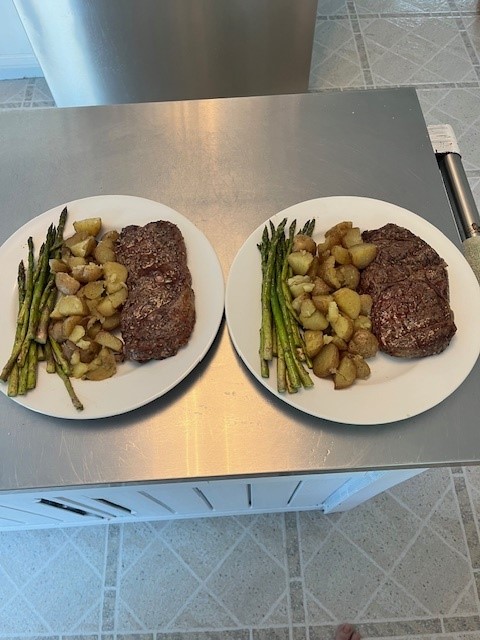
-
Central Pa. Summer 2024
Mount Joy Snowman replied to mahantango#1's topic in Upstate New York/Pennsylvania
It may be that your home station is overcooking the dew point numbers by a good bit. A common problem I have found. Didn't you say your DP was above 80 on a few occasions? Seems a bit overdone. And that's to say nothing of any air temp anomalies as well. I know I can't trust my own station during peak solar hours. -
Central Pa. Summer 2024
Mount Joy Snowman replied to mahantango#1's topic in Upstate New York/Pennsylvania
Low of 72. One day I'll get rain again. Maybe. -
Central Pa. Summer 2024
Mount Joy Snowman replied to mahantango#1's topic in Upstate New York/Pennsylvania
NOW! -
Central Pa. Summer 2024
Mount Joy Snowman replied to mahantango#1's topic in Upstate New York/Pennsylvania
I’m making ribeyes on the grill later today for the wife and I, along with asparagus and potatoes. Just made some orange crushes for us as well. Off and running over here ha. #SundayFunday -
Central Pa. Summer 2024
Mount Joy Snowman replied to mahantango#1's topic in Upstate New York/Pennsylvania
Edit: Latest guidance suggests the storms may form over eastern Lancaster County and move away from us, just out of reach. Would be fitting. -
Central Pa. Summer 2024
Mount Joy Snowman replied to mahantango#1's topic in Upstate New York/Pennsylvania
Low of 72. The Meso’s seem to think there’s a slight to perhaps decent chance of some storm activity over this way later this afternoon or this evening. Here’s to hoping. -
Central Pa. Summer 2024
Mount Joy Snowman replied to mahantango#1's topic in Upstate New York/Pennsylvania
Low of 73 with .1” of total rainfall. I’ll take it but it’s mostly another fail. They are adding up. -
Central Pa. Summer 2024
Mount Joy Snowman replied to mahantango#1's topic in Upstate New York/Pennsylvania
The Harrisburg Mile is Wednesday and I have been talked into doing it with some of my coworkers, despite the fact that I don’t run. That should go over well. Hopefully they have ambulances along the route ha. -
Central Pa. Summer 2024
Mount Joy Snowman replied to mahantango#1's topic in Upstate New York/Pennsylvania
What I’m gonna call round one is in the books here, to the tune of .05”. Skies brightening a bit and sitting at 75/71. -
Central Pa. Summer 2024
Mount Joy Snowman replied to mahantango#1's topic in Upstate New York/Pennsylvania
Rare MJS nooner: 77/69 with light rain falling but a more moderate batch approaching. Did I do that correctly? -
Central Pa. Summer 2024
Mount Joy Snowman replied to mahantango#1's topic in Upstate New York/Pennsylvania
First shower of the day rolling through here now. Hopefully the start of something substantial. -
Central Pa. Summer 2024
Mount Joy Snowman replied to mahantango#1's topic in Upstate New York/Pennsylvania
Low of 66. Hoping for a nice soaking rain. We were out on the river all day yesterday and I got to say I was stunned by how persistent the cloud deck was. We never really saw the sun all day and at times it was borderline chilly if you weren’t in the water, which was like bath water ha. A great time had by all though. Now, let’s wrangle in this rain.


