

TimB
-
Posts
17,227 -
Joined
Content Type
Profiles
Blogs
Forums
American Weather
Media Demo
Store
Gallery
Everything posted by TimB
-
Tomorrow seems like a sure bet but who knows anymore. Edit: aaaaand, now it doesn’t. This is getting comical.
-
The last time Pittsburgh strung together 4 straight 93+ days was the first 4 days of August 2002.
-
Second half of summer 1995 was absolutely brutal, so it’ll be tough but this seems doable.
-
Coming into today, we were even with August 1995 for hottest month at Pittsburgh International with a mean temp of 77.7. That should go up to about 77.9 or 78.0 after today, but will likely go down in the coming days.
-
93
-
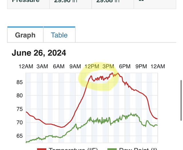
Yet another 91 in the books.
-
It’s crazy. Dewpoints mix into the low 60s at ASOS sites and then you check the dewpoints on nearby PWS and it’s still close to 70.
-
Don’t dewpoints typically run high on PWS?
-
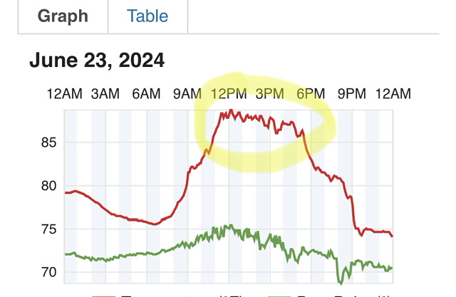
This is the first time AGC has hit 96 or higher since 7/7/2012.
-
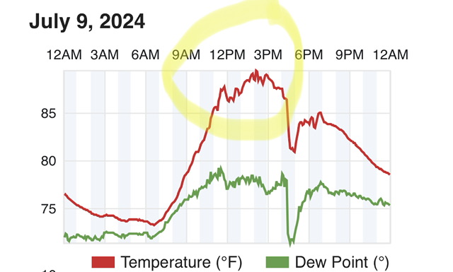
Up to 91 at PIT. That’s the 13th day of 91 or above so far this season, which is tied for the 6th highest total of 91+ days through today’s date behind only: 1. 1876 (19) 2. 1988 (18, only year at Pittsburgh International with more 91+ days on or before 7/15) 3. 1880 (18) 4. 1881 (15) 5. 1911 (14) and tied with 1966 (13). The magnitude of heat may not be extreme, but the number of days is up there with some of the hottest summers Pittsburgh has ever experienced.
-
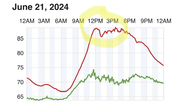
Officially 90 at PIT already.
-
Couple of 91 5-min obs. Done deal.
-
Impressive that not a single one of the 90s so far has been by the skin of our teeth, all of them have gotten to at least 91.
-
Bit of a strange route to 90 at that. 5-min obs of 90 (probably 89) at 2:30, then down to 85 at 2:51, now back up to 89 or 90. Edit: 90 is official on the daily climate report. Actually reached 91 after 5pm.
-
Today was the first day where the normals are 83/64, which is the highest they go. They’ll stay at 83/64 until the 28th, then it’s all downhill.
-
Is it a paid gig or volunteer? I know there’s big money in climate denial these days, but I ain’t doing it for free.
-
Oh, pretending you’re all official and shit. Cute.
-
I don’t have an issue with you having multiple weather stations, I have an issue with you using “we” (plural) when talking about yourself (singular).
-
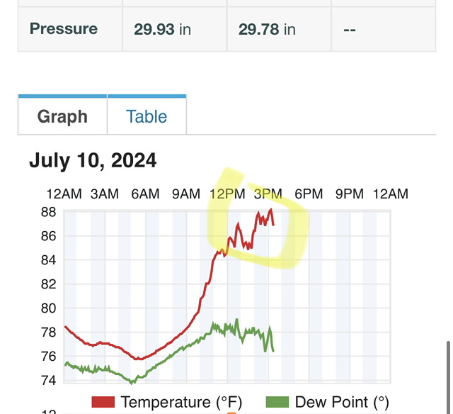
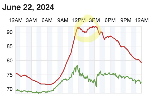
You didn’t catch it in time on 6/22. I’m imagining your face as you went out there and said “oh shit it’s already at 91”.
-
I wouldn’t put it past you.
-
I mean, you’re (plural) admitting you (plural) have a feature on your (plural) weather stations that doctors the temperatures, so this doesn’t surprise me.
-
Why does it only happen on days that are on track for 90?
-
A little curious here, you identify as a “we”?
-
@ChescoWxcan you explain why your weather station completely defies diurnal temperature trends and consistently stalls or drops a couple degrees between noon and 1pm, especially on days when getting to 90 is a threat?
-
Regardless, we can say with 100% certainty that at least one hourly record (8am) and maybe others were set this morning.


