wx_observer
-
Posts
256 -
Joined
-
Last visited
Content Type
Profiles
Blogs
Forums
American Weather
Media Demo
Store
Gallery
Everything posted by wx_observer
-
After a period of sleet in Worcester, it looks like we have changed back to freezing rain...though much lighter precipitation than earlier this morning.
-
Not all kids can access their education well remotely, and K-12 students have already experienced a significant social emotional impact from remote learning. On paper, it makes sense to have remote days count. In real life, it doesn't look like this is what is the right thing to do for students at the K-12 level.
-
This turned to ice in Worcester at some point in the past 45 minutes. Surfaces are getting a glaze on them now.
-
Private schools, like St John's did have today as a remote day. The state has ruled that no remote days will count towards the 180 this year, so public schools won't do remote days.
-
Why are so many winter storm warnings still up in MA? It doesn’t seem like the forecast meets criteria.
-
Closings list is pretty long, for the day before anyway: https://www.wcvb.com/weather/closings
-
A lot of QPF there in that area south of the snowfall line. Doesn't matter if its sleet or freezing rain, it's not going to be pretty if that pans out.
-
That 2008 storm did take down a lot of the weaker trees, for sure. That was right around when the longhorn beetle showed up in MA—wonder if that storm slowed down or sped up the spread of the beetle with all the downed trees that got moved around.
-
No thanks on the ice storm warnings. Would rather one of those fish falling from the sky events than an ice storm. That one we had in 2008 was the last one of those I ever need to see…in a lifetime. At least you can make snow cones with sleet…right?
-
School closures, probably. I’m l ready hearing that it is expected to be a snow day.
-
Harvey just mentioned about 1-3” sleet. Better than getting it as all ice I guess…
-

OBS/DISCO - The Historic James Blizzard of 2022
wx_observer replied to TalcottWx's topic in New England
We're getting the best snow of the day right now -
OBS/DISCO - The Historic James Blizzard of 2022
wx_observer replied to TalcottWx's topic in New England
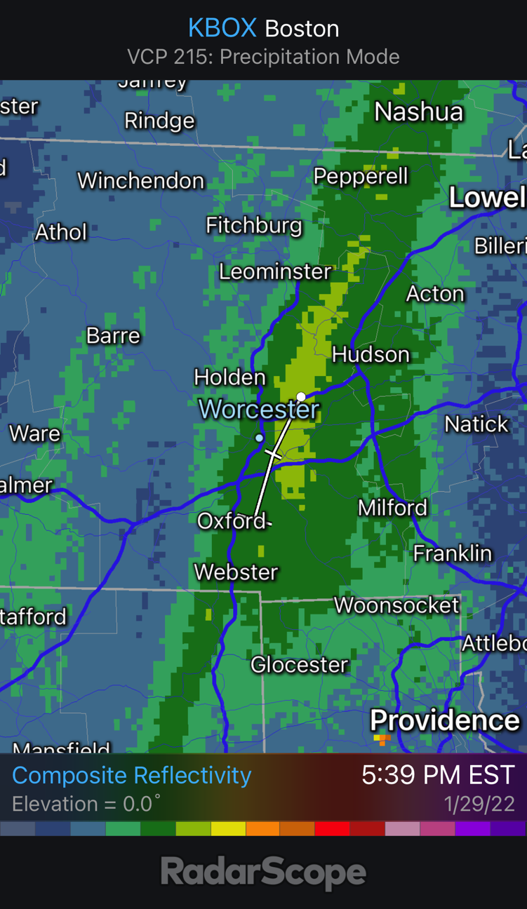
RadarScope just gave that band a storm cell...
-
OBS/DISCO - The Historic James Blizzard of 2022
wx_observer replied to TalcottWx's topic in New England
Radar disintegrating a lot since 5pm, between that dry slot, and the western edge of precipitation collapsing. Enjoying that final band of heavier snow coming down in central MA. What a rapid wind down, unless I'm missing something. -
OBS/DISCO - The Historic James Blizzard of 2022
wx_observer replied to TalcottWx's topic in New England
If it is any consolation, I was thinking this too. I feel like I saw way more snow fall than what verified on the ground. -
OBS/DISCO - The Historic James Blizzard of 2022
wx_observer replied to TalcottWx's topic in New England
That band threading the needle between 495 and 290 is picking up intensity…looks like the most potent band over land right now -
OBS/DISCO - The Historic James Blizzard of 2022
wx_observer replied to TalcottWx's topic in New England
This storm may have underwhelmed to the west, but with pics like that…it’s an epic storm regardless. -
OBS/DISCO - The Historic James Blizzard of 2022
wx_observer replied to TalcottWx's topic in New England
I’m a bit northwest, near Holden…Worcester has its fair share of near vertical hills for sure -
OBS/DISCO - The Historic James Blizzard of 2022
wx_observer replied to TalcottWx's topic in New England
I’m not far from green hill…same thing here. Bigger flakes, low visibility, but less wind. The flakes are finally falling more vertical than horizontal. -
OBS/DISCO - The Historic James Blizzard of 2022
wx_observer replied to TalcottWx's topic in New England
If it’s gusts at least 35 mph each hour, Worcester would verify between 7:54 am - 3:54 pm. (Airport) https://w1.weather.gov/data/obhistory/KORH.html -
OBS/DISCO - The Historic James Blizzard of 2022
wx_observer replied to TalcottWx's topic in New England
Do gusts count, or does it need to be 35 mph sustained winds to meet blizzard criteria? -
OBS/DISCO - The Historic James Blizzard of 2022
wx_observer replied to TalcottWx's topic in New England
Riddle me this—why reduce the speeds on the turnpike from NY border to Framingham, but not east of there? Seems like the worst weather is east of there. -
OBS/DISCO - The Historic James Blizzard of 2022
wx_observer replied to TalcottWx's topic in New England
Radar is looking better in central ma—it looks like that gap between the bands just west of Worcester and at 495 is filling in. -
OBS/DISCO - The Historic James Blizzard of 2022
wx_observer replied to TalcottWx's topic in New England
Not sure if this was already posted—but 1:17 pm update still not backing down on totals
-
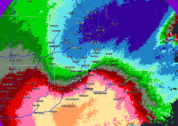
This is a pretty neat sat image…for both the double low, and the rippling of clouds between them. Will be interesting to see how that area evolves in the next few hours.