
Snowzone
-
Posts
40 -
Joined
-
Last visited
Content Type
Profiles
Blogs
Forums
American Weather
Media Demo
Store
Gallery
Everything posted by Snowzone
-
Don't get me wrong, I love spring, and I know the temps will be trending back to near, or even slightly below normal by Sunday or Monday. But to bypass early to mid spring-like 50's and 60's and jump right into the middle of June is a little too soon for me. It's not like we have to wait for months on end for this type of warmth to return. And we know that once the heat returns, it will lock in for several months. I wish we could just have a slow, but steady climb to this type of warmth. My high temp of 79.8 degrees is exactly normal for June 15th. As they say, "to each his own."
-
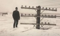
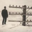
What a difference 133 years make.... The Blizzard of 1888.
-
My high yesterday was 71 degrees reached at 3:39pm. So far for today, my high temp is 66 degrees. Yesterday at this time I was at 69 degrees.
-
Wow. Very nice to know there is still a little bit of snow happening in some parts, even if it's far away from my location.
-
Possible Major Winter Storm/Coastal 3/6 - 3/8
Snowzone replied to Northof78's topic in New York City Metro
I'm about 15 miles NW of NYC at an elevation of 255 feet above sea level and received a total of 31 inches of snow from March 2, 2018 - April 2, 2018 -
Currently temp 51.1 degrees, low was 27.5 degrees. Only third time to hit 50 or above here since January 1st. The others being January 2, 50 degrees and February 16, 51 degrees.
-
15 miles NW of Central Park, NY I had 5.5" of snow on February 22, 2001.
-
OBS and nowcast 10A-5P both Mon and Tue 2/22-23
Snowzone replied to wdrag's topic in New York City Metro
Well, the inevitable has happened, the beautiful snowfall has be replaced by rain as of 2:00pm, but not before delivering an unexpected 3.2" of snow. I now have had 45.6" for the season. I'm very happy with that. -
OBS and nowcast 10A-5P both Mon and Tue 2/22-23
Snowzone replied to wdrag's topic in New York City Metro
I don't even want to look at the radar to see where the rain/snow line is. Ignorance is bliss. I just want to enjoy the snow while we have it....When it turns to rain, it turns to rain. -
OBS and nowcast 10A-5P both Mon and Tue 2/22-23
Snowzone replied to wdrag's topic in New York City Metro
As of 1:29pm, very heavy snow continuing. Temp of 32.4 degrees, 2.75 inches so far on non-paved surfaces. Snow started around 10:45am with temp of 36.7 degrees. Intensity picked up quickly and had moderate snow by 11:10 am. Non-paved surfaces were covered by 11:30am. Snow became heavy around 12:00pm and very heavy around 1:00pm. -
OBS and nowcast 10A-5P both Mon and Tue 2/22-23
Snowzone replied to wdrag's topic in New York City Metro
Wow! Nice. Enjoy -
OBS and nowcast 10A-5P both Mon and Tue 2/22-23
Snowzone replied to wdrag's topic in New York City Metro
Agree. -
I remember April 6 - 7, 1982 snowstorm while living in Hawthorne, NJ. Sunny and 55 degrees on April 5 with approaching storm. Temps dropped to 35 by midnight when rain started, then by 12:30am turned over to snow. I had 4 or 5 inches accumulate by dawn. Temps for that storm were much colder as they dropped down into the low 20's by sunrise and stayed there all day. Heavy snow continued all morning and became lighter by mid to late afternoon. I ended up with 12 inches from that storm. And very low temps for a couple of days after.
-
OBS and nowcast Thursday morning 2/18 - 11PM Friday 2/19/21
Snowzone replied to wdrag's topic in New York City Metro
3.3'" of snow with a trace of sleet. North Haledon, NJ -
Feb 18-19 long duration manageable snow and ice event
Snowzone replied to wdrag's topic in New York City Metro
Regardless of how much snow or cold we have had, I'm not fully ready to embrace spring until March 15 - 20. -
Feb 18-19 long duration manageable snow and ice event
Snowzone replied to wdrag's topic in New York City Metro
I believe that took place around February, 24th. -
Feb 18-19 long duration manageable snow and ice event
Snowzone replied to wdrag's topic in New York City Metro
Wow! I feel so old. That was the year I turned 40. -
Feb 18-19 long duration manageable snow and ice event
Snowzone replied to wdrag's topic in New York City Metro
That "storm" was indeed an epic disappointment. -
I know that the February 1899 Artic blast did indeed extend to the east coast. As did other severe Artic outbreaks. My point was, I do not recall any Artic blast this extreme, located this far south and far enough east to include the Ohio River valley, that did NOT reach the east coast?
-
I do not think it would be an exaggeration to say that this Artic outbreak has been extraordinary. I know there have been similar Artic outbreaks in the past, like the above mentioned. However; unlike the current Artic outbreak, the February 1899 Artic blast, extended to the east coast. As did the Artic outbreak in January 1893 and I believe January 1977 as well. So it made me wonder if there has ever been a similar Artic blast; like the current one, located this far south and far enough east to include the Ohio River valley, yet not reach the east coast?
-
This is true.
-
Having this week look so promising only several days ago, but not verify is a bit disappointing. I was just hoping the stratospheric cool down would not have started until early March. Of the 38.7" of snow I received, 28" fell between Jan 31 - Feb 7. I understand your point's about an early spring, I was just hoping our active, colder pattern would last longer than 2 weeks.
-
Stratosphere is cooling and PV is consolidating and pulling north... certainly not favorable for sustaining snow and cold in the NYC Metro-/Mid-Atlantic beyond February.
-
OBS and nowcast 9 AM today - Noon Valentines Day Feb 13-14, 2021
Snowzone replied to wdrag's topic in New York City Metro
As of 2:28pm, Temp is 25 degrees, Dewpoint 7. -
I actually remember this storm. I was 12. It started as light snow and turned to ZR in NYC during the evening. The temps stayed in the upper 20s. In Queens and Nassau the ice measured around 1" in diameter. Long Island had many homes without power. There was also a sharp pressure temperature over Long Island. It went up to 55 degrees on Montauk, while it was 36 in Islip and 25 in Central Park. The temperature dropped on the second day, (Dec. 17) and went down to the upper teens late that evening.


