
PantherJustin
-
Posts
738 -
Joined
-
Last visited
Content Type
Profiles
Blogs
Forums
American Weather
Media Demo
Store
Gallery
Everything posted by PantherJustin
-
Mid to Long Range Discussion ~ 2022
PantherJustin replied to buckeyefan1's topic in Southeastern States
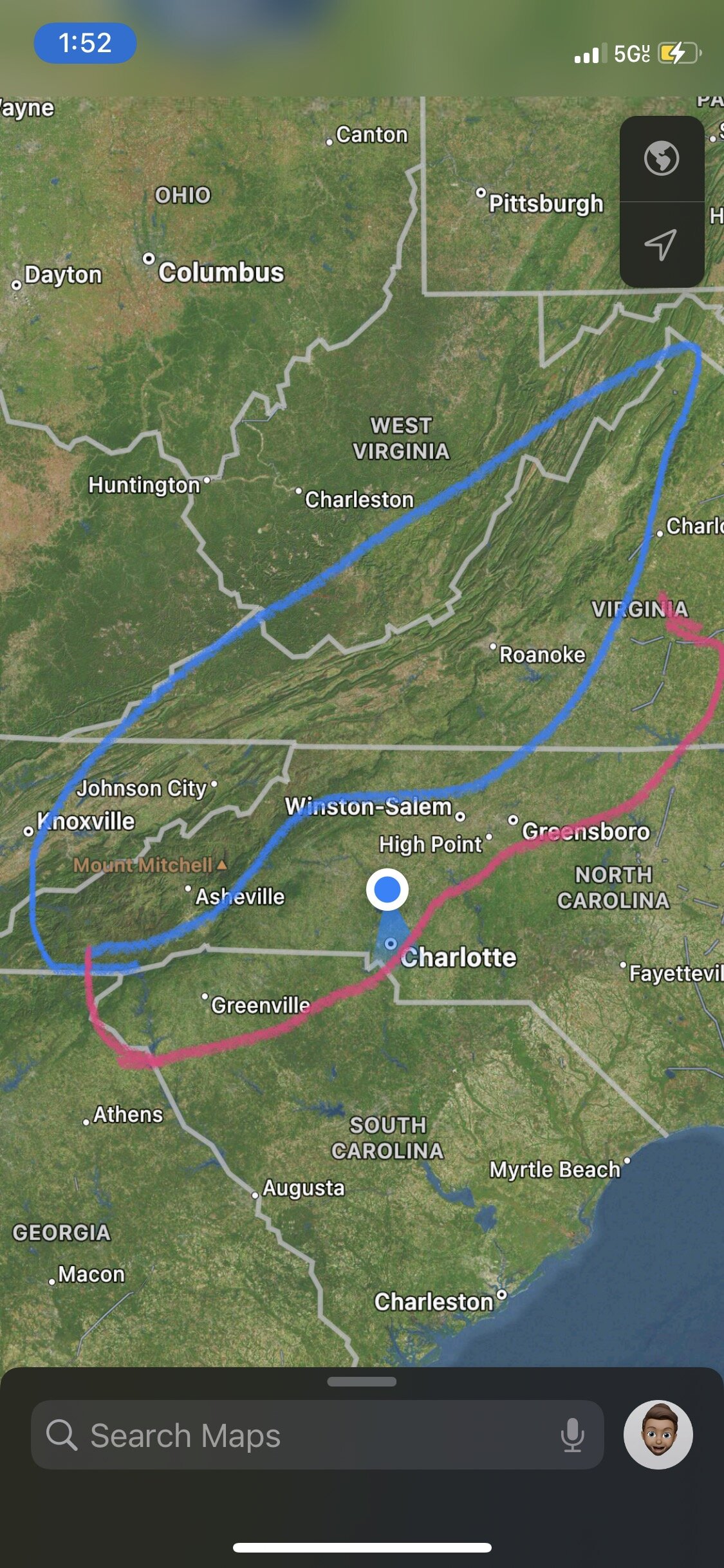
I don’t work for WPC… but imo I’d draw something like this… as a general “idea” no amounts obviously but for that little track thing they do 5-7 days out … roast me if you want …. Just for fun
-
Mid to Long Range Discussion ~ 2022
PantherJustin replied to buckeyefan1's topic in Southeastern States
Very true…. Although not 100% it’s normally similar to UKMET … I’d much rather have UK/EURO ENS in my corner than GFS (it’s gotten better but it’s still goofus) everyone here wants to crown the GFS bc normally it shows us eye Candy we wanna see but that Jmo …. In A CAD scenario in NC I’d place any bet with anyone on NAM thermals, and normally take GFS/EURO mean and avg then slice by 40% to get a forecast -
Mid to Long Range Discussion ~ 2022
PantherJustin replied to buckeyefan1's topic in Southeastern States
Wouldn’t the expansive Snowpack to our North create a Stronger HP than models could set up? Hybrid or not…. Also, I’d have to check but as much as we crap on the EURO imo it was decent last two events, Was first (even though it left it) to show further West Snow Accums 2 weeks ago, and this weekend it was first to go away from pure coastal QPF to the deform scenario…. Someone correct me if I’m wrong but that’s Jmo it bounces more than it used to but it’s not a clown model as some here may think -
Mid to Long Range Discussion ~ 2022
PantherJustin replied to buckeyefan1's topic in Southeastern States
It would…. But same song and dance you likely cut 75% off W/E any model says for Ice imo … that verbatim would be widespread .1-.25 amounts no more -
Mid to Long Range Discussion ~ 2022
PantherJustin replied to buckeyefan1's topic in Southeastern States
Bc it’s something to track -
Mid to Long Range Discussion ~ 2022
PantherJustin replied to buckeyefan1's topic in Southeastern States
Feb 2022 Big Frostys revenge -
Mid to Long Range Discussion ~ 2022
PantherJustin replied to buckeyefan1's topic in Southeastern States
Would also make sense coming off a slight warmup going back into a “Pattern” -
Potential 1/28-1/30 2022 winter storm
PantherJustin replied to Prismshine Productions's topic in Southeastern States
Not bad for 7 days out WPC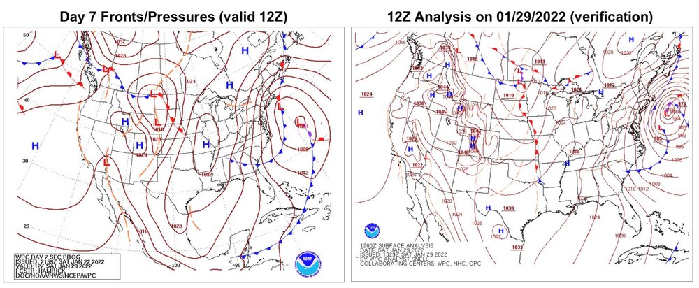
-
Im hoping to make it down to 10 -12 tonight but Idk if I will make it
-
Mid to Long Range Discussion ~ 2022
PantherJustin replied to buckeyefan1's topic in Southeastern States
Ik we’re just looking at signals but that’s a much more realistic signal imo… than some Blitzing snowstorm. It’s consistently shown a classic CAD signal in that time period for awhile now -
Mid to Long Range Discussion ~ 2022
PantherJustin replied to buckeyefan1's topic in Southeastern States
Wouldn’t 2022 without a weekend storm Tarheel -
Mid to Long Range Discussion ~ 2022
PantherJustin replied to buckeyefan1's topic in Southeastern States
Wouldn’t that technically be the same storm that’s been showing up? -
Is it football season yet? My god UNC can’t miss what an absolute beating man. Onto the next congrats UNC tip your hat, they’d beat the Lakers shooting like this just their day
-
Mid to Long Range Discussion ~ 2022
PantherJustin replied to buckeyefan1's topic in Southeastern States
Still something to track… the Carolina classics 5” SN/ 1” IP/ 1/4” Ice lol I enjoy those they stay forever -
Mid to Long Range Discussion ~ 2022
PantherJustin replied to buckeyefan1's topic in Southeastern States
***Correction ^^^ ALL OF NC/SC Upstate major cities need a Make up storm soon these 3 weeks have been cool I can’t lie (6.5”) now but I’m thirsty for a Feb 2004, Feb 2014 something where we see it coming 5 days out and it’s just pure Screenshots day in day out on the models. Realistically Asking, what’s a good storm? I say 8-12” ++ but that could vary for different areas so I’m curious what everyone thinks -
Potential 1/28-1/30 2022 winter storm
PantherJustin replied to Prismshine Productions's topic in Southeastern States
I can vouche here, I grew up in Concord (Always 3 degrees warmer than anywhere), Then I moved to Mt Ulla/Salisbury in 2014 (They always Cash in CAD the same ones I used to get screwed in) same now here in Mooresville. You’ve gotta get North of HWY73 in CLT Metro imo but I can’t cry as much as I do (two 10+ seasons since 2014, 6.5” this year) I’ve cashed many times since 2014 when I moved while 15- 25 miles away in Stanly, Cabarrus, especially Union have all rained or Sleet ect -
Potential 1/28-1/30 2022 winter storm
PantherJustin replied to Prismshine Productions's topic in Southeastern States
I apologize to everyone for my greed and basically just personality flaws taking over last night …. Aside from that , my lord is 3 feet UNDER done in a couple spots? I’ve seen a couple 12” reports in their Thread already lol -
OBS/DISCO - The Historic James Blizzard of 2022
PantherJustin replied to TalcottWx's topic in New England
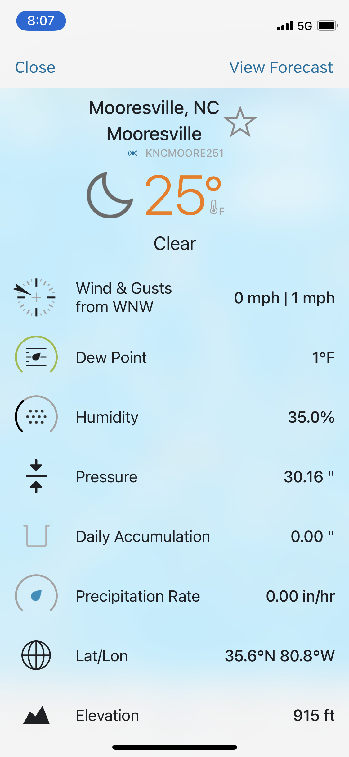
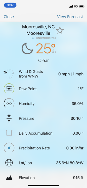
Lake Norman 30 miles N of Charlotte …1/2” carry on -
Potential 1/28-1/30 2022 winter storm
PantherJustin replied to Prismshine Productions's topic in Southeastern States
Having trouble uploading pics…. Trace-1/4” Mooresville/LKN -
Potential 1/28-1/30 2022 winter storm
PantherJustin replied to Prismshine Productions's topic in Southeastern States
Yea my bad… lol I took the sarcasm a bit too far last night my apologies…. Go Pack -
It’s Jan 28th…. Come on man lol
-
January 28-29 2022 Miller abcdefu Storm Obs/Discussion
PantherJustin replied to mappy's topic in Mid Atlantic
Don’t know if you guys are looking for reports from down here…This storm sucks…. HRRR sucks it’s a flaming dumpster… it’s 34 and raining here 30 miles North of Charlotte I was supposed to have 3” in this “Death band” if you listen to the short range Goofus … goodluck to you guys upstream but I’m out …. I can’t whine too much im 7” for a season total but still -
Well atleast we can hope this thing bust Tomm too… would be hilarious if All of New England got like 6-8” the meltdown would be hilarious
-
Probably when NC State wins a Championship in anything other Than Skeet Shooting
-
What a horrible run…. Gotta cancel the blizzard warnings now FML we can’t win