IowaStorm05
-
Posts
1,486 -
Joined
-
Last visited
Content Type
Profiles
Blogs
Forums
American Weather
Media Demo
Store
Gallery
Everything posted by IowaStorm05
-
 V16 says the storm doesn’t care that the CT River valley is there. Just like how last night the west coast storm didn’t care that there was a 12,000 Sierra crest in front of Reno and dumped a foot of snow on my cousin there anyway these storms just don’t care.
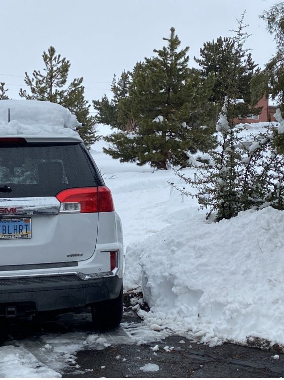
-
I don’t live IN it that is true. But I’m still on the edges of it....at Willi River level. But my dad does live there and He likes snow too! Not that anyone cares but my sister takes the cake of us all.... living on a hill in Coventry at like 700 feet.
-
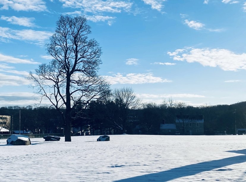
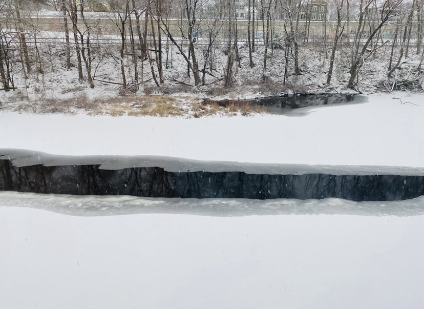
Open area showing the shallow yet stable snow cover in Willimantic today
-
And the 18z GFS repeats that CT River screw zone again. Not too bothered by it again at this far out
-
I have screenshotted this and am adding it to my collection named “Weirdo Art”. This isn’t creepy behavior

-
Yes I think it did. Dry slots. Screw zones. If I remember.
-
The grabbing hands, grab all they can. all for themselves, after all its a competitive world. everything counts in large amounts.
-
It’s damn good!
-
If this still looks like it does now 36 hours from now I’ll be able to get a lot more excited than I am currently. In other words to me the next 36-48 hours are the most critical
-
What’s the deets on a good radar? the new NWS is higher res and comprehensive but it loads soooo slow on my thing.
-
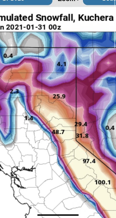
A good time to be in Reno, NV. Not New England but I figured i could pass it on grounds of being “banter”. Models are notoriously difficult for western Nevada snow due to shadow and spillover details but 30 inches does happen in the truckee meadows probably every 15-20 years on the valley floor and every 5 years in the foothills of town. It is achieved by multiple moderate events over a weeks period. 1992-1993 and 2004-2005 are such examples
-
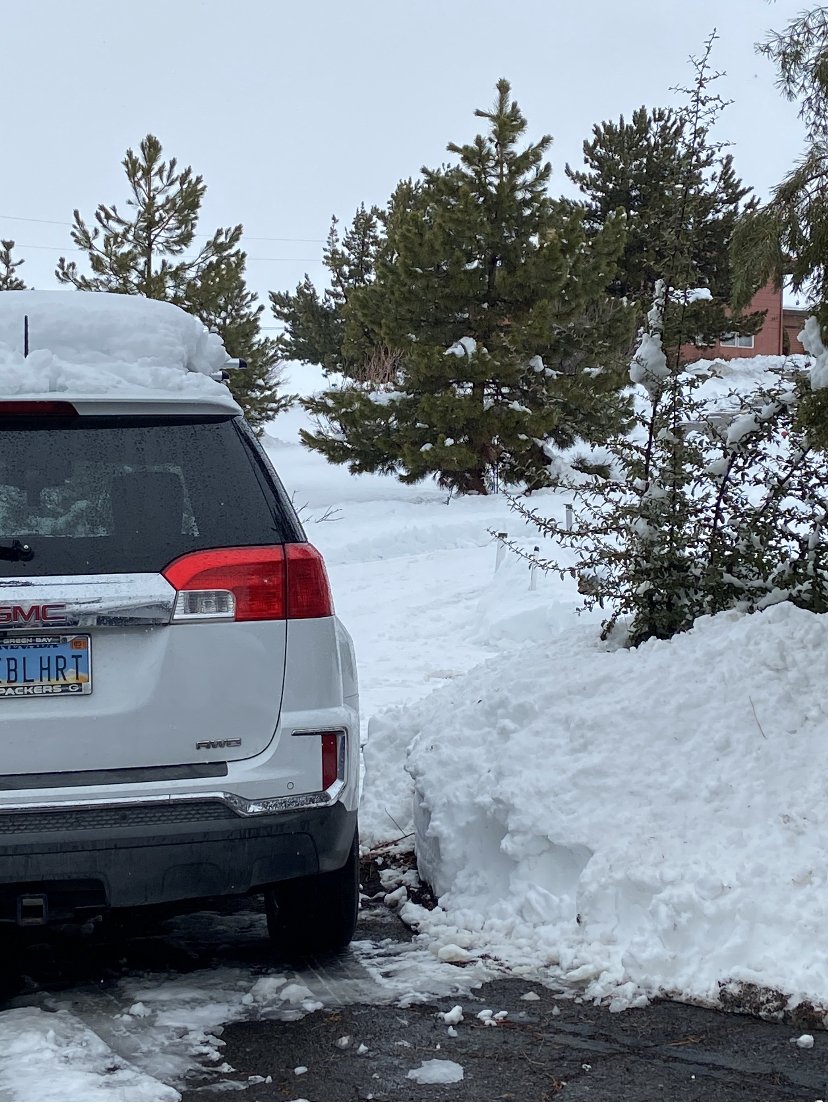
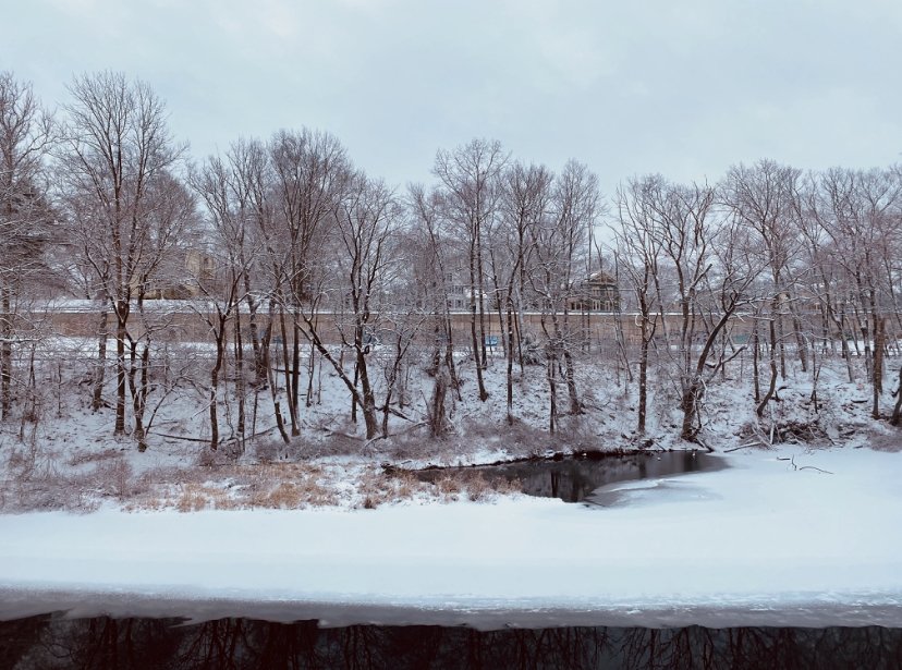
Final storm photo. It’s a bit of a distant rubbernecking but if you zoom you can see that it’s piled pretty good and thick on the wall and was enough to completely cover the jagged ravine surfaces. Would be cool if they upgrade max size limit so I can submit the high res original shots and not the screenshot of the original!
-
Just woke up to eat something and noticed it has definitely continued to snow shower overnight intermittently... Eyeballing at least 2.5 inches at this point with intensifying radar to our west
-
A pause in the action Vincent Price Laughter
-
1.4 here! It’s pretty.
-
Look it’s not exactly the blizzard of ‘78 but I see the full-in potential on radar, and, it’s in the guidance! drink your whiskey.
-
The River has made its own River.
-
The Weather Channel Radar future at least thinks so ha ha ha
-
Totally ripping and turning white now. I feel like lower areas like the Willimantic River still do a lot better than a similar elevation in the Connecticut River valley in an event like this. proximity to higher elevation hills and towns also reaps benefits, orographically or otherwise (depending) compared to equal-elevation spots that are surrounded by generally low elevation regimes. I could make inter mountain west examples but nobody cares here
-
1:41 pm EST - first flakes have abruptly started falling in Willimantic at the Riverbank
-
model trends esp GFS are actually underdoing CT now? I get that hunch at this time
-
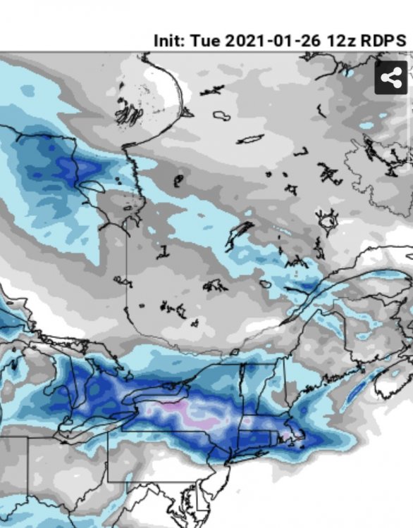
12z going out 60 hrs
-
With yesterday’s model runs I was tempted to Poo Poo the NWS conservative ideas about this but sometimes they are right to hold back a bit... we will see maybe upcoming short terms will correct back south a bit
-
It’s definitely a slight warming / lower totals trend for S CT in recent and short term runs.
-
Afternoon package sort of catching on to model trends but remain quite conservative indeed.