jculligan
-
Posts
451 -
Joined
-
Last visited
Content Type
Profiles
Blogs
Forums
American Weather
Media Demo
Store
Gallery
Everything posted by jculligan
-
1.0" new snow in North Salem NH overnight. 6.0" event total. Very light snow and 33F at the moment.
-
Power is back after an 8-hour outage here in North Salem. I measured exactly 5.0" before accumulation stopped around 1:30pm. It's been snowing lightly ever since, but melting on contact for the most part. It does appear that we are getting into some better snow growth now, so as we approach sunset I expect things to start whitening up again.
-
3.5" North Salem NH
-
Sleet flipped to snow here in North Salem (Exit 3 on I-93) about 20 minutes ago. Huge fat flakes coming down now, with a few pingers still mixed in but predominantly snow. 34F.
-

At least it's something - Jan 16th Snow/Sleet/Ice OBS Thread
jculligan replied to The 4 Seasons's topic in New England
Just flipped to sleet in Salem NH. I measured 3.2" before the changeover. -
1/9-1/10 Now Morphing to Less-Than-Exciting Power Cutter
jculligan replied to Torch Tiger's topic in New England
1.2" here in Salem NH but definitely mixing now. Was definitely snowing at a good clip with massive snowflakes for awhile. -
Another 1.4" of pure fluff since 6:00 brings our total up to 16.2" here in Salem NH. I think we're close to wrapping it up now.
-
14.8" here in Salem NH and pretty much stopped for the time being. Watching those interesting squall-like elements up in the Lakes Region to see if maybe we can pick up a little more this evening. Great storm regardless.
-
Another 1.1" last hour in Salem NH. Up to 14.2" for the storm total now. Still snowing quite steadily. This one definitely surpassed my expectations.
-
1.7" in the last hour for a storm total of 13.1" in Salem NH. Still snowing at a good clip.
-
After a prolonged lull with only about an inch of snow between 7am and 1pm, we are back in it again. I measured a 10.5" total at 1pm before we really got into this band. Hoping for a few more!
-
Calling it 9.7" here in Salem NH. Temp down to 22F now that the coastal front has collapsed south. In a lull at the moment with bands to our north and south.
-
I moved down from Jackson NH last year, and I've quickly become accustomed to living on the 32/33F boundary now. This one has broken in our favor. I ran errands around Tuscan Village this evening, and there was a noticeable difference between even there and here (Exit 1 and Exit 3). Wild how it can be so different sometimes.
-
2.7" in Salem NH, mostly from the OES preceding the main synoptic event. 32/30 at the moment. Looking forward to seeing what the morning brings.
-
70 mph MHT.
-
Preliminarily ... a medium impact partial Miller B, Friday
jculligan replied to Typhoon Tip's topic in New England
I have a feeling boundary layer temps were an issue in the immediate valley, which is why the amounts were so much lower than you might have expected. They definitely got the QPF but a lot of it was probably at temps of 33-34F. 1000' higher at my old cabin in Jackson this must have been 20"+ -
Preliminarily ... a medium impact partial Miller B, Friday
jculligan replied to Typhoon Tip's topic in New England
I could be mistaken, but I believe 31" at Pinkham is their largest single event since the 54" event in December 2003. That, by the way, was followed by a massive Grinch Storm. -
Really missing the cabin in Jackson for this event! They've been under some pretty solid echoes on the radar for quite some time now; thinking this likely eclipsed the largest event I witnessed during the two years I lived up there (14"). I'm really interested in knowing how this treated the eastern slope on Mount Washington. Unfortunately, the automated station at Hermit Lake does not appear to be reporting at this time. Just a light coating of snow (not really measurable) here in the tropics of Salem NH. Up early to go for a skin at Crotched Mountain in Francestown NH. Man, I miss skiing out the back door lol. Definitely an earlier alarm clock when based in southern NH.
-
Preliminarily ... a medium impact partial Miller B, Friday
jculligan replied to Typhoon Tip's topic in New England
Flipped to snow here in North Salem NH about 15 minutes ago with huge fat flakes coming down. Temp down to 34F and starting to accumulate on colder surfaces. We're late to the party down here (at least amongst the NH crew) but hoping to make up for lost time as temps continue to tick downward and we take advantage of a little extra lift in the vicinity of the coastal front. -
Good evening NNE crew! Maybe some have noticed the lack of posts from me so far this season, and assumed it was due to the slow start to winter. While partially true...the real reason is that I have relocated to southern NH with my (now) fiance. Leaving the mountains was obviously a VERY difficult decision, especially since I just arrived in 2020, but this was an extremely positive life change and let's face it...there is more to live than skiing and (gulp) weather. Make no mistake, we will be visiting the mountains with extreme frequency this winter but our place of residence is Salem NH now. At least I'm still in the Granite State! I have a feeling our future will ultimately point north again at some point. I'm traveling for work this evening but on the flip side there was probably more snow tonight in Salem than there was in Jackson Cheers to an historic rally in the next few weeks...
-
Looks like a little shy of 10" of new snow at Hermit Lake on the east side of Mount Washington. I figured the western slope would get crushed by upslope, but that's an impressive number for the east side which normally experiences a fair degree of shadowing. There must have been some synoptic stuff going on in addition to the upslope. 40" depth at the plot. This isn't 2020 when the Hermit Lake plot had a 100" depth on May 1st, but the alpine is way snowier than last year.
-
Remote station at Hermit Lake showing 6" of new snow accumulation up there, so this event seems to be smoking the east side as well. I skied King Ravine on Mount Adams this past Sunday, and I'm hoping to ski in the Great Gulf this upcoming Sunday...so keep it coming!!
-
That's quite the upslope signal emerging from Wednesday through Friday and potentially lingering into early Saturday. Long duration event with substantial QPF. 850 temps get quite low for this time of the year as well (down to -10C for a bit) so this one is going to be fun in the higher terrain. The snowpack at 4000' in the White Mountains has been amazingly unwavering for the majority of the season...essentially holding in the 30-40" range at the Hermit Lake snow plot for the last four months lol. But I wonder if the late week event can actually push some locations to their deepest snowcover of the season. Historically, the snow depth at 4000' should peak toward the end of March but you only have to go back to 2020 to find a year when it peaked much later. A dry winter followed by a cold and stormy spring will do it. I think the Hermit Lake depth peaked around May 1st in 2020.
-
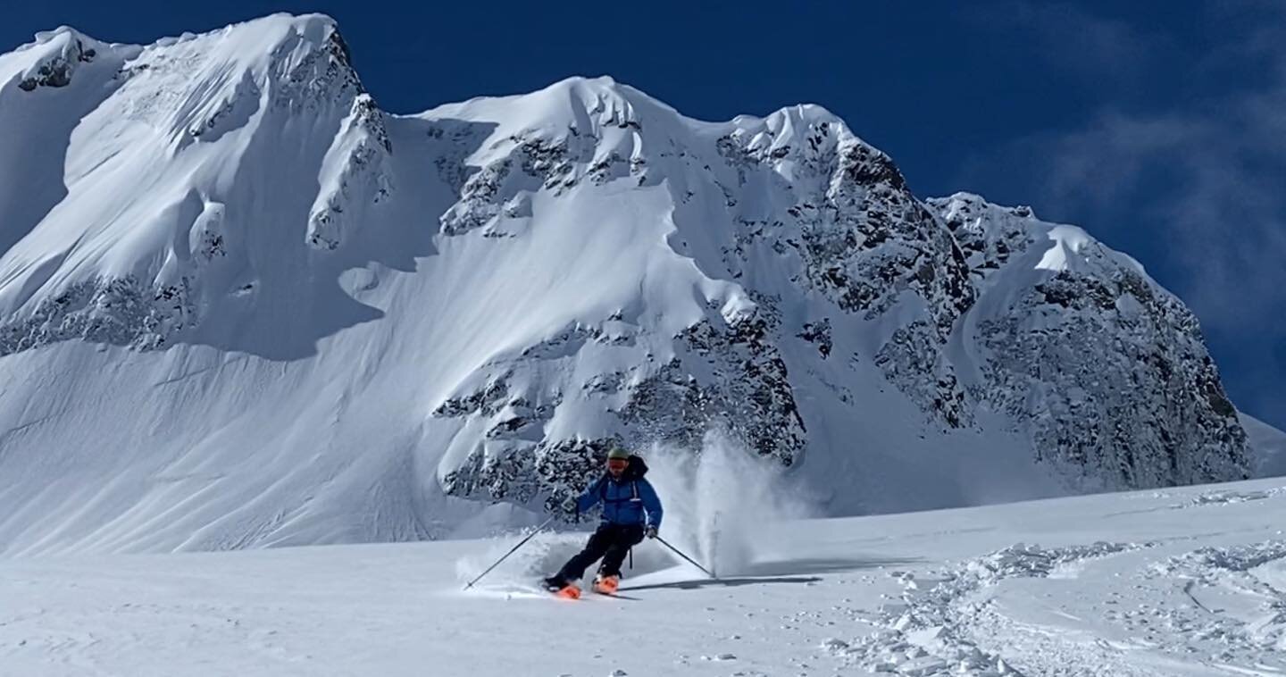
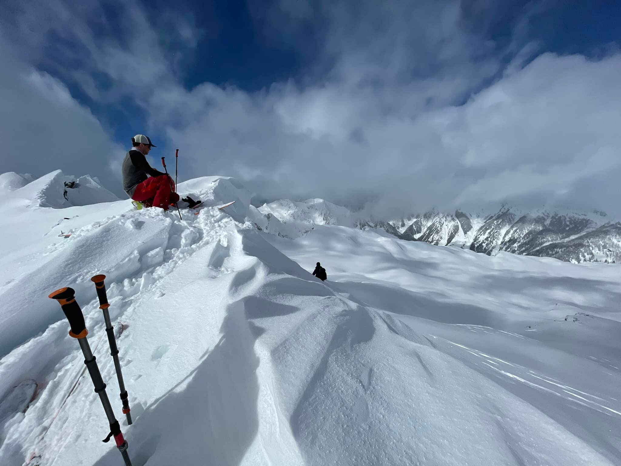
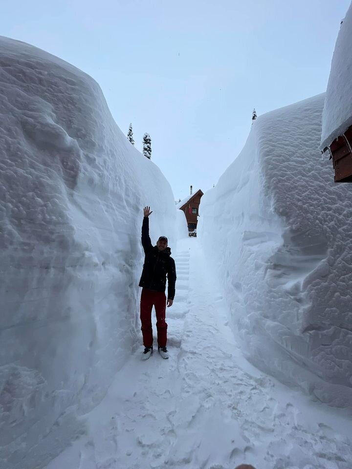
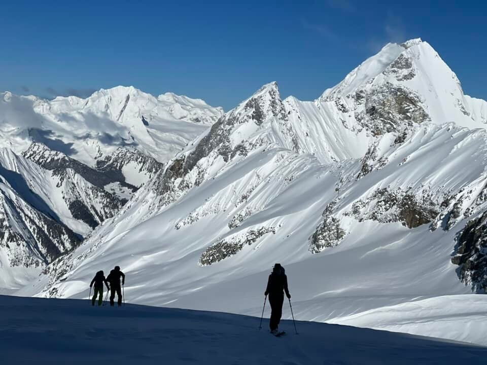
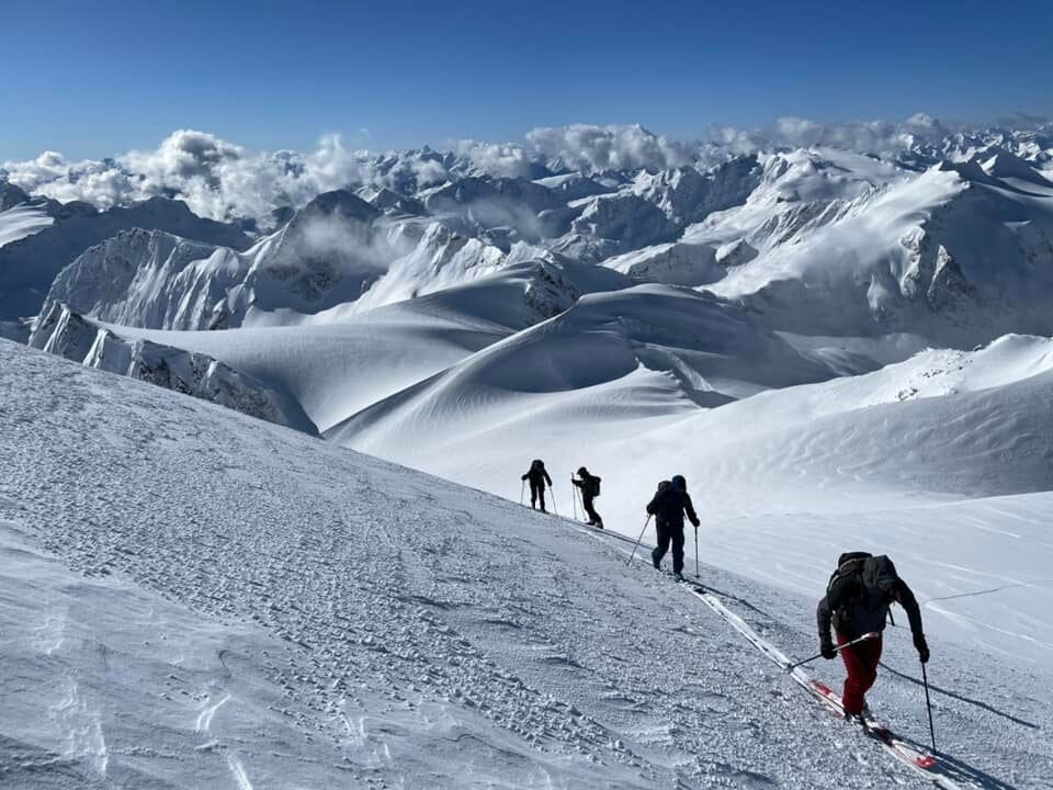
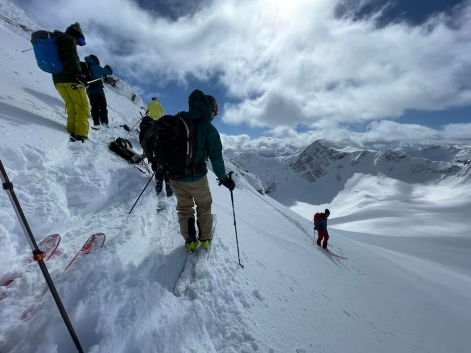
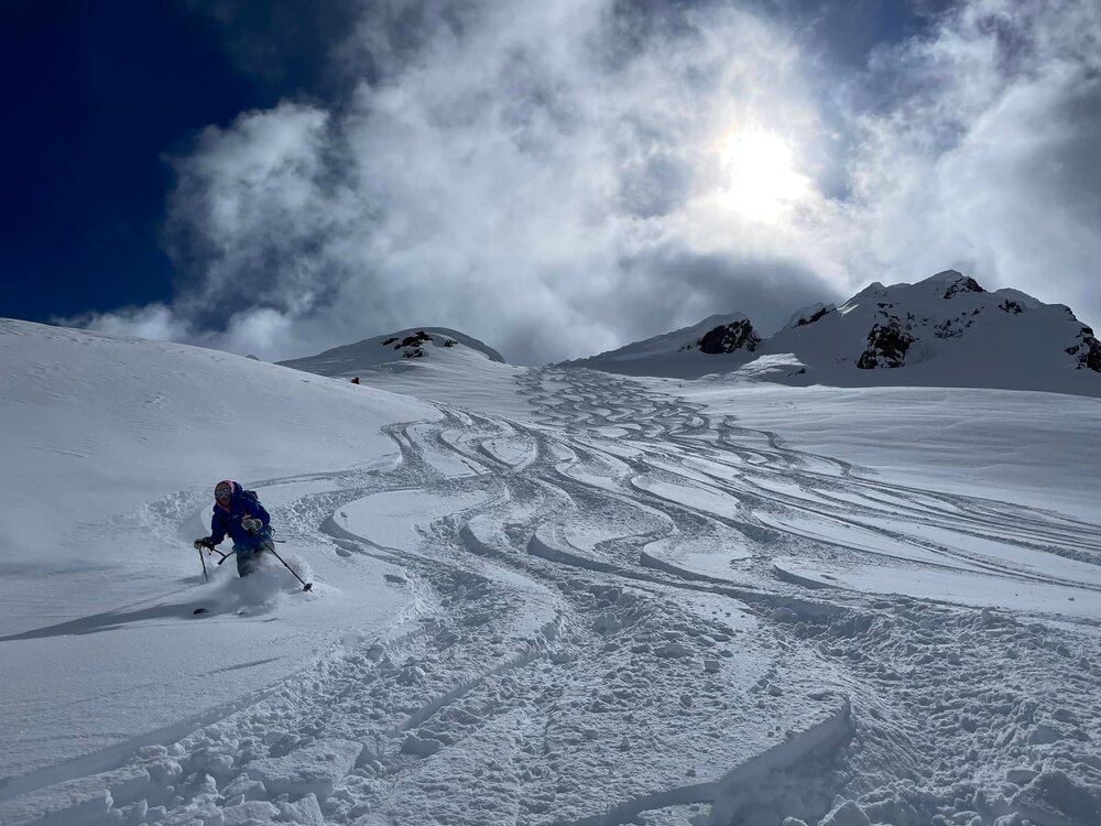
Here's a few!


-
On the plane back from the Durrand Glacier Chalet in British Columbia. They aren't hurting for a snowpack there...