jculligan
-
Posts
451 -
Joined
-
Last visited
Content Type
Profiles
Blogs
Forums
American Weather
Media Demo
Store
Gallery
Everything posted by jculligan
-
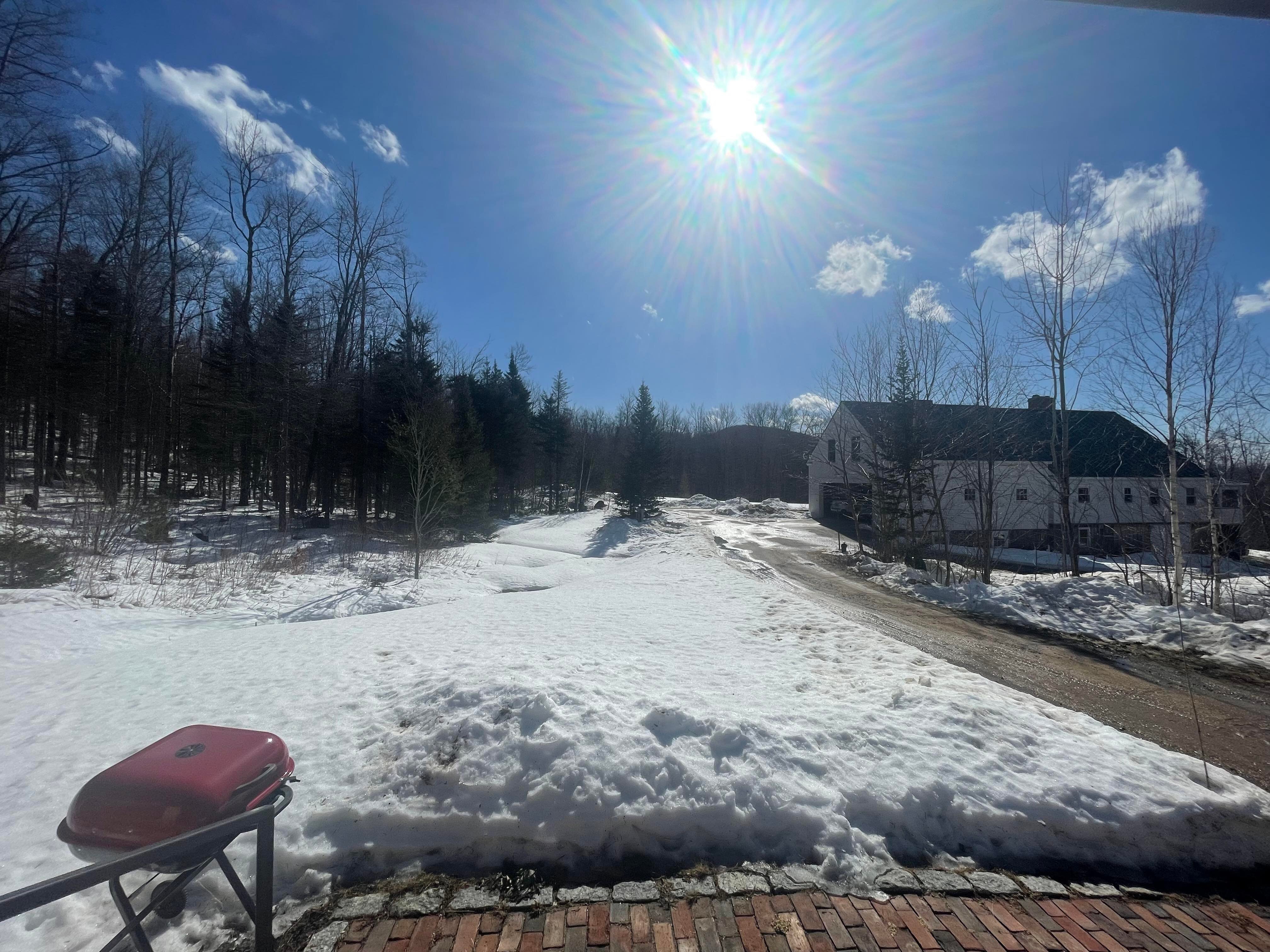
8F and 2.4" down so far.
-
9 degrees and 1.5" down so far. Finally broke 60" on the season and we should come within striking distance of last year's seasonal total today. My course with the Mount Washington Backcountry Ski Festival was called off due to the low tide conditions right now, so I'll be lapping groomers instead. Hard to call that a bad day.
-
I'm registered for two days of touring with the Mount Washington Backcountry Ski Festival tomorrow and Sunday. Tomorrow I'm registered for the "White Mountain Exploration" course and Sunday I'm registered for a "Ski Mountaineering" course. Based on this morning's avalanche advisory, conditions sound absolutely atrocious with a multitude of hazards. Many of the ravines in New Hampshire are watershed drainages, and with the volume of meltwater and rainwater that was funneling underneath the snowpack this week...a lot of very significant undermining has occurred. Apparently a large chunk of Hillman's Highway has washed away, according to this morning's avalanche report. Undermined snow, ice dams, moats and glide cracks - these are hazards that don't typically emerge until late spring. For backcountry enthusiasts in the White Mountains, this is a bottom tier winter. I have a call with my guide this evening, and I have a feeling our list of potential objectives will be quite short...
-
My blocked anemometer just hit 40 mph which is the peak gust of the year so far. There's a private wx station on Thorn Hill Road which is only 100' higher than my location, and that site has apparently clocked a 63 mph gust so far this evening. Hoping to keep onto the power here at this point.
-
Very impressive temperature drop. From 55F at 2:30pm to 23F now. The wind is roaring. Welcome back winter.
-
Also, my records indicate that my snow depth peaked on this date last year when we had 23" OTG. So we're much worse off than we were last year at this time, which is pretty discouraging to think about. Hoping for a miracle March.
-
The valley is almost completely melted out, but I think we're going to make it through with a solid pack still in place here. Roughly 8-10" OTG right now. That's way down from our seasonal peak of 33" back on 2/8, but hey...no grass showing here which is a win in this pattern. Made it up to 59F today but back down to 55F with a noticeable uptick in the wind last hour. Ready for winter to come roaring back in.

-
2.4" total in Jackson NH today
-
Ended up with 2.4" between the synoptic snow and the squalls that followed. Very pleased with this outcome! I hiked to Ripley Falls in Crawford Notch early this afternoon, and estimated at least 3.5" to 4" of snow there...and that was even prior to the squalls blasting through. Wintry appeal has been restored to the New Hampshire mountains.
-
I think it's a combination of factors. It's somewhat against climatological norms to have a storm track that particular way in the month of February, but even more unusual to have two within a single week. Add a below average snowpack into the mix, and we don't have the normal insurance policy to protect us from snowpack decimation that we normally would. All that being said, I have a suspicion that next week's event will not feature 24+ hours of 40F+ temps in the White Mountains. There are some better indications for low level CAD that were missing in this most recent event. I'm hoping we rot at 32/33F for hours followed by the more typical spike that often accompanies the frontal passage, rather than having an all out torch that lasts for more than a day.
-
I've been a frequent visitor to the White Mountains since I first arrived as an undergrad at Plymouth State University in the autumn of 2001. I'm sure some folks in here have a better memory than mine, but I'm not sure I've ever witnessed the seasonal snowpack being wiped out in the month of February. There have been years where it took a long time to initially establish the seasonal snowpack...but usually once it's there, it stays through at least the end of March. Last year was perhaps the earliest melt-out I've seen, with the possible exception of 2016. If you lose all of your natural snow next week, that will truly be noteworthy. I don't have official stats to back this up, but...that would be quite a significant deviation from the climatological norm in this area, if not close to unprecedented.
-
In other news, looks like a great setup for squalls tomorrow afternoon/evening.
-
Makes me afraid to see what Black Mountain looks like today. It took until last week, but they finally had almost 100% of their terrain open...but they have wide open south-facing slopes which I'm assuming took a huge hit with this event. As they fight the increasing sun angle with each passing day, I don't know that they'll be able to bounce back to the trail count prior to this event.
-
I'll be returning to Jackson early this evening. There was two feet OTG when I left Wednesday evening. I don't think CAD was much of a factor in this event, so I'm assuming our pack took a healthy hit. I'm hoping there's a foot left at my place as well. Still planning to head to Stowe on Monday, so I'm hoping for some Green Mountain magic out of tomorrow's clipper. Even if it's just a couple inches, it has to do something to freshen the snow surface...
-
I'm heading down to Massachusetts this evening until Friday afternoon, then traveling back north to Jackson Friday evening. I have about two feet OTG in my yard right now, so it'll be interesting to see how much survives the inevitable torch. I'm hoping CAD saves the Mount Washington Valley for most of the day tomorrow, but I'm sure there will be at least a 12-hour period of rapid melt tomorrow night...especially at my 1500' elevation. Hopefully we only lose 6-8" but I get nervous when I see dewpoints nearing 50F in the forecast. We'll see. I hope the Greens really cash in with the post-frontal upslope on Friday and then the follow-up clipper system on Saturday. Planning to take the girlfriend and her 10-year-old son over to Stowe on Monday in search of better snow.
-
Looks like some opportunities for the Vermont folks to pick up some snow on the back side of Friday's system, then again with a little clipper Saturday afternoon/evening. Maybe a couple/few inches in the northern Greens from both systems? Little hope here in the eastern Whites and I envision ski conditions won't really improve here until warmer temps arrive early next week. Looking farther down the road, I'm cautiously optimistic about the Thursday/Friday period late next week. Looks like an opportunity for an SWFE type system on both the Euro and the gfs. The gfs is particularly robust with it. Things were really good here about a week ago, so hopefully this current stretch will be just a temporary setback and late Feb/March will deliver the goods once again.
-
Lost a good 6" of snow between Friday and Saturday, but man were conditions great yesterday. I skied the Doublehead ski trail twice in the afternoon and it was super soft and springy with bumps that had a perfect flow to them. Hands down the best it has skied all year. Today will be an entirely different story. The gfs is trying to spit out some QPF here with the inverted trough tonight, so maybe we can squeeze out a coating to an inch. Otherwise we aren't looking at much now until the cutter at the end of the week, which looks to be another huge hit to the snowpack. Those cutters with 50-degree overnight temps are notorious snowpack annihilators, so I really do hope something changes. I'd estimate about two feet OTG right now.
-
March 2001, March 2007, March 2018 are probably top three. 2001 was probably the biggest, and that's a bitter pill for me to swallow since that was largely due to one of the most historic busts of all time in the NJ/NYC area (where I was living at the time). I remember watching Paul Kocin on TWC displaying a map of 20-30" forecast across the entire state of NJ, but the storm shifted north at the last minute and pounded New England instead. As a high schooler and TRUE weather weenie at the time, it was devastating! Meanwhile up north, some parts of NH (even outside of the mountains) had a 40" depth that lasted into early April if I recall correctly.
-
Low of 36F here at 1500' in Jackson. This was the first night that failed to dip below freezing in many weeks. I'll have to get out into the woods to do some depth measurements today, but I don't think we've lost more than a few inches since our peak depth of 33" was reached on Tuesday. Maybe we have 28" OTG now? But the melting has certainly accelerated today with higher dewpoints. 47/34 with a gusty west wind currently.
-
I think Crescent Ridge may be calling my name soon. How's your snow depth shaping up these days?
-
Ended up with 6" on the nose here. The temperature did briefly spike all the way to 40F when the sun came out this afternoon, but it was short-lived and doesn't seem to have made too much of a dent to our very robust snowpack. Back down to 29F now. My peak snow depth last winter was measured on February 22nd, which is likely quite early for this location compared to climo. With 30"+ on the level right now and at least 2-3 weeks until our climatological peak depth, I would imagine we have a fighting chance of reaching a 40" depth this season which would have seemed nearly impossible just a few short weeks ago. The rest of this week looks quiet on the synoptic front, but I'm not writing off the coastal system early next week as our next potential. In the meantime, I'm looking forward to more tolerable temps this week.
-
I'm one mile from the Black Mountain parking lot and immediately adjacent to the Doublehead Ski Trail. Conditions are superb right now!
-
Drove up from Boston early this morning. It rained all the way to Ossipee, briefly flipped to snow in Tamworth then changed back to rain from Chocorua Lake all the way to Center Conway. Changed back over to snow in North Conway where I stopped for a brief ski tour on Peaked Mountain, but even North Conway flipped to rain prior to my departure around 10am. Here in Jackson...no rain to speak of. There was 5.3" of new snow on my driveway when I arrived home, and it continues to snow big fat flakes at 34F. Our settled snow depth is up to 33" which is 10" deeper than at any point last year. The pack has a LOT of water content in it. I know this area is particularly known for snowpack retention, but I feel I didn't get to test that last season. Hopefully we don't HAVE to test that for a while yet...
-
 5.3" of snow here in Jackson with a settled depth of 33" OTG. Snow continues to fall but it's up to 34 and the roof avalanches have begun. Deep winter out there either way.
 -
Haven't really been tracking this one closely - had family from Georgia visiting this weekend, and I'm actually down in Massachusetts until tomorrow morning. It'll be interesting to see how much snow is waiting for me when I return north! This should get our pack up and over the 30" mark.