

jculligan
-
Posts
451 -
Joined
-
Last visited
Content Type
Profiles
Blogs
Forums
American Weather
Media Demo
Store
Gallery
Everything posted by jculligan
-
30/28 -SNPL 3.3" total so far.
-
30/28 -SNPL 3.0" total so far. Looks like some solid echoes are about to move in, but I feel like we're going to be dancing with the mix line for the next several hours now.
-
Yep, the NAM seems to have a better handle on the mid-level warm layer compared to the HRRR. Having said that, it looks like the northward progress of the mix line MAY have halted or even been knocked back a bit over Essex County MA...but could be just a temporary trend. Hard to say at this point if we have a snowy or an icy evening coming up.
-
30/28 -SN 2.8" total so far in Salem NH. Watching that mix line creeping toward us.
-
30/28 -SN 2.0" total so far.
-
30/28 -SN. Total accumulation of 1.7" so far.
-
30/27 -SN continues. Total accumulation 1.1" in North Salem NH. Sadly, this is now the most significant December snowfall since I moved to this location in 2022. Really underscores how these last few seasons have really struggled to get started, even in southern NH. This is a nice change.
-
29/27 with steady -SN in Salem NH. 0.7" accumulation so far.
-
Overcast and 27/22 after a low of 19 here. We had a brief flurry around 7am but the real stuff is probably a couple hours away. My location will be uncomfortably close to the mixing line by late this afternoon but most guidance seems to keep it just a hair to my south. I'm just off exit 3 on I-93.
-
Exactly 1.5" in Salem NH. It's letting up as the heavier echoes shift north, so we're probably done now. Still, it's our first measurable since 2/27 and our first 1"+ since 2/16. We are now tied with last year's seasonal total at a whopping 36 inches.
-
Very interesting and valuable insight, thank you both!! The upslope signal does appear to be fairly decent from Thursday evening through Friday morning, from my perspective, so hopefully the signal holds/increases as we get closer to the event. It's been a heck of a winter for the Green Mountains, so hopefully Wednesday's rain is just a small blip on the radar before the good times resume. Think snow!!!
-
Question for the local experts here on "blocked" versus "unblocked" flow. This has some relevancy for a ski day I have planned for this upcoming Friday. I know that blocked flow tends to favor locations that are west of the Green Mountain spine, whereas unblocked flow favors locations to the east. It looks like most ski areas in Vermont are along/east of the spine...but I'm curious about Smuggler's Notch. In looking at topo maps, it appears that Smuggs is west of the spine. Do they tend to do better in blocked flow situations compared to other VT ski areas? I'm asking because I have a ski day with a good friend that has been on the books for this coming Friday since the autumn. Naturally, we have rain coming this week...but there may be a limited window for upslope snowfall after the departure of this ugly weather system Thursday night, and I'm trying to figure out the location that is most likely to pick up a couple/few inches of snow to *hopefully* cover up the inevitable crusty/scratchy conditions that will follow the rain. Thanks in advance!
-
One inch in the last hour. Storm total of 6.8 inches. Still snowing, so this will likely end up the top event of the season to date (previous was 6.9" last Saturday night/Sunday AM). It's the winter of light to moderate snow events around here.
-
Started pouring sleet here around 8:30, flipped to heavy snow with huge aggregates about 20 minutes later then has alternated between heavy sleet and heavy snow ever since. The temp had crashed down to 23F but is now back up to 25F. Very interesting conclusion to this event. Going out to measure around 10pm.
-
Took a little bit longer than I expected, but the coastal front slipped through Salem as I was clearing the slush off the driveway. It was 34F when I started, and 29F when I came inside. Freezing rain now.
-
We stayed snow/sleet until around 1pm here before finally flipping to rain/sleet. My final snow/sleet accumulation will be logged at 5.8 inches. The temp has crept up to 34F but it looks like the CF is going to be slipping back through here within the next few minutes. Flash freeze incoming...
-
About a quarter inch of sleet on top of the 5" of snow now. It's been mostly sleet here for the last two hours, but there have been very brief periods where it has gone back to snow...but usually only lasting a minute or two. Still no freezing rain at this location yet. Temp holding at 24F.
-
5" on the nose here in Salem NH before the flip to sleet shortly after 6am. 14" total OTG. 23F with pingers at the moment.
-
Snow just about wrapping up here in Salem NH with 6.9" total for the event. 13" OTG at the moment.
-
4.8" Salem NH
-
0.9" in the last hour for an event total of 4.0" in Salem NH. Not the prolific rates we experienced between 10pm-12am but steadily piling up. 26F.
-
Very impressive burst of snow here in southern NH. We picked up 2.5" of snow in the last hour for an event total of 3.1" so far in Salem NH. Dumping.
-
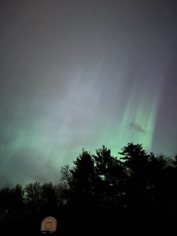
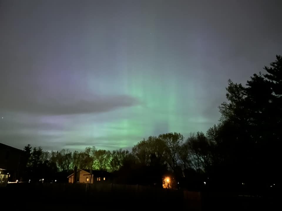
Visible in Salem, NH!!
-
Well I am clearly out of the loop! lol
-
Good morning old friends! It's been a while since I poked into this thread. Does Phineas still post in here? With the avalanche rating forecast to be "considerable" tomorrow I'm hoping to find some lower angle glades to ski instead of heading into the alpine, and I'm curious about the snowpack situation in the vicinity of Crescent Ridge. I'm sure they did very well with the recent storm, but I'm hoping it fell on a decent enough base. Down here in the Flatlands of southern NH we picked up 6" of incredibly moisture-laden snow. Decent event for the first week of April in this climo zone, but I was definitely missing the old cabin in Jackson for this one...


