jculligan
-
Posts
451 -
Joined
-
Last visited
Content Type
Profiles
Blogs
Forums
American Weather
Media Demo
Store
Gallery
Everything posted by jculligan
-
Snow has commenced here. 24/21 with a light dusting so far. Here we go.
-
Hey there! Been a busy few days so I haven't really had a chance to follow this event very closely. Caught up for a bit today, and I agree that I'm sitting pretty for this event. Fascinating how tenacious the RGEM is at popping big numbers in my neighborhood compared to the other models; it really nukes us with a TROWAL feature as the secondary low takes over in the GOM tomorrow evening. I'd love to think we can get into a period of 2"/hour rates tomorrow evening, but I'm not really buying it until I see some of the globals warm up to the idea. The overnight models runs could be interesting. Currently 24/21 as we await the first flakes here in Jackson. After a run of pretty frigid nights, mid 20s feels downright tropical out there. Bring on the snow!!!
-
Low of 0F here for the coldest morning of the winter to date. Did a sunrise skin up to North Doublehead and measured a temp of -4F on the summit. But we're definitely getting some blocking from the Presidentials, because there isn't much of a breeze out there. And that's perfectly fine by me ha. My ideal winter would be 20s and snow every day; I really don't have much use for the arctic stuff.
-
Picked up 0.2" early this morning to break 36" on the season. Alex and Phin are both within an hour's drive, and it never ceases to amaze just how different the climate is on the other side of the Notches. But this is well established now. With little chance of meaningful snow here, the real story in this area will be the prospect of our first sub-zero morning. So far my coldest has been 2F back on 12/16. If we're going to go sub-zero, I think it'll be either tonight or tomorrow night. Saturday night could be the coldest on valley floors, but we'll be inverted by then at this elevation. How low will we go...
-
Maybe a little more on the way later today/tonight too. Hopefully we can squeeze out another inch or two.
-
2.8" total with light snow still falling. 13" on the ground, which is my greatest depth of the season. 23F with no wind. Heading to Pinkham for a quick powder lap!
-
2" down as of 11pm and still snowing at a steady clip. Beautiful night out there.
-
Sounds nearly identical to here. About 1" down and 22 degrees with no wind. I'd take this all winter.
-
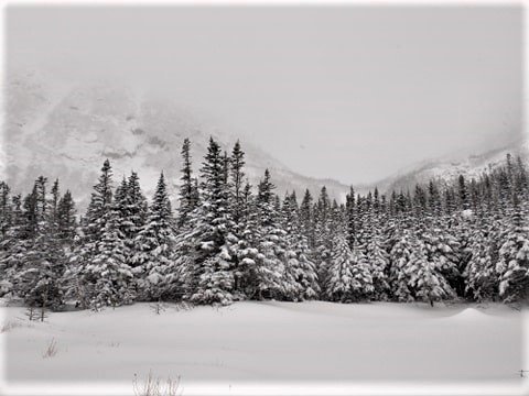
Snow has commenced here. 25/18 with decent flake size. Not expecting much, but it's always nice to get a little refresher. Ventured into the yard for some depth measurements this afternoon and came up with an average of 10-11" in most spots. Not sure how that measures up compared to the historical average, but at least we're doing a lot better than the valley. Either way, it looks like a nice wintry period coming up with a light refresher tonight, deep cold air incoming Friday/Saturday and then a possible coastal early next week. Fingers crossed.
-
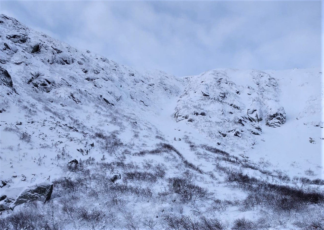
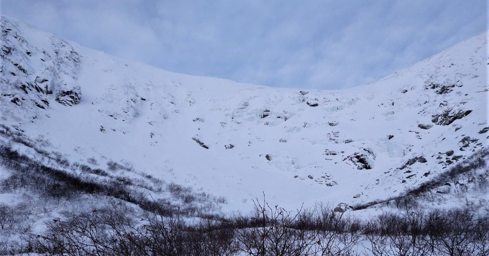
The lady wanted a bit of an adventure today, so we wandered up to the First Aid cache at the floor of Tuckerman Ravine late this morning. The wind was absolutely insane at Pinkham Notch (car shaking gusts as we were getting geared up) and you can imagine things were off the hook at the floor of the ravine. The avalanche danger was lowered to "moderate" this morning, but the advisory indicated that there was a low probability of avalanches up to D3 (large and destructive; the type that can take down trees) if something were to trigger...and with the raging wind and low visibility, we wouldn't even see/hear it coming. For that reason, the First Aid cache was as far as I was comfortable going since anything beyond that is most definitely avalanche terrain. Between the skier traffic yesterday, and the incredible wind today...the Sherburne Trail is down to very hard snow with sections of exposed rock. I think I'll be back to lapping groomers this week until we can get more snow. I would imagine the ravines were pummeled to the point that the avalanche rating will likely be reduced further this week, but "slide for life" conditions will prevail instead. No interest in that. The backcountry is once again on hold around here.
-
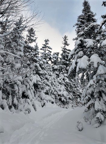
Conditions were very good in Phin's neighborhood today. We haven't reached the magical 40" snow depth, so it was definitely a little brushy/scrubby in sections (especially the steeper pitches) but it was nice to finally get some turns on an off piste glade. Crescent Ridge is a super fun zone! I'll be back after the next storm/period of persistent upslope.
-
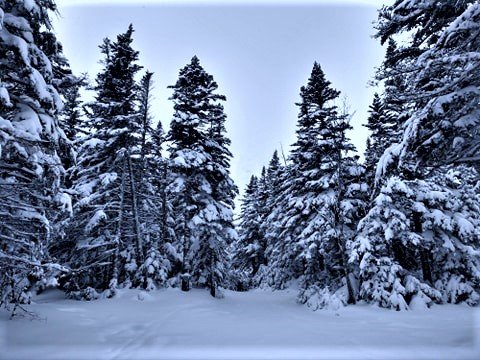
There was about 3" of new snow last night with a persistent westerly wind of 30-40 mph in the alpine zone today. No doubt there was some pretty significant loading at the top of Left today. With snow falling on the mountain right now and a significant wind event shaping up for the weekend, the ravines are definitely a "no go" for me over the next few days. Mellow trees will be the ticket this weekend.
-
Heading up to Phin's hood to check out the Crescent Ridge Glade tomorrow morning. No snow here in Jackson this evening. Hopefully it's a different story north of Pinkham.
-
The NAM has been consistently painting a strip of enhanced QPF in parts of Grafton and Carroll Counties this evening...sometime in the 21z-03z tmeframe. Seems to be a squall signal with the passing arctic front. The latest run actually has a very narrow strip of up to 0.30" which could mean someone really cashes in with the high ratio fluff we've been seeing lately. Looks like a fun evening ahead. Appears we picked up at least 1" here overnight, and I see the remote site at Hermit Lakes picked up around 3 inches. The Sherbie should be good this morning.
-
My neighborhood! I'm less than a mile up the road from the Black Mountain base area. I absolutely love the vibe at Black; you can't get more of a quintessential "Mom and Pop" New England ski hill than Black Mountain. It is, however, very tiny...so I would check it out more for the character than the variety of terrain. They really cater to the uphill crowd, so you'll see quite a few people skinning there (probably including myself) compared to other mountains, but in general the place almost always seems empty. Black Mountain has southern exposure and a base elevation near 1200' so I find it is a really good spot on the bitter cold days when it's sub-zero at places like Wildcat, Bretton Woods and Cannon. It is also downslope of Mount Washington, which means it gets way more sun than neighboring ski areas to the west but also takes a hit in the snowfall department as we have seen this year. I saw an old advertisement from like the 1940s that said, "Ski Black Mountain. Ski in the Sun" and it definitely appears to ring true more often than not. Cozy little place.
-
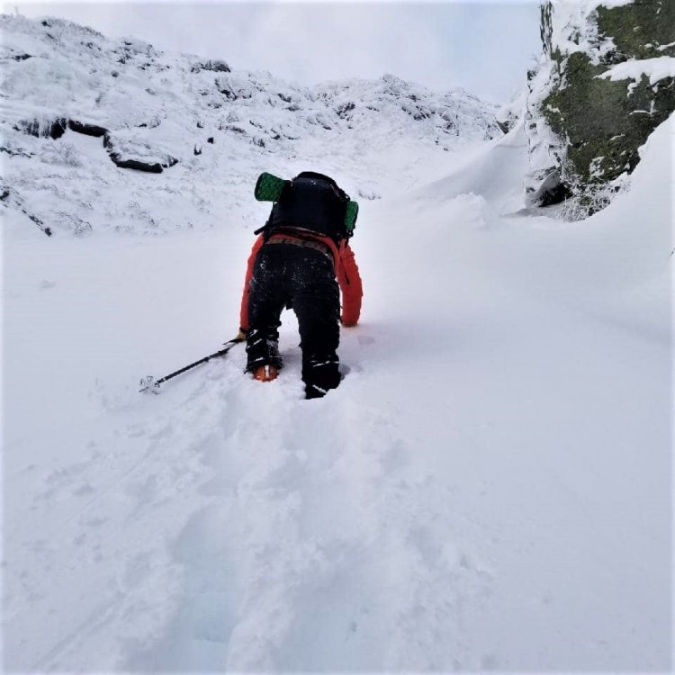
I took my AIARE 1 in 2019 and I attend the ESAW every autumn. MWAC actually ran a series of virtual presentations on Thursday nights this past fall which were offered for free, and I found those to be nice refreshers as well. I think my background in meteorology and overall experience in the mountains helps a ton as well. The main avalanche problem today was wind slab, but I found it was fairly easy to avoid if you knew what to look for. We traversed around sections where the snow had a more styrofoam/hollow texture...even though that certainly would have made for an easier boot pack ha. There was definitely a lot of wallowing in deep snow today, but I'd rather that than risk kicking off a slab and going for a ride...even if it means a slower ascent time.
-
This can obviously vary from one year to the next, but in a "typical" year I find that the best skiing on Mount Washington tends to line up around April 1st. That seems to be the time when you can maximize your potential for a top-to-bottom run from the summit down to Pinkham Notch. However...there have certainly been years (the last two in particular) when early April has featured conditions more representative of mid winter...which means you need to have avalanche education/tools OR be willing to deal with heavily scoured/icy conditions that don't soften up over the course of the day. If you wait until the mid April timeframe, the snowpack tends to become more isothermal (lower avalanche risk) and the skiing can be quite good in the ravine...but you start to run the risk of the Sherburne Trail melting out, which requires a bit of a hike to get back to the car. So I guess it all depends on exactly what you are looking for. If you're just looking to ski the ravine but you're ok with the possibility of hiking the last 1-2 miles back to Pinkham...anytime from mid April to early May is probably when you'd want to target. But for a full summit-to-Pinkham run, April 1st to April 15th is what I would recommend.
-
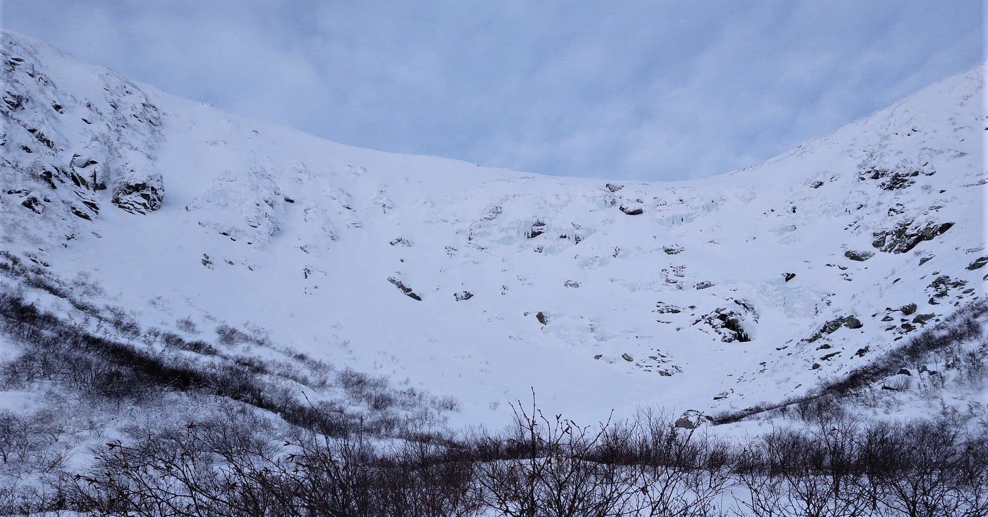
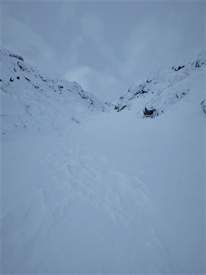
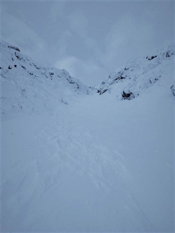
Tagged my first big mountain objective today. Skinned from Pinkham Notch to the floor of Tuckerman Ravine, then booted up Left Gully...which is an east-facing couloir on the west side of the ravine. Things are rapidly filling in, and I was able to ski in/ski out without having to carry the skis once. Considering the lean start to the year, Left Gully skied exceptionally well with only a few scoured sections higher up as is typically the case. Interestingly enough...I have never waited so long to ski the Sherburne Trail before, but this is the earliest I have ever skied the ravine.

-
Fast-moving squall just put down a quick 0.3" here. Sunshine and blue skies once again now.
-
Incredible to have the privilege of enjoying these conditions during the middle of the week!! I have skied the Sherbie countless times before, but when I was a "weekend warrior" I almost never got to experience a true powder day given the popularity of that trail. I reached the top of the skin track around 8am this morning, and I think there were only three people that had gone down at that point...so there was plenty of untracked powder which simply would not have been there at the same time on a Saturday or Sunday. I'm loving the option to snag a quick lap on what previously required a 3+ hour commute from Massachusetts! Darkening skies here in Jackson now. I think the squall that just unloaded on Alex may have made the push over the Notch. About to find out...
-
Definitely need another synoptic event south of Crawford and Pinkham Notches. We managed a half inch imby this morning, but for the most part we still have the death crust leftover from last weekend with a little dust on top of it here in Jackson. The Doublehead ski trail behind my house is not very enjoyable at the moment, and this area just doesn't get the upslope. Amazing what a different world it is just 20 minutes north right now.
-
Well that was an unbelievable morning ski tour. Pulled into the Pinkham Parking lot to find 2.5" of fresh blower, and amounts quickly increased to at least 4-6" by the time I got up to 3900 feet. The Sherburne Trail skied like a dream with nary a rock or a water bar the entire way down. It's amazing how our base has improved over the last week. Winter is full on!
-
Looks like the SNOTEL at Hermit Lakes picked up 4" of snow overnight. Up to a 31" depth there now. Doing a lap on the Sherburne Trail before work this morning...should be quite nice!
-
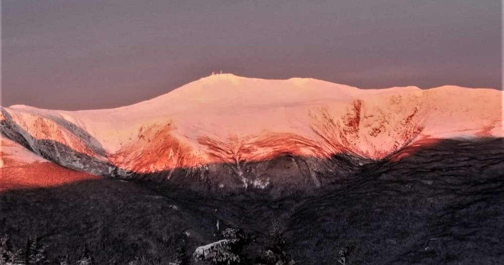
Skinned a pre-dawn lap up Wildcat this morning and experienced some of the best alpenglow I've ever seen. Makes the dark start so, so worth it.
-
I'm kicking myself now, because for some reason the idea of Crescent Ridge didn't even pop into my head until this evening. I would have much rather skied 20" of powder in your neck of the woods than served as a human-powered ice breaker in my backyard! But with deep cold moving in and a few more nickel-and-dime type events this week, I would imagine Crescent Ridge will be skiing very well for the foreseeable future. Back on the weather side...I do like the potential for some squalls tomorrow night. It takes an extremely unstable setup for the squalls to push over the Notches into my neighborhood, but I have a feeling you'll be good for a couple/few inches of fluff by Wednesday morning.