StormfanaticInd
-
Posts
2,065 -
Joined
-
Last visited
Content Type
Profiles
Blogs
Forums
American Weather
Media Demo
Store
Gallery
Posts posted by StormfanaticInd
-
-
2 hours ago, cyclone77 said:
Man it feels like I'm living in Michigan or something with the lack of any severe prospects this year.

I have never seen it this quiet before in my life. I'm about to go crazy over here

-
 1
1
-
-
-
1 hour ago, jbcmh81 said:
There was never going to be a response that prevented the loss under the previous administration.
Sad but true unfortunately
-
-
-
Hospitalizations down to 25k)!

-
Next week does have some potential on the models but I will believe it when I see it

-
 1
1
-
-
Does severe weather season even exist in the O.V. anymore?
-
We are in unusual times with how quiet it is thunderstorm wise. I think I've only heard thunder maybe three times so far this spring

-
3 hours ago, mattb65 said:
Down below 30,000 on the 7 day average, we are experiencing exponential decay, the halving is happening about once every 3 weeks right now, if the rate of decay remains constant, we'll be below 10,000 on the 7 day average in ~5 weeks, approximately June 22nd. That would be cutting it closer than I'd like for my bet.
Hopefully the declines gain more momentum.
-
India with over 4500 deaths today. Cases however are starting to come down thankfully
-
Hospitalizations continues to rapidly decline. Now at 27,163
-
 1
1
-
-
Deaths have now hit 600k on worldometers
-
I really don't see drought conditions being a concern anytime soon
-
Looking like a washout today. We need the rain though
-
Hospitalizations now below 30k!!!!


-
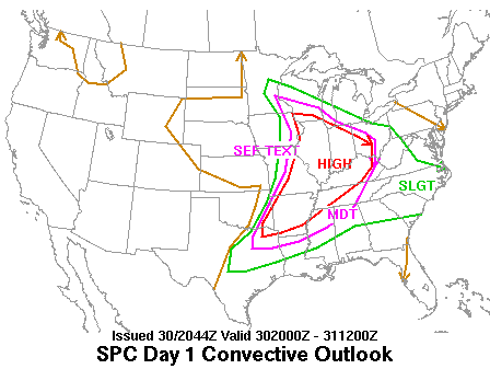
 Pretty solid setup for severe weather coming up
-
1
-
-
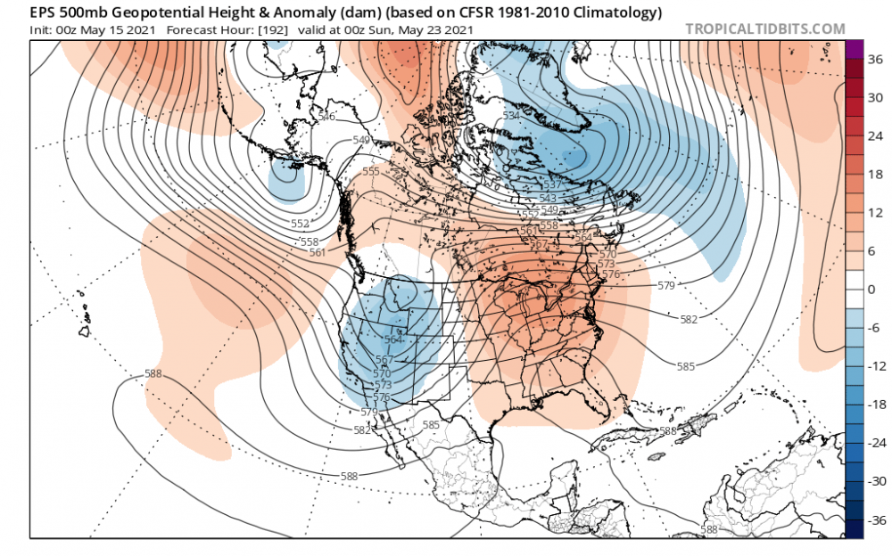
20 minutes ago, WxMatt21 said:
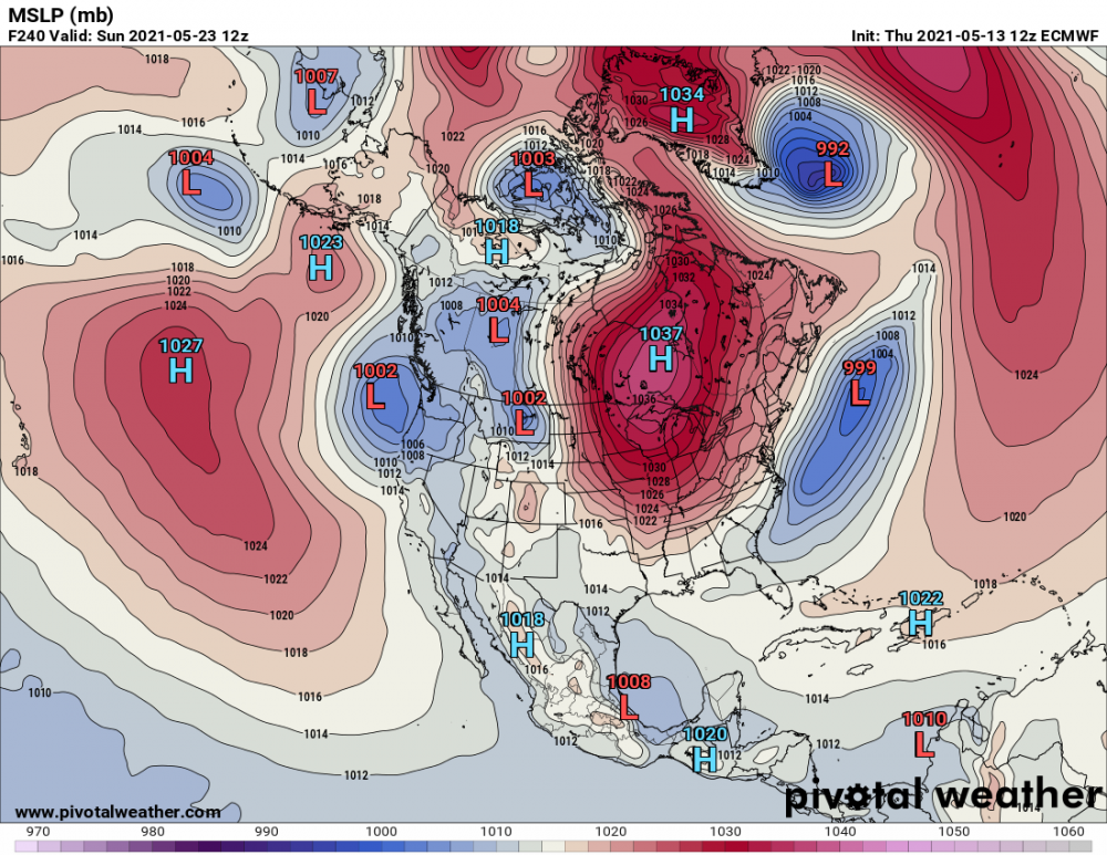
Interesting blog post from Judah Cohen about the late spring and early summer pattern
The never ending block
-
1 hour ago, cyclone77 said:
zzzzzzzzzzzzzzzzzzzz

I agree. This is just weird lol
-
Hospitalizations almost down to 30k.
-
6 minutes ago, mattb65 said:
I'm still liking my chances here, the trajectory on the decline looks good.
By July/August this thread is going to be dead anyways just like the pandemic.

I hope you are right. Getting below 10k is going to be a challenge
-
I think mask will now mostly be done with by the summer. Could however make a comeback next fall and winter just out of a abundance of caution?
-
 1
1
-
-
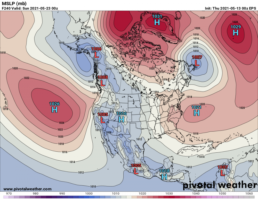
54 minutes ago, Gino27 said:
Seems like both euro and gfs want to bring the freezer back at some point.
Yeah not a good look. Hopefully it changes. Eps not nearly as bad thankfully lol
-


2021 Short/Medium Range Severe Thread
in Lakes/Ohio Valley
Posted