IronTy
-
Posts
2,973 -
Joined
-
Last visited
Content Type
Profiles
Blogs
Forums
American Weather
Media Demo
Store
Gallery
Everything posted by IronTy
-
I spent the first 25yrs of my life in Michigan (born 1980) and not once do I recall anything about wildfire smoke. I didn't even know it was a thing until after I move out here.
-
Watching that outflow coming SE from PA while sitting on the stoop downtown and really hoping it at least brings a breeze as it hits us.
-
Not sure on totals from yesterday's storm. Prince fred Mesonet says 0.28" but at my place about 2mi north you wouldn't surprise me if you said I got 2.8". It dumped here for a while and was very heavy. Way more than a quarter inch. There must've been some cutoff shenanigans or something.
-
It's definitely happening. That big storm has its eyes on Calvert. Was out taking care of caterpillars and tons of thunder and the humidity can be cut with a knife. Gonna be a drought buster for sure.
-
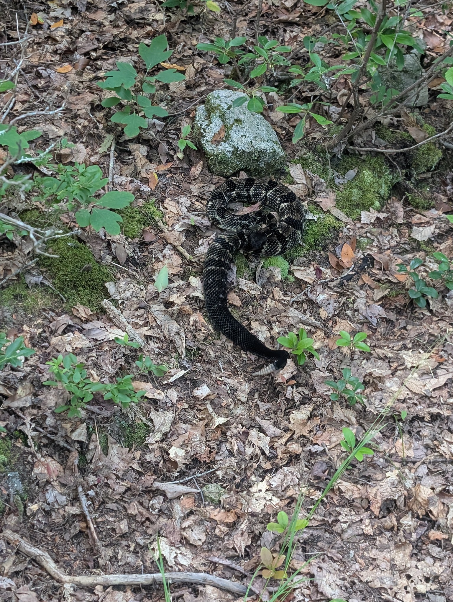
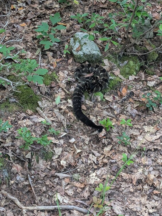
One of the things I was not prepared for when we moved from Michigan to "the south" was how paranoid people are of snakes down here. I don't know if it's religious or what the deal is, people are so weird about them down here.
-
Went hiking this morning and came across this guy on one of our trails. Luckily we left the dog home! He was very aggressive and rattling nonstop.
-
I eat my words. Was watching the Arlo camera back home and it was torrential downpour then the camera feed cut and I immediately got a SMECO text that power was lost to our house. Good to see some rain there finally! Looks like a decent shower complex moving in here at the cabin. Doesn't seem like we need the rain much up here but it will make for a good night collecting moths if we get.some.rain this evening.
-
Lol, is it even going to rain back home? Not even a Strong Shower?
-
Heat wave 2026 is over here at DCL. Clouded over with tons of thunder non-stop. First storm went barely to our north but the outflow really cooled us down and more storms are incoming. We've dropped into the low 70s.
-
Down at 79F here, pretty nice sitting on the back deck.
-
Drove down to Lowe's near DCL this morning and my car thermometer read 87F around the lake. Got back up to the cabin and it was down to 81F. Some clouds moved through and it's not bad outside as long as you're not in the sun.
-
76/73, nice morning out with a good breeze.
-
Sitting at 82F here with a good breeze.
-
Out at the cabin...it's a breezy 82F. Though it is a tad humid so I had to close the windows and put the A/C on for a few hours til the sun drops down. Some patchy clouds moved in so that should hold temps down a bit.
-
Meh, only 86F at my house right now, not impressed. Leaving for DCL at 4am to beat the traffic. My game cam up there reported 82F at 11am.
-
I went through that phase down here as well when we first moved here. I battled against it until the summer of 2012 where I finally threw my hands up and naturalized my lawn. Now I have oaks and loblolly pines 30-40ft tall covering most of my yard and what grass remains is mostly replaced by moss that stays green all summer, doesn't need mowing or watering. Plus it's a lot cooler with all the shade.
-
I wonder if TWC will start naming heat domes like they do winter storms? Heat Dome Aaron?
-
Special marine warning ALEET! Strong Sprinkle alert!
-
This needs to be brought back under control. Who's running the show at these agencies? A special marine morning with "a strong shower" and a FFW when I can't find anything more than some sprinkles within 100mi on radar. We've reached Baghdad Bob levels of forecasting. I guess if you're gonna be wrong all the time you might as well be spectacularly wrong. Get it to together, you're supposed to be pros.
-
The time to watch will be when the heat wave breaks. That's when I'll be on derecho watch.
-
It's been that way for like a year now. If they haven't caught on by now I don't think there's any hope. Every one of the CPC lookahead precip charts shows above normal precip over the entire area yet their drought map shows that drought "persists" (doesn't "remain but improve"). They're covered no matter what happens I guess.
-
Sure is gross out here in the city now. Even with the clouds the UHI effect is substantial.
-
Lmfao. There's a lot of AI crap out there but there are the occasional gems... https://open.spotify.com/track/3o0chLfv2A0jSPTEeVIqoK?si=Kq4rP4JtQyShR49gN1MLgQ
-
So they overpredicted on the precip? Pretty shocking actually, they've hardly been over-bullish on those calls this year...
-
LMAO, have fun at the DC festivities peeps, I'll be out at the cabin. Might have to actually turn the AC on out there from noon til 5pm.
- 259 replies
-
- 1
-

-
- we got burned
- rugpull central
- (and 1 more)