csnavywx
-
Posts
5,722 -
Joined
-
Last visited
Content Type
Profiles
Blogs
Forums
American Weather
Media Demo
Store
Gallery
Everything posted by csnavywx
-
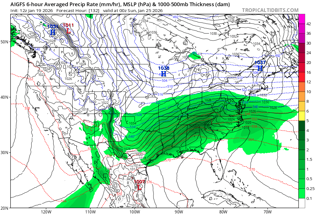
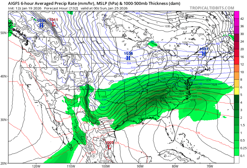
Both the EC-AI and AIGFS are tucking a stronger advection lobe in the far major axis of the NS trough instead of evenly distributing it along the length. The stronger and better oriented that is, the better the chance of getting this oriented correctly as it picks up the other two shortwaves.
-
I know folks are doing the Euro vs. GFS thing, but it's more like AI vs. non-AI at this point, esp when looking at these 500mb charts. Maybe that changes this run, but interesting to note how resistant they've been to totally caving offshore.
-
12Z GFS/AIGFS:

-

Southern MD / Lower Eastern Shore weather discussion
csnavywx replied to AnEndlessMaze's topic in Mid Atlantic
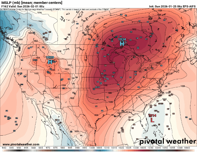
AI-GFS and EC-AIFS are on top of each other on this morning's 6Z run. Not much room to maneuver from here though. Gonna be a tough one unless we can get a faster tuck, neg tilt or a slightly stronger/amped and separated northern stream wave. -
Southern MD / Lower Eastern Shore weather discussion
csnavywx replied to AnEndlessMaze's topic in Mid Atlantic
E. Shore -- overdid snow (flipped early), about right with sleet and rain flip. Inshore -- overdid snow, underdid sleet (flipped early), about right with ZR (0.3-0.4 IMBY). We got the heavy rain showers (as freezing rain) but the CAD ended up chasing the precip out, so very little/no ZR on eastern shore. We did indeed get some light snow today over the inshore areas w/ the big upper trough. All in all, not too bad. Flipping sleet 2-3 hours earlier would've almost entirely corrected this to reality, so B/B-. -
Southern MD / Lower Eastern Shore weather discussion
csnavywx replied to AnEndlessMaze's topic in Mid Atlantic
Run to run variability seems to have calmed down somewhat. A hold through tomorrow gets me bullish. -
Southern MD / Lower Eastern Shore weather discussion
csnavywx replied to AnEndlessMaze's topic in Mid Atlantic
Triple phaser. Great if it works, but as always, delicate with timing. Suspect there will be some changes until Wed. So far, so good on trends. Plenty of cold air, so there's a chance of staying snow even if it gets fairly close. Suspect the main fail modes are a phase miss (and we get some consolation snow a la last Feb) via being too progressive or it overamps and we have to deal with a narrow mixing zone. -
Continuing off of @Terpeast's trend GIF from yesterday:
-
Eh. It did pretty well. Took an extra 12-24hr to snap in, but had the right general idea not long after.
-
The EC-AIFS *was* really good with the last system from this distance (it had locked into a large mix zone and virtually nailed all of the major features by this point), but I would say that the initial interaction is more delicate on this one has a tighter timing window. Prob need to be sub-100hr for equivalent. Would really like to see the AIGFS come on board.
-
Really cool triple phaser. However, it's a triple phaser. Powerful but delicate setup, so your expectations should be very guarded as there's quite a bit of dprog/dt even 3 days out right now. Here's a quick chart to help you manage your expectations should guidance continue to show it working out:
-
Finally ended down here. Getting power flickers and still hearing the occasional branch crash outside. Will get a proper radial measurement in the morning. Headed to bed.
-
The NAM's ability to get thermals right is very useful. As was the fact that CAMs were useful today with the embedded heavy rain showers. Can always use other guidance for precip amounts.
-
Southern MD / Lower Eastern Shore weather discussion
csnavywx replied to AnEndlessMaze's topic in Mid Atlantic
Chef's kiss. (Watch til the end)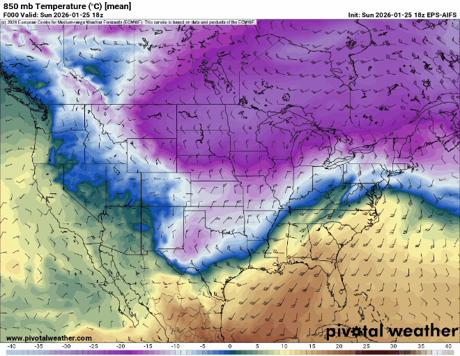
-
It's another tool in the toolbox. I am personally *very* pleased with the EC-AIFS and AIGFS with the last storm. Helped me keep my sanity when every other piece of guidance was insisting on washing out the CAD here today, against every bone in my body. Anyways, link is here: WeatherNext 2.0 Model Viewer
-
-
Southern MD / Lower Eastern Shore weather discussion
csnavywx replied to AnEndlessMaze's topic in Mid Atlantic
It's going to be quite a bit worse just northwest of me. Lotta places never got above 29. -
Southern MD / Lower Eastern Shore weather discussion
csnavywx replied to AnEndlessMaze's topic in Mid Atlantic
Hearing the occasional branch crash outside. Ice casing on the sleetpack is thick enough to be relatively difficult to break now. -
Southern MD / Lower Eastern Shore weather discussion
csnavywx replied to AnEndlessMaze's topic in Mid Atlantic
About a quarter inch of glaze so far. -
Southern MD / Lower Eastern Shore weather discussion
csnavywx replied to AnEndlessMaze's topic in Mid Atlantic
Temp should mostly stall or only very slowly rise once the winds flip NW. Hour or two? -
Southern MD / Lower Eastern Shore weather discussion
csnavywx replied to AnEndlessMaze's topic in Mid Atlantic
Have been getting absolutely crapped on by freezing rain. Lost what sleet was left about 45m-1hr ago. 29F. -
Freezing rain and 27 degrees here. Only 3 hours til sunset, wind has shifted northwest. 0.5-0.75 of liquid to go. Wish me luck. If we can't break above 30 before dark, it's going to get nasty here.
-
Southern MD / Lower Eastern Shore weather discussion
csnavywx replied to AnEndlessMaze's topic in Mid Atlantic
26F, Freezing rain has begun. Light glaze so far. -
Southern MD / Lower Eastern Shore weather discussion
csnavywx replied to AnEndlessMaze's topic in Mid Atlantic
That's an impressive coastal front. I wasn't thinking you'd get much in the way of ice out there. But there's a chance that front gets pushed back through later this evening before the last line of precipitation is through and it might give you a glaze. Up in the air at this point since we're so far away from almost any guidance at this point. -
Pounding sleet and needles still. Some of the highest rates of sleet I've seen. Vis about half a mile.