WhirlingWx
-
Posts
404 -
Joined
-
Last visited
Content Type
Profiles
Blogs
Forums
American Weather
Media Demo
Store
Gallery
Everything posted by WhirlingWx
-
HRRR doing HRRR things for the TX panhandle lol (tomorrow/Sat I believe)
-
Saturday (and perhaps into Sunday) poses the best tornado threat IMO, as I think most of us have read/seen/observed. At this time (meaning that it could change), it appears like it will become linear by the time it gets to me here though, with perhaps a couple embedded tornadoes remaining possible. I know it's not for this subforum, but IA/MN/WI is really looking like an up-trending surprise setup along the triple point today.
-
I will say, we haven't really seen any significant outbreaks this year, going strictly by tornado counts. We've had damaging isolated events in the SE, but a general lack of tornadoes (and other severe weather) up to this point. I don't really see these three days ending up being a big outbreak (which I could, of course, end up wrong about). Similar to the post above by @jojo762, I do think that severe storms will almost certainly occur on these days though. Wouldn't take many tornadoes to clear the bar of "biggest outbreak" up to this point of the year.
-
First SVR watch of the year for me, but with the cold front coming through soon, I'm doubting I see much in the way of storms IMBY. Grayson county storm might be weakening, too.
-
I've read it a couple of times on twitter... is it true that more pipes might burst when the weather actually warms up? I've already had at least three friends with pipe bursts in their homes, and I'm afraid that my luck will run out at some point. I hope all of y'all are still able to be warm and safe. Obviously, problems are pretty widespread throughout the state (power, water, etc.), but I've heard a lot of bad things going on with Austin's infrastructure. They've had multiple major ice events in addition to their snow.
-
I only got another 1.2" of snow from overnight, so my total is 4.6" over these two events. I am considering myself very fortunate, as my power hasn't gone out at any point over these past few days. I'm not sure what's sparing me, as friends living only a mile away have been having their power going on and off.
-
FWD's snow forecast has been changing a good deal, but now they're basically forecasting another 3-4" for me, with a relatively tight gradient to the south along I-20
-
Segment from short term AFD update from 2 hours ago regarding the Tue/Wed system Later in the day, further amplification of upstream ridging off the West Coast will allow a broad trough to continue digging into the 4-corners region and West Texas. As it does, surface pressure falls across Texas will lead to a broad surface trough draped roughly along the I-20 corridor by midnight Tuesday night. This will help pull additional moisture north and westward while deep layer forcing for ascent begins to increase. The tightening low level thermal gradient will result in a strengthening upper jet of near 140 kt overnight Tuesday night right across Central and North Texas. Widespread deep isentropic ascent through the lower half of the atmosphere should lead to an area of precipitation rapidly developing in the Texas Big Country and moving into North Texas overnight Tuesday night. This should be mainly a freezing rain and/or sleet mix which could result in additional significant icing especially south of the Metroplex. As the trough pivots eastward and colder air spills southward, a transition to all snow is expected north of I-20 with additional snowfall amounts of 3 to 5 inches possible from the Metroplex northeast into the Arklatex through Wednesday. In addition, temperatures will continue to be very cold through the end of the week. A Winter Storm Watch is expected to be issued this afternoon. Dunn
-
Yup, do not like that. The warm nose is going to probably be a much bigger issue for us this time around than yesterday.
-
As of the NWS Fort Worth's last area forecast discussion, with regard to the next system, they think that areas north of highway 380 see mostly snow, and then between there and I-20 sees a sleet, freezing rain, and snow mix. So, the further north you are, the more snow you could see (being DFW-centric here).
-
Happy for y'all farther east who are enjoying those monster totals - this is an event that I'm sure a lot of us will never forget from our time here.
-
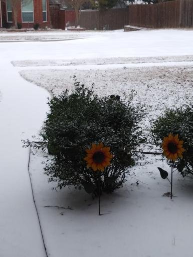
Event total for me is just over 3.4" of snow here in southern Collin county, and I have drifts up to 6"
-
That snow band approaching the San Antonio and Austin areas is just insane
-
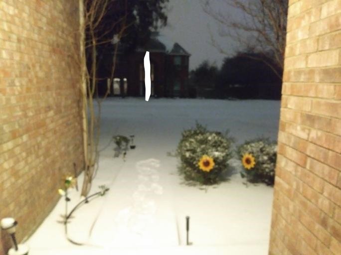
An incredibly grainy picture, but without daylight I can't get a better one... but it is a sea of snow. I would say it's got to be more than 3 inches at this point.
-
2" of snow IMBY... I am annoyed by my footprints messing up the uniform blanket of snow that was there. Y'all farther south stay safe... Ice is nothing to mess around with either obviously.
-
These are the biggest snowflakes I can ever recall seeing, main band is still not even here yet.
-
All of a sudden, I have almost a full blanket of snow here now Might be approaching 1" soon, and the heaviest is still to the west of here
-
Measured roughly 0.25" of snow at my house... maybe the initial band "underperformed" slightly (I saw forecasts and model runs around a max of one inch) but it's still snowing lightly and so I'm pretty confident that we'll get a good deal more. Either way, this is the most I can remember at my house for the past 4 years haha (I don't think I'm missing any events)
-
Consider me optimistic that we will be able to get to at least 3 inches of snow by this time tomorrow
-
I've got about 40% grass coverage now in Richardson area (southern Collin county)
-
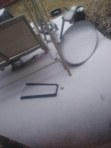
What the heck is this?? (it is very messy in my tiny backyard) Not much on the grass yet but the concrete surfaces look to be covered
-
Looks like a little batch of wintry precip northwest of Waco, moving NNE. I'm not sure how dry we still are here in the atmosphere, but it can't hurt to have that move through and try to give us a few flakes, I suppose.
-
Looking way ahead, end of 00z NAM just gave us all sleet/freezing rain for midweek storm, ugh. I'm not buying the second storm system somehow being a bigger snow-producer than this one for us in north Texas.
-
We should make a bingo board.
-
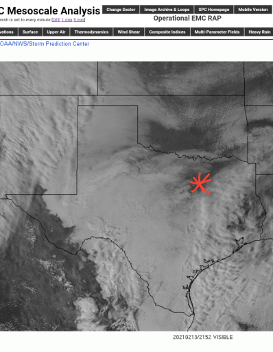
Even if, fingers crossed, the sun being out right now has no impact on the event, this is still painfully funny to look at... Pretty much the rest of the state socked in clouds, and then us (southern Oklahoma is also being bathed in sunshine though, FWIW)