Snowstorm920
-
Posts
91 -
Joined
-
Last visited
Content Type
Profiles
Blogs
Forums
American Weather
Media Demo
Store
Gallery
Everything posted by Snowstorm920
-
-
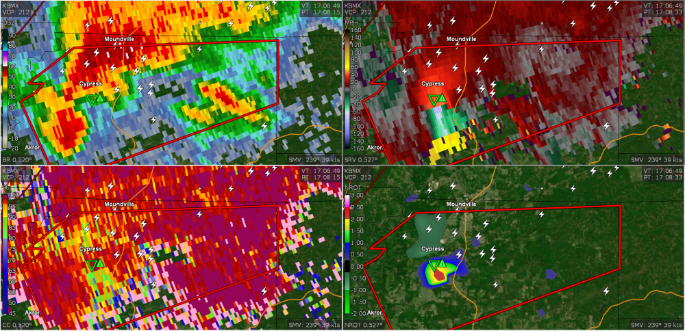
Strong couplet just west of Akron, AL
-
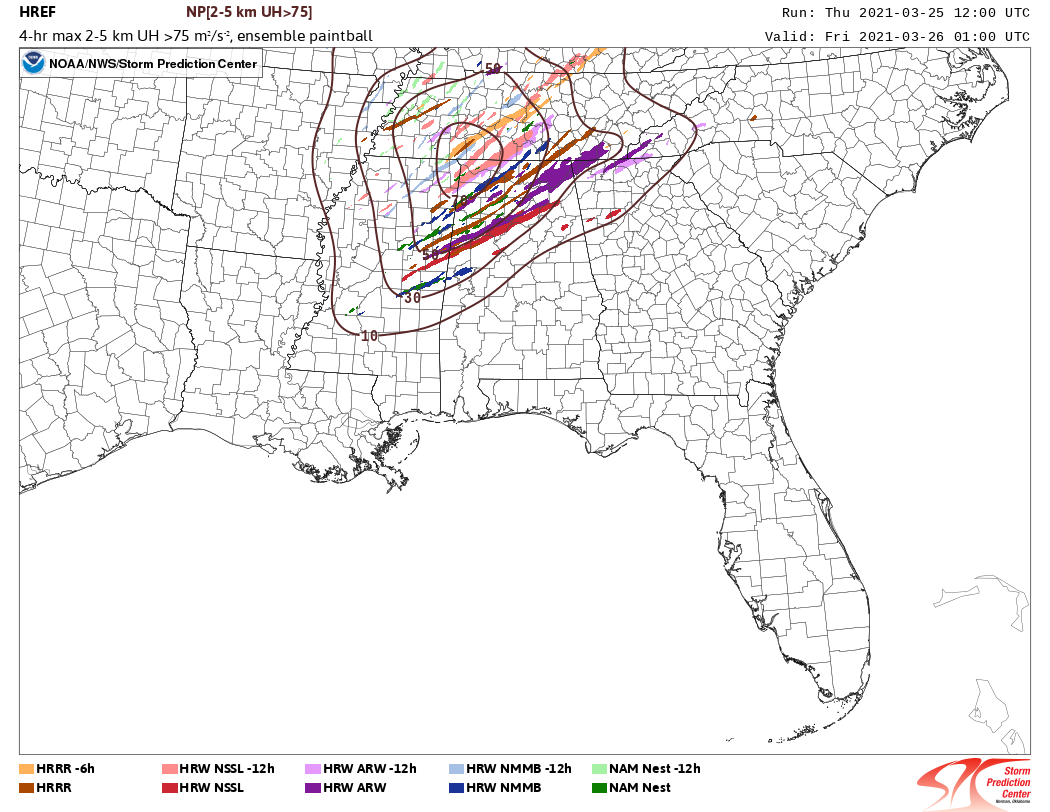
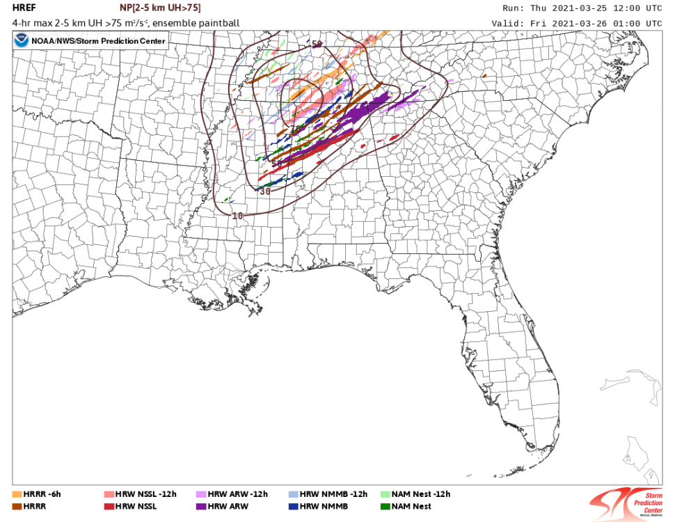
That is a concerning amount of strong helicity tracks from the 12z HREF. Some of those are very long tracked
-
Its still pretty bare with deep convection in Mississippi and Alabama. Looking at some soundings in the warm sector I'm not sure why that is either. There is an EML and associated CAP in the afternoon but nothing that would hamper convection that much.
-
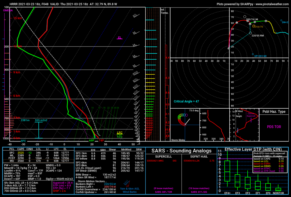
In typical HRRR fashion its pretty crazy in the warm sector Thursday
-
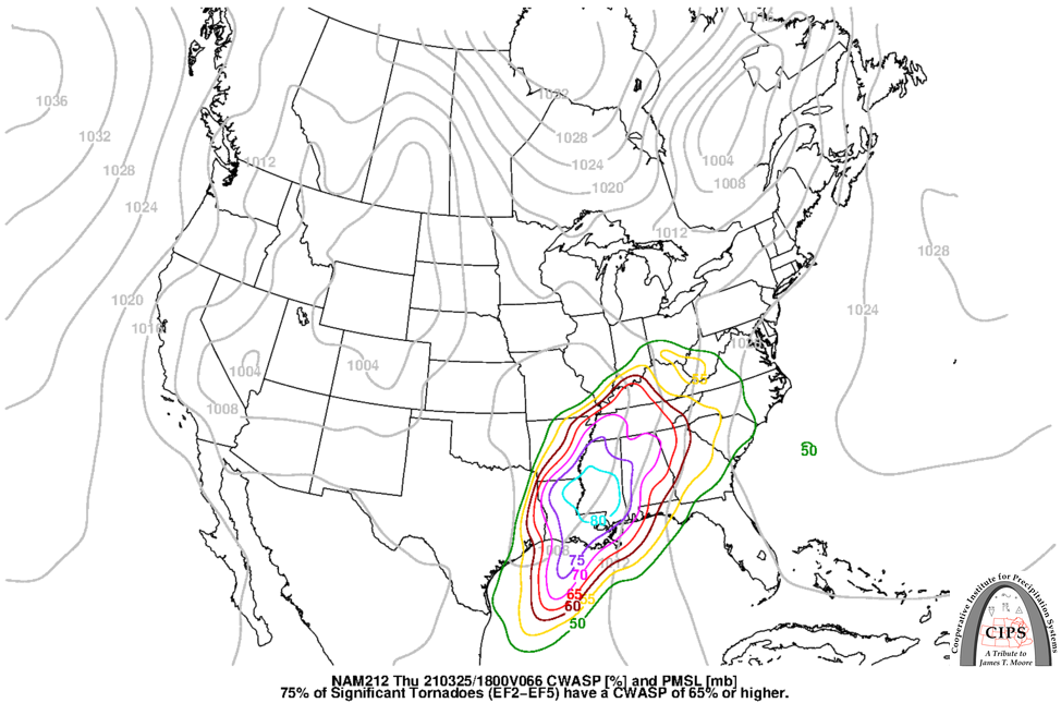
http://www.eas.slu.edu/CIPS/MODEL/WXmodelx.php
-
You do have to wonder about the lack of a CAP Thursday and how that might allow junkvection to fire and contaminate the warm sector. Besides that, environmental parameters are off the charts. A potentially very potent setup.
-
That storm north of Brockwood had 130kts of G2G shear
-
Nasty MCS tonight across South Dakota. Several 80+ wind reports so far
-
Surprised they didn’t pull the trigger on that watch. Severe storms haven’t been hard to come by
-
Central/Western Medium-Long Range Discussion
Snowstorm920 replied to andyhb's topic in Central/Western States
Soundings on Wednesday look nasty across portions of Kansas and Oklahoma. Going to be a day to watch for sure -
Central/Western Medium-Long Range Discussion
Snowstorm920 replied to andyhb's topic in Central/Western States
Wonder if this one will work out better than the last one of these I posted
-
Central/Western Medium-Long Range Discussion
Snowstorm920 replied to andyhb's topic in Central/Western States
First half of May 2011 was very quiet, then Joplin happened. All it takes is one -
Central/Western Medium-Long Range Discussion
Snowstorm920 replied to andyhb's topic in Central/Western States
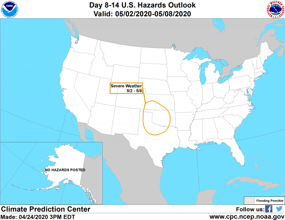
CPC highlighting the southern plains for severe weather the first week of May