MN Transplant
-
Posts
17,642 -
Joined
-
Last visited
Content Type
Profiles
Blogs
Forums
American Weather
Media Demo
Store
Gallery
Everything posted by MN Transplant
-
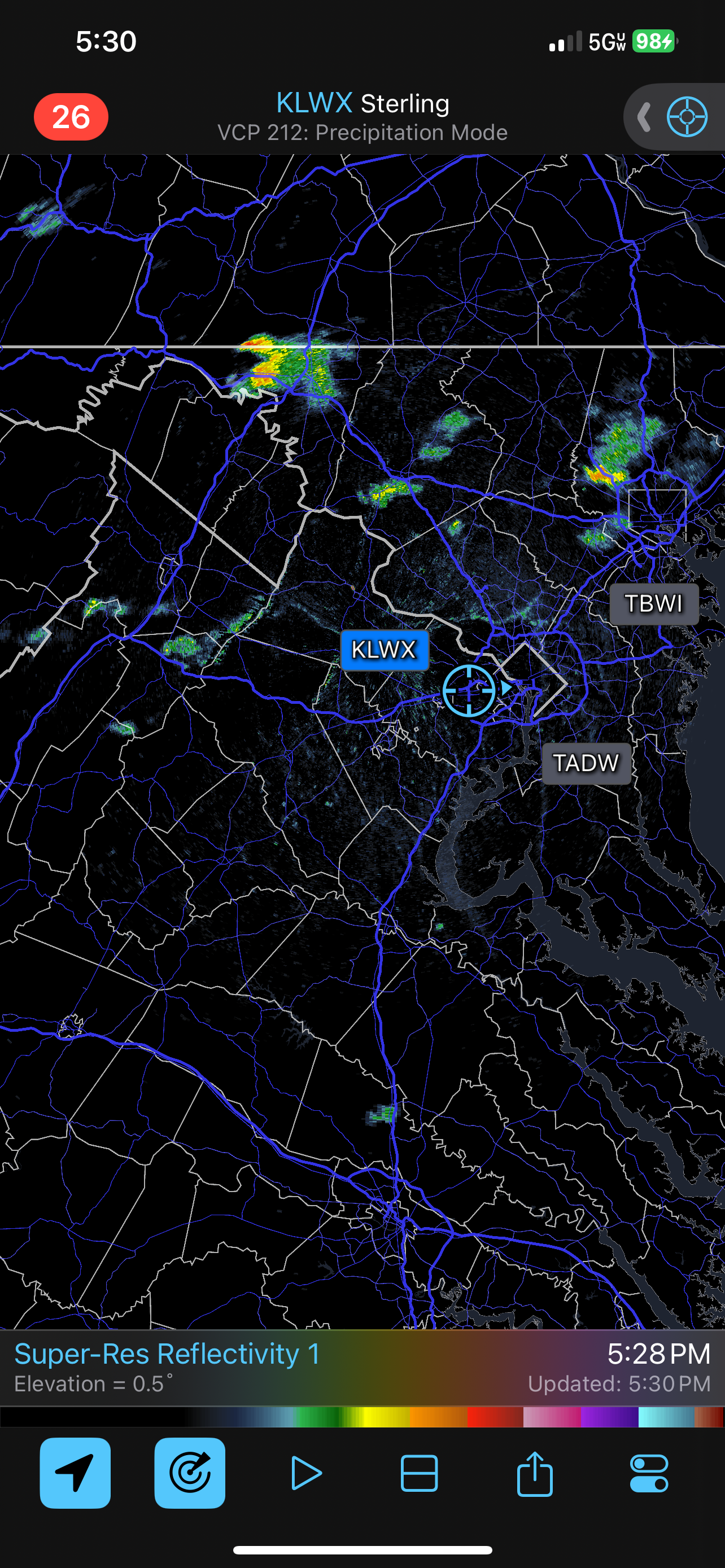
Radar hopping in NoVA

-
98/75 for a 111 HI at the 1:52pm ob at DCA
-
And in case anyone was worried, the Euro has us back in the upper 90s by Sunday.
-
Yes. Yes it is.
-
Bouncing around 97/98. 6th consecutive day with at least a high of 97 at home.
-
Yes, there is absolutely a failure scenario for us, with the highest risk from 95 and west.
-
Exactly. 2010 had the crazy number of 90s, 2011 had the stretch I listed including obscene humidity ("sweat ceiling"), and 2012 had the really big-ticket heat (104 and 105 at DCA). Since then, it has really only been 2016 that went big. Yeah, the slow start to the summer 90s means that this year won't challenge those types of records. I'm curious whether the Staunton data shows the same as DC, where '34 and '36 had hot daytime highs, but the lows were more "reasonable" on those days. Likely some combination of dry conditions and the lack of UHI.
-
Looking back at the climatological data, this is going to end up high on the list of average temperature over 7 days. And yet, I'm glad this isn't quite a repeat of 2011. 8/2/2011 98 74 8/1/2011 100 75 7/31/2011 99 80 7/30/2011 97 81 7/29/2011 104 80 7/28/2011 95 78 7/27/2011 93 78 7/26/2011 95 76 7/25/2011 93 78 7/24/2011 97 84 7/23/2011 102 84 7/22/2011 102 83 7/21/2011 99 80 7/20/2011 94 77 7/19/2011 97 79
-
It would trend west and 95 would mix.
- 58 replies
-
- 12
-

-

-
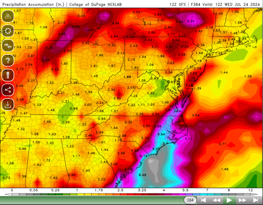
Wouldn't this be a kick. Full run 12Z GFS total precip.

-
If anyone else needed to look up Maddox, here it is: https://journals.ametsoc.org/view/journals/bams/60/2/1520-0477-60_2_115.xml
-
97 for the high so far at DCA. 97.3 at home. I had forgotten how much closer I run to the airports when it is dry vs when my garden is healthy! What a truly putrid stretch of weather.
-
What an eyewall pass for Houston proper.
-
90 already at home. Airports in the upper 80s.
-
97/99/100/97 is a top stretch at my house from 2012-on. Just brutal.
-
Ours died too. Staying overnight with family in MD.
-
Hit 99.7. So that’ll go in the books as the 2nd 100 of the year.
-
River wind effect. DCA is +13 to yesterday as of the 11am ob.
-
All three have hit 98. I got to 99.0.
-
98.5, HI 114
-
Somebody finally broke DCA. 81 vs near 90 at BWI/IAD/My house.
-
Nice hit from Dulles down to Fairfax. Not so much for the rest of us.

-
HRRR and GFS are really pumping the heat tomorrow (100+).
-
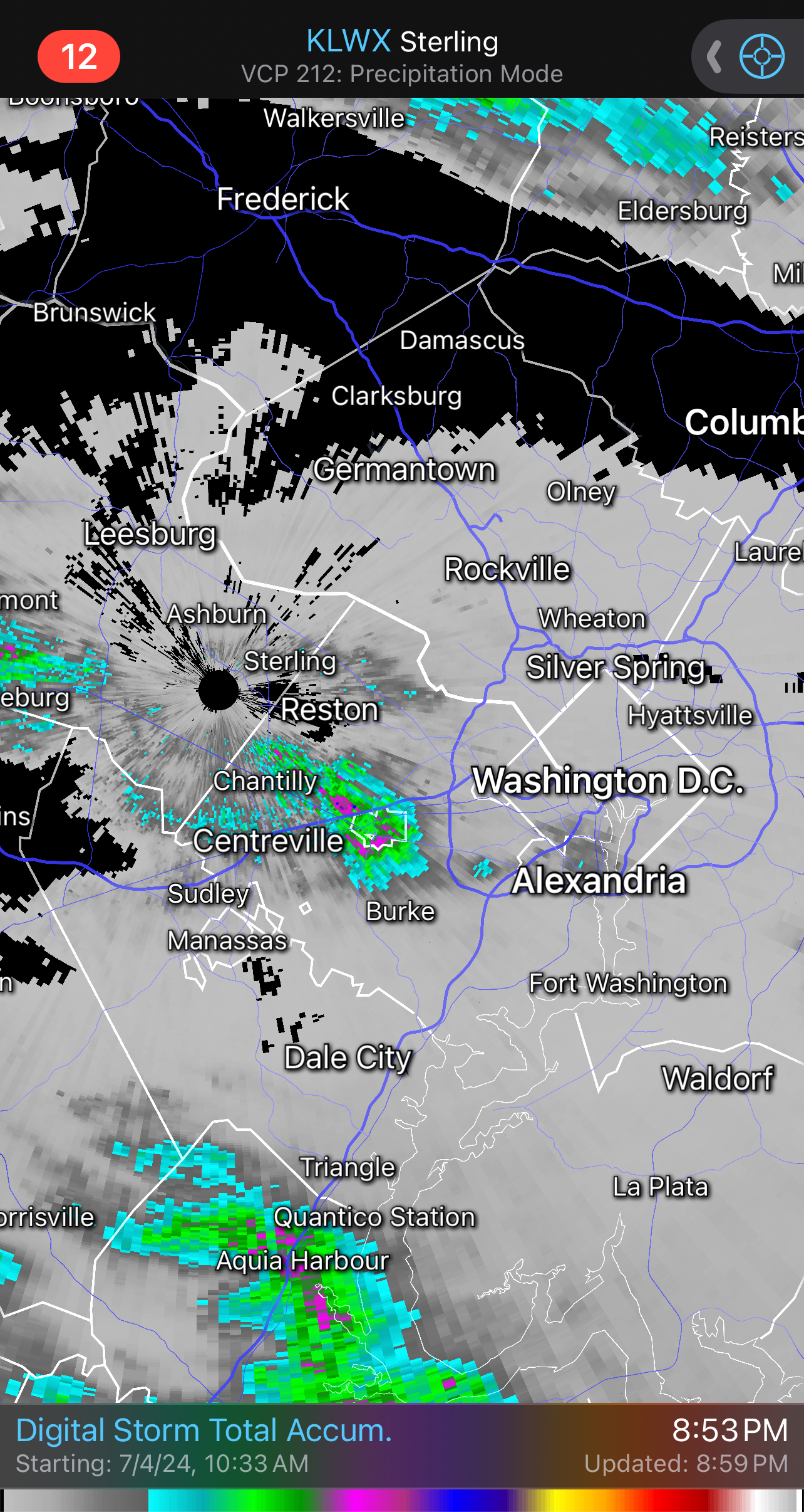
0.14". Better than nothing.
-
Catastrophic for where, though? Take a look at Google Maps for Jamaica. There doesn’t seem to be many places that would be significantly impacted by a surge from an E to W moving storm.