McHenrySnow
-
Posts
701 -
Joined
-
Last visited
Content Type
Profiles
Blogs
Forums
American Weather
Media Demo
Store
Gallery
Everything posted by McHenrySnow
-
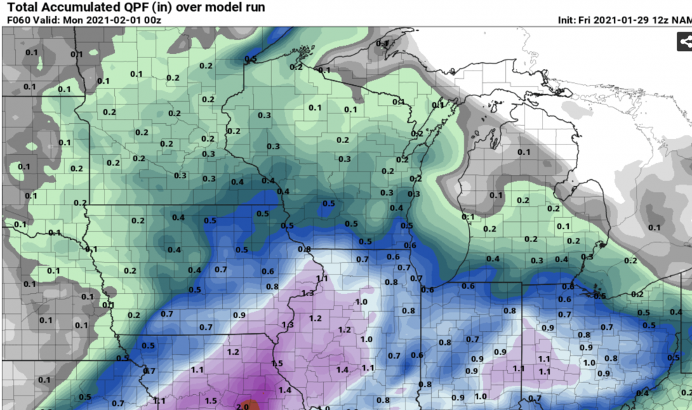
There is definitely an increase in QPF across Missouri across both versions of the NAM and the 3K paints a relative QPF minima over central Indiana. I don't have time to delve into it more deeply than that right now. Just something to watch.
-
I don't think the gap in QPF makes a lot of sense. Would like to see the other models 12z runs to see if this is clearly an outlier or if there is a trend among all of the models.
-
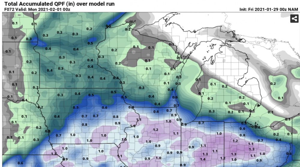
Certainly drier in NE IL/NW IN.
-
Though that is only for the 12k. 12z 3k NAM looks great.
-
Trends on the NAM have been going in the wrong direction.
-
No, but as mentioned earlier, some whiteout conditions and very dangerous driving conditions are almost a certainty.
-
RGEM quicker with the weakening of the primary as compared to the NAM. Really screws our Ohio members over.
-
I agree as far as the melting. I'm glad this one is on the weekend so I can stay up and watch it.
-
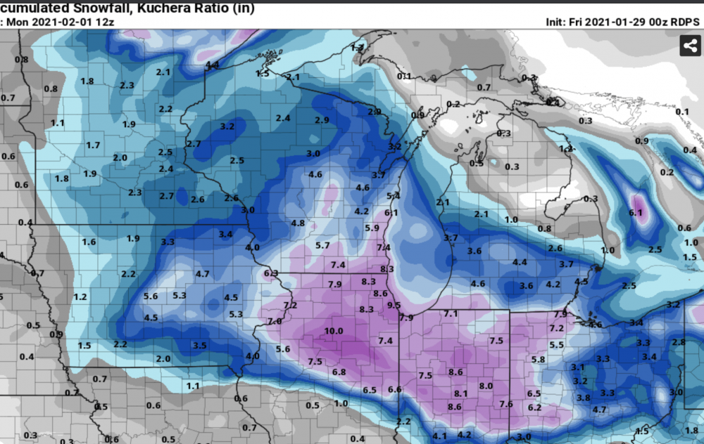
I like seeing the 6" line staying north of the border.
-
You can get one. Be prepared for childish insults if you say something Stebo or certain others don't agree with.
-
Winter 2020-21 Medium/Long Range Discussion
McHenrySnow replied to Hoosier's topic in Lakes/Ohio Valley
Let's hope that block saves us, because February 2019 was painful here. Storm after storm going right overhead. -
-
Feb 3rd - 5th Potential strong stm threat
McHenrySnow replied to Brian D's topic in Lakes/Ohio Valley
Yup. I know the current storm was once upon a time a cutter of guidance, but this one appears like it will stay that way. Blocking has been steady, but it's gotta weaken at some point. I hate to see what happens with our snowpack prior to the cold coming. -
Feb 3rd - 5th Potential strong stm threat
McHenrySnow replied to Brian D's topic in Lakes/Ohio Valley
It's going to be a rainer. Not just for you, but for most of us. -
I highly doubt a watch will be issued this afternoon for LOT. Possibly in the morning.
-
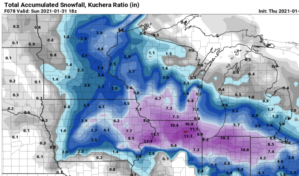
I'll gladly take the Para totals.
-
Hoping that cutter won't be too harmful to our snowpack.
-
take it to the dms
-
I mainly meant CR and IC. Des Moines has had some warm days and even warmer in the southwest corner. I'm very lucky to have had snow cover the entire month of January, I just wish we could have had a big dog.
-
Hasn't this happened all winter in Iowa?
-
Complain all you want, I get it 100%, and do plenty myself, but compare our totals to normal and it gets pathetic.
-
I've gotten 13" so far, including 1" before December 1 that melted immediately. I AM snow greedy, but this year I'm snow starved.
-
With the totals being produced, a dry slot (which I can't see coming north of Chicago) wouldn't even be that big of a deal.
-
If only. This is a beautiful screenshot.
-
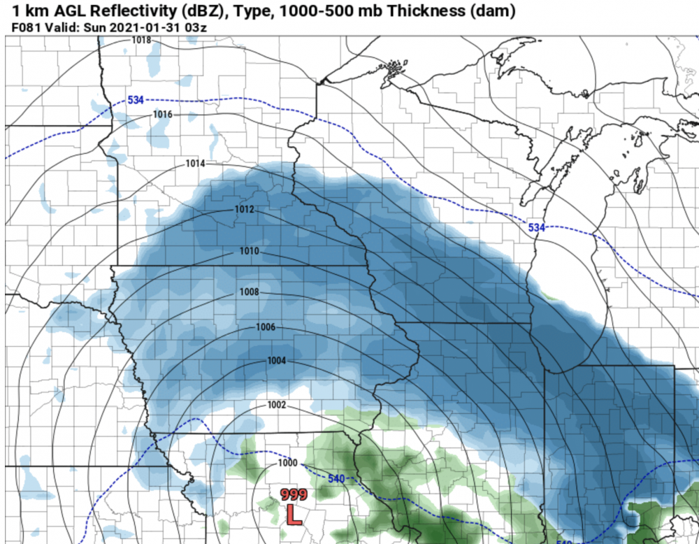
I was worried on Thursday when models were still trending south. Both Cary and I did make final guesses that were low (4 and 5" respectively). Mine panned out as we got 4" (though, that may be a slightly rounded up version of the actual total from averaging multiple measurements, lots of drifting). He busted a bit high. The LOT snow map shows the painful bullseye of lower totals across Winnebego-Boone-McHenry Counties, which, aside from the megaband that blasted Wisconsin, I was prepared for. Honestly, it was Madison getting 6-8" that was the real kick in the balls.