

stormdragonwx
-
Posts
416 -
Joined
-
Last visited
Content Type
Profiles
Blogs
Forums
American Weather
Media Demo
Store
Gallery
Posts posted by stormdragonwx
-
-
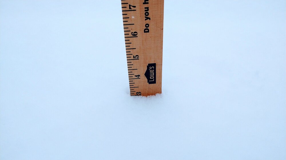
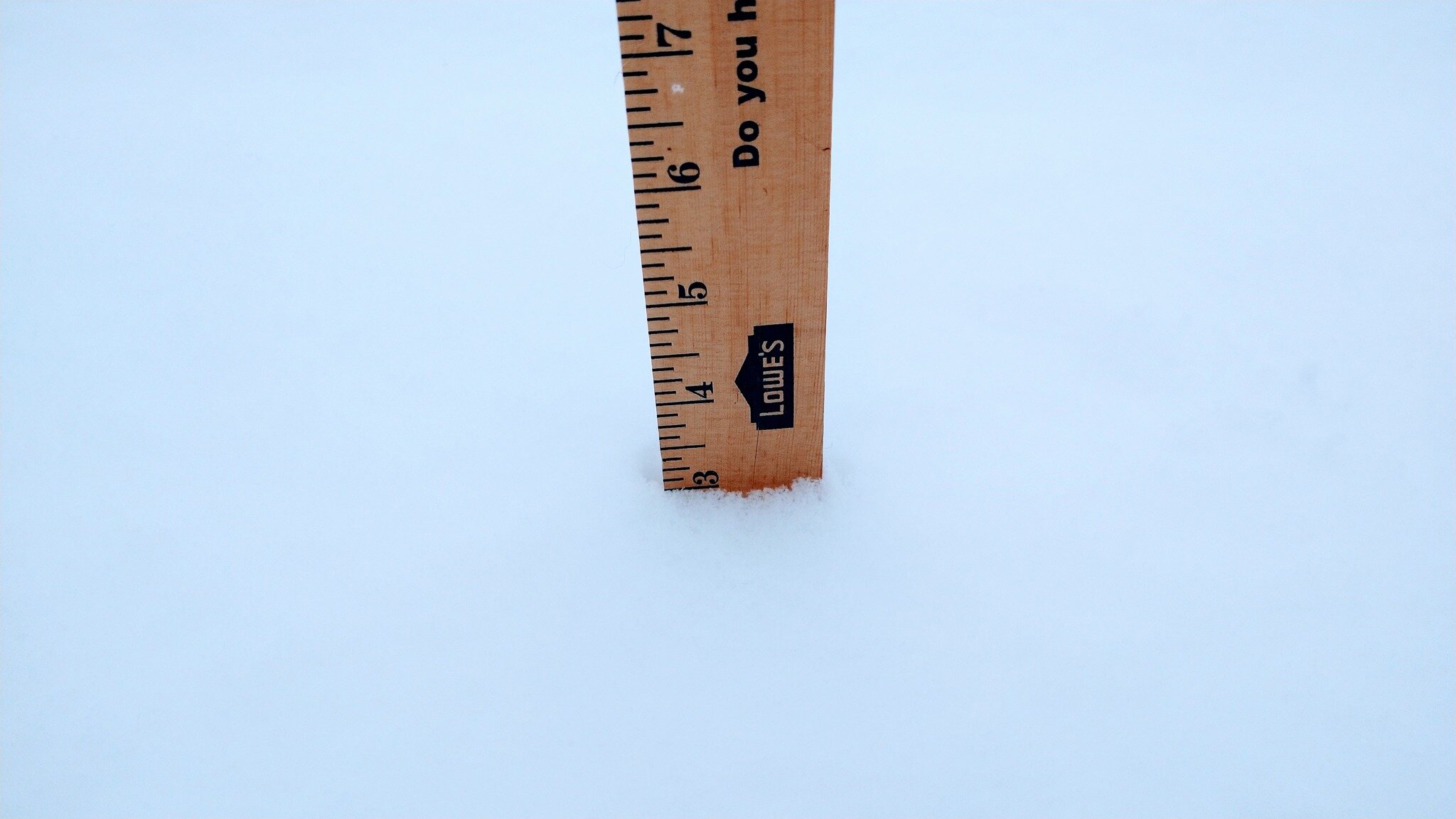
Got a solid 3" with moderate snow still falling at this hour in E Fayetteville, AR. Will probably see another inch before the dry slot kills it.
-
 3
3
-
-
T-Minus 12 hours before the fun begins. Thinking 2-4" in my area.
-
1
-
-
Safe to say the end of the week is gonna get fun.
-
1
-
-
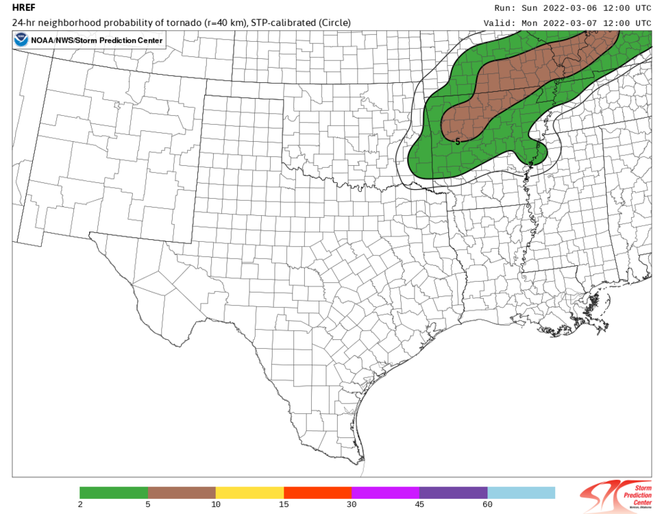
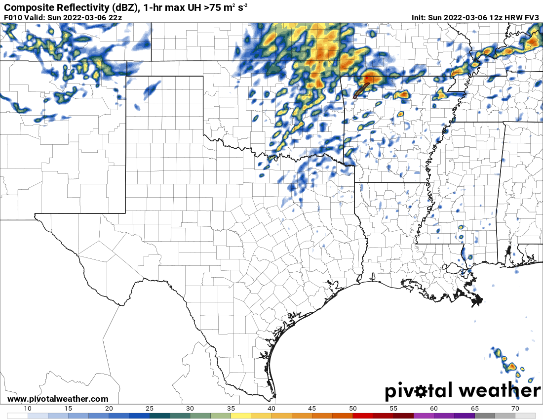
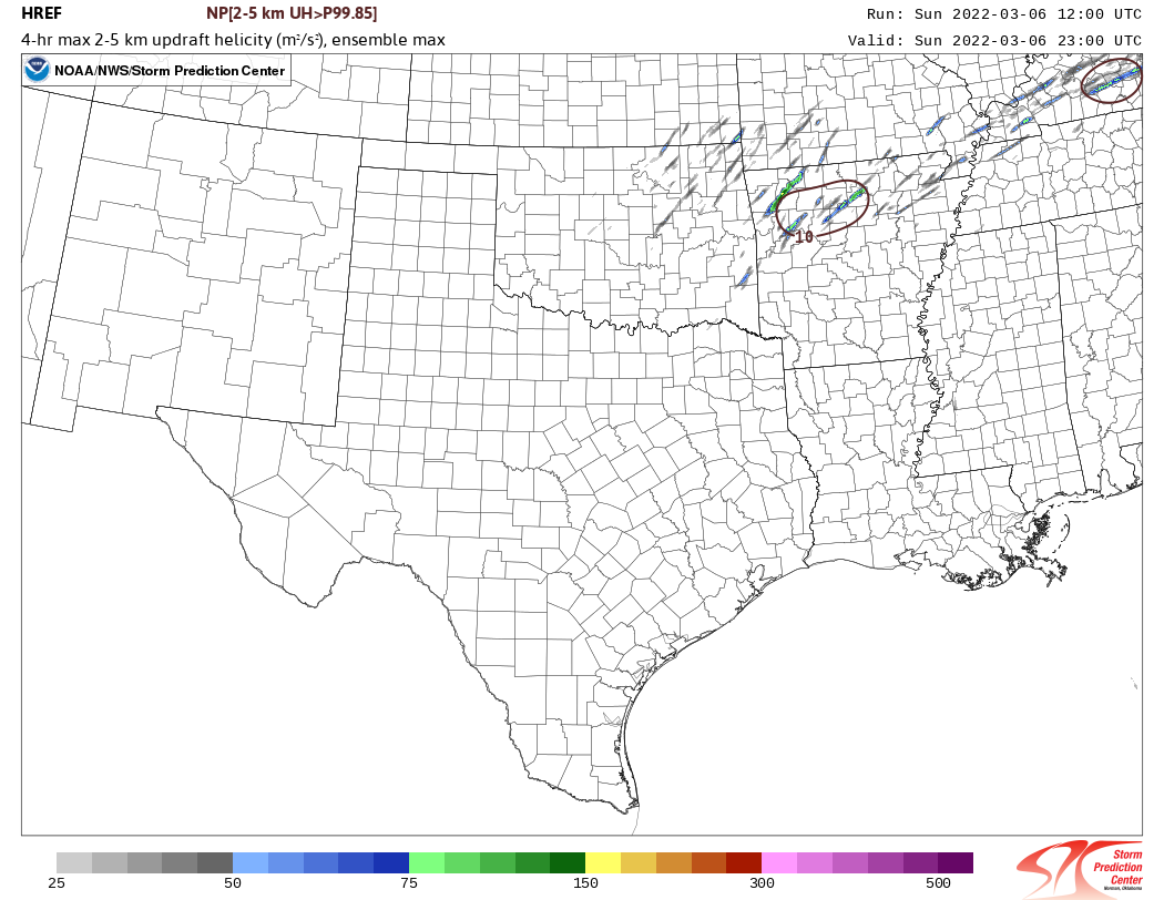
Thoughts on NC AR today? While I don't expect a repeat performance of what we saw in Iowa yesterday, im thinking things could get interesting later.
EDIT: Meso Discussion is out, Tornado Watch likely for said area. https://www.spc.noaa.gov/products/md/md0207.html

-
So who thinks we might squeeze out one more decent snowstorm across the Southern Plains/Ozarks? I remember in the 90's 00's that was a regular thing in March. Including some of our biggest, wettest snowfalls.
-
1
-
-
I know its wishful thinking but its been spitting snow all day in NWA and yes its MUCH colder than what the models indicated. Hoping maybe the cold air will remain deep enough and avert an ice storm disaster here.
-
2
-
-
Ugh yeah guess my time is up. Probably getting an ice storm in the next few days.
-
Yeah this system was pretty much meh across the board IMO. Very interested to see how next weeks system evolves. Hopefully it evolves into more snow than ice like before.
-
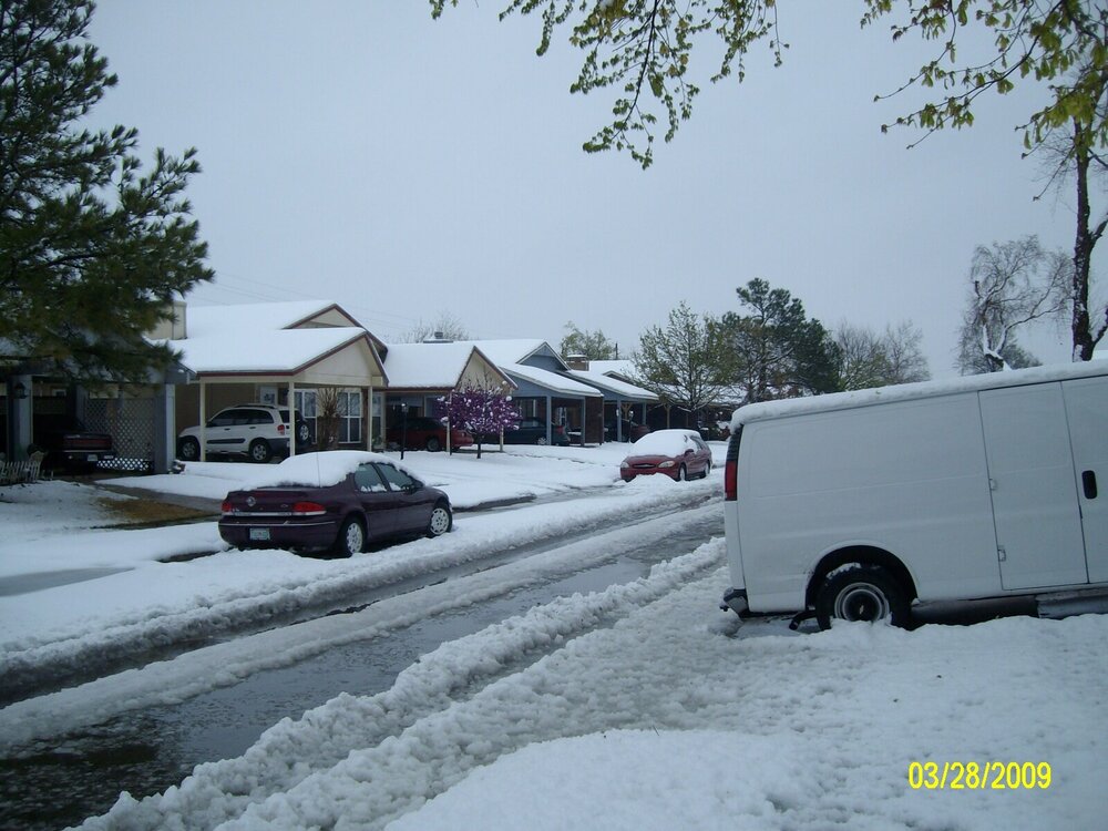
Looks like we had 8" here.
-
1
-
-
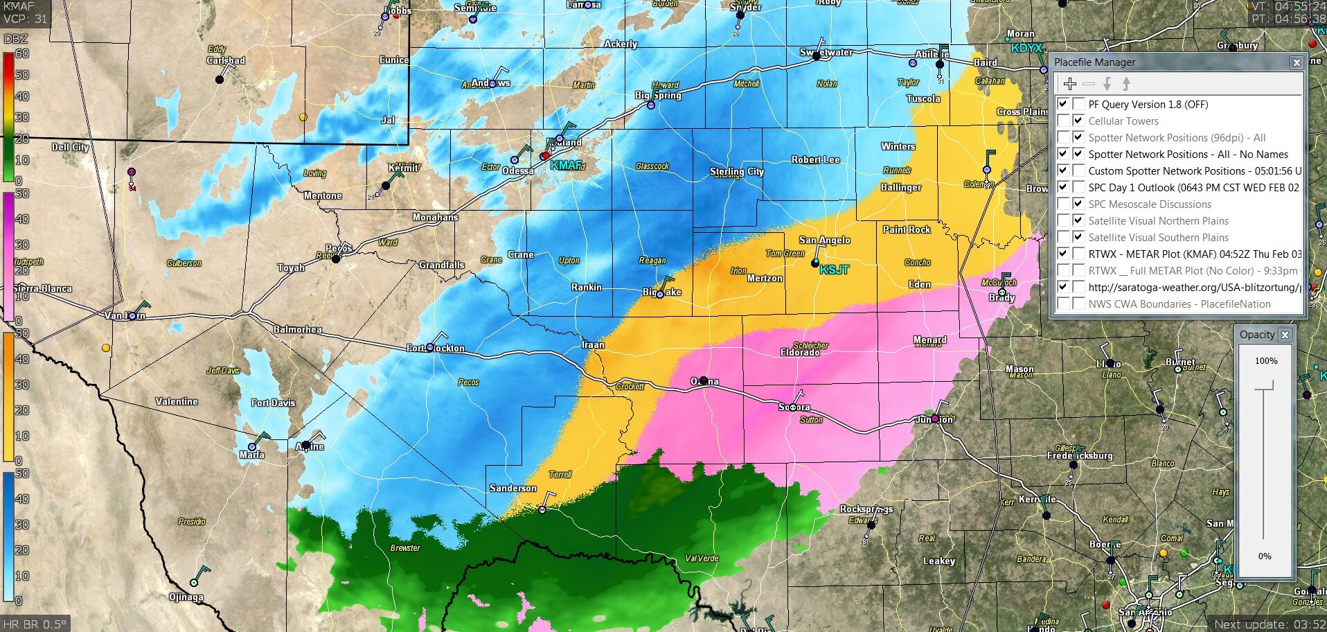
Strangely enough it seems like this current wave of precip. is over performing now. Current snowfall where I'm at is heavier than last nights batch. Noticed the tail end of it is still out by Lawton. Wonder if it will hold together or if dry air will kill it as it moves east.
-
1
-
-
Looking at Radarscope, is it just me or is the new snow band evaporating as it moves east?
-
1
-
-
^Can report the same. Looks like I got just shy of 6" here in E Fayetteville. Was hard to measure since there was a lot of drifting. Some spots was 3" some was 7".
-
10 minutes ago, MoWeatherguy said:
All snow here in Bella Vista, has been for a couple of hours maybe. I see the new graphic out of Tulsa shows pockets of 8-12 across some of this region. Makes the Dan Skoff call look reasonable for 10+ across N Benton Co. We'll see.
We changed over to all snow here in E Fayetteville about 20-30 mins ago. Something to note too, the snow band that has reached us tonight in NE OK and NW AR extends all the way down to the Fort Stockton, TX area. Needless to say its gonna be snowing for awhile.
-
2
-
-
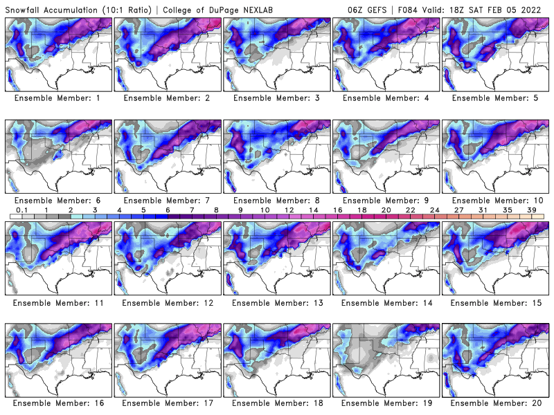
Even though its old data as of this posting, models were in pretty good agreement still. Astounding. https://www.pivotalweather.com/model.php?m=gfs&p=sn10_acc&rh=2022020300&fh=48&r=us_sc&dpdt=&mc=bl
-
Yeah starting to lose confidence in the snow forecast outdoing last years event. Still no changeover and its almost 10pm. Might just be a nasty sleet storm here with flurries by daybreak.
-
Yeah a mix of sleet and freezing drizzle in my area. Hope it changes over soon or it will screw up the snow totals later. Fingers crossed the dry slot stays away.
EDIT: Decent wind gusts going on too.
-
1
-
-
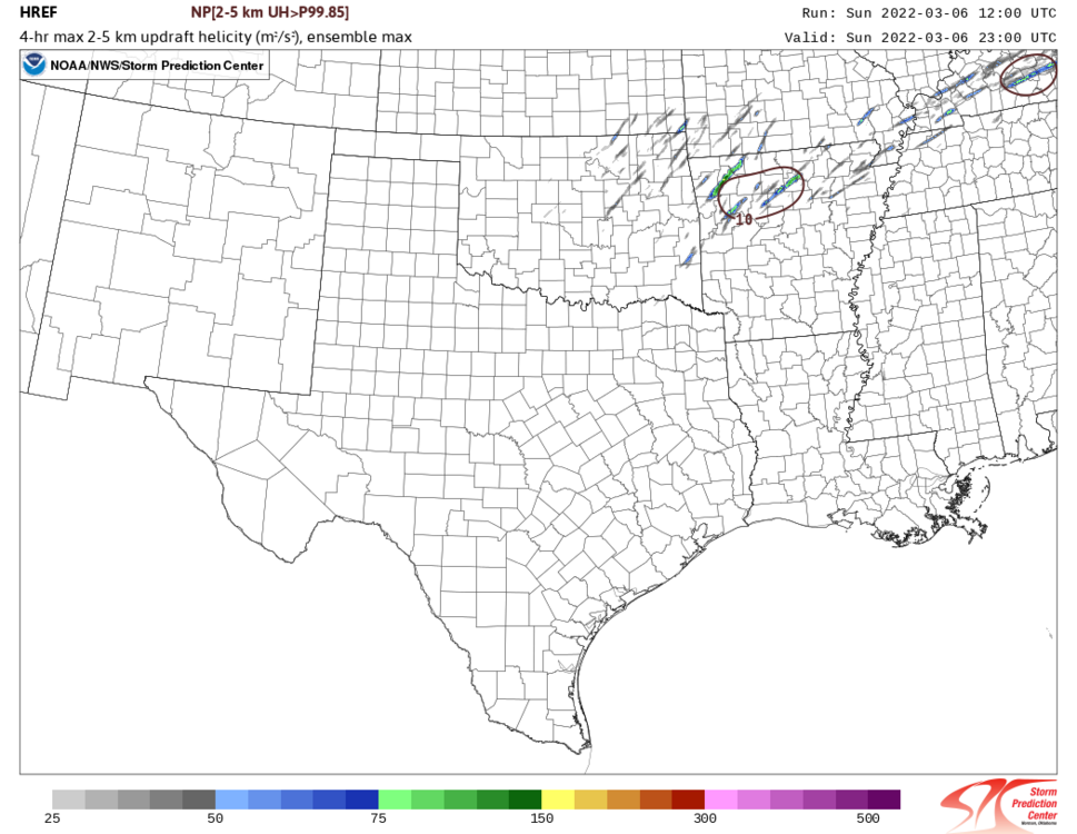
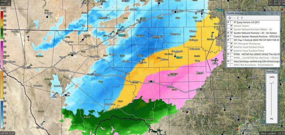
You can see round 2 organizing in NW TX and headed NE along I-44 but it's just a tad bit further south than anticipated. This also puts it on an ideal track to slam those of us in NW Arkansas later on. From what I've seen on the GFS ensembles over the past couple days I'd be astonished if this system doesn't overproduce at this point. This will likely be our biggest snowfall in 11 years.
-
Surprisingly there was a quick burst of snow over here in Fayetteville as the precip pulled out. That might set the trend later today.
-
2
-
-
Yeah its not often you see Ensembles that are pretty much in full agreement (save for a couple members) that the area is about to be slammed with snow. The 00z was the same way. I'd say its locked in.
-
1 hour ago, MoWeatherguy said:
I second that. That's Dan Skoff totals there.
Ironically for whatever reason he pulled back on the totals on his latest update. With the exception of Benton and Carrol County he has the NWA area getting 2-4" max now.
EDIT: Though I think I saw him mention something about the 850mb level getting too warm causing more sleet than snow. Theres also the chance of the dry slot being stronger than indicated.
-
If anybody is on Facebook KNWA Meteorologist Dan Skoff is doing a very detailed live discussion. https://www.facebook.com/danskoff/videos/692624532115265
-
heh that would be typical, I always suspect it because that's what always seem to happen here
 26 minutes ago, The Waterboy said:
Unfortunately this seems plausible considering the terrain issues. There’s going to be a sharp cutoff somewhere in our area. And then a dry slot on top of that.
-
44 minutes ago, NwWhiteOut said:
I wasn't here until 2013 but my buddy actually told me about that 2011 storm and said ya'll got a ton of snow? from that one! Feb 1st 2011 we lived in Missouri(central) and it was the most intense heavy snow I ever witnessed in my life probly, we got nearly 25" of snow from that storm in maybe 8-10 hours!! Of course it had melted off in a few days and was a complete mud/flood mess lol.
Yeah 14"-24" was common along I-44. Then a few days later (Feb 8th-9th) a similar storm dropped nearly the same amount along the 412 corridor into NW AR. That was also around the time the record -31 low was recorded in Nowata, OK.
December 2013 was a decent storm system too. On the low end this storm could be comparable to that one as well.
-
1
-
-
I'm betting this will be comparable to the Jan 2010 storm.
EDIT: Now if we can get the cold air in here sooner on all levels and not get dry slotted unlike this past system we had earlier in January, I can see this being a redux of the Groundhog Day 2011 storm.
-
1
-


3/17/2022, 3/21/2022 & 3/22/2022 Severe Weather, Major Tornado Damage in New Orleans
in Central/Western States
Posted
Not to discount the risk as is but if that CA gets closer to 90 then I'd be very concerned for you folks down there.