

stormdragonwx
-
Posts
416 -
Joined
-
Last visited
Content Type
Profiles
Blogs
Forums
American Weather
Media Demo
Store
Gallery
Posts posted by stormdragonwx
-
-
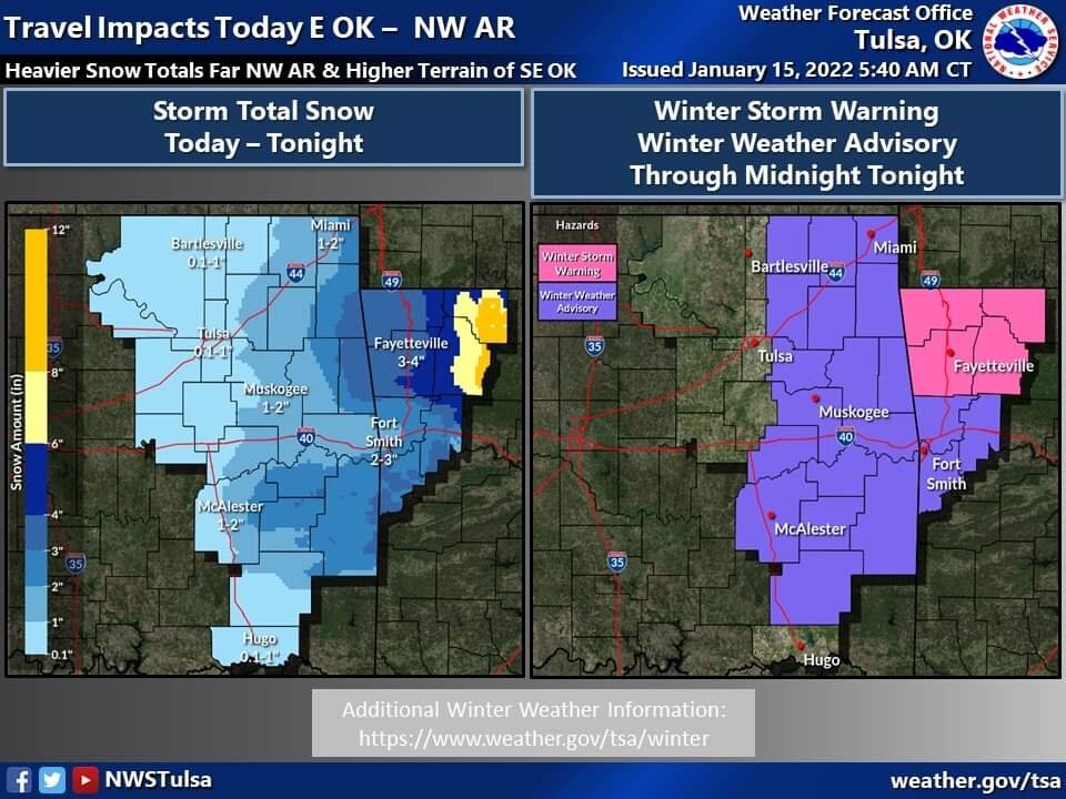
Lol the waffling of the forecast continues. TSA massively pulled back on amounts.
-
On a side note Oklahoma had a 4.5m earthquake this morning. Earthquakes and big winter storms? Feels like 2011 again.
-
IIRC was it last February's system the NAM did terribly on? I remember one winter event where every other model did well on forecast location and amounts but the NAM was pretty much out to lunch doing its own thing the whole time.
-
7 minutes ago, ouamber said:
You would think as long as I’ve been watching models, I should’ve known NOT to fall for some of those “Big numbers” that were being thrown out. I’m going with 22 with sleet and freezing rain for Tulsa with maybe 2 inches of snow on top. #IHateThisHobby

Tell me when the NW trend stops!
I feel your pain. Its why I was so cynical on this last system that came thru earlier in the month. lol
-
 1
1
-
-
Being in Fayetteville I have to say "yuck" to current trends. lol Thankfully its only Sunday so hopefully that freezing rain line nudges further south away from me in the coming days. (sorry for you guys further south though)
-
6 minutes ago, MUWX said:
Gfs is gonna have a huge sleet storm for most of us
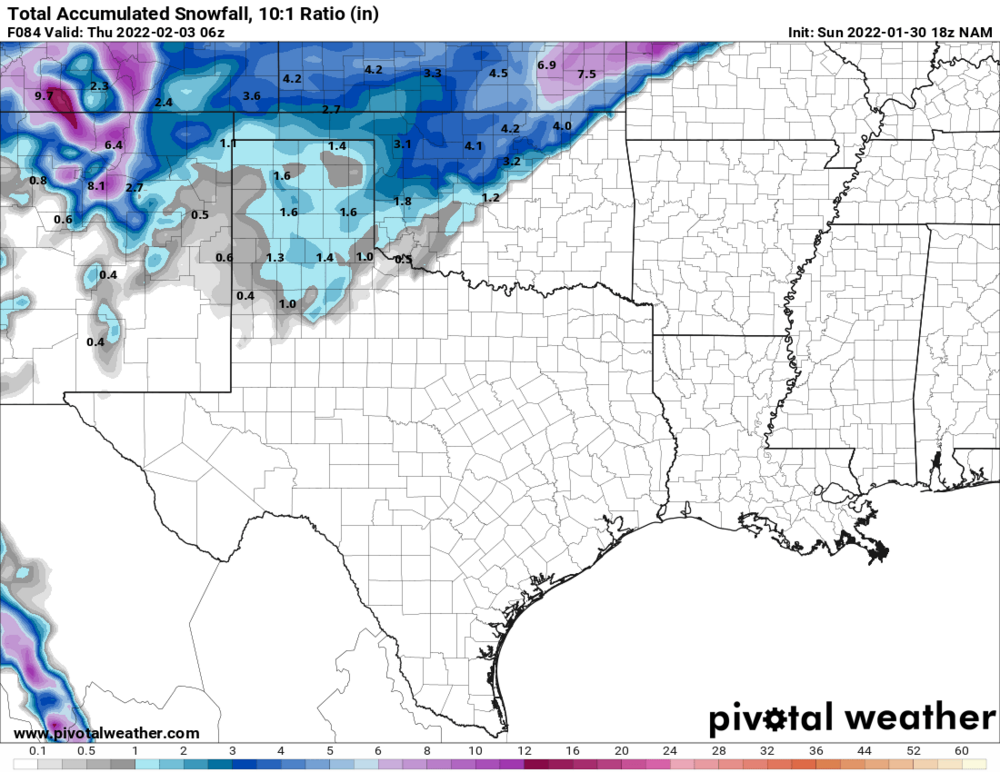
Yeah upon further investigation I am thinking that's also why the Snow Depth parameter is going nuts. Its not taking into account how much of that could likely be sleet.
QuoteIn that regard, it can be more useful for estimating the ground accumulation at the end of a snowstorm than our 10:1 and Kuchera snowfall products. Still, this benefit is offset by the substantial pitfalls of using very imprecise SLRs and typically treating sleet as snow.
-
I got it mixed up with that 18z NAM run I posted about. The GFS is however coming thru now.

-
 1
1
-
-
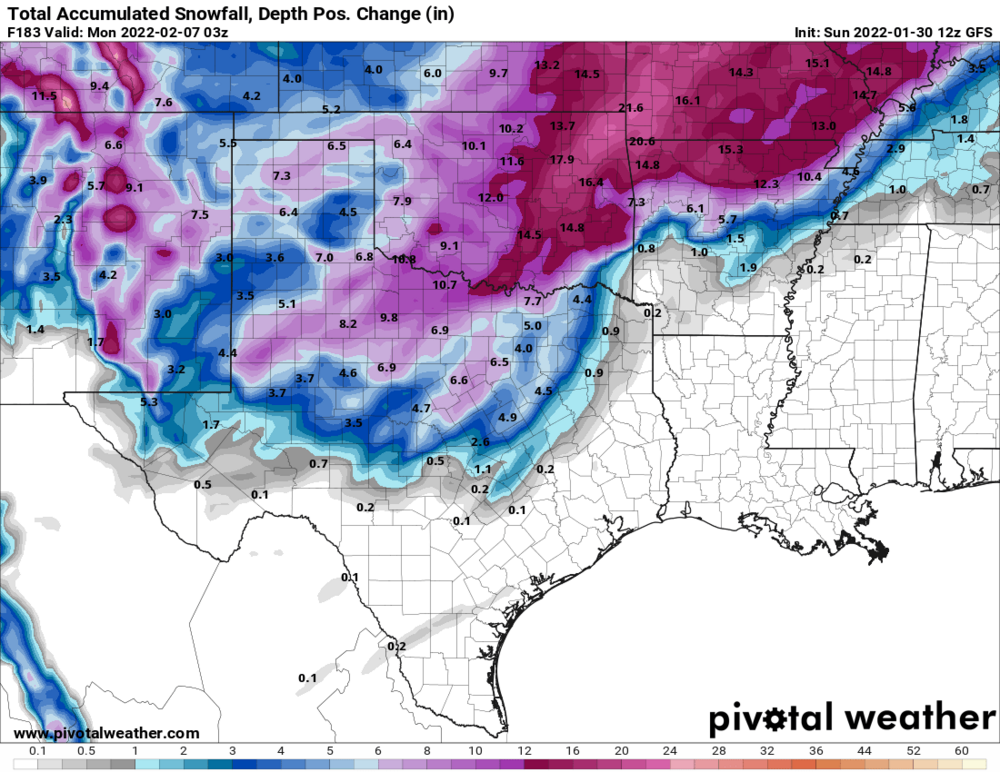
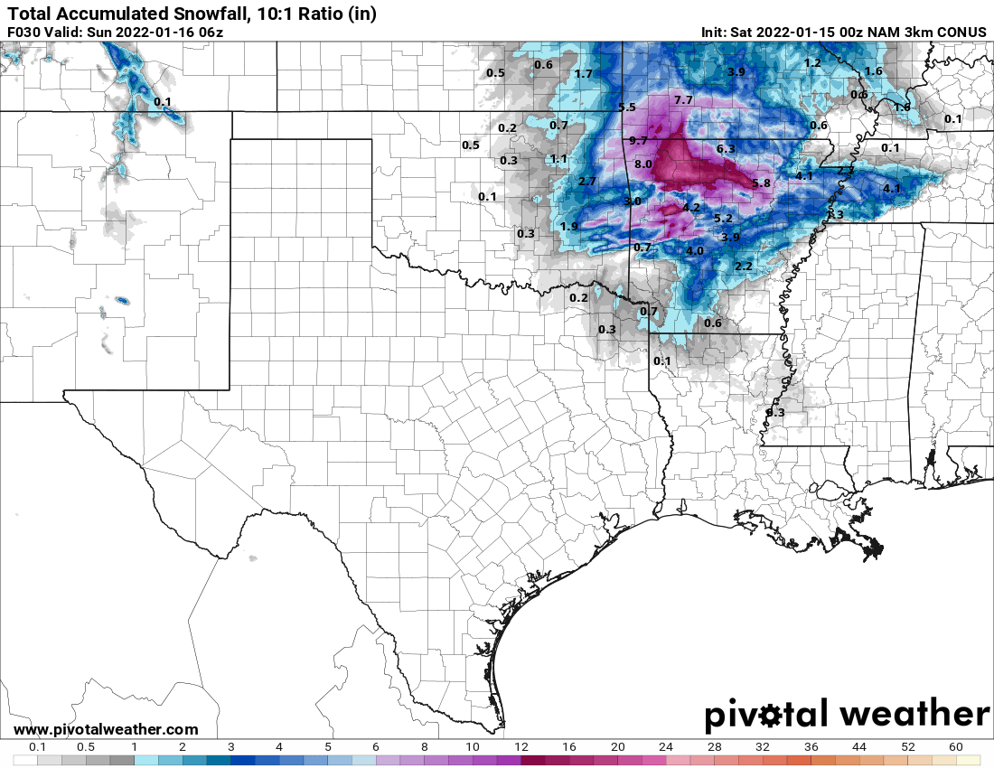
Ironically the 12Z GFS Snow Depth parameter is going bonkers. Depicts a secondary system moving in over the weekend. This reminds me of the 2010 & 2011 winters when we had back to back systems at the end of January going into February.
The 10:1 and Kuchera parameters are depicting the I-44 corridor getting slammed with nearly two feet in spots if this holds.
-
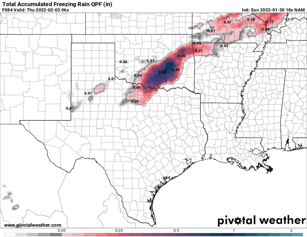
Lovely, unless its depicting a slower storm system, its looking like the latest NAM is calling for more ice than snow. Granted its just coming into range. Note its valid Thurs morning.
-
1 hour ago, StormChazer said:
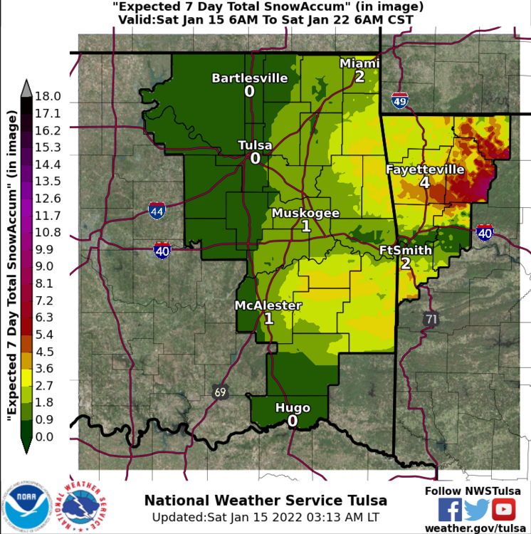
Tulsa NWS
That escalated quickly. Was just 1-2" for most of the area yesterday.
-
1
-
-
Yeah I dunno what happened there. But I was hoping I could edit it before someone noticed. You ninja'd me lol now I probably jinxed it.
-
 1
1
-
-
We got a few days out still but fingers crossed its more snow and less ice. Funny thing is I've been lucky as I missed the 2007 event in E OK since I lived in NWA at the time and then I missed the big 2009 event in NWA as I had just moved to Tulsa the previous fall. lol
-
With the way its looking, I will be surprised to see that much. Dry air intrusion is really brutal. Saw dewpoints in the teens around here.
-
I knew not to expect much to begin with but I'm thinking tonight's system is gonna be a bust for E OK and W AR. Too much dry air.
-
1
-
-
8 minutes ago, Doramo said:
I sure hope that Feb is are jackpot month ?
Historically speaking... yes. When I was a kid March used to be around here as well. Not so much in recent years though.
-
Yeah that was a pretty fun little surprise snow squall. Got a quick inch out just east of Fayetteville.
-
1
-
-
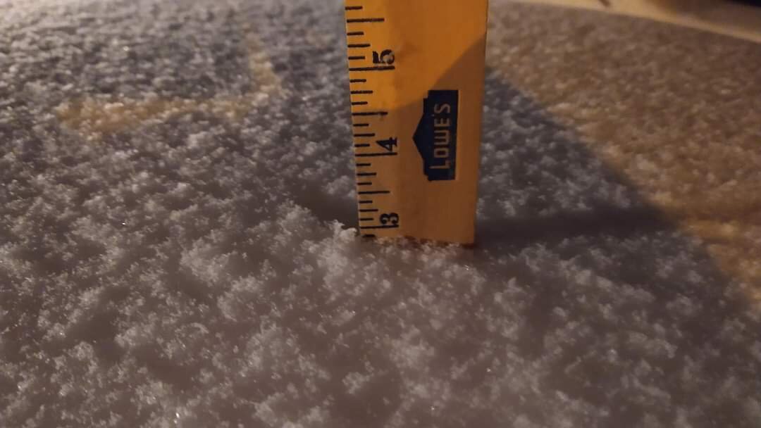
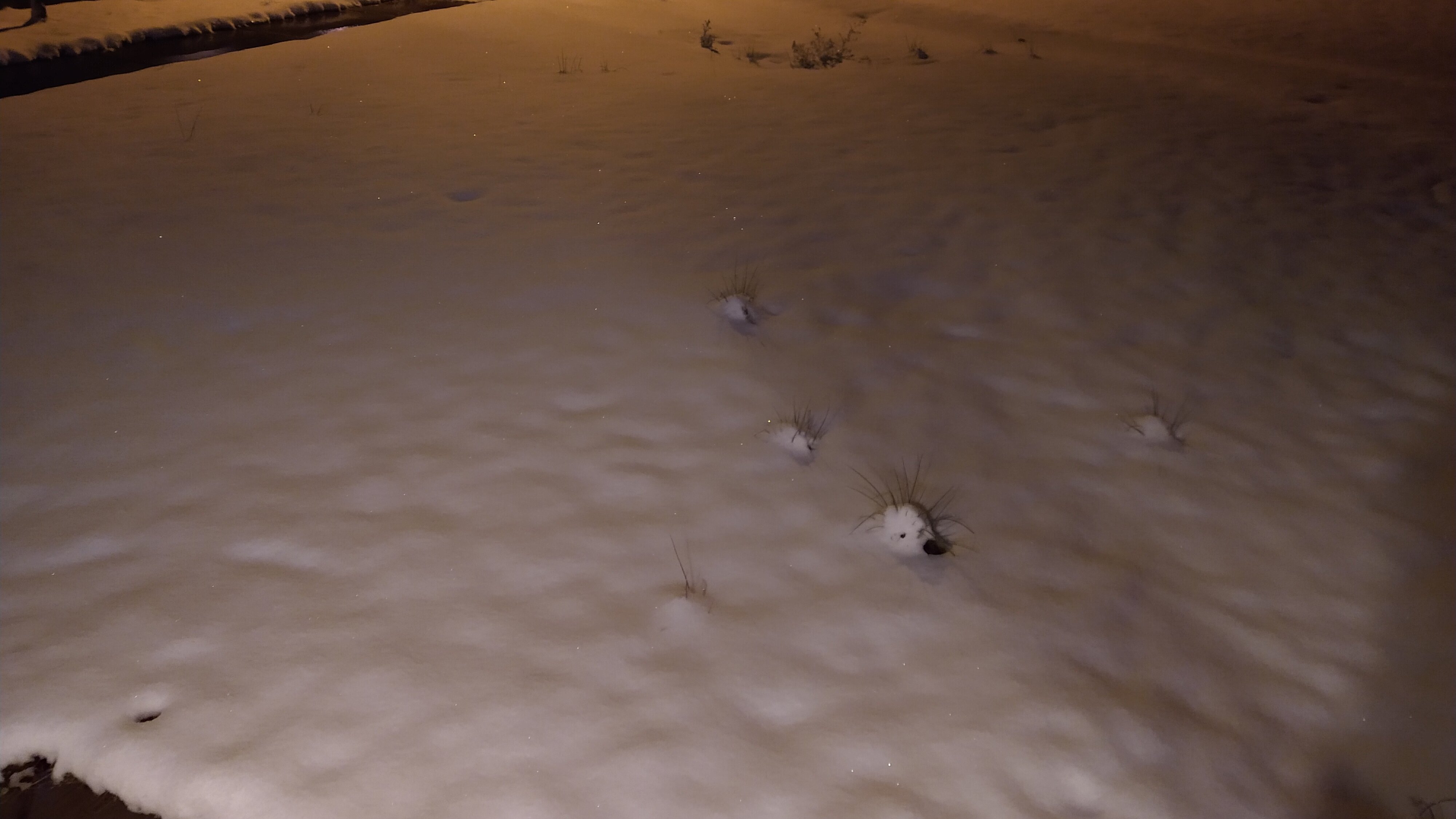
And that's all she wrote. Got 3" officially here in east Fayetteville. Measured in 4 different spots to verify.

-
3
-
-
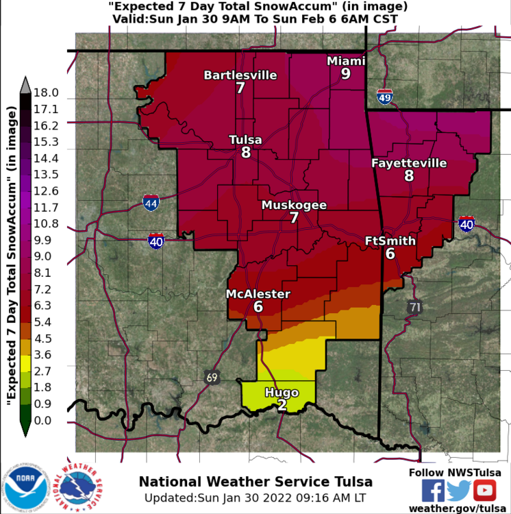
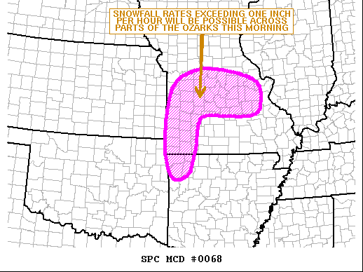
Winter Storm Warning expanded west to encompass all of NW AR now. SPC also put out a Meso Discussion regarding a Heavy Snow Threat increasing for much of MO/AR.
-
1
-
-
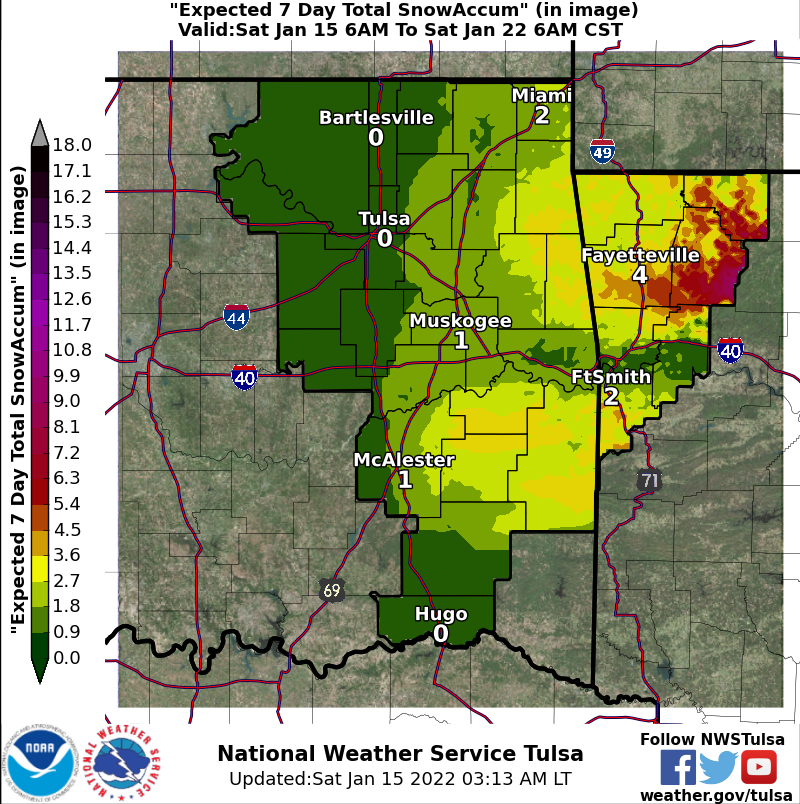
Snow has reached Drake Field in Fayetteville as of 4am. Temp at 33 degrees which seems cooler than what was forecasted this soon. Gravette, AR reported the changeover about an hour ago with heavy wet flakes.
TSA also updated their Decision Support graphic.
-
8 minutes ago, NWAflizzard said:
Wow! Was just able to look at the latest NAM maps. Really hoping those are right... I mean we are only 6 hours from this starting here and there is snow in southeast Kansas.
The model data is lining up with the currently ongoing precip in KS. Another good sign if you want the snow totals to verfiy. In fact, moderate to heavy snow is occurring already just north of Wichita on GR3.
-
Amended my above post. Crazy to note too that rural areas like Kingston and Jasper in Newton Co, AR could see upwards of 20".
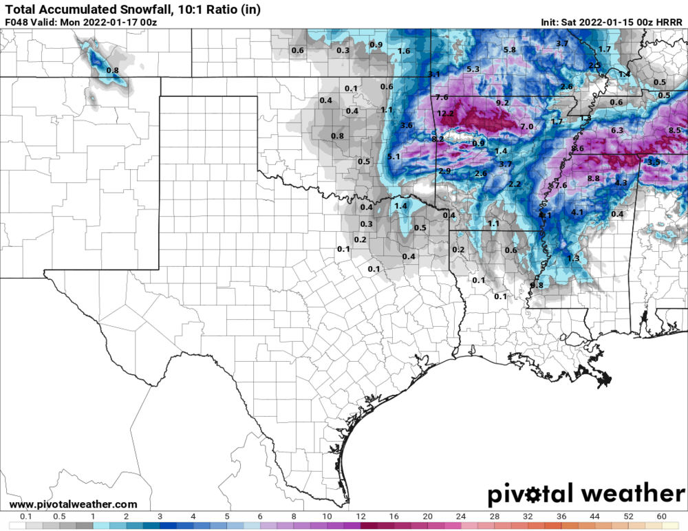
EDIT: The WRF is showing 30" lol
-
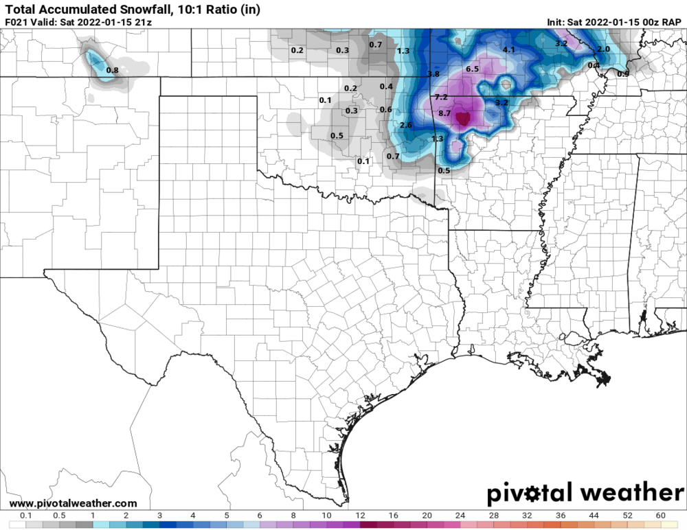
You guys beat me to it. lol Interesting development being less than 12 hours out now. 8-15" being shown over the metro part of NW Arkansas via the RAP, 3km NAM, and HRRR 00z runs. The 12k NAM is a bit more conservative showing 4-7". There's also talk of convective banding/thundersnow developing over this area.
Feb 9th, 2011 all over again?

-
^Yeah I think this system is even confusing the forecast data algorithms and not just meteorologists. Been seeing odd anomalies going on with the short range convective models like that. Same with weird spotty accumulation maps being rendered.
-
53 minutes ago, JoMo said:
Yeah, it's the NAM anyway, not like it's going to be right, lol.
HRRR showed under an inch for much of NW AR and NE OK, it will need to be watched closely but myself and my colleague at the TV Station I chase with is considering it a fluke ATTM. This low still has a lot of potential still to overperform.


MO/KS/AR/OK 2021-2022 Winter Discussion
in Central/Western States
Posted
The Euro just smiled on the NW AR peeps wanting a lot of snow. Looks like heavy snow slams the area on midnight Thursday. (06z UTC) Snow then lingers well into Friday too. (accumulation map shows Noonish Friday with flurries possibly remaining)
Also almost every GFS ensemble is showing the 4 state region getting slammed with heavy snow. Incredible.