

Modfan2
-
Posts
2,357 -
Joined
-
Last visited
Content Type
Profiles
Blogs
Forums
American Weather
Media Demo
Store
Gallery
Posts posted by Modfan2
-
-
Meanwhile in E CT

-
 2
2
-
-
4 hours ago, tiger_deF said:
Looks like an active pattern ahead in the tropics

Lock it!
-
Stein Stein everywhere Stein.Drying up the community drying up the pines. Burn this burn that can’t you see the Stein!

-
 3
3
-
 1
1
-
-
37 minutes ago, CoastalWx said:
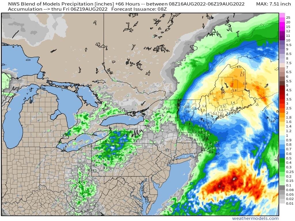
They’ll be some welcomed rains here. Nobody forecasted 5”. That’s all I said.
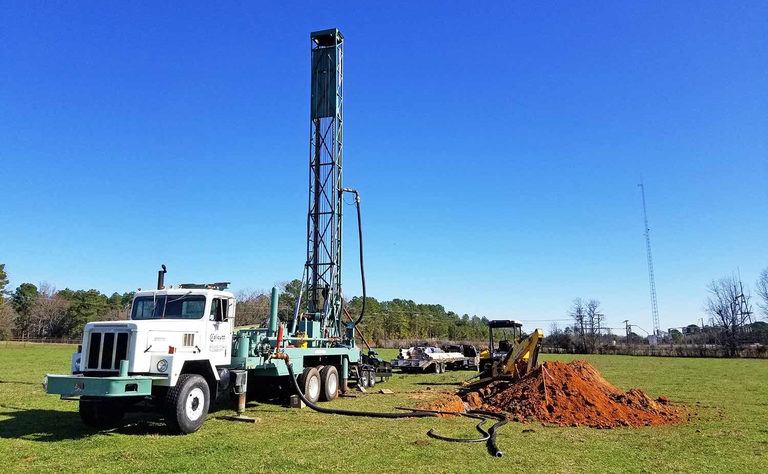
Maybe in se Mass, meanwhile DIT is digging his third well for drinking water!
-
1
-
-
-
What’s that a Seabreeze line pushing west over NE CT/ORH county on radar loop?
-
1
-
-
Enough to knock down for most!
-
3 hours ago, Seminole said:
SAL is just brutal out there.
https://tropic.ssec.wisc.edu/real-time/sal/salmain.php?&prod=split&time=
This; in my past 10 years in S FL I cannot remember a summer being this dry on the East Coast and water temps from the boat are running 82-84 and 86 in the Gulf Stream which is a little cool for this time of year.
Obviously things can and will change but Fl East coast cities are running 5-8” rain deficits in the middle of rainy season.
-
1
-
-
4 minutes ago, kdxken said:
77/71 ewww
77/74 here is S FL to start; your not far off!
-
2
-
1
-
-
14 minutes ago, Ginx snewx said:
I got smoked. Happy VJ day. Maybe it's because I grew up on the open ocean beaches but 86 degree pool water is not refreshing. Near record high water temp in da pool. We max this week before the gradual to sometimes quick cool return. Winds again today.
Try 86 degree ocean water!
-
7 minutes ago, amarshall said:
We are so due and as a coastal business owner it scares the shit out of me.
That and the amount of tree growth since Bob in 91; power outages from a legit CAT 1 or greater will be 2+ weeks.
-
15 minutes ago, WxWatcher007 said:
Just came across this
Been listening, 2 miles into the woods and about an 1 acre; just difficult terrain to access.
-
1
-
-
35 minutes ago, TauntonBlizzard2013 said:
TMLP hiked rates 15% July 1. Unprecedented for them, a municipal utility.
$288 last month… highest it’s ever been
Meanwhile My AC is going 24/7 10 months a year here in SFL and My Florida Power & Light bill averages $125-135
-
1
-
-
6 minutes ago, CoastalWx said:
75 out there.
Welcome to S FL lol!
-
6 hours ago, Torch Tiger said:
Quiet also means primed SST's.


Temps here off Palm Beach are 82-83 and 86 in the Gulf Stream which is cool for this time of year.
-
Is that a hail core over Hamden Ma or just heavy rain?
-
2 minutes ago, weatherwiz said:
Could have been a tree topper
Cell on MA/CT line looks good
-
1
-
-
1 hour ago, Ginx snewx said:
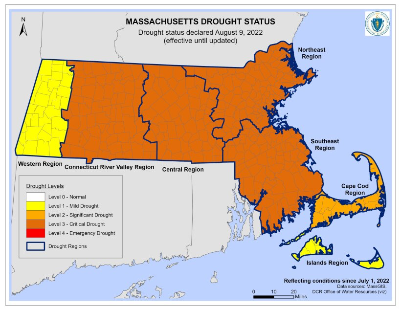
With .27 rain for the month this is my driest month ever since I started keeping records here at the Moosup/Sterling border(2001)
How are peoples wells doing?
-
Just now, CoastalWx said:
Probably overdone on Euro op, but EPS looks hot and gfs trying to rip some in here briefly. We shall see.
DIT installing additional units!
-
2
-
-
1 minute ago, weatherwiz said:
IDK...I think this is actually better overall than last week. We got some decent clearing coming in quickly. While that LIS anvil blowover is giving us clouds now that is moving ENE. I have a feeling around 3-4 we're going to start popping supercells in the HV and they move east and eventually form a line across central MA/CT.

Agree, I think the later start time helps areas partially clear out/Heat up.
-
Million dollar question is how does the junk in Western/Central CT impact areas further east?
-
Just now, weatherwiz said:
There is some legit dewpoint pooling going on. LCL's have actually lowered quite a bit. 2000+ J/KG of MLCAPE with 45-55knots of bulk shear to go along with 150-200 m2s2 of effective helicity and 100+ m2s2 of sfc-500m helicity. If anything robust develops in that environment it could go to town. Have to watch southern VT/NH and western MA the next few hours
The junk on the MA/CT line appears to be drying up, the stuff on the NY/VT line looks like the area to watch as you stated
-
15 minutes ago, weatherwiz said:
I think the tornado potential is rather low, but we should be able to see supercells early on in development but hodographs become more straight as opposed to curved as the day progresses (maybe some splitters?). DCAPE though running decently high though (800-1000 J/KG) so damaging winds is certainly the main hazard here.
Enough damage was done in the Rt 2 area of Mass near Orange/Warwick with straight line winds….Don’t need a spinner to make the trees thinner!! Lol!
-
1
-
1
-
-
14 minutes ago, weatherwiz said:
Should see a few pretty nasty storms today. Seems like extensive cloud cover and weak lapse rates will hold overall potential back a bit but if any cell can become mature enough and generate a strong enough updraft that can maintain...oof.
If your chasing today head to RT 31 in Charlton Ma (just before old Dresser Hill ice stand); you can continue south on 31 to water tower in Dudley with great views east and south
-
1
-
1
-

August Discussion/Obs
in New England
Posted
Living here in Martin County, Cat 5 Dorian Sat 76-80 miles to our east and destroyed part of the Bahamas; that’s as close to a Cat 5 I want to be!!!
Growing up in ORH County for Gloria and Bob; New England will have considerable tree damage from a Cat 1 or greater. Many are unprepared