

Rhino16
-
Posts
1,591 -
Joined
-
Last visited
Content Type
Profiles
Blogs
Forums
American Weather
Media Demo
Store
Gallery
Posts posted by Rhino16
-
-
Mine is probably impossible to achieve.
-
Managed to mostly split the gap earlier, but did get maybe a 0.1” from the south half of the line. Got to see 2 small shelf clouds though, and lots of lightning. Getting random showers now with some rumbles. Waiting for the random beginning of august impressive unexpected thunderstorm.
-
23 hours ago, high risk said:
The NAM Nest is the gold standard. The HiresW ARW2 is decent. HRRR and especially the HiresW FV3 are the worst. When they both showed the warm front staying south of DC yesterday, I started writing off severe potential up our way.
Are there any good resources to learn little things like this, or is it all just time, experience, and networking? It feels like there’s still so much to learn. I should practice forecasting while I’m not doing anything.
-
Not a drop today, kind of disappointing when the air is a liquid.
-
DCA: 99
IAD: 99
BWI: 99
RIC: 101
-
51 minutes ago, NorthArlington101 said:
Booooo. Have to see if it holds all day now
We’ll probably have to wait for a substorm tonight for best chances.
-
-
Tomorrow night seems to be the one to watch. Won’t complain if it continues into monday night.
-
1 minute ago, NorthArlington101 said:
Thanks for turning me on to this… been harder to track this stuff since I deleted a lot of social media. Worth a go Sunday night.
We haven’t had much interesting that hasn’t been timed alongside clouds and rain so I’m hopeful this time will be good.
-
Did get some good storm photos yesterday! I was quite surprised. Sunday and Monday may be chances to see Aurora if the air can stay clear.
-
 1
1
-
-
Not many changes at 20z, just some adjustments north and “trimming”.
rest of outlook is same as previous.

...20Z Update...
   The primary change to the Day 1 Convective Outlook was to slightly
   expand severe probabilities farther north in NJ to account for
   placement of stronger storms likely preceding the surface low track.
   The western bounds of severe probabilities were also trimmed to
   account for the passage of the surface low and surface cold front.
   Otherwise, the previous forecast (see below) remains on track.

   ..Squitieri.. 05/30/2025
-
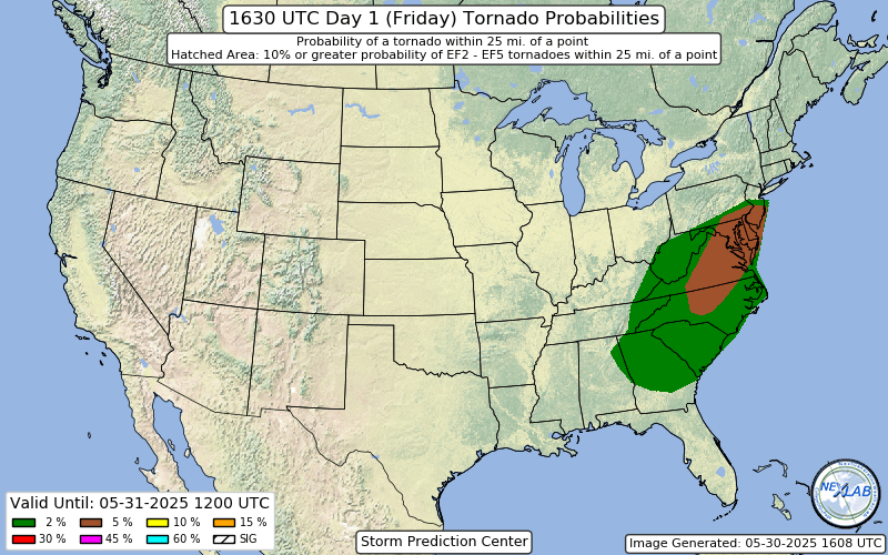
Very big expansion of the 5% Tor in the latest outlook…
-
 5
5
-
-
Reviving this thread, maybe it’s better to make a new one soon, or we can see how long this one can persists.
I’m a little more interested in today. I think I can see some hints of instability on the northern edge of the cloud cover, and mesoanalysis indicates we have about 500 j/kg of CAPE over the area.
I’m still waiting for the clouds to leave, it’s 69/67.
-
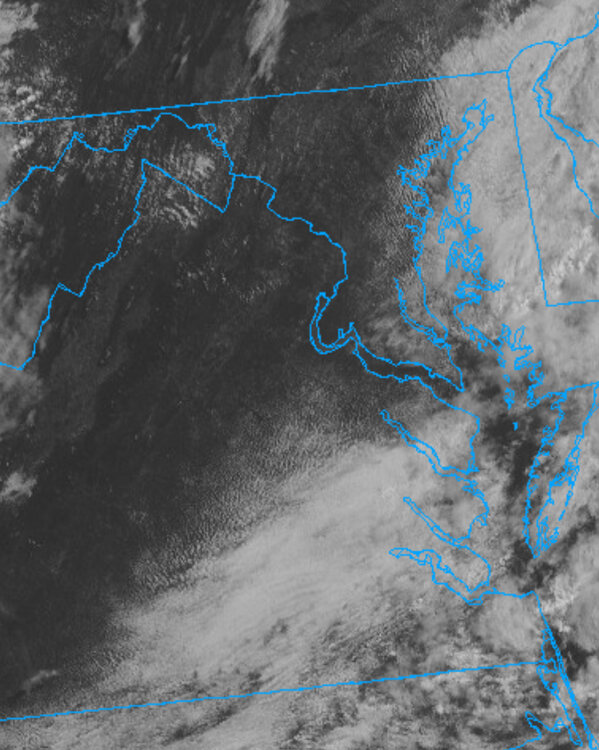
A lot of guidance has the classic gap that opens up just west of Richmond and continues to the coast. Not sure if that’s because of the rain the models want to send through early morning, or some other phenomenon, but it’s annoying to see instead of something to break up the cloudy days.
-
35 minutes ago, WxUSAF said:
Been pretty uneventful for years it seems?
I’ve forgotten what good storms are like. Makes me want to return to the plains.
-
2 minutes ago, TSG said:
It was so damn windy the annual Rappahanock Rivah Regatta had to stay off the water today. Sailboats. Too much wind in late May... when we're almost always concerned with too little. Lol
Hopefully it’s not all used up! I can’t take another 98° 0 wind day on the water.
-
1
-
-
Officially a meteorologist! yay.
-
13
-
-
1 hour ago, Siberian-Snowcover-Myth said:
Down here near RIC…. Where’s this deluge we were supposed to be getting? Only a couple light showers today.
It’s out here in the mountains.
edit: hopefully it’s gone before graduation Thursday…
edit2: imagine if this were snow…
-
 1
1
-
-
2 hours ago, Eskimo Joe said:
Model guidance really waffling. Genuinely wonder if the lack of RAOB data is hurting.
It’s that time of year too. Spring patterns can be rough sometimes.
-
Interested to see what happens with the morsels of CAPE and LLJ combo… I have some guesses, but will wait until tomorrow…
-
I need these clouds to go away!!!
-
4 minutes ago, Round Hill WX said:
Doesn't look like the clouds are going to cooperate for tomorrow night's full lunar eclipse.
I noticed that yesterday, I really hope there’s a conveniently timed gap.
-
1
-
-
grading for blacksburg:
D. I don’t think we got to half our mean snowfall this year. There were 2 huge ice storms that were just annoying. When it did snow, it impacted travel to AMS, so that was annoying. I might be able to allow a low C just for the cold, and the mood flakes from upslope.-
 1
1
-
-
I had some cool pea sized hail today from an odd storm that had a really cool streaky look from the precip / hail.

June Banter 2025
in Mid Atlantic
Posted
Happy Birthday!