Prospero
-
Posts
1,168 -
Joined
-
Last visited
Content Type
Profiles
Blogs
Forums
American Weather
Media Demo
Store
Gallery
Everything posted by Prospero
-
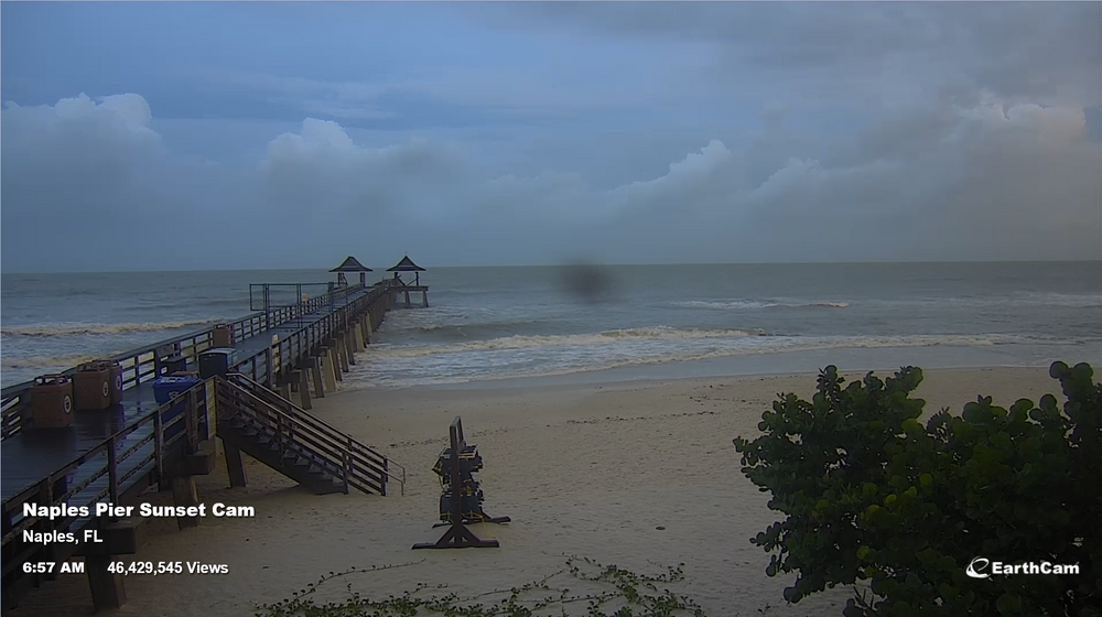
We can see the surf starting to kick up in Naples. https://www.earthcam.com/usa/florida/naples/?cam=naplespier
-
There has been some dry air in our part of Florida. Its been hot and muggy, yet dry enough that thunderstorms have been subdued. Still feels like a strong storm a brewin'...
-
It must be time to say, "I see an eye!" LOL
-
Debby and the GOM are ready to party.
-
A long way away in Pinellas County feeling the wind already, it appears to be a very large storm. With moon tides I wonder if the storm surges will be higher than expected. Seems like a lot of rotation happening that could push up a little bit of the Gulf of Mexico into low areas.
-
I think I may have been wrong anyway. LOL Hermine might have been in my memory.
-
Really? Seems I've seen that a few times. But my memory is getting fuzzy... Hurricanes crossing north Florida into the Atlantic, then making landfall again on the Carolina/Virginia coast? Happens a lot, right?
-
ChatGPT (AI): There have been several notable hurricanes in the Gulf of Mexico that made a "hard right turn," meaning they changed direction sharply, usually turning toward the northeast or east after moving westward or northward. Here are a few examples: 1. Hurricane Charley (2004) Path: Charley moved northwest across the Caribbean and then turned sharply to the right as it entered the Gulf of Mexico, making landfall in southwest Florida near Punta Gorda as a Category 4 hurricane. This sharp turn caught some forecasters and residents off guard as the hurricane had been predicted to take a more westerly track. 2. Hurricane Elena (1985) Path: Elena exhibited a very unusual path. It initially moved northwest in the Gulf of Mexico, then stalled and made a sharp right turn toward the east, heading toward the Florida Panhandle. It made landfall near Biloxi, Mississippi, after meandering in the Gulf and threatening multiple states. 3. Hurricane Michael (2018) Path: Michael moved northward through the Gulf of Mexico and then made a hard right turn toward the northeast before making landfall in the Florida Panhandle near Mexico Beach as a devastating Category 5 hurricane. 4. Hurricane Ivan (2004) Path: After moving northwest across the Gulf of Mexico, Ivan made a hard right turn toward the northeast, making landfall near Gulf Shores, Alabama. It then continued inland before looping back into the Atlantic, turning into a subtropical storm, and eventually curving back across Florida. 5. Hurricane Opal (1995) Path: Opal moved northwest across the Gulf before making a sharp right turn toward the northeast. It intensified rapidly just before landfall and struck near Pensacola, Florida, as a Category 3 hurricane. These examples illustrate how unpredictable hurricane paths can be, particularly in the Gulf of Mexico where weather patterns can lead to sudden changes in direction.
-
I've seen plenty of hard right turns from storms. LOL
-
Another band is inching this way from the south. I've finished the work I need to do in order to have 15 minutes or so to close the last shutters in the unlikely event I will need to. But Charlie caught so many off guard and taught everybody on the Central West Coast of Florida so many lessons about being casual when any kind of storm passes by. Being a season since I've hung out here and only popping in to read now and then, I am wondering when a Banter and/or Conditions forum might appear. I am not a Met, just a passionate Enthusiast who is getting excited. Right now that feeling of a broad circulation is very familiar to we who live on the Gulf Coast is invigorating. It's like we can feel a storm approaching. I can hear the trees and ground beneath me cheering for the seasonal rain we need from these storms. Yay!
-
The circulation is becoming much more evident: https://weather.cod.edu/satrad/?parms=meso-meso2-truecolor-48-1-100-6&checked=map&colorbar=undefined
-
I guess there are rarely any prediction numbers on whether any rapid intensification might occur?
-
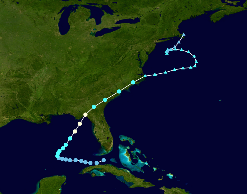
My first storm was as a kid in 1968 on Charleston Air Force Base with Hurricane Gladys passing by. All us kids were playing outside when our parents called us in. There was no Weather Channel or online Weather forums. Most people still had a black and white TV with rabbit era antennae. I think my dad was called to fly one of the fighter planes to another base and passed on the news a storm was pending. Soon as it got dark, lawn furniture started to fly and the backyard became a lake very quickly once it started. An ancient very large oak tree came down which always makes me sad. But I was hooked forever on storms at 8 years old. Gladys came through Pinellas County FL where I live now too. https://en.wikipedia.org/wiki/Hurricane_Gladys_(1968)
-
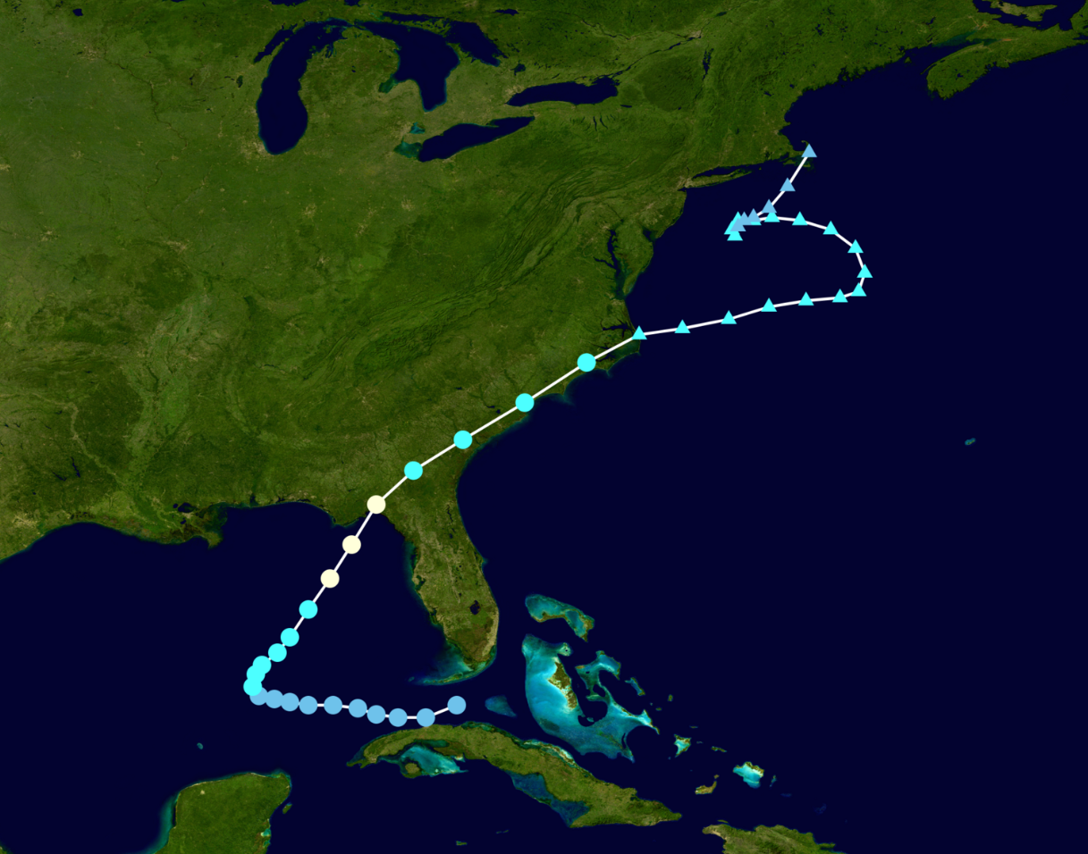
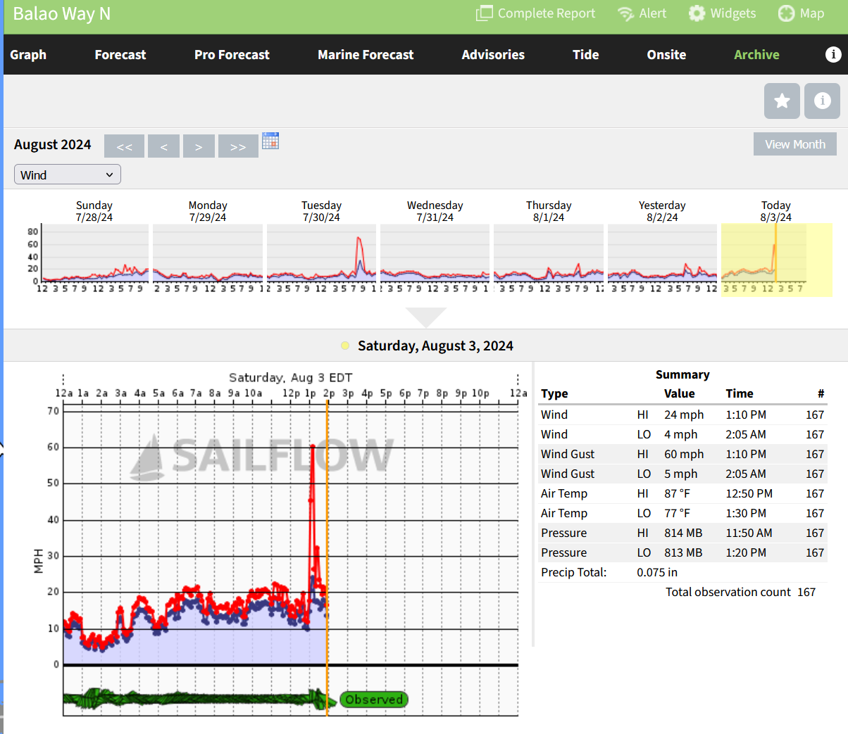
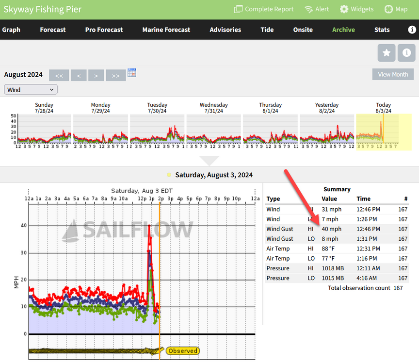
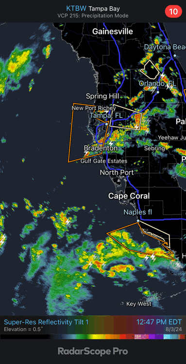
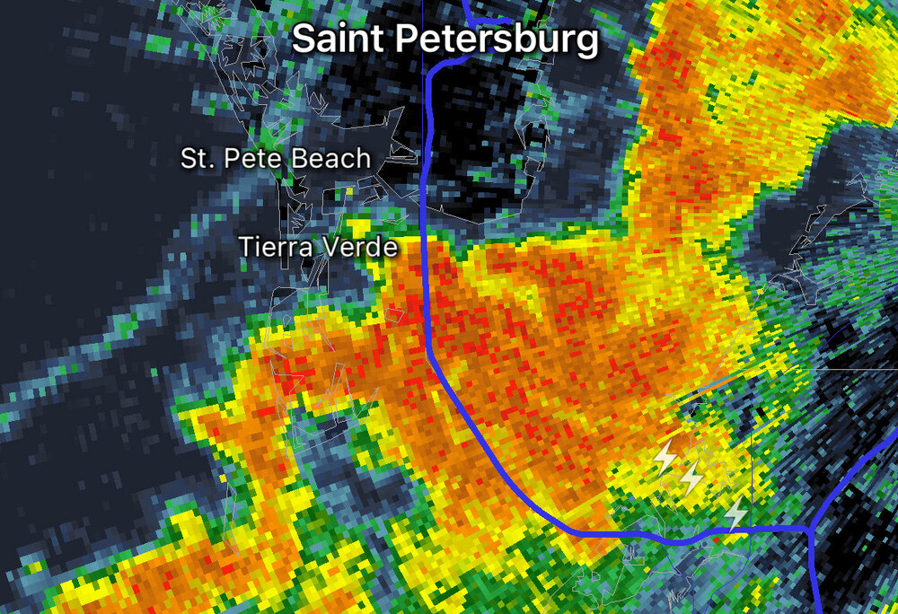
Pinellas County FL: The Skyway Fishing Pier recorded a gust of 40 mph. Baleo Way N captured a 60 mph gust with this line of storms that appears to be from the TD we are watching on SailFlow.

-
Opinions?
-
I’ve watched this band for a few hours. EDIT: OK, maybe not a “band”, but not a typical every day afternoon thunderstorm I obsess about every day. This line across the Florida peninsula has been coming up with the circular motion of the future Debby.
-
First band to hit St Petersburg. Having a pizza out for lunch and people jumped up looking out the window. I thought a tornado maybe but the scene was a few shopping carts without humans moving fast across the shopping center parking lot!
-
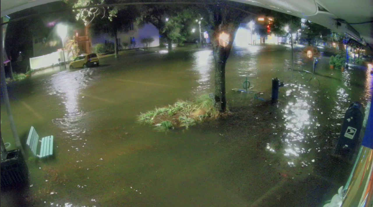
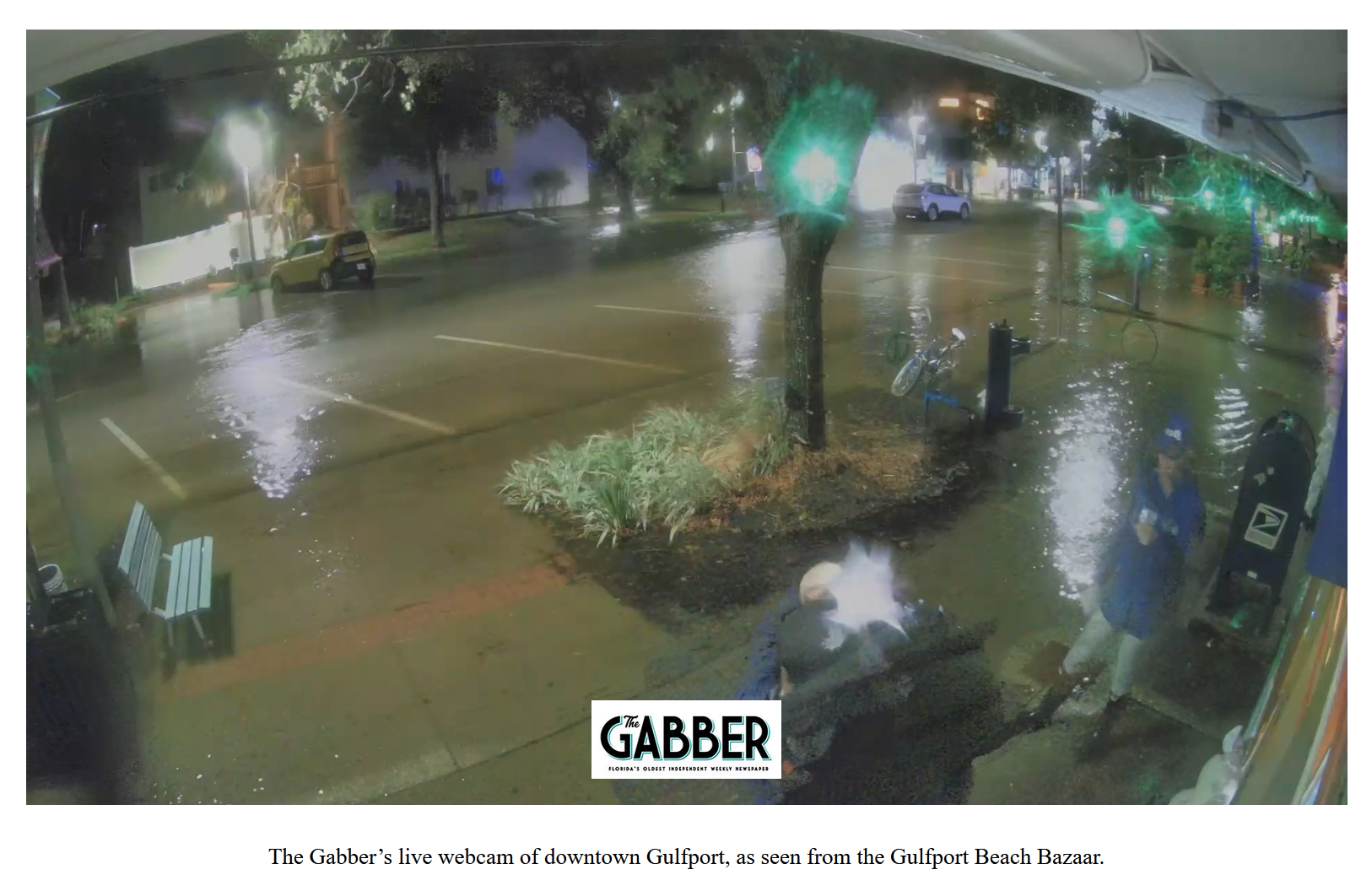
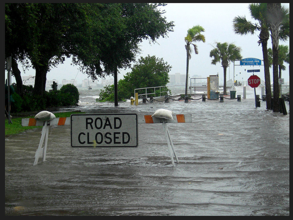
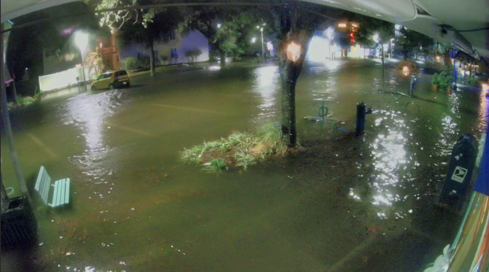
Here in Gulfport FL a 4ft surge on top of a 2ft tide is a problem. Shore Acres in St Petersburg will be flooded…AGAIN.
-
Gulfport, Florida in Pinellas County: Just filled up our van with gas and swapped out an empty propane bottle for a full one. There was no line for gas and it looked like plenty of full propane bottles left. I may pick up a bag of ice for the freezer. We don't expect much here with Debby except some always welcome rain. But with 24 hours of unknowns we want to be ready for a "Charlie" just in case. The last Tropical Storm Debby we enjoyed in 2012 dumped 16 inches of rain on us, blew some trees down, cut power off, and made a respectable storm surge:
-
 It's obvious they have been through a storm or two before and don't build their buildings out of straw.
 -
No pics or video? Seems unusual for a storm like this.
-
2024 Atlantic Hurricane Season
Prospero replied to Stormchaserchuck1's topic in Tropical Headquarters
Not tonight. This may have been the first wishcast of the 2024 season. Just we need the rain so bad around here in Tampa Bay. Sometimes a tropical system will just "pop" up in a few hours surprising everybody in the Gulf. But not tonight.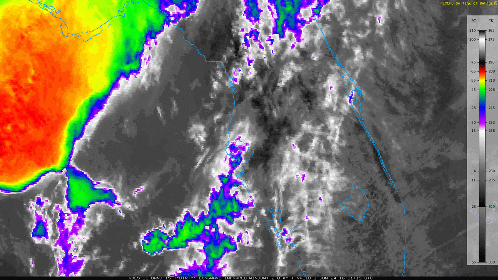
-
2024 Atlantic Hurricane Season
Prospero replied to Stormchaserchuck1's topic in Tropical Headquarters
A new named storm before Midnight tonight? https://weather.cod.edu/satrad/?parms=local-Orlando-15-24-1-100-1&checked=map&colorbar=data
-
Storm surge rising in Gulfport.
-
News reporters are already in Gulfport. The ocean is rising at a solid rate possibly until mid-day tomorrow or longer. https://thegabber.com/gulfport-fl-beach-webcam/