

NorthHillsWx
-
Posts
7,652 -
Joined
-
Last visited
Content Type
Profiles
Blogs
Forums
American Weather
Media Demo
Store
Gallery
Everything posted by NorthHillsWx
-
Storm total of 1.18” here. Looks to be done unless something develops in the subsidence. One interesting thing is many models predicted it’d rain through tonight and into tomorrow. This thing moved through in a hurry
-
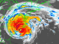
The storm has impressive upper level outflow in basically all quadrants
-
Can already tell where today’s going: currently 77 with a sultry dew point of 75. Looks to be a dry, hot, and excessively humid end to June. Likely going to end the month at 6.21” which has done wonders to help alleviate the dry conditions following our rainless spring
-
Remnants of Danny looking remarkably well organized over Alabama this morning
-
Every now and then you get lucky Edit: Ended with an unexpected 0.18” today, up to 6.21” for June
-
With the cutoff low in the Ohio valley, we could enter into an extended wet period as well. Below average and wet, I’ll take it going into the peak of summer
-
Looking like we’ll have a named storm before landfall. Weak and limited impacts but always fun to watch tropical on radar
-
We have officially broken the 6” mark! 0.01” but still raining puts us at 6.00” on the month! Edit: Only very light rain today. Ended with 0.04” and 6.03” for the month
-
0.13” was the total yesterday. Now at 5.99” for the month.
-
Just had a heavy shower push through. 0.12” in about 5 min
-

2021 Atlantic Hurricane season
NorthHillsWx replied to StormchaserChuck!'s topic in Tropical Headquarters
Watch the low pressure system that has formed off the Carolina coastline. Very common spot for quick spin ups -
.38” today. 5.86” on the month now
-
We’re at 0.09”. Hopefully we get in on it this evening
-
Radar looks as if you’ll be fine. It’s rained here all morning and we haven’t had anything measurable yet
-
Picked up 0.67” overnight. 1.71” is going to be our total from Claudette. 5.48” on the month, pretty dang happy overall, wish the rain was more consistent but decent total with more than a week left in the month
-
Just broke an inch here. 1.04” and still raining. Pretty dang happy and looks to rain off and on through tomorrow morning
-
0.91” at the house. Looks like more to come
-
Definitely looks like a tropical storm today on Sat and radar. Widespread tropical storm conditions have been reported as well. Yesterday, not so much, but NHC waited until it did to call it, so good work as always.
-
06:53 S 24 G 81 1.25 Heavy Rain Fog/Mist Squalls and Breez Pretty good gust in Pensacola
-
Why we have everyone’s favorite measurement: ACE
-
I’m really banking on the Euro, everything else essentially dissipates the low and drives any rain south and east of North Carolina. Per the GFS, our only rain chance in next 10 days would be some afternoon storms one day with the frontal passage. These 2-3 week gaps in any rainfall are not ideal
-
This would hurt
-
Anyone know how to get climate data from Franklin County airport? Our farmer up there says it’s the driest spring he’s ever had and it literally didn’t rain in April and they had just 1 thunderstorm in may. They have been unable to plant this year without irrigation
-
Share some with the rest of us!!!
-
Yep and I mistyped too, our May rainfall was only 1.32”, not 1.42”

