NorthHillsWx
-
Posts
7,652 -
Joined
-
Last visited
Content Type
Profiles
Blogs
Forums
American Weather
Media Demo
Store
Gallery
Everything posted by NorthHillsWx
-
Looks like a textbook cycle has taken place. Ominous for southern b-ham suburbs
-
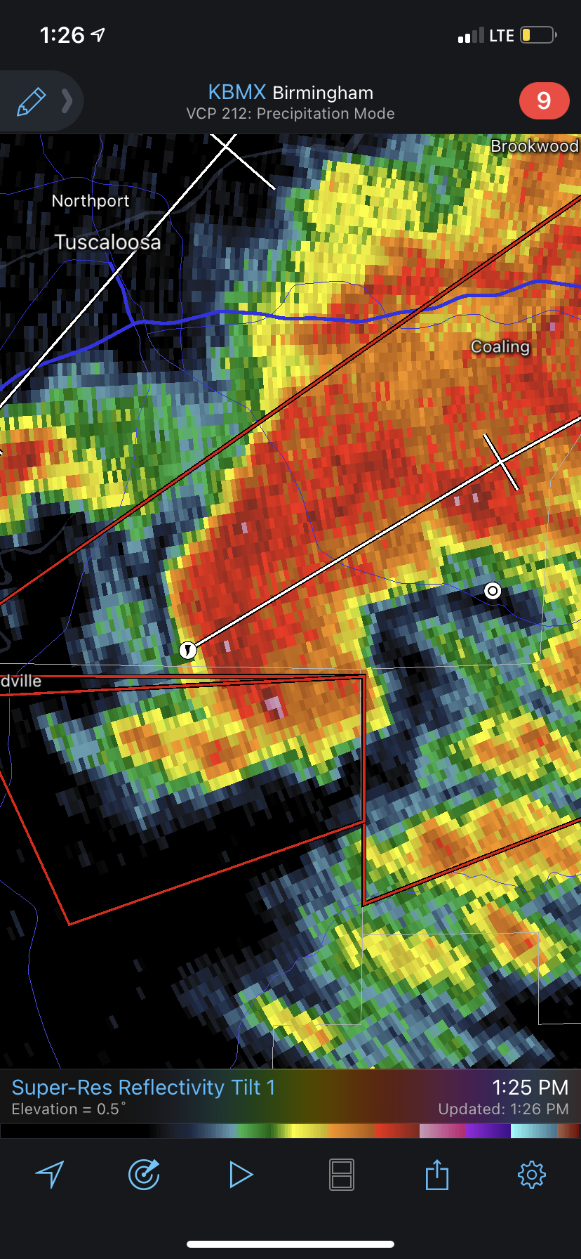
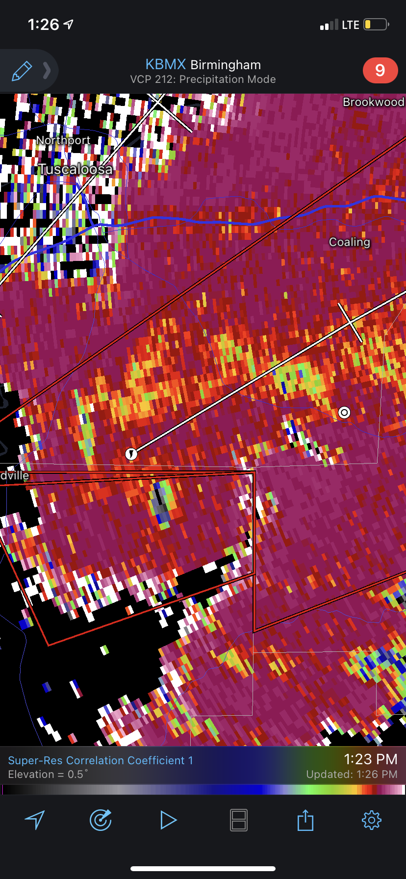
Cell approaching Tuscaloosa needs to be watched. Moving into clean air on the backside of the tornadic storm to its east and has some broad rotation already
-
Believe we have our first monster of the day. Stay safe everyone
-
This storm already looks more severe on radar than anything from last week
-
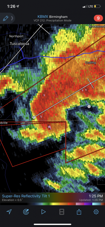
Not good y’all
-
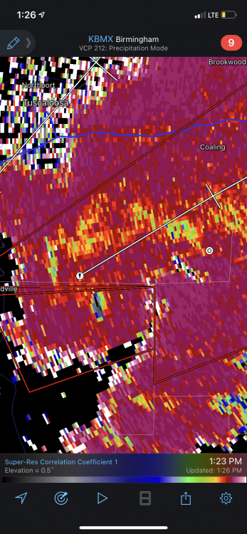
Large debris ball
-
That is a ferocious looking storm
-
Definitely need a whining thread for every season. Need a place for people to vent when a severe threat fails to produce a tornado that takes out their house
-
The LP off the Carolina coast is very potent this morning. Really well wrapped up. Pretty cool radar loop
-
There wasn’t a single severe report in the level 3/4 threat area. I’m sure there were 2-3 weak spin ups that certainly were scary and damaging under that meso low yesterday but that was outside the threat area. Like issuing a winter storm warning and not getting a flake but a rogue band set up and dropped 1-3 inches outside the warning area Not downplaying your experience, I’m sure that was harrowing. But this was a bust outside of a very isolated area. If it’d been a level 1 day no one would be calling bust, but it was forecast to be high end.
-
Reminds me of that video from Zebulon a while ago on 64
-
There are a couple of observations I made as to why yesterday failed to produce. 1) lack of strong LLJ. This was apparent from modeling about 24 hours out and very noticeable yesterday. Even when the sun broke out and mixing should have occurred, winds were pretty much calm all afternoon until the outflow from the QLCS came through. On significant severe days, as soon as the sun breaks out and screaming LLJ winds start mixing down, it becomes extremely windy and gusty 2) The meso-low develop in a textbook location from pressure falls along the southern edge of the retreating wedge layer and rode that boundary to a T. This happens so frequently we need to look past other parameters in our area and always remember that these meso scale systems frequently are our main mode for severe weather. The only significant weather yesterday occurred with this feature and it was well outside the area SPC progged for severe weather.ALWAYS watch the wedge front for severe, even if CAPE and other values are not high in those areas 3) as the low crossed the mountains it got strung out. Pressure falls along the coast set up a secondary boundary that became the primary forcing region and led to the formation of a large area of convection near or over the ocean. This was very well modeled within 36 hours. Most CAMs eliminated all convection in the SPC risk area more than a day out. This was very noticeable. Whenever you get a large convective mass on the coast you can pretty much kiss severe threats goodbye. Not only was the LLJ disrupted but a large area of subsidence existed between the pressure falls along the coast and the meso low. This negated the favorable mid level parameters that argued for an outbreak 4) do not take so much stock in mid level parameters. They definitely determine a severe outbreak, but to be exploited you need storms, lol. This was a situation where the LP got strung out and reformed over the coastal boundary leaving most of NC/SC in a zone of subsidence and no forcing for storm formation. This was actually very well modeled from 24-36 hours out, plenty of time to adjust the severe outlook
-
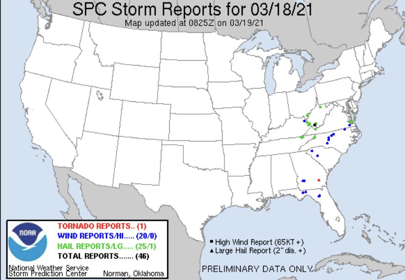
Not to beat a dead horse, but this is pretty laughable. Not a single severe weather report in the level 4 area from yesterday or even the enhanced area (maybe a wind report on the extreme edge?). They dismissed school early and many, many business shut down from the triangle east due to the severe weather threat
-
0.04” of rain from this morning. Low of 48.4 High of 72.6 Literally not a drop of rain from this evening’s line of weather
-
It has to be rare to be under a level 4 severe threat and not see a single severe warning much less report within 100 miles like SE NC was today
-
And I got called out for calling today a complete bust when the level 4 area from this morning literally won’t get a thunderstorm or shower. I regress, definitely lessons learned from this event based on a number of limitations that kept favorable parameters at bay
-
Has there been a confirmed tornado report?
-
I’m sticking with my call. Still no TOG reports and I do not think this makes it east of the triangle where they started the day with a level 4 threat
-
Why is there not a NWS radar station closer to Charlotte... Storm definitely has strong mid level rotation
-
The pineville storm is likely to be the storm of the day. Has a ripe environment in front of it too
-
I’m failing to see the mode for storm formation outside the current line. There seems to be massive subsidence between the QLCS moving through the western Piedmont and the convention hugging the coast. Yes, there are positive tornado parameters present and some would favor a significant tornado, but by the time that line gets east to where the CAPE has surged it will be well after nightfall. The front remains west and the biggest forcing is along the wedge front. I do believe there will be severe weather, but I think it’s going to be limited to roughly Columbia-Raleigh and relatively nothing east of there. It will not be widespread either. I do think there could be a tornado or two, I’m absolutely not saying we’re out of the woods, but it will not be a widespread severe day
-
May have to get your spotlight out. I’m not sure it gets here before dark.
-
I say bust too being they dismissed schools early and many business across the eastern part of the state closed between 2-4 in anticipation of severe weather. Many of these areas may not see any weather (rain) period. That’s a bust when you get to the point of closing schools and businesses and there isn’t a severe report within 100 miles when you started the day in a level 3-4 severe threat.
-
I’m thinking this busts pretty significantly even for a level 3 severe weather outlook. That line looks to ride the wedge boundary I could see a few severe cell segments in the line but i don’t think there will be enough instability this afternoon further east to induce many showers or storms. There may even be some areas from the triangle to the coast that avoid all rain period until the ULL swings through tonight. Definitely looking like a run of the mill system in terms of severe potential here. We’re at the point, 4 pm, where we’d be seeing cell development outside that line and it’s just too stable. Certainly looking at a very isolated severe event
-
Storm moving towards jonesville might need a tornado warning