

Bob's Burgers
-
Posts
510 -
Joined
-
Last visited
Content Type
Profiles
Blogs
Forums
American Weather
Media Demo
Store
Gallery
Posts posted by Bob's Burgers
-
-
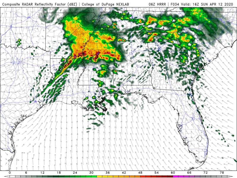
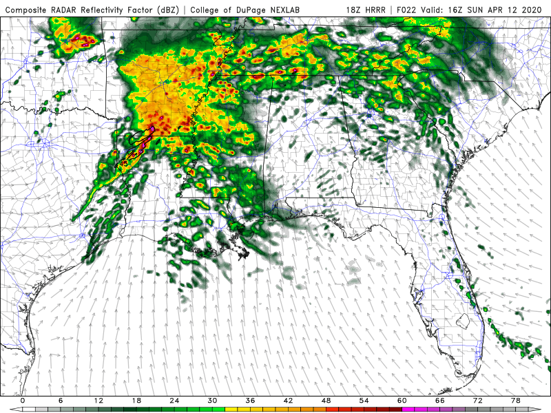
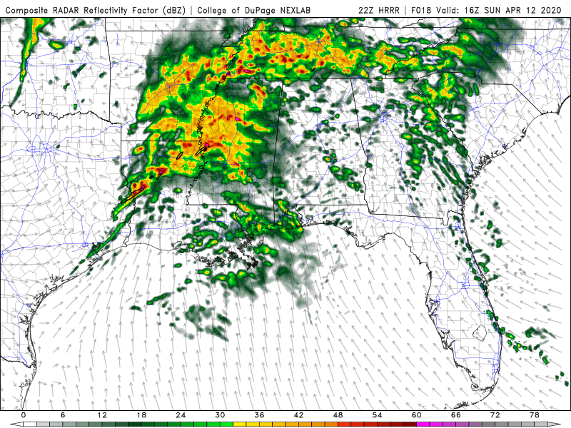
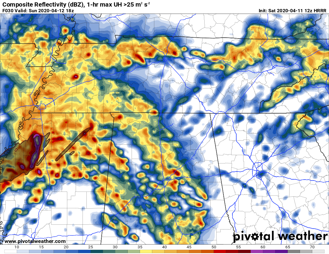
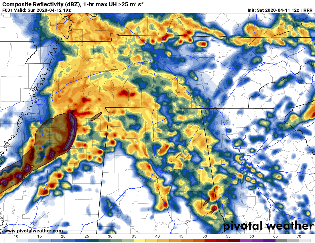
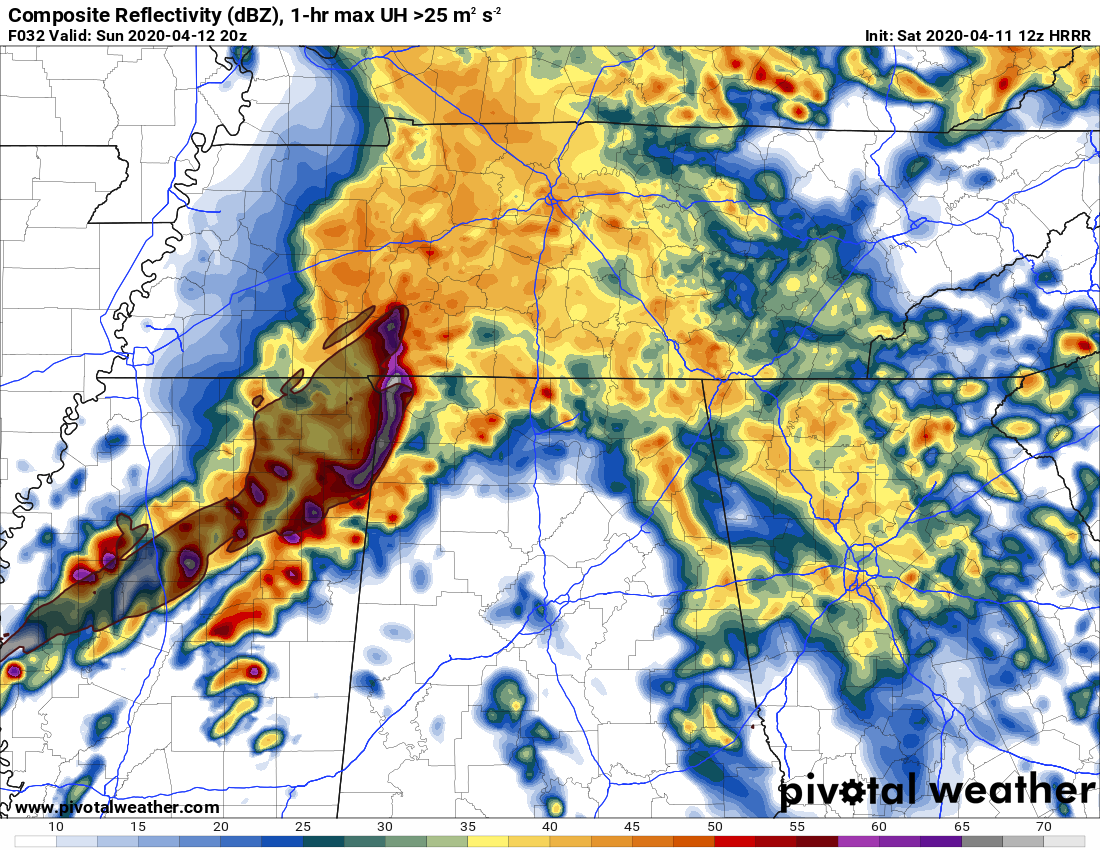
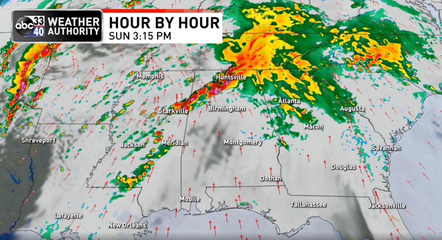
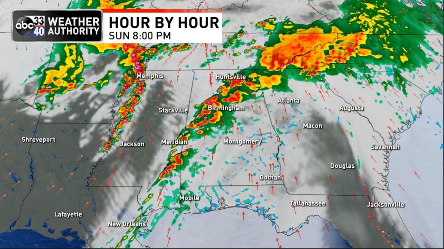
4z HRRR coming in with a much different solution than previous runs. Lack of convection/del rio supercell that died out has a huge impact on how the convective complex plays out tonight per 4z hrrr. Warm sector is much farther north this run of the hrrr tomorrow afternoon which can be a game changer.
-
-
New Data from Baron 3k/James Spann


-
 1
1
-
-
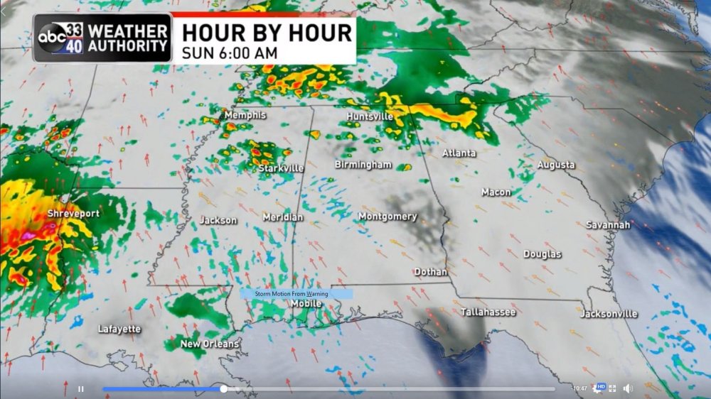
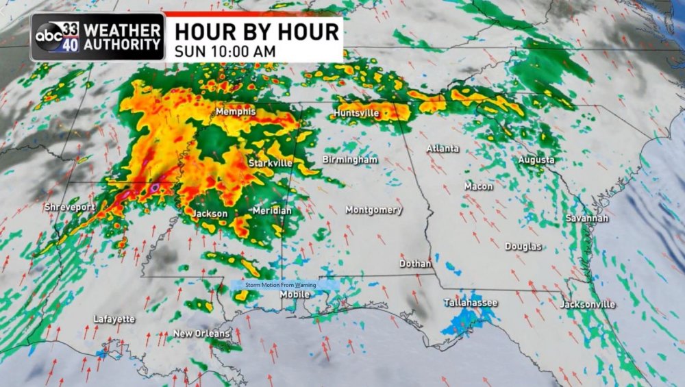
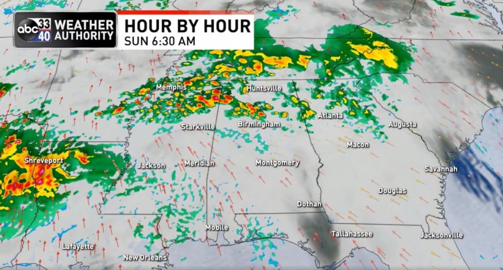
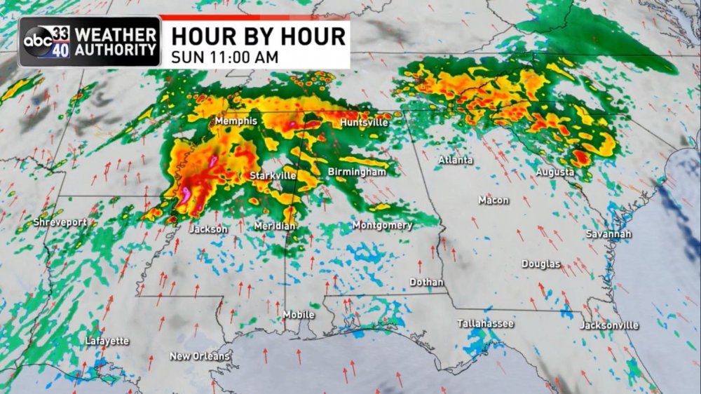
HRRR trends for tomorrow morning
-
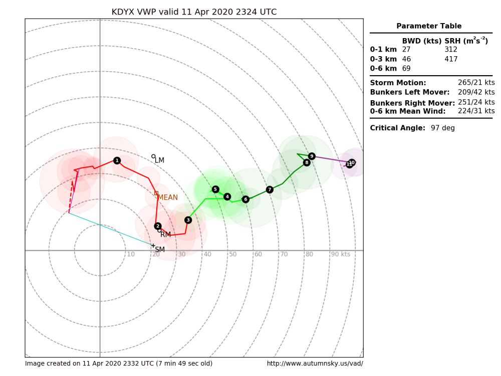
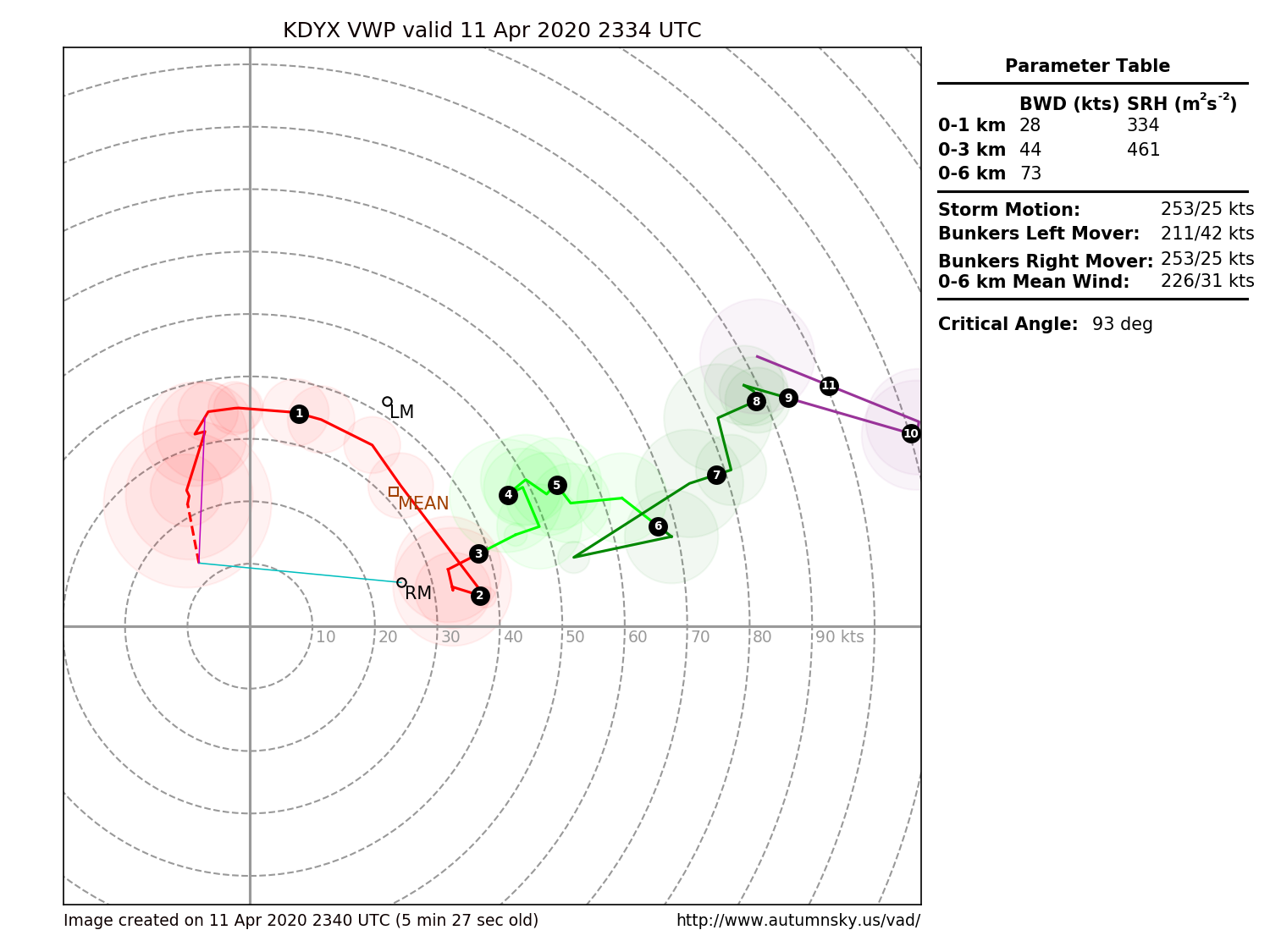
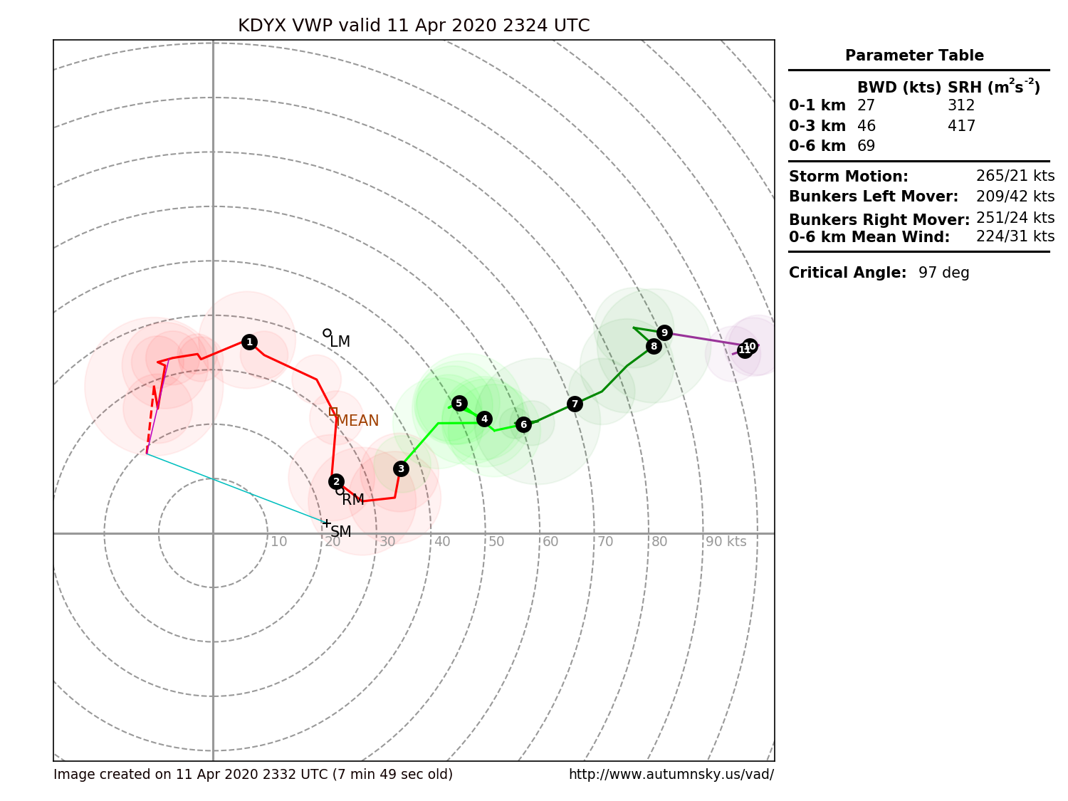
Latest VAD/Hodo with Breckenridge obs

-
43 minutes ago, 1900hurricane said:
Here's a Twitter post that maybe gives us a glance into the current thoughts of SPC forecasters.
See latest post
-
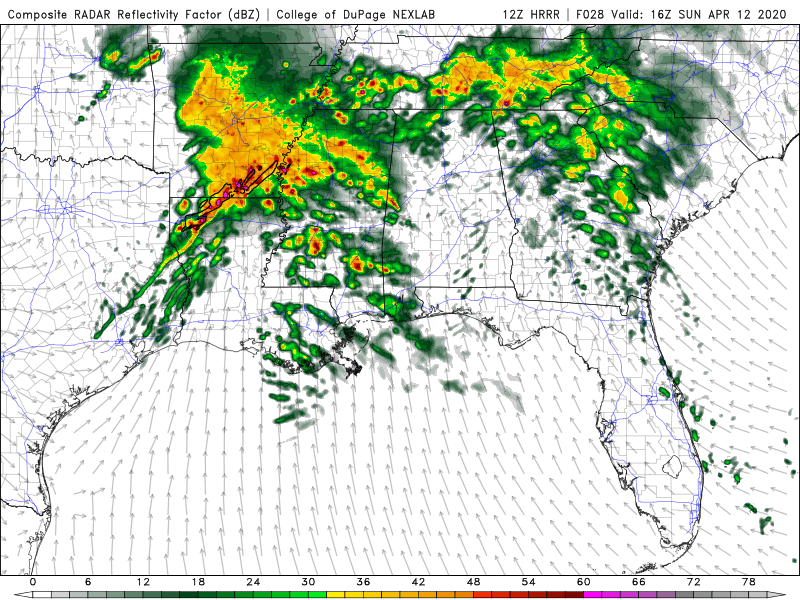
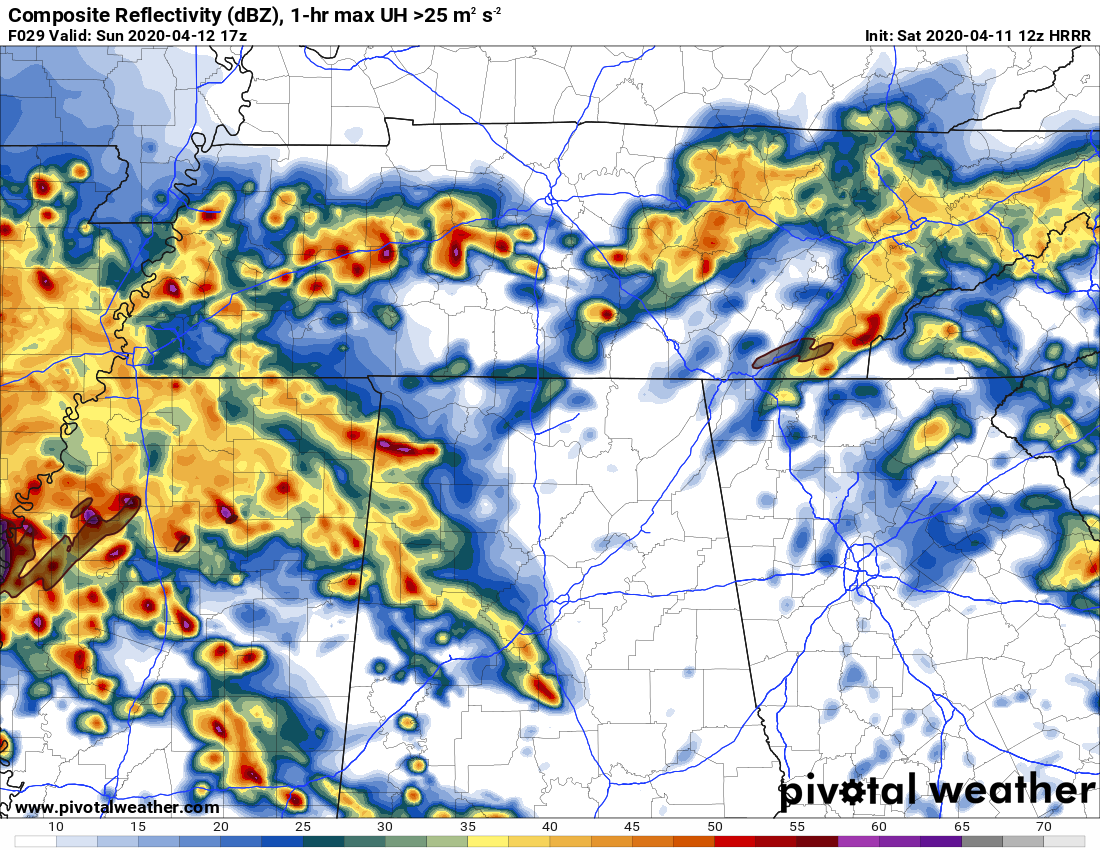
12z HRRR continued


-
1
-
-
Problem solved lol


-
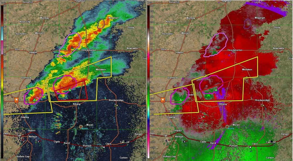
Conditions are getting much better near Dyess
-
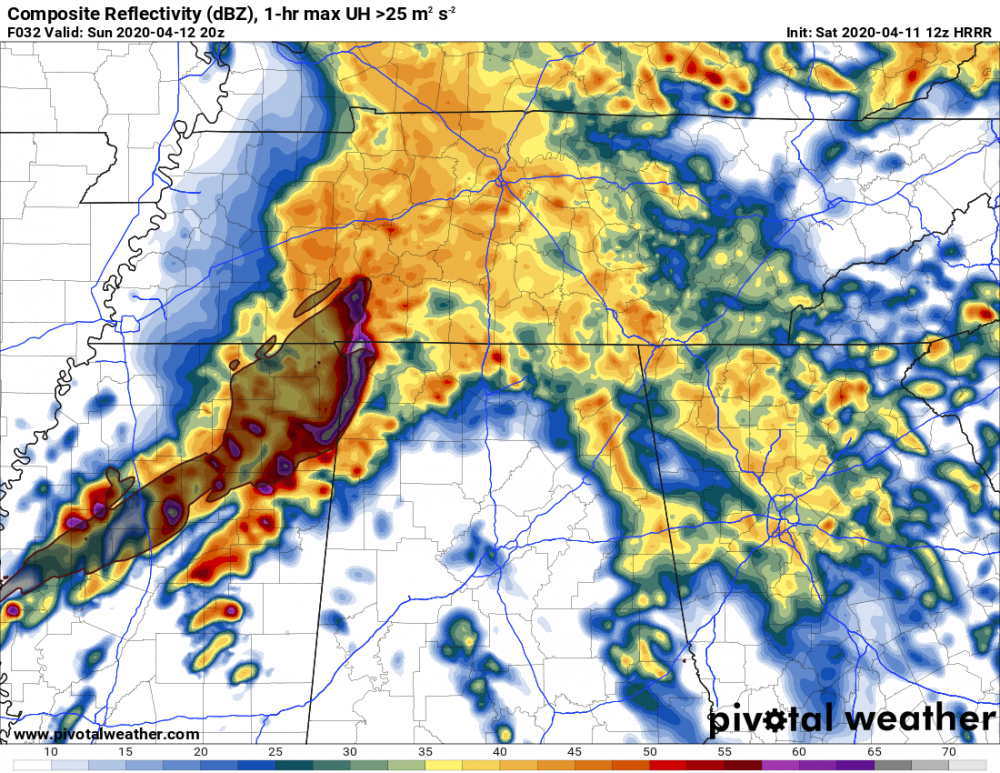
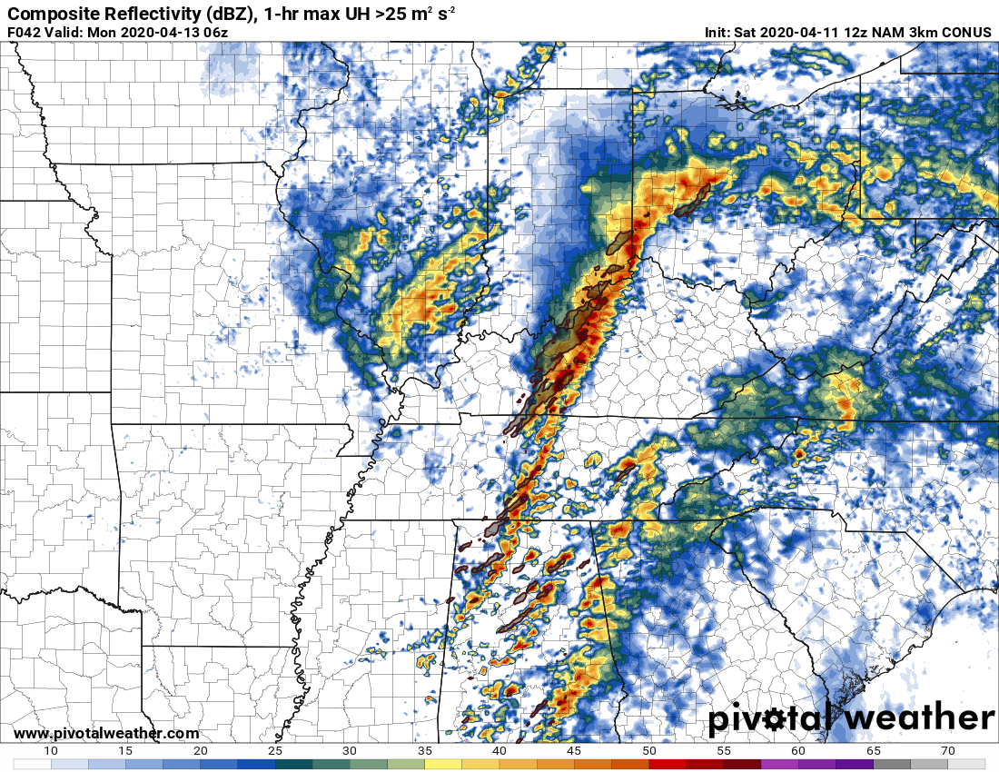
Interesting NAM3k solution overnight in Alabama
-
 1
1
-
-
Evolution of the Baron 3km WRF solution as presented by James Spann this morning -->

-
1
-
-
Just now, jjwxman said:
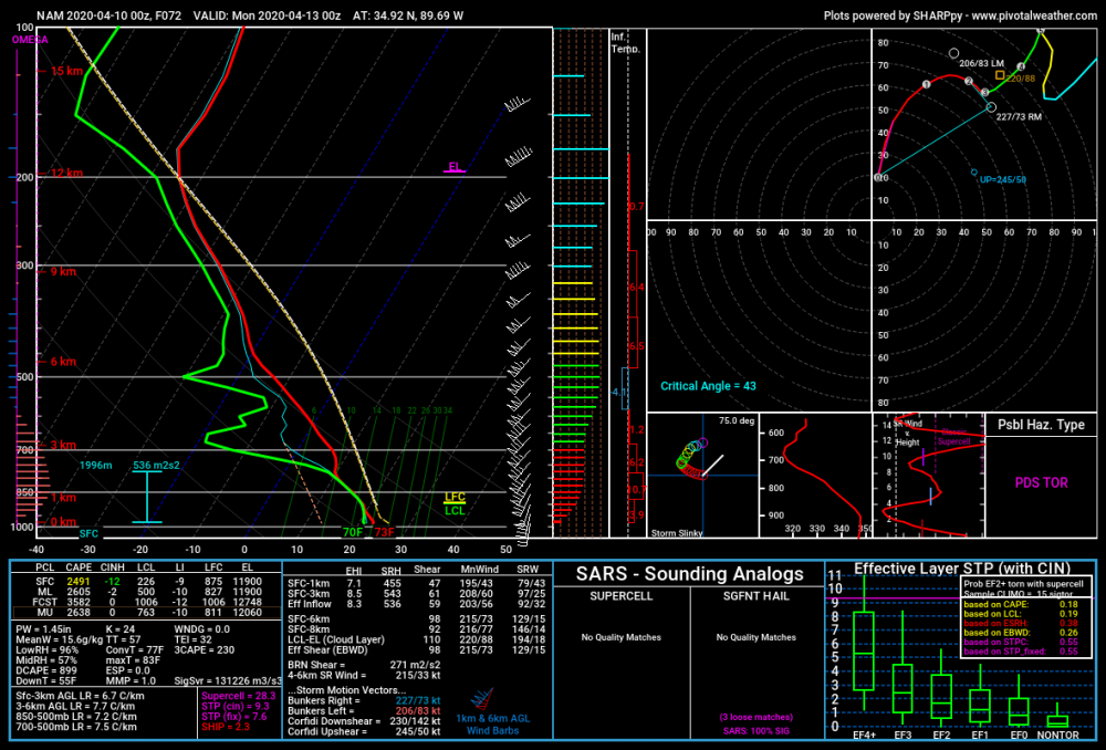
I believe the algorithms used to determine the STP are different among different model websites. Pivotal weather in my opinion has a more realistic outcome with STP in the 5-7 range (which is still really significant) across MS/AL/S TN. Other pages such as COD Meteorology and WeatherBell have the STP in the 12-15 range which is just off the charts, but maybe a bit misleading as well?
PW will show different STP numbers (usually conservative compared to NSHARP), whereas COD is the exact opposite. I believe COD uses a different STP equation than NSHARP/SPC
-
1
-
-
Just now, jpeters3 said:
I think we found the ceiling XD
-
 1
1
-
-
-
-
-
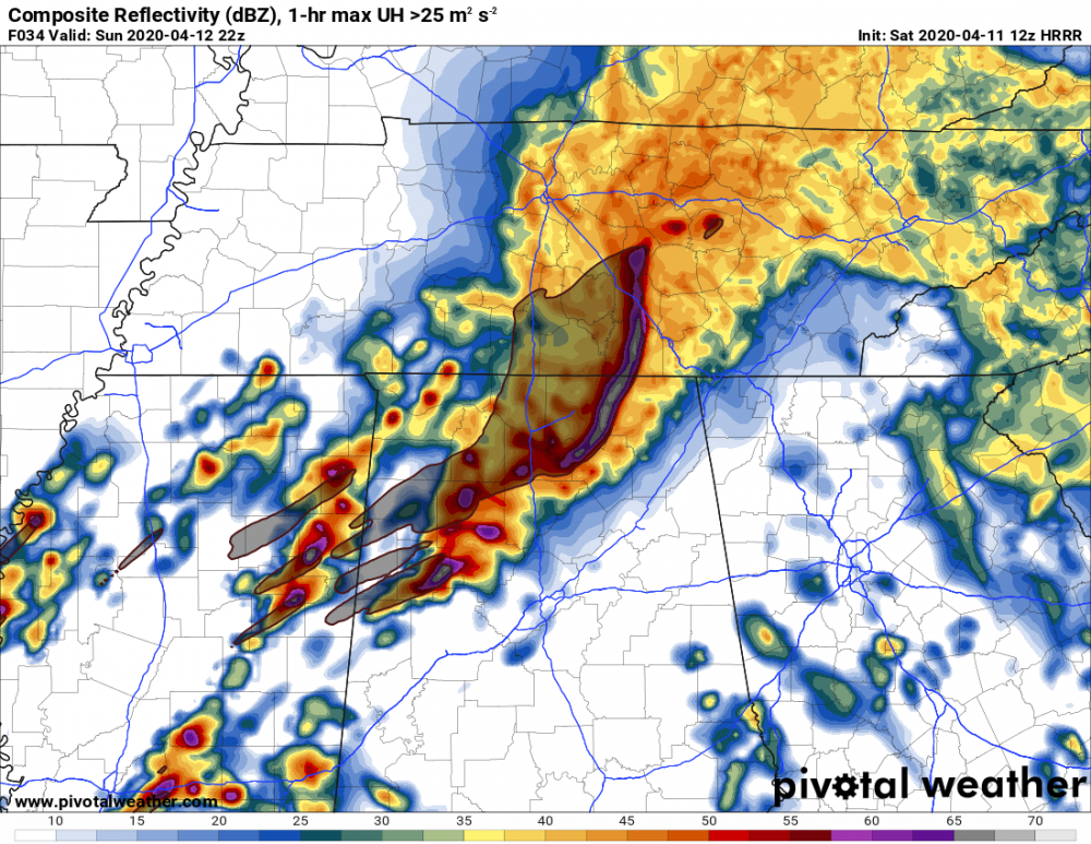
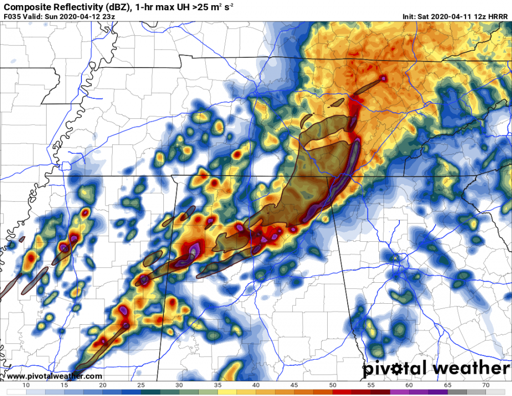
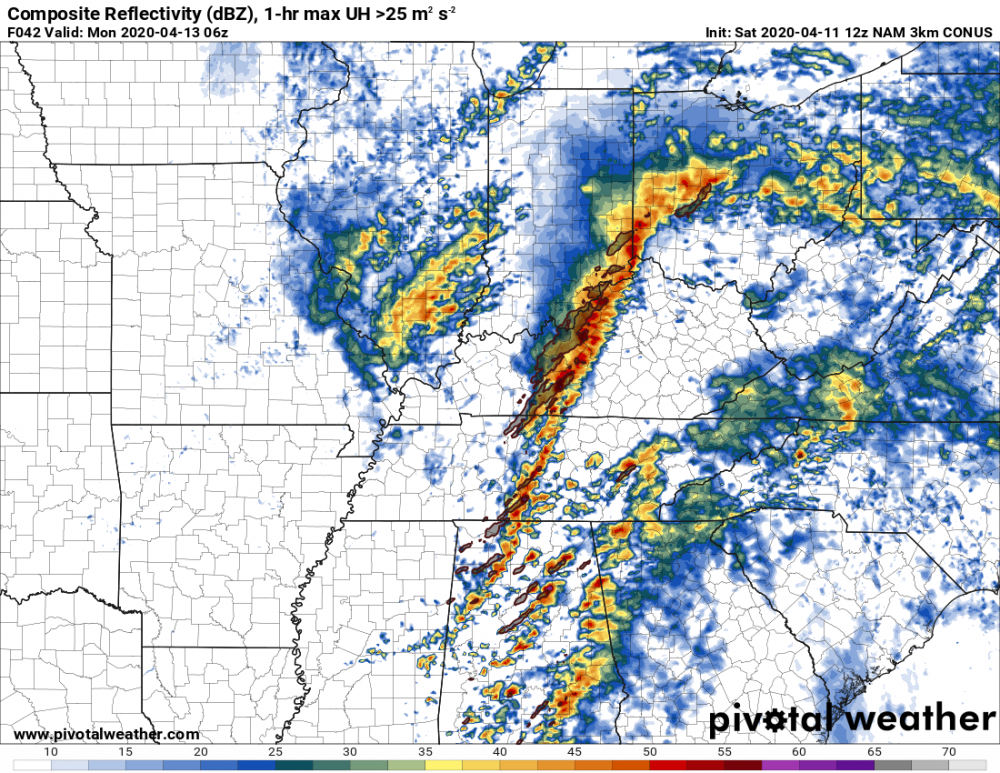
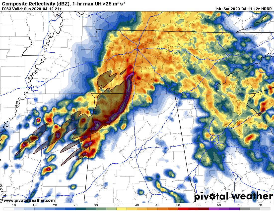
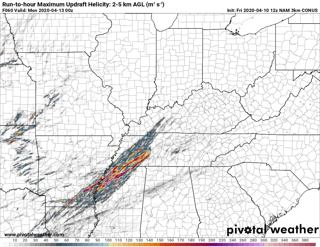
Big-time UH swaths coming off the NAMNEST

-
1
-
-
Notice the 73 knot storm motion for right movers; northern MS sounding here, maybe 70 miles west north west of Tupelo
-
1
-
-
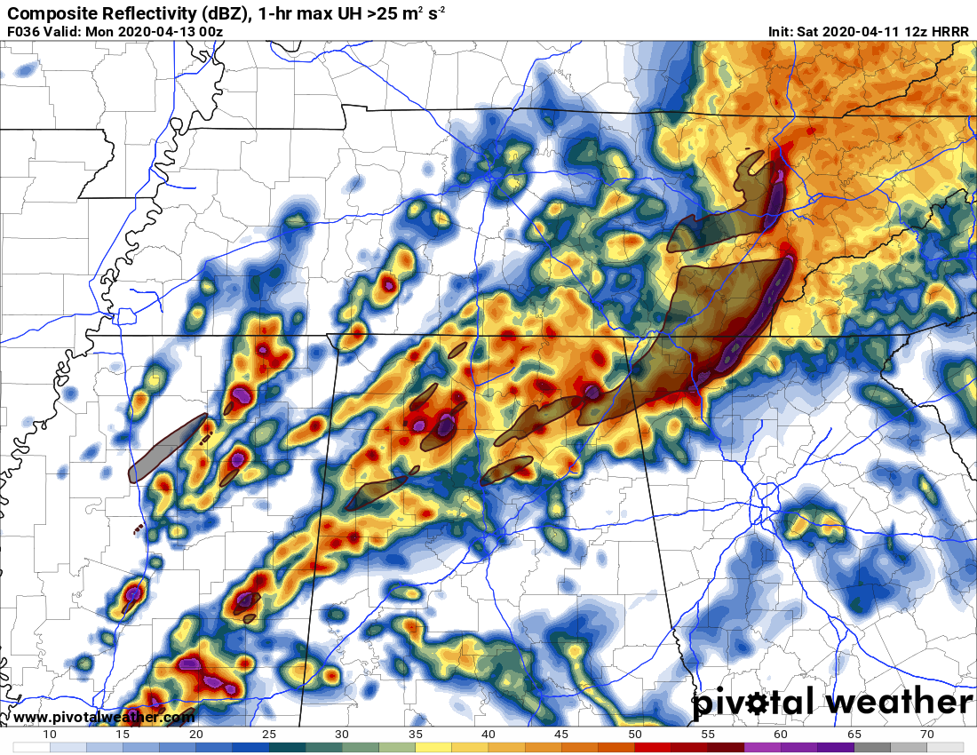
Tennessee is very much in the mix now. NAM gets more and more dangerous per run.
-
16 minutes ago, DanLarsen34 said:
Exactly. The language in the outlook can adequately convey the level of the potential threat that far out without having to issue a high risk. Moderates are rare enough as it is for Day 3.
^This. You can tell it's pretty clear from the SPC Convective Outlook that at least one upgrade is coming. Rare to see "Outbreak" mentioned in a D4, let alone a headline with 3 more subsequent uses. While it's ENH for now, it's worded like a high-end moderate risk.
-
1
-
-
13 minutes ago, Bob's Burgers said:
Yep. You'd have to add about 1,200 j/kg ML cape to get to april 27 levels. Shear is there though. Modeled afternoon temps in the low 80's is very concerning though, especially the UKmet.
12z Euro now on board with 80+ temps across LA, MS. Very bad scenario unfolding here.
-
17 minutes ago, DanLarsen34 said:
One thing that jumps out to me in the model runs right now is that instability, though sufficient for an outbreak of tornadoes, isn’t off the charts. That’s one distinct difference from the 4-27 comparison that was tossed out there.
The speed and directional shear, however, is highly concerning. Will be interesting to see how things play out over the next couple of model runs.
Yep. You'd have to add about 1,200 j/kg ML cape to get to april 27 levels. Shear is there though. Modeled afternoon temps in the low 80's is very concerning though, especially the UKmet.
-
Posted this in the SE thread, but if this forecast holds, high risk would seem probable if not expected.

-
12z NAM would suggest a High Risk is coming
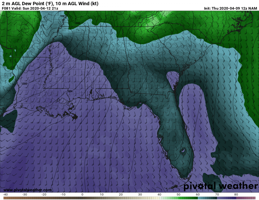


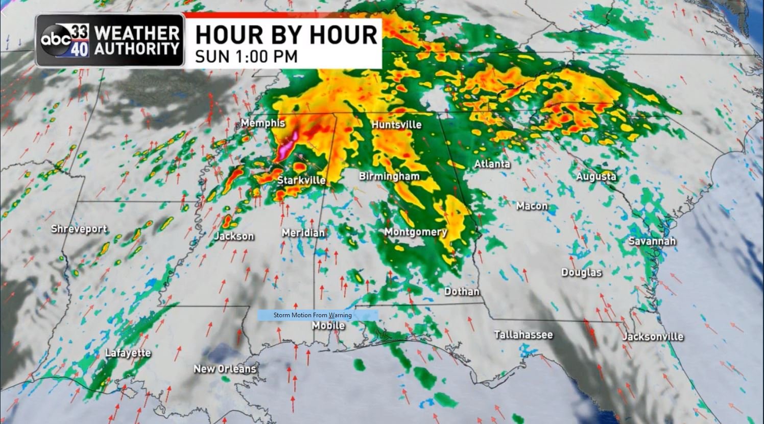
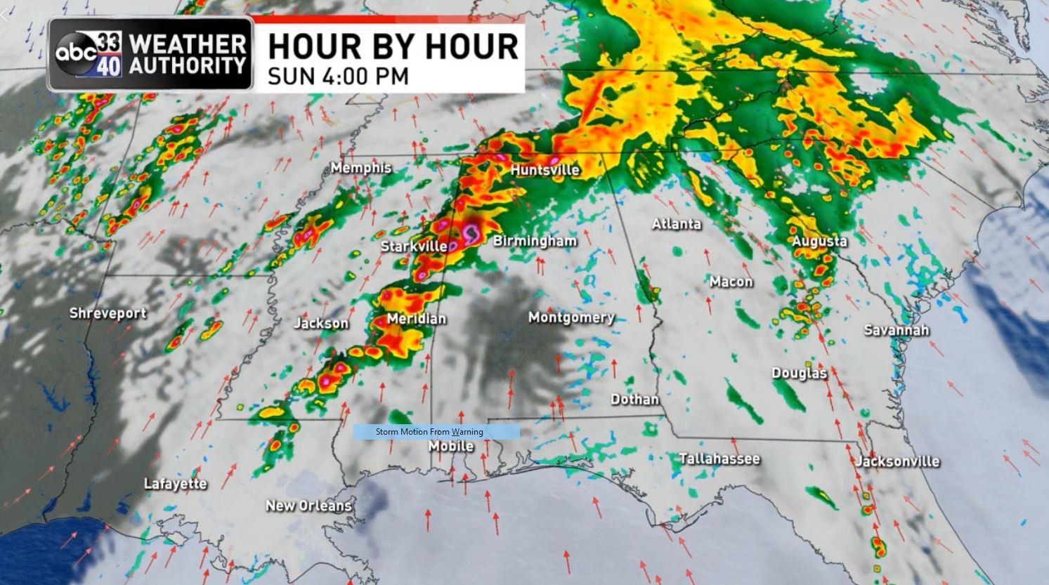
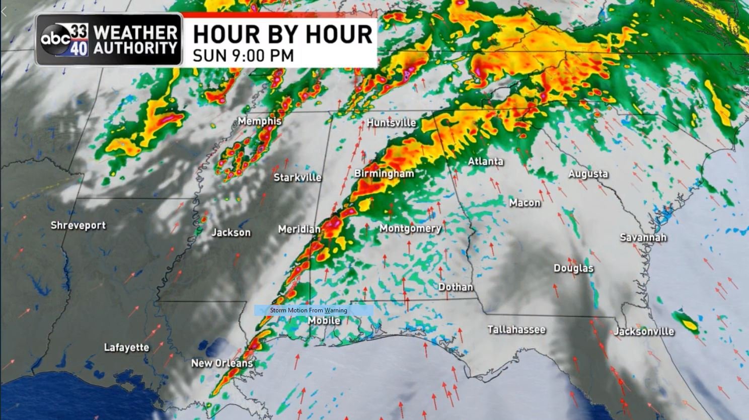


April 12 Severe Event
in Southeastern States
Posted
here's what i mean