

Bob's Burgers
-
Posts
510 -
Joined
-
Last visited
Content Type
Profiles
Blogs
Forums
American Weather
Media Demo
Store
Gallery
Posts posted by Bob's Burgers
-
-
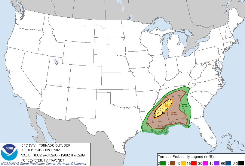
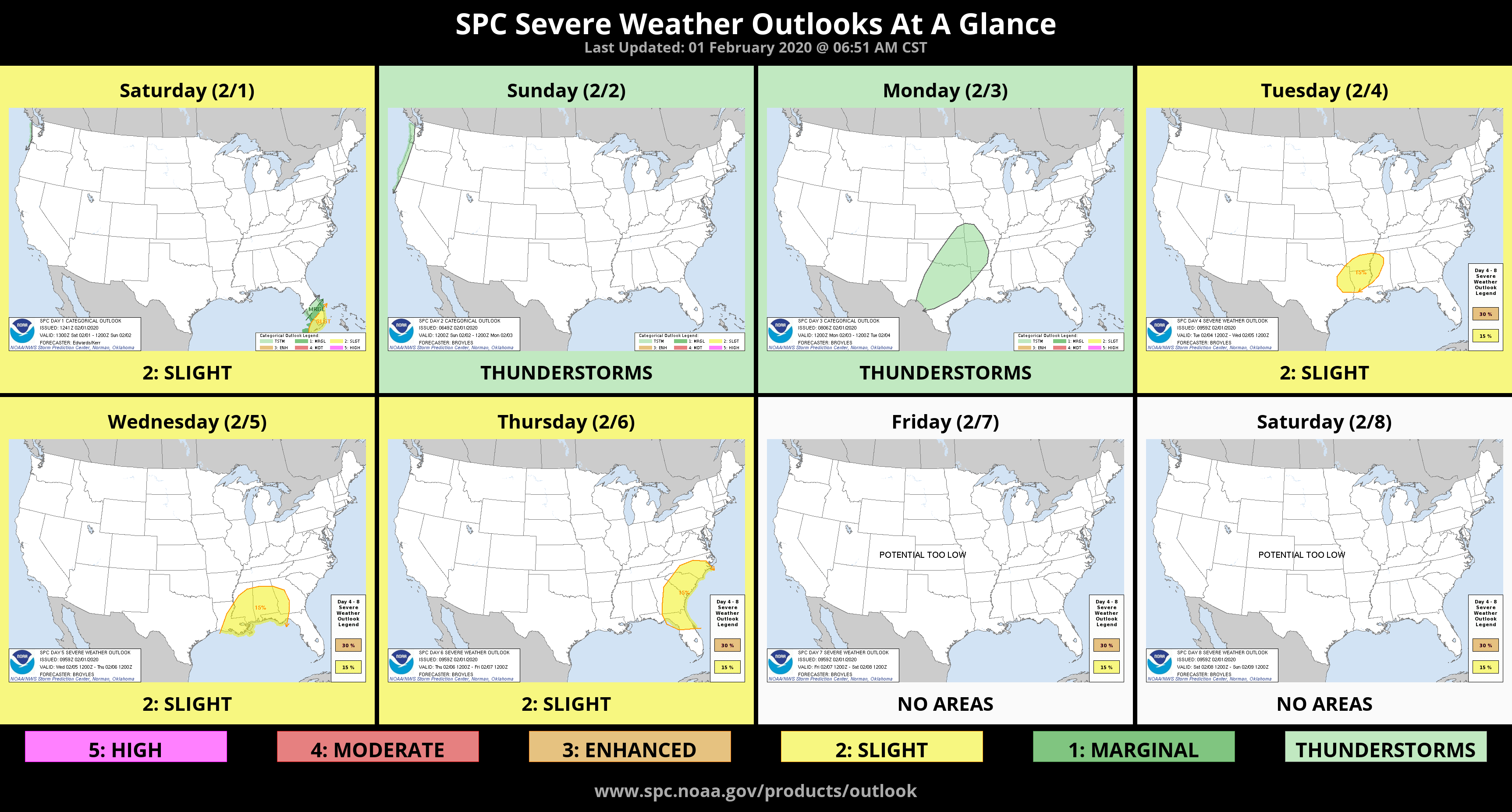
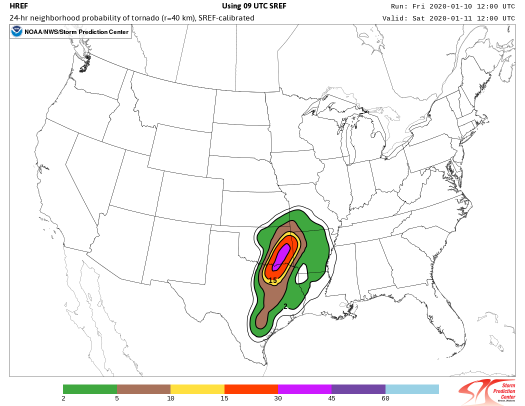
Significant tornado risk added to D1
-
.png.6bab822d06109b4aba29b32f9c2dfec6.png)
Day 2 update/expansion with wording hinting at an upgrade if trends continue.
-
Slight Risk has been re-introduced for Day 2 in MS
-
1450 tornadoes
first high risk: March 25th
-
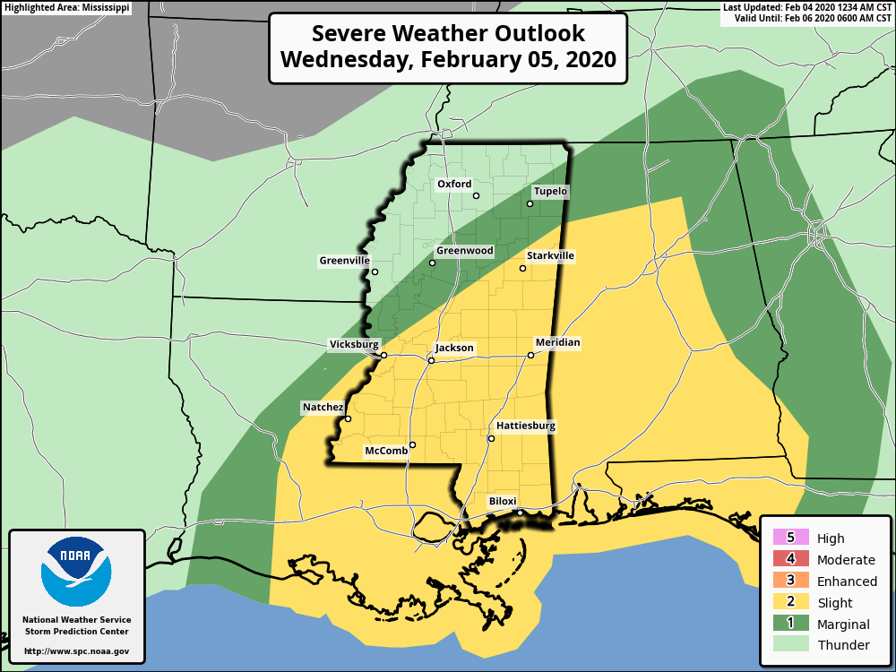
Not much different for today's outlook; some of the risk areas got larger but the general idea remains unchanged.
-
-
He's still showing some odd stuff that's for sure.
-
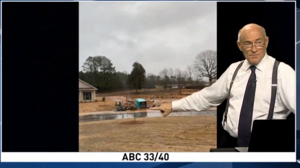
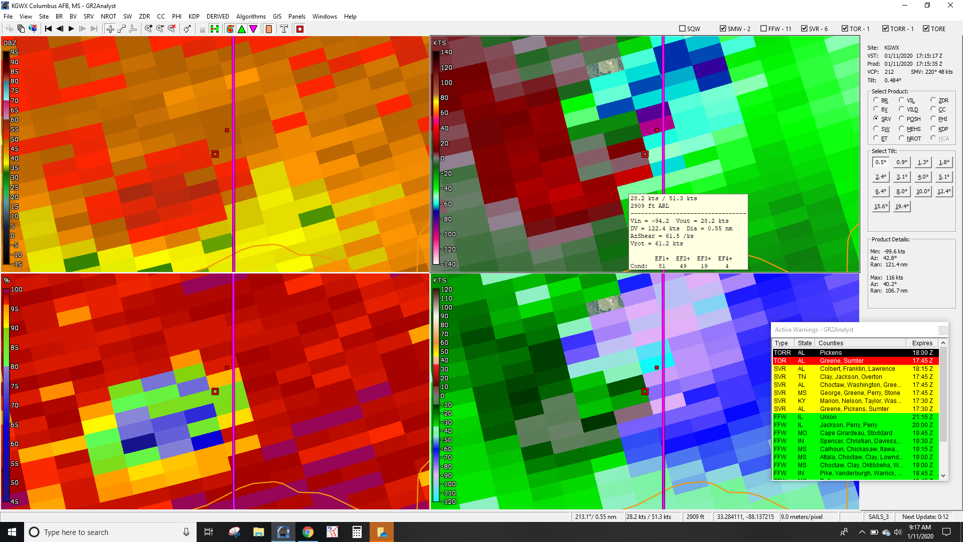
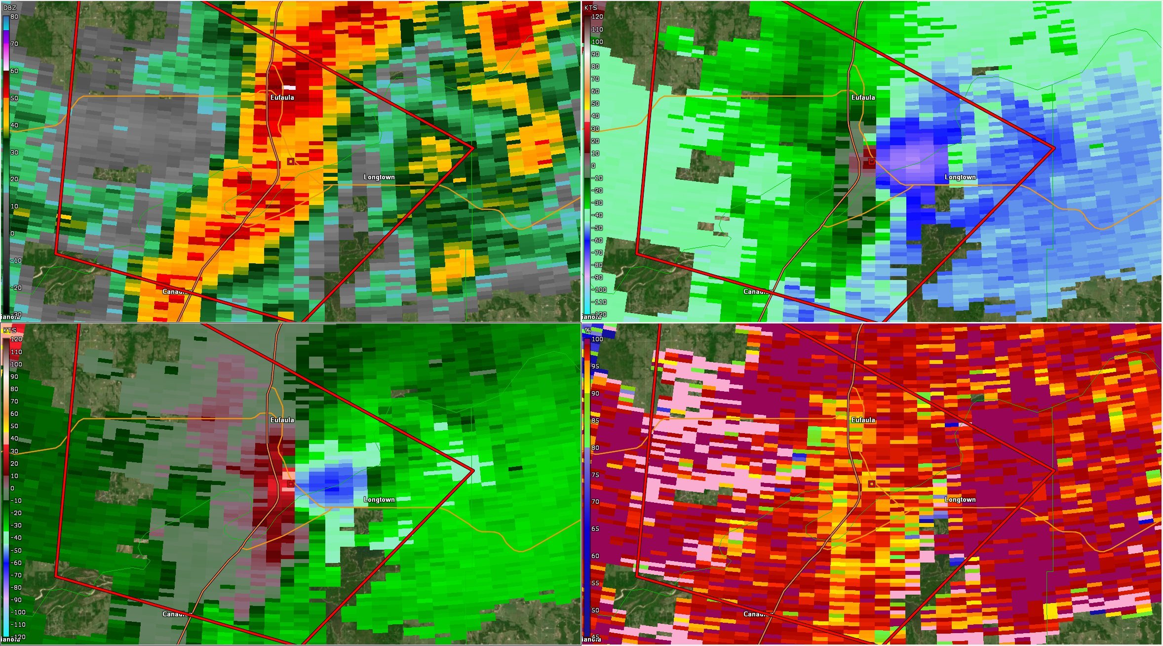
Lots of damage in B'ham area
-
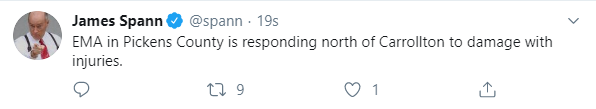
At least 3 are now confirmed dead near Carrollton from the tornado earlier.
-
-
-
4 minutes ago, Chinook said:
Radar-confirmed tornado at Carrollton/Reform Alabama (probably what's in the last post?)
Yeah that's what I was referring to. Looks like there is a small area of buildings right off the highway where it touched down (plus copious trees), so there should be quite a few damage indicators.
-
-
2 minutes ago, cheese007 said:
Can you explain that in layman's terms?
EDIT: Another tor warning on the squall line just north of the previous one, this time near Granbury, TX
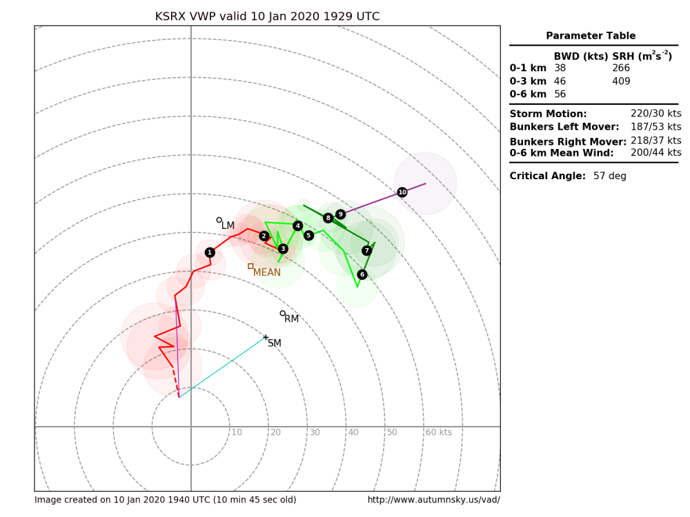
Basically there is a layer in the atmosphere where the winds are turning counterclockwise with height instead of clockwise with height which can screw up storm mode and meso cyclone maintenance (if it's really robust like that example).
-
 2
2
-
-
 might explain why these storms are failing
-
Tornado threat going up in texas; deep free sector convection is getting anchored with previous WAA elevation convection becoming surface-based.
-
 There it is. Could be our first SigTor of the day
-
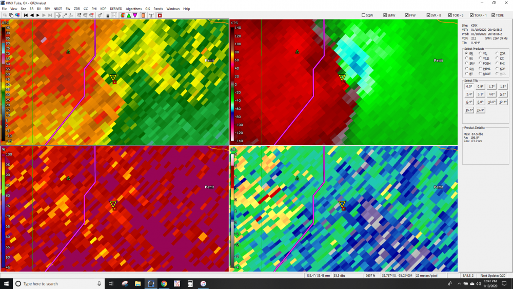
Probably not too far off from a significant tornado event in NE Oklahoma
-
Pretty impressive available streamwise vorticity ingested by this storm using local sfc obs, fort smith radar, and nws calculated storm motion
-

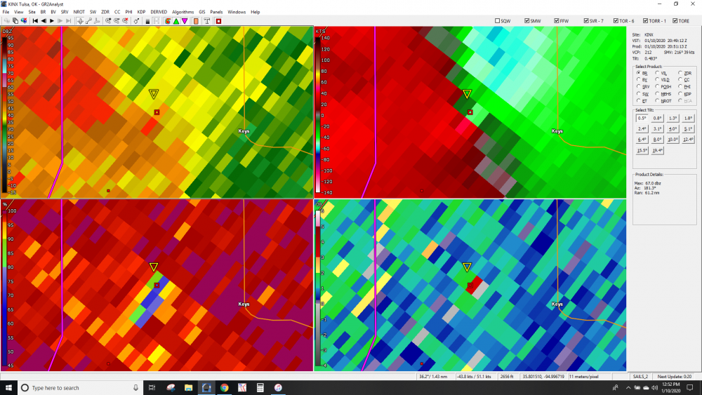
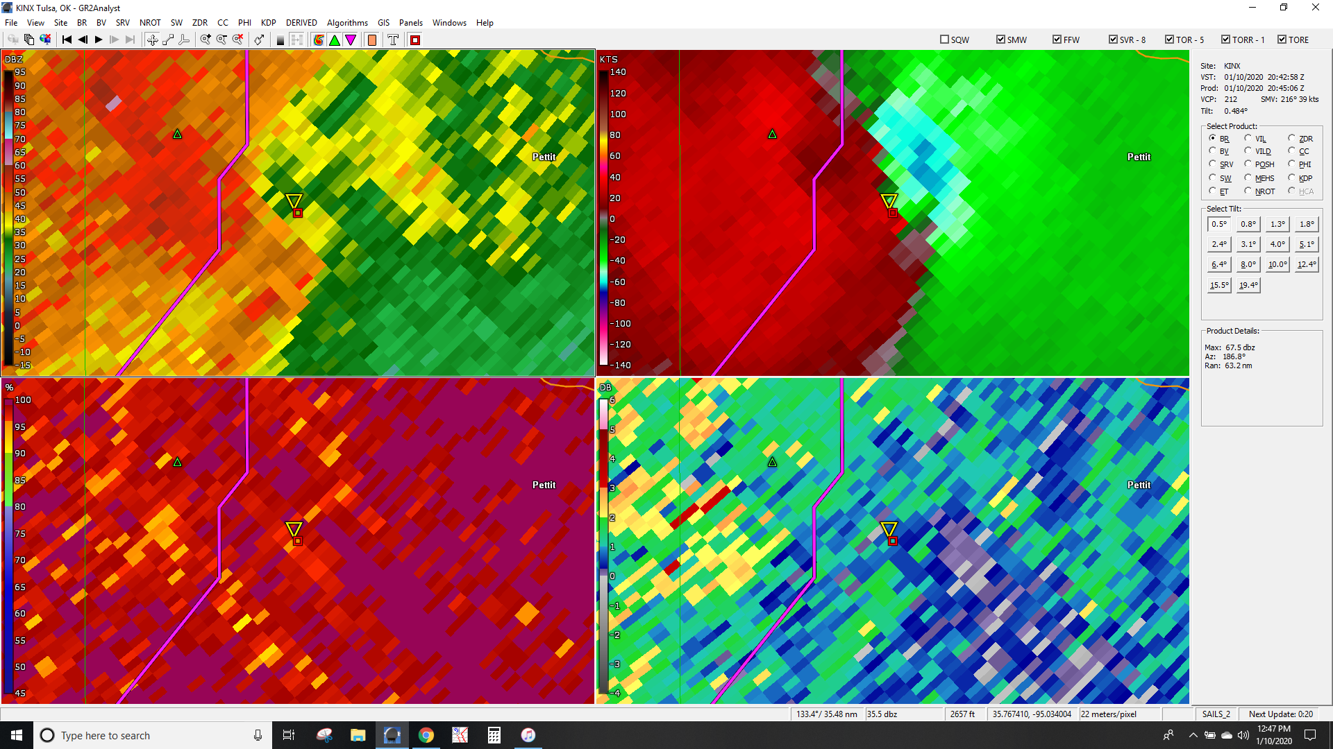
First real couplet of the day
-
-
Just now, weatherwiz said:
If we see an upgrade to high risk b/c of tornado probs this is the area I'm thinking. Latest guidance really hammering in on this area

You could probably extend that further into AR if you believe that latest HRRR trends. The Super Tuesday analogue seems less comical now than it did a few days ago
-
-
48 minutes ago, weatherwiz said:
12z sounding out of DFW...yikes

What month is it again?
-
 2
2
-


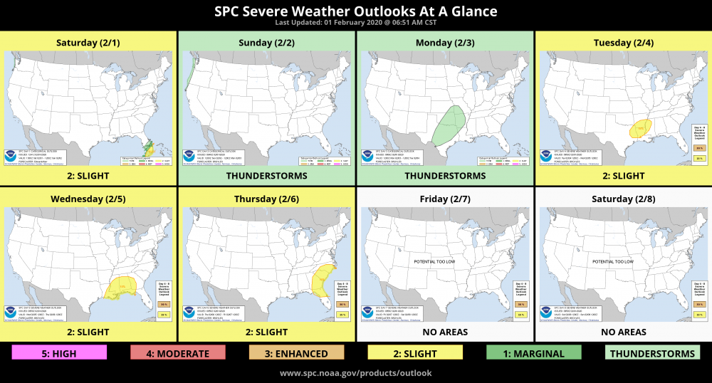
Day 4 Enhanced Risk -- Deep South
in Central/Western States
Posted
Pretty large Enhanced Risk area this far out. Threat includes damaging squall line and supercells capable of all hazards --
   ...DISCUSSION...
   ...Wednesday (day 4)--central Gulf Coast into the Mid-South...
   A mid-level shortwave trough is forecast to move from the Northeast
   into the Canadian maritimes prior to Wednesday with a mid-level
   ridge remaining over FL/Bahamas.  As a result, a CP airmass will not
   likely not infringe on the central Gulf Coast prior to Wednesday.
   There is increased agreement in model guidance for the evolution of
   a well-defined mid-level shortwave trough forecast to eject
   northeast from the southern Great Plains into the OH Valley on
   Wednesday into Wednesday night.  Models are in good agreement
   showing a previously stalled front advancing north across the Deep
   South, concurrent with a surface low developing/deepening as it
   moves northeastward from the northwest Gulf Coast and into TN/KY by
   early evening.  Strong to very strong flow fields overspreading a
   destabilizing warm sector (featuring low-mid 60s F dewpoints as far
   north as parts of northern MS/AL) will support the potential for
   organized severe thunderstorms.  In addition to a severe squall
   line, a supercell risk capable of all hazards is currently forecast.

   By Thursday (day 5), the ejecting disturbance will likely become
   increasingly displaced from a moist/unstable sector across the
   Southeast.  However, uncertainty is too high to include a potential
   severe area due to thunderstorm evolution/magnitude of
   destabilization and predictability of larger-scale features.  It
   appears severe potential will be minimal by Friday-Sunday (days 6-8)
   as the overall pattern becomes less supportive for thunderstorms
   over the Lower 48.

   ..Smith.. 02/09/2020