

Bob's Burgers
-
Posts
510 -
Joined
-
Last visited
Content Type
Profiles
Blogs
Forums
American Weather
Media Demo
Store
Gallery
Posts posted by Bob's Burgers
-
-
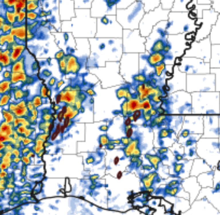
Reflects the aggressiveness of recent CAMS. You also see a subtle depiction of a 2ndary 15% contour in LA likely representing the chance of warm sector discrete convection.
.thumb.png.91b205670f94274e435a032471574e31.png)
-
NSSL WRF is very aggressive with open warm sector development in two areas:
1. SE Oklahoma
2. Nighttime supercells in the arklatex area, shreveport
-
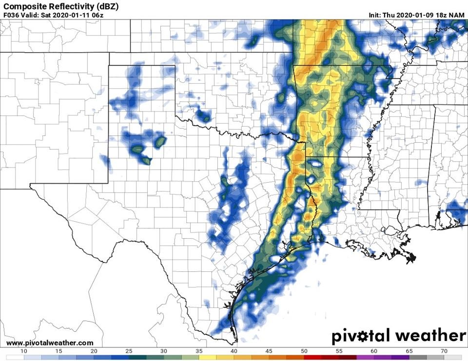
More interesting observations is the latest NAM3k --> Successfully launches discrete cells in the open warm sector with UH (rooted, possibly tornadic cells) in LA. Several models have been indicating this could happen but this is the best evidence of it happening undisturbed.
-
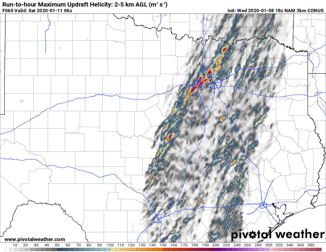
I had to zoom out to the National Level on Pivotal Weather to capture the HRRR total UH swaths.
-
3 minutes ago, MUWX said:
Any chance this goes high risk?
I would be surprised if they did it at 0600 UTC, but I would imagine a considerable expansion of the MOD would be appropriate.
-
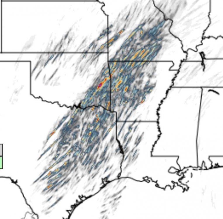
Latest HRRR is trying to form cells well into the warm sector near shreveport around 00z Saturday. We'll see how that forecast evolves.
-
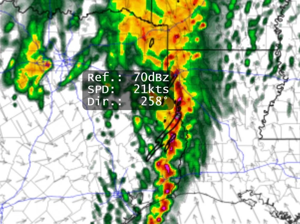
Similar evolution appears to be taking place on the 18z HRRR with simulated hail cores up to 70 dbz with significant UH -- further indicative of a mode transition. Only one set of runs though; 00 UTC CAMs will be telling.
-
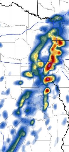
You can kinda see what the SPC was talking about re/ the reverse evolution of the convective mode on the latest NAM.
-
20 minutes ago, nrgjeff said:
I expect supercells in Texas Friday evening. If things go early enough, maybe late afternoon. Trying to find positives for storm chasers that way, haha.
LLJ indeed will increase with time, and do so quickly and substantially. SPC rightly talks about the line possibly breaking up into supercells. We normally discuss the more common opposite, sups congeal to line. However with a rapidly strengthening and backing LLJ lines can and do occasionally break up into supercells. It's most common right after the line develops (as opposed to sup line sup). In this case a line may develop; then within 1-2 hours, actually break up into supercells for a couple hours.
In all cases sups eventually go linear (or go back to linear) this weather pattern. You won't see me travelling to chase this. However I know people closer who are watching it.
I remember that phenomena happening on May 1st, 2018. Rather unimpressive squall line evolved into a few discrete cells which eventually dropped a massive EF-3 near Salina, KS.
-
 1
1
-
-
1 minute ago, CheeselandSkies said:
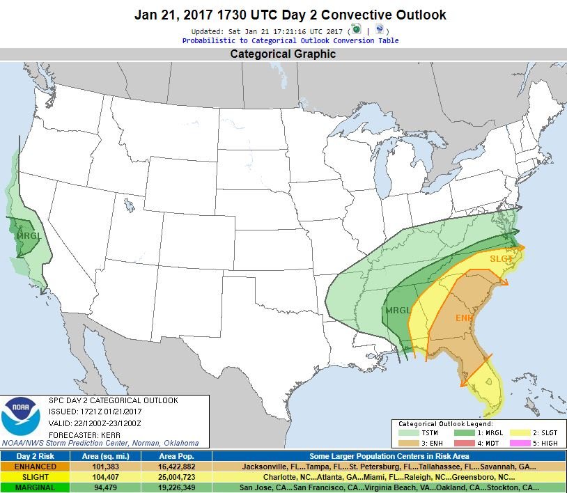
Wouldn't they have done it for the January day in 2017 that became a high risk on Day 1?
I looked it up and the Moderate was a Day 1 0600 UTC upgrade. Here is the outlook created on 1730 UTC Jan 21
-
1
-
-
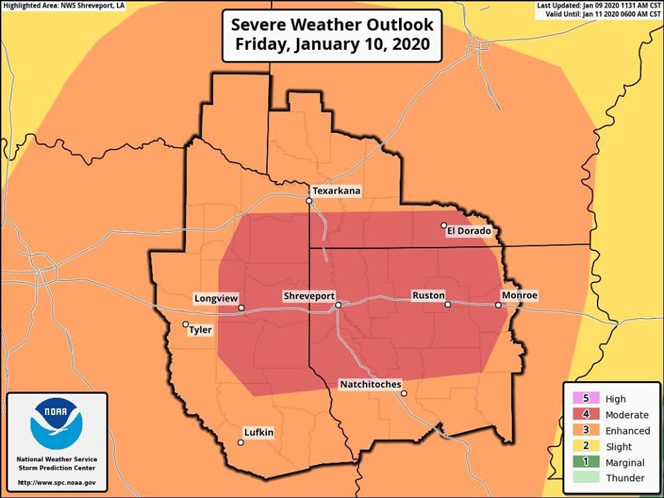
Current Moderate Risk area is confined to Shreveport's CWA
-
1 minute ago, JasonOH said:
45% Sig Wind driven Moderate for tomorrow.
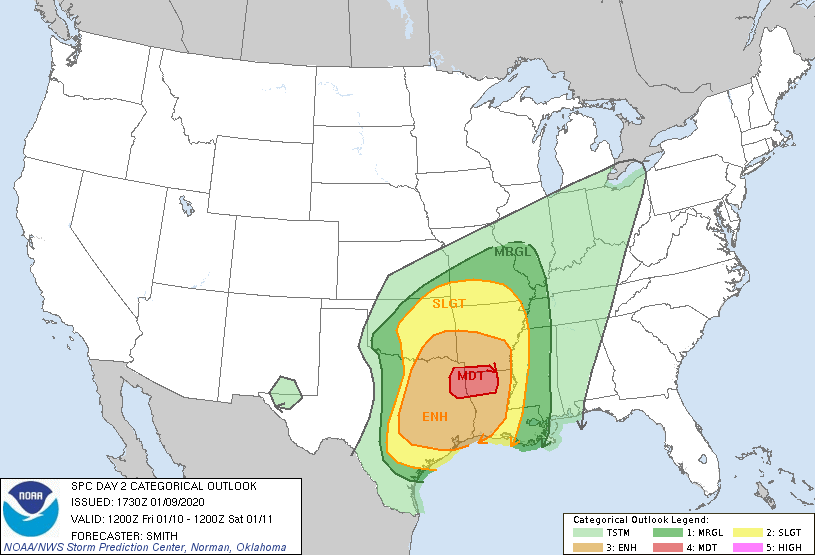
Day 2 Severe Weather Outlook is only the fourth (4) time SPC has issued a Day 2 Moderate Risk in January, & first since 2013.
From Patrick Marsh ^
-
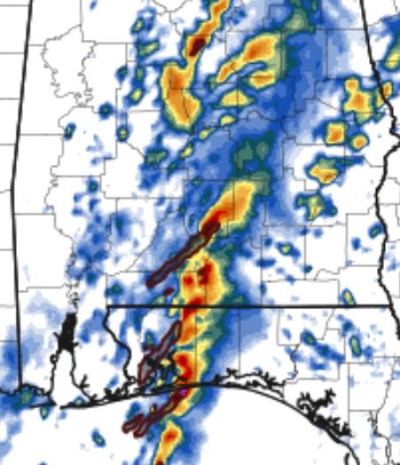
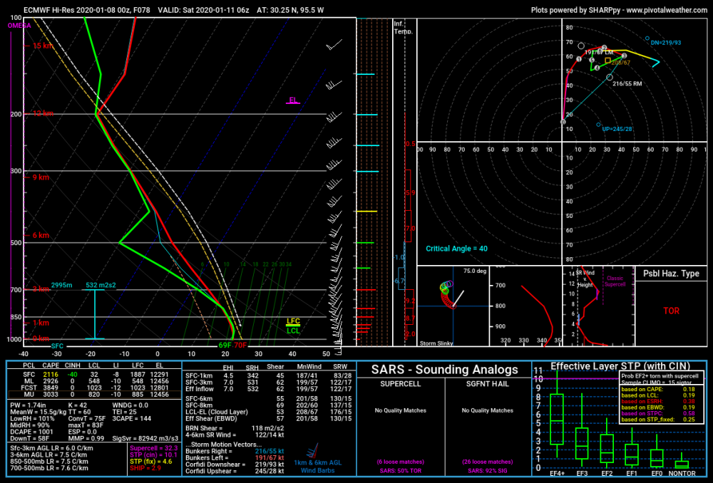
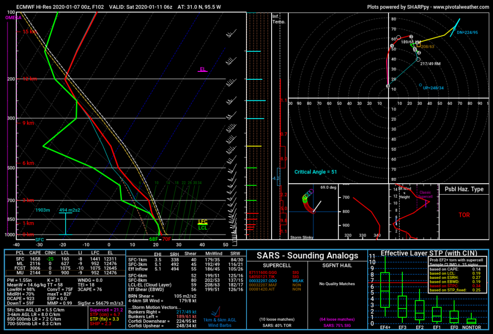
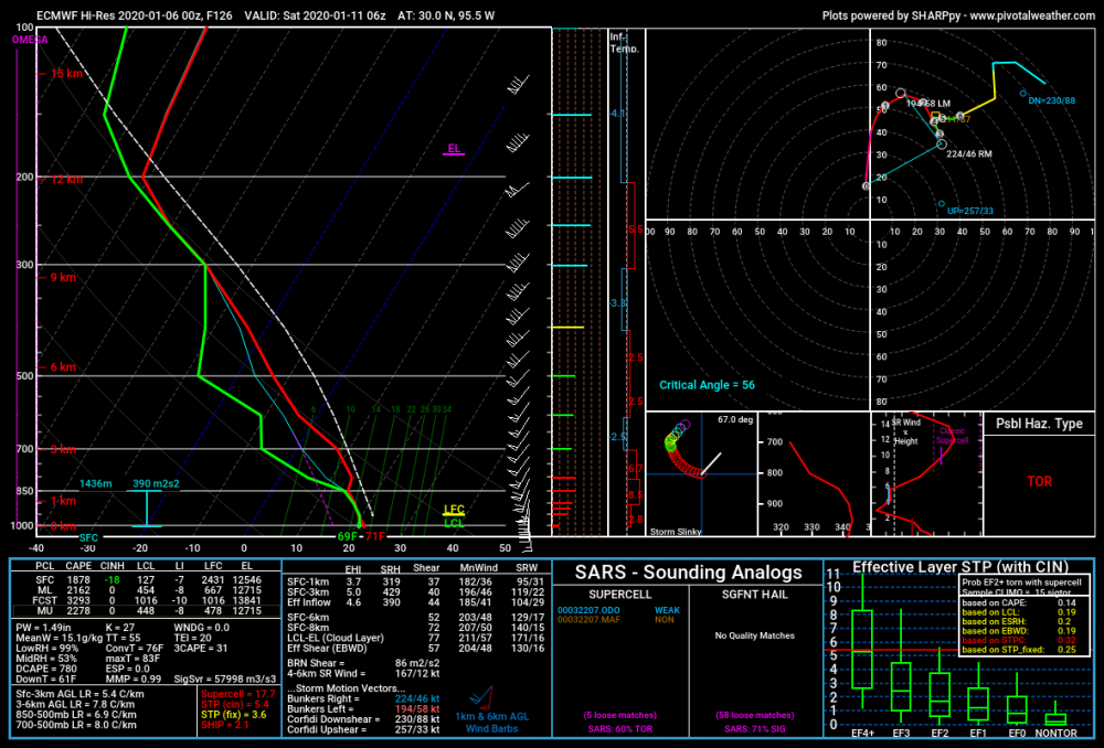
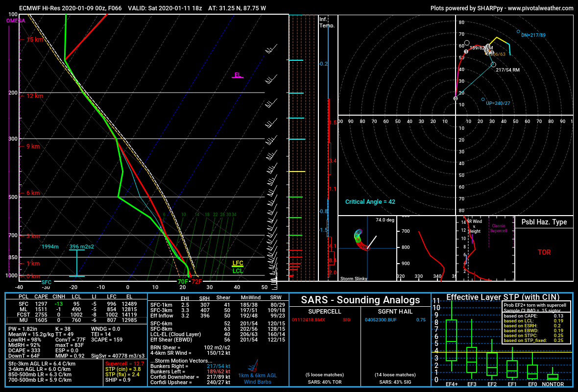
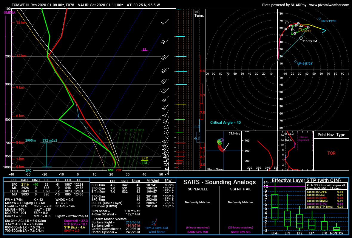
Still thinking southern Alabama is most at risk for a strong tornado on Saturday. 3km CAPE is very high (near 200 j/kg) in some areas.
-
The Mobile Alabama area is really catching my attention right now. Good shear/ML cape combination around 18z Saturday (ECM) with large 3 KM cape. Critical angles are modest in the 40-50 degree range which would be a limiting factor.

-
It would seem that LIX, LCH, and SHV are expecting upgrades to moderate
-
Lots of strongly worded AFD's this afternoon. Lake Charles just had a strongly worded live stream.
-
NAM and NAM nest slowed down some to match the Euro and Canadian better. Looks like a mixed mode of QLCS/Embedded sups/ and possibly a discrete mode as well.

-
Area Forecast Discussion
National Weather Service Birmingham AL
607 AM CST Wed Jan 8 2020
Friday will mark the beginning of an extended period of unsettled
weather as a trough strengthens and becomes increasingly dynamic
over Texas and New Mexico. Strengthening southerly flow will lead
to isentropic lift as a warm sector begins to advance northward.
Widespread showers with isolated embedded elevated thunderstorms
are expected across much of the forecast area on Friday.

As the upper-level trough transitions from a neutral to negative
tilt Friday night, rapid pressure falls are expected near the
Mississippi River at 6 AM Saturday. An extremely strong low-level
jet is anticipated in advance of a well-organized QLCS, with mid
to upper 60s dewpoints overspreading the forecast area by noon
Saturday. As it stands, a significant severe weather event appears
likely beginning as early as 9 AM in our western counties. SBCAPE
is currently modeled at 500-1000 J/kg by most model guidance, but
my hunch is that these values may be a little on the low side due
to the effects of erroneous-looking QPF as noted in the ECMWF
data. Even taking CAPE a face value, strong forcing combined with
extreme low-level winds and wind shear would result in a QLCS
capable of producing widespread damaging winds and embedded
tornadoes. The ECMWF shows a wide swath of 70-80 kt 700mb winds
with pockets up to 100 kts, meaning that a derecho cannot be ruled
out particularly across our northwestern counties. The potential
for supercells ahead of the QLCS will depend on the state of the
warm sector. If the warm sector is relatively uncontaminated and
the current timing holds true, temperatures would rise into the
70-74F range during the late morning and early afternoon hours,
aiding in the formation of cellular convection ahead of the QLCS.
In order for any cellular activity to become tornadic in the
presence of extreme wind shear, robust updrafts will be required.
Otherwise, these updrafts will be torn apart.

This system should exit the area late Saturday afternoon or
Saturday evening, and dry conditions expected on Sunday with the
exception of a slight chance of showers across our southeastern
counties. Here the front is expected to stall and return northward
as a warm front Sunday afternoon into Monday. Showers and embedded
thunderstorms should expand in coverage and move northward to
near I-59 on Monday. These high rain chances will continue into
Tuesday across most of the forecast area.

87/Grantham
-
BMX is thinking derecho/LEWP. Supercells on Saturday are looking less and less likely.
-
Yeah, you never know when those embedded tornadoes get strong. Think El Reno and Rushton, LA from last year -- both killer EF-3's in squall lines at night.
-
The euro is the new hype machine lol
-
STP up in the 4-6 range in a lot of areas in eastern texas from the 00z Euro this evening.
-
Might be battling a cap
-
.png.50297202474e556e0e3271a6b7d648b5.png)


January 10-11 Severe Weather Threat
in Central/Western States
Posted
Moderate risk area expanded, significant tornado area removed