

Bob's Burgers
-
Posts
510 -
Joined
-
Last visited
Content Type
Profiles
Blogs
Forums
American Weather
Media Demo
Store
Gallery
Posts posted by Bob's Burgers
-
-
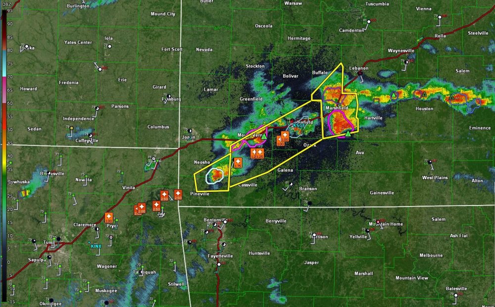
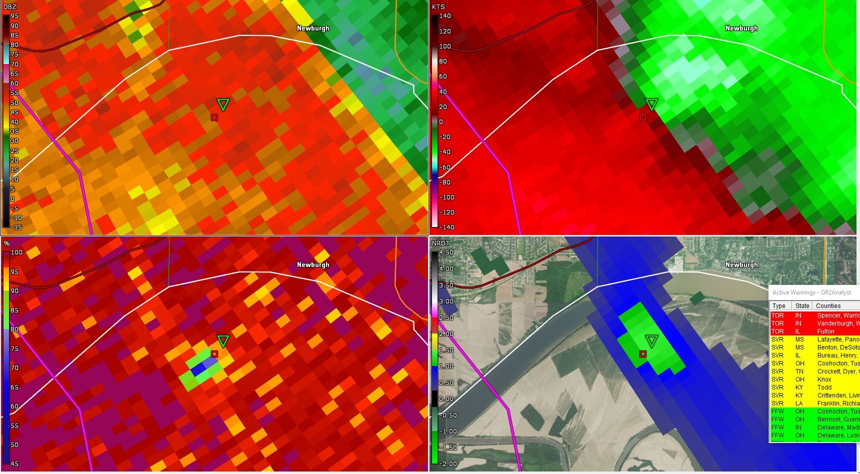
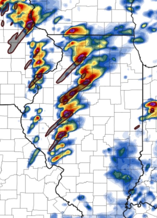
TDS got weaker (went over the river), might pick back up in intensity
-
90 mph wind gust measured near Baskett, KY
-
-
-
-
Worth watching

-
 1
1
-
-
28 minutes ago, Indystorm said:
The hailers mean business this Friday evening.
BULLETIN - EAS ACTIVATION REQUESTED
SEVERE THUNDERSTORM WARNING
NATIONAL WEATHER SERVICE TULSA OK
357 PM CDT FRI MAR 27 2020
THE NATIONAL WEATHER SERVICE IN TULSA HAS ISSUED A
* SEVERE THUNDERSTORM WARNING FOR...
SOUTHEASTERN CRAIG COUNTY IN NORTHEASTERN OKLAHOMA...
NORTHERN DELAWARE COUNTY IN NORTHEASTERN OKLAHOMA...
SOUTHEASTERN OTTAWA COUNTY IN NORTHEASTERN OKLAHOMA...
NORTHEASTERN MAYES COUNTY IN NORTHEASTERN OKLAHOMA...
* UNTIL 430 PM CDT.
* AT 357 PM CDT, A SEVERE THUNDERSTORM WAS LOCATED OVER CHEROKEE
STATE PARK, MOVING NORTHEAST AT 80 MPH.
HAZARD...TENNIS BALL SIZE HAIL.
SOURCE...RADAR INDICATED.
IMPACT...PEOPLE AND ANIMALS OUTDOORS WILL BE INJURED. EXPECT
DAMAGE TO ROOFS, SIDING, WINDOWS, AND VEHICLES.
* LOCATIONS IN OR NEAR THE PATH INCLUDE...
JAY... GROVE...
LANGLEY... BERNICE...
KETCHUM... SPAVINAW...
DISNEY... BIG CABIN...
PENSACOLA... HOOT OWL...
HONEY CREEK STATE PARK... CHEROKEE STATE PARK...
BERNICE STATE PARK... SPAVINAW STATE PARK...
CLEORA... CHLOETA...
STRANG... DISNEY LITTLE BLUE STATE PARK...
ZENA...
THIS INCLUDES INTERSTATE 44 BETWEEN MILE MARKERS 274 AND 276.
PRECAUTIONARY/PREPAREDNESS ACTIONS...
THIS IS A DANGEROUS STORM. PREPARE IMMEDIATELY FOR LARGE DESTRUCTIVE
HAIL CAPABLE OF PRODUCING SIGNIFICANT DAMAGE. PEOPLE OUTSIDE SHOULD
MOVE TO SHELTER INSIDE A STRONG BUILDING, AND STAY AWAY FROM
WINDOWS.
Yep
-
-
Nam Nest has a similar idea, just farther west

-
Posted for documentation purposes.

-
1
-
-
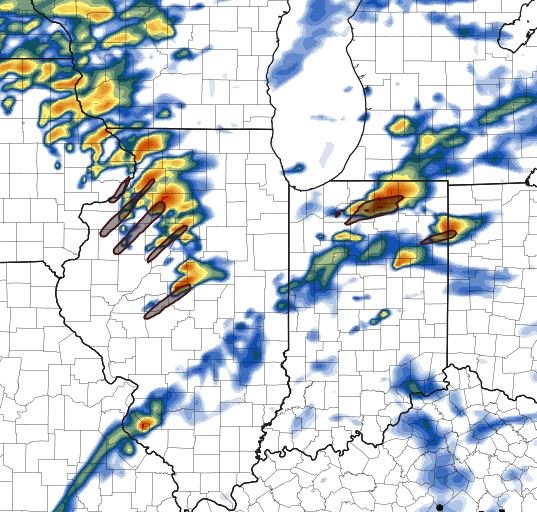
WRF firing up quite a few cells as well
-
 1
1
-
-
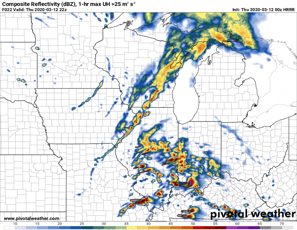
Looks active.
-
2 hours ago, METALSTORM said:
Here is Bree Smith's forecast from WTVF. Not an over alarming forecast but she did emphasize that severe weather was possible and to have a way to get warnings overnight. I consider her one of the better TV mets out there.
That model (probably the RPM?) had trouble with storm mode.
-
1
-
-
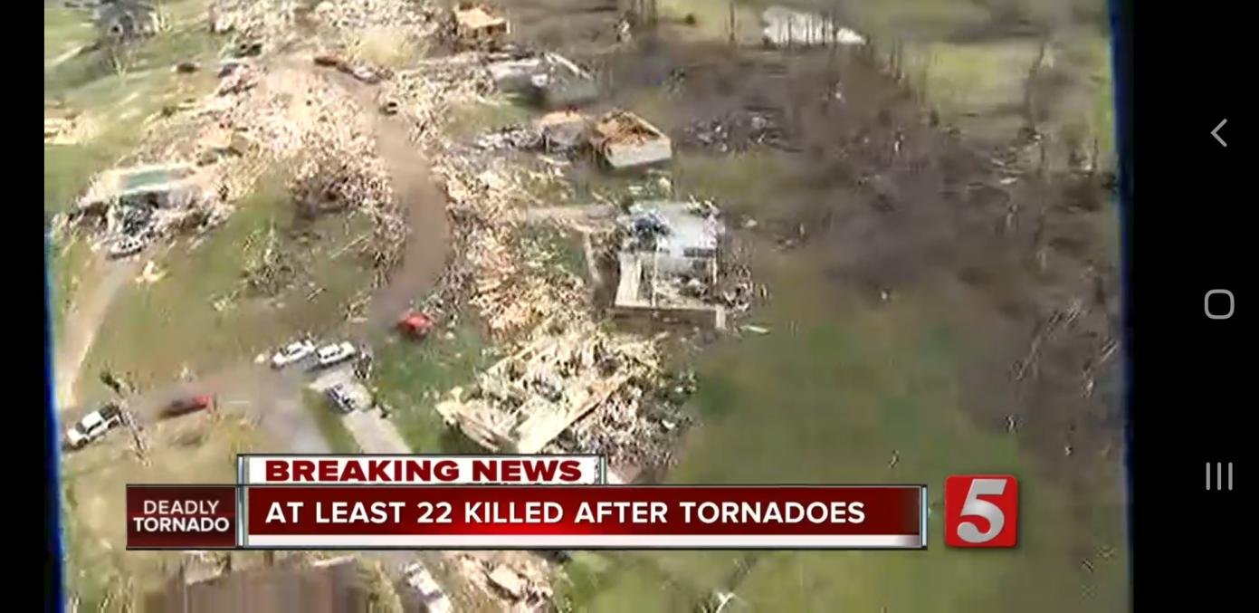
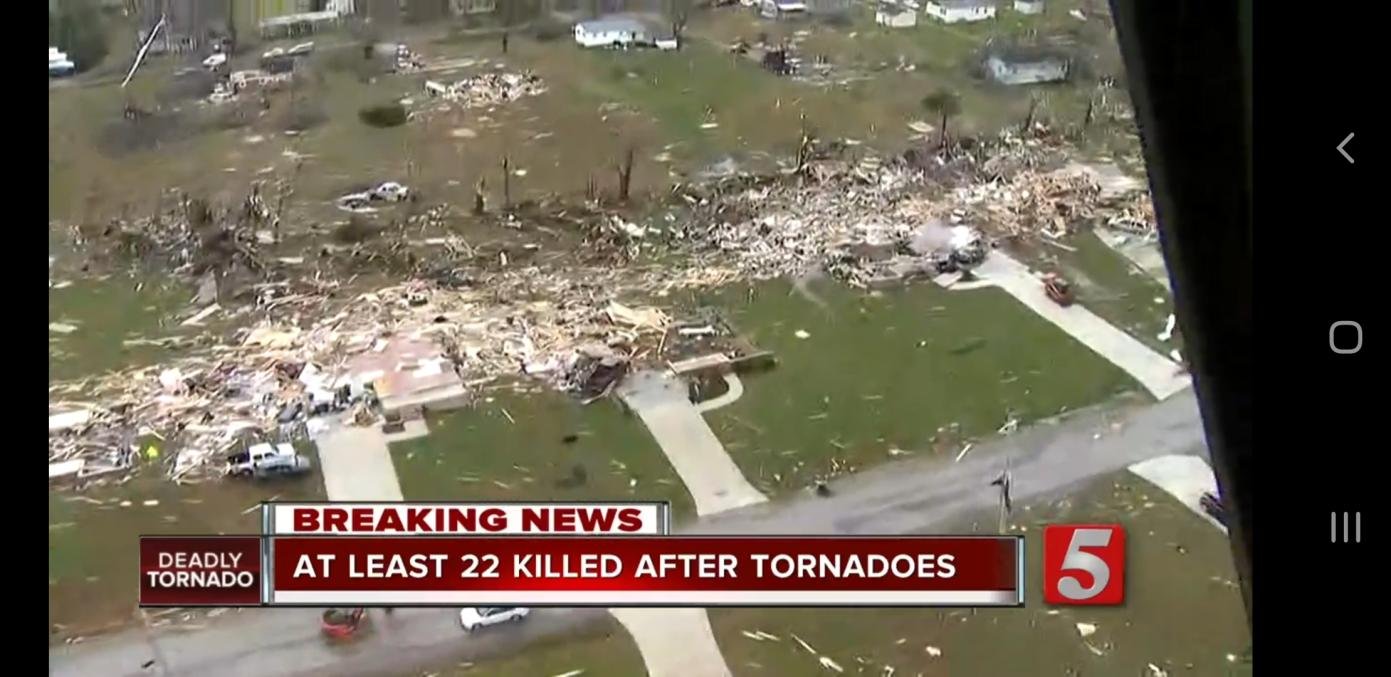
1 minute ago, Witness Protection Program said:
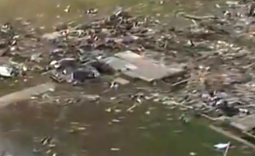
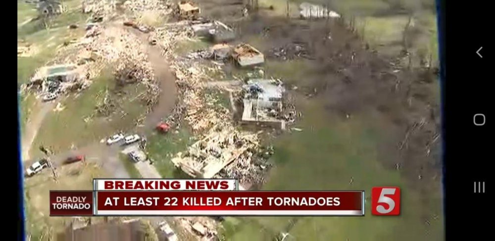
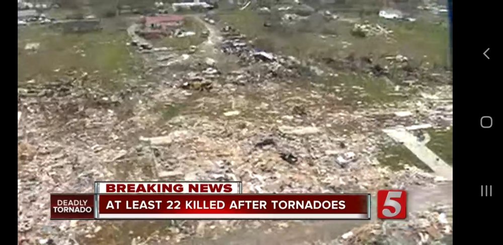
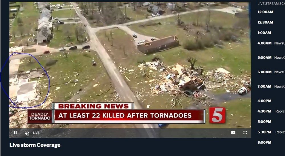
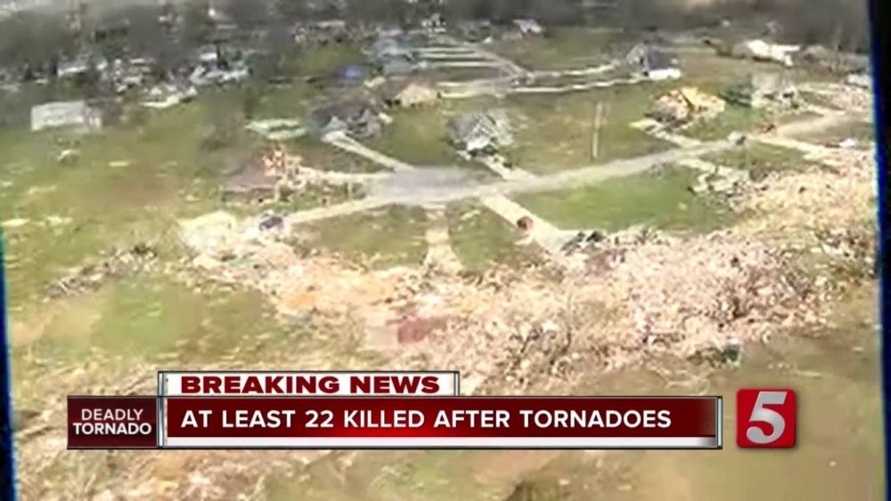
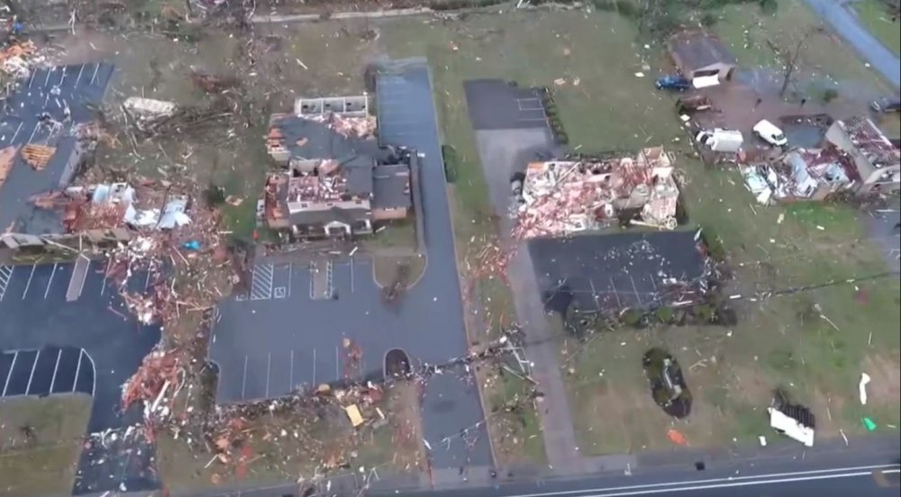
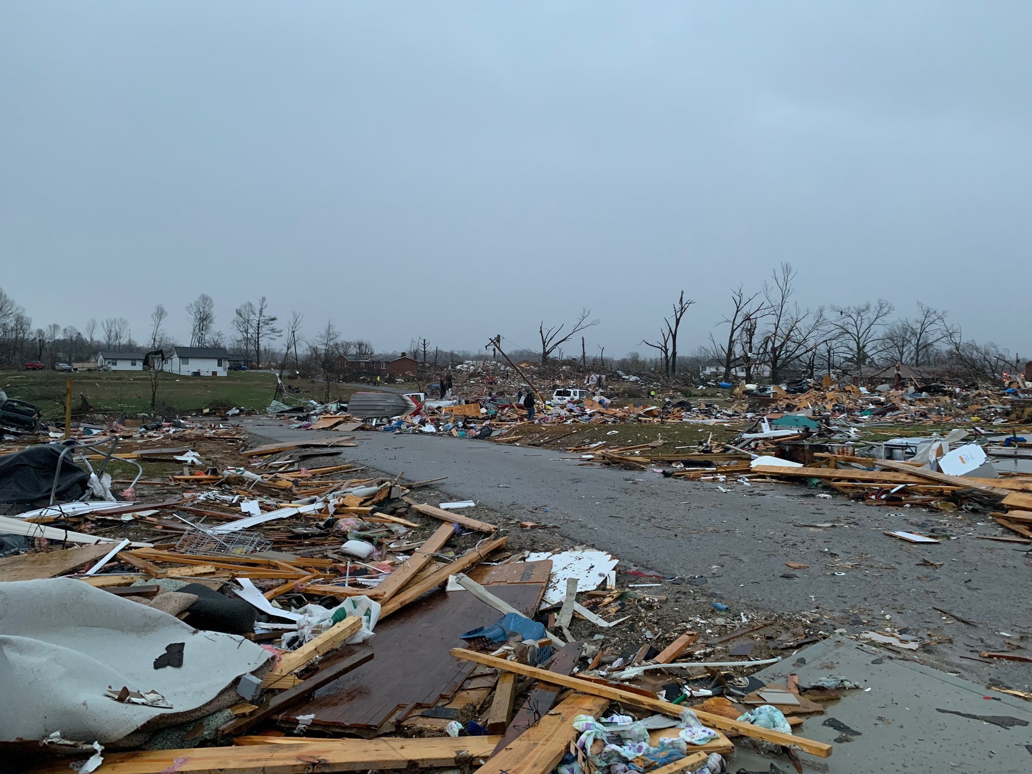
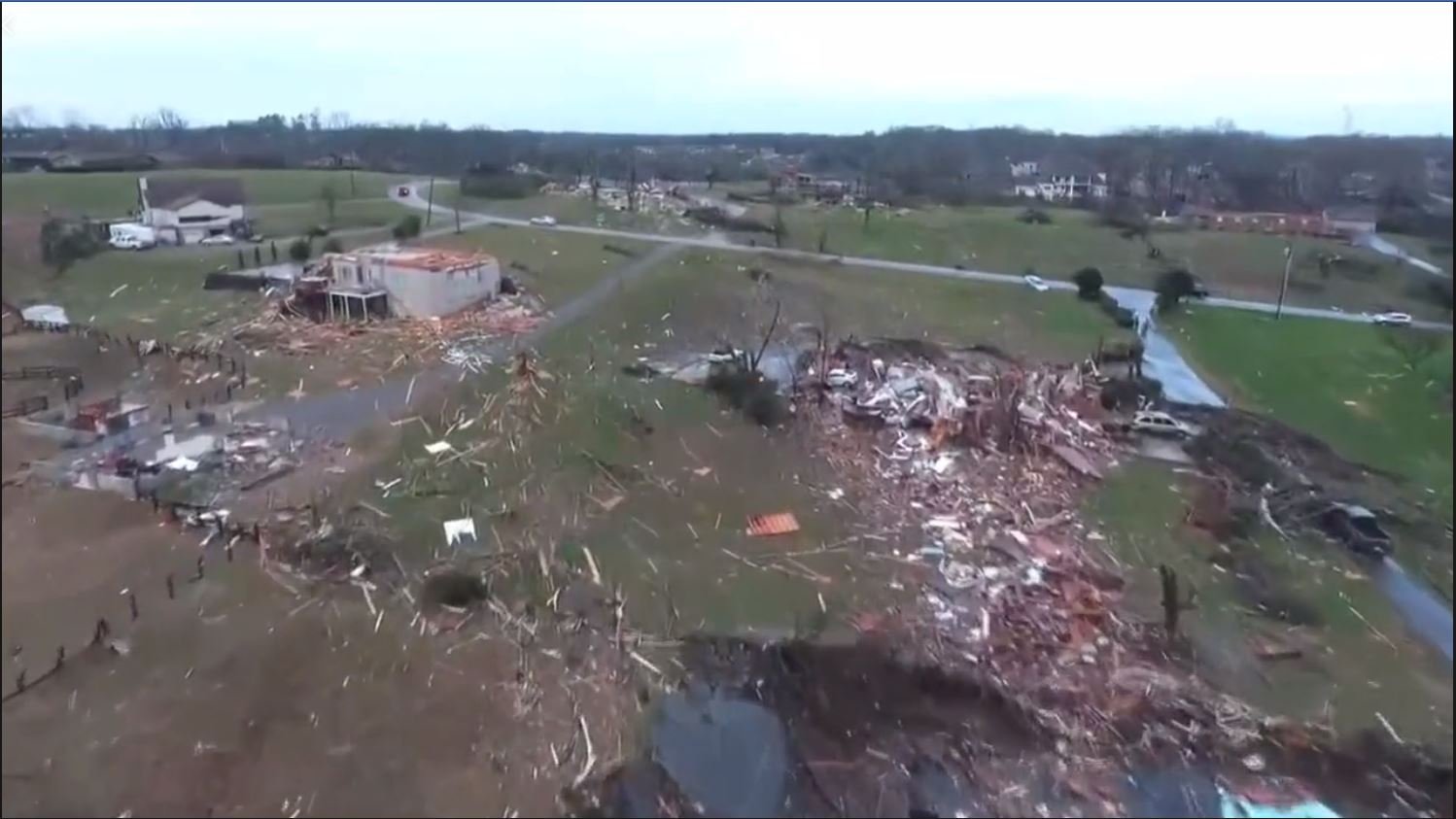
Starting 14:55 into the video, that's probably EF4 damage, right? Home after home blown down to their foundation.
At least. I counted at least 10 that looked like clean sweeps or close to it.
-
Everybody should watch this
-
1
-
-
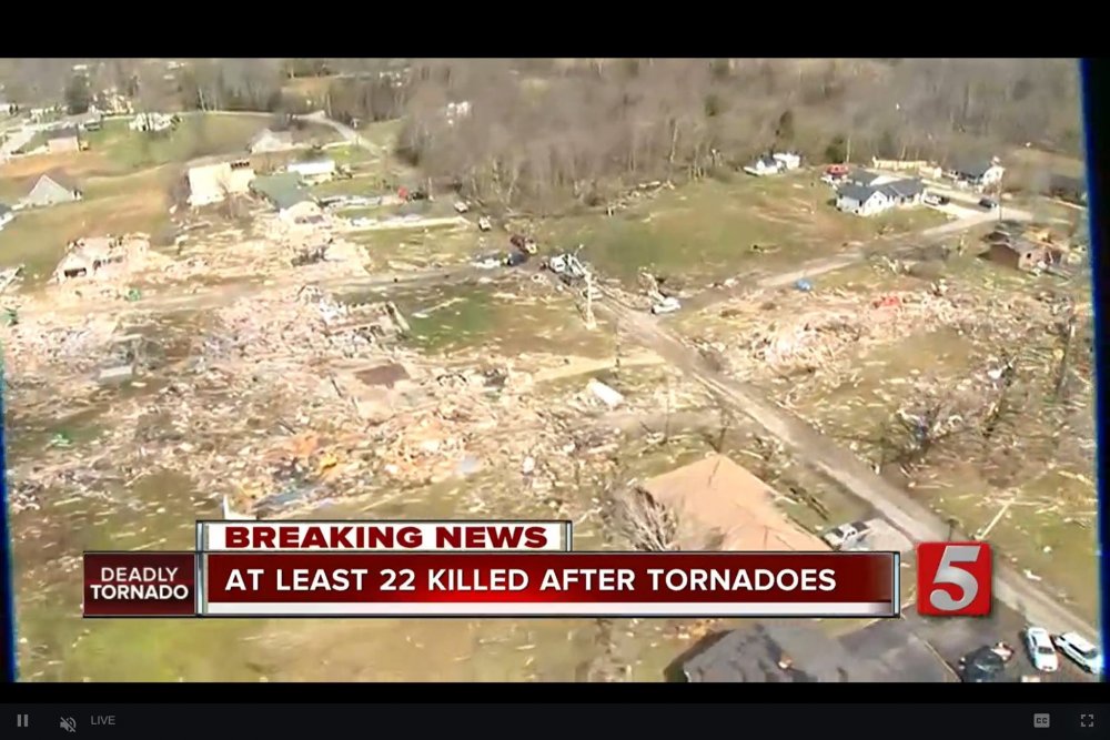
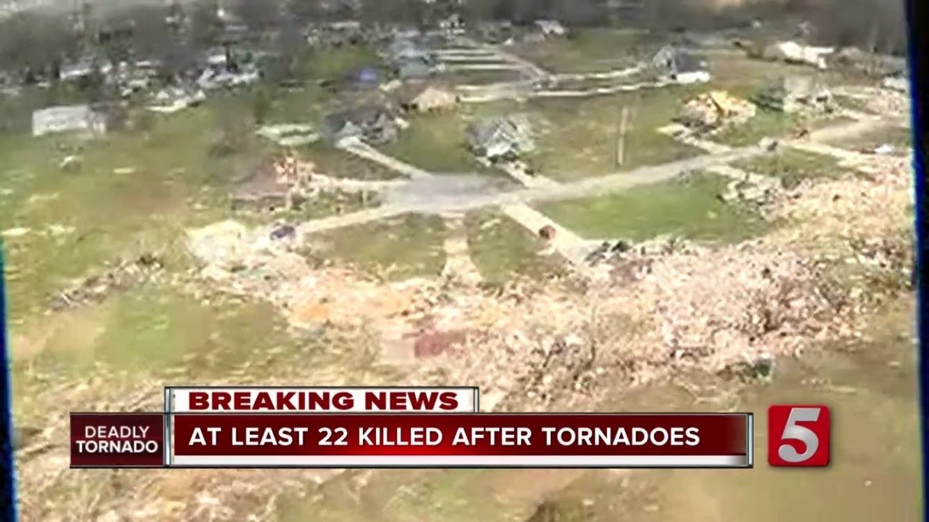
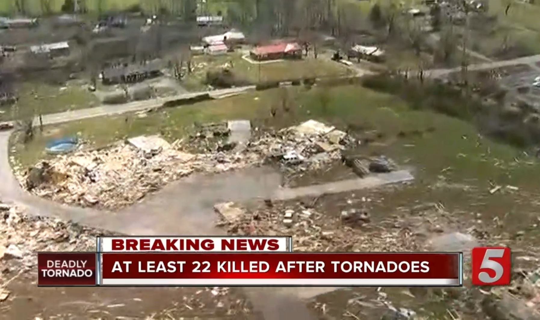
Just watched the entire ariel coverage from News 5 Nashville, and I gotta say, this reminds me a lot of Joplin. The damage is nothing short of astonishing. Entire condo duplexes leveled. Many homes swept completely off their foundation, ground scouring, debarking... you name it. Just horrible. Absolute tragedy.
-
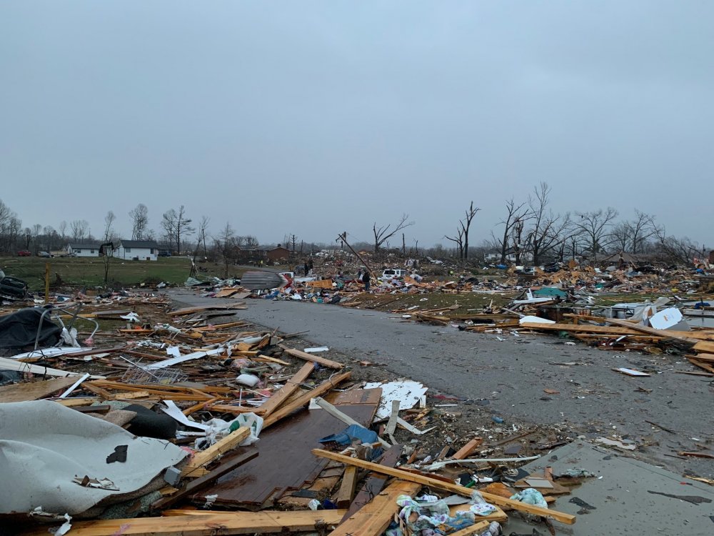
more slabs showing up
-
More damage:

-
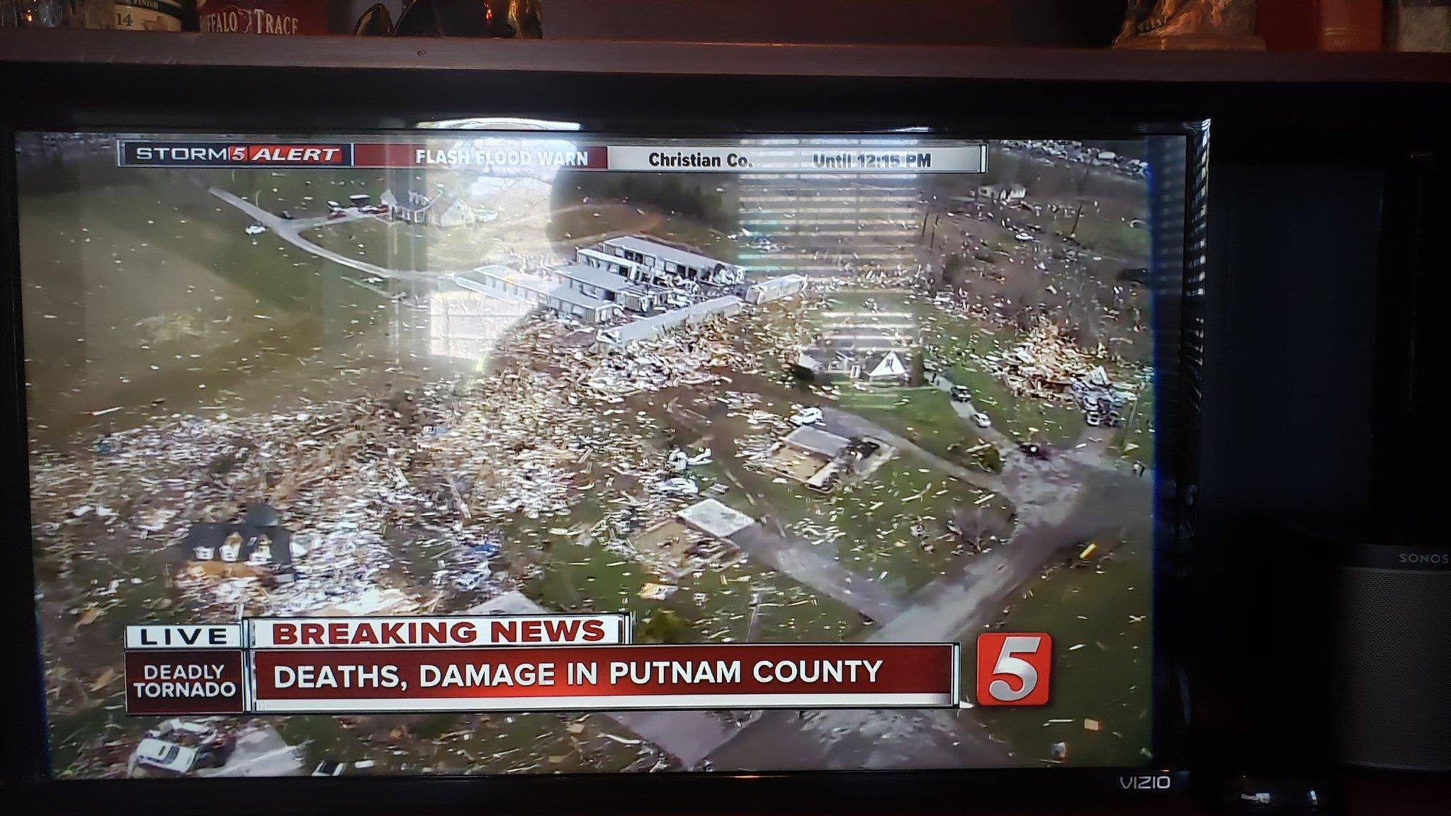
Say a prayer for all of those who were involved. The death toll is already enormous and will likely rise even more in the Cookeville area.


-
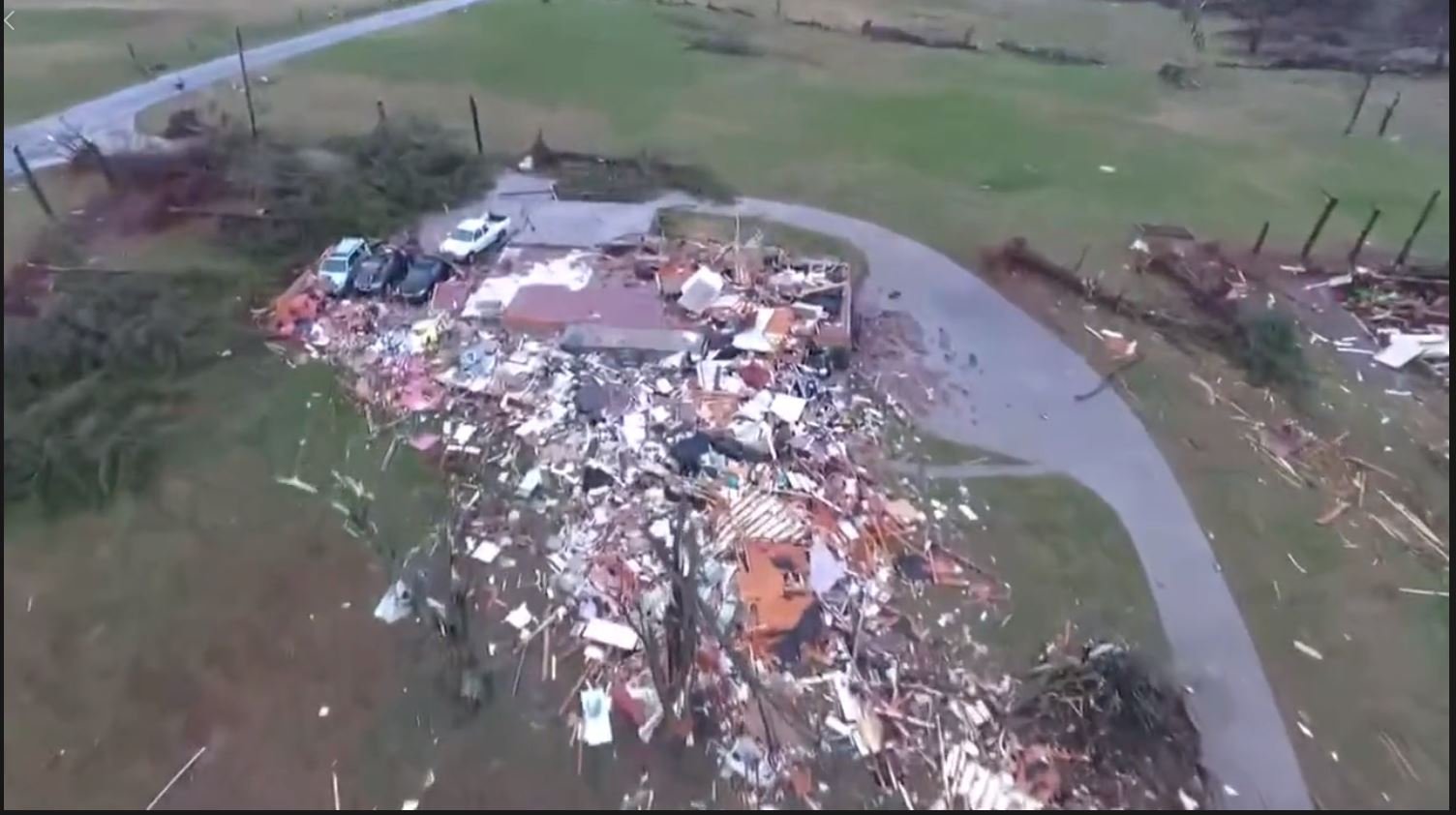
Extreme tornado damage
-
1
-
-
-
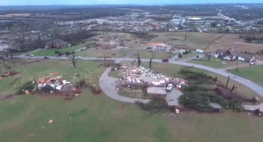
Damage looks at least ef-4 near Mount Juliet


-
1
-
-
6 minutes ago, jaxjagman said:
Everybody say a prayer. Horrible
-
Models are still not super consistent with this event, but they all appear to show some severe risk on Tuesday. GFS and Canadian are the slowest (which is odd, GFS usually is faster than the EC) while the UKmet and EC are faster.

-
 1
1
-


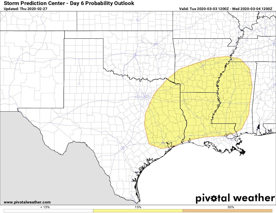
March 26-28 Severe Threat
in Lakes/Ohio Valley
Posted
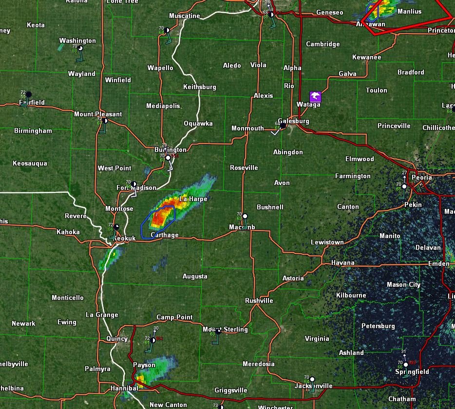
TDS near Tampico