


crossbowftw3
-
Posts
1,401 -
Joined
-
Last visited
Content Type
Profiles
Blogs
Forums
American Weather
Media Demo
Store
Gallery
Everything posted by crossbowftw3
-
Wild swings on these runs. If I end up with a 6-8” caliber accumulation from this and widespread 1-2’+ starts just 50-60 miles southeast again as it was in January 2016, I’d be rather disappointed
-
Between 1-2”. Enough to re-whiten the ground
-
Looks like I may be on the fringes of this one—a nice advisory event(low end warning?) should still in play for me in Sullivan
-
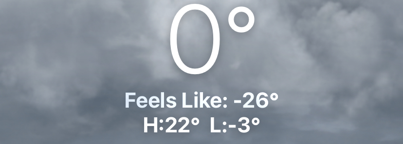
Brutal stuff. Coldest wind chills I’ve seen since the winters of 2013-15.
-
I’d count on city east for this one, and considering where I’m at and what amount of shoveling I just had to do, you guys can have this one.
-
Early feeling is that this weekend will probably end up one of those “city east” specials we see once a winter. After the hell of trying to shovel out what happened Sunday, would like a small break, then get on with the rest of winter.
-
You would be correct
-
Honesdale just to my west received 17”. I measured anywhere between 15-16 at my location.
-
1’ on the dot. Can still get to 18” if 1” an hour for the next six hours. 42” or so YTD and counting
-
Closing quickly on 1’. 4 inches in the past 3 hours.
-
Approaching 8”. With another 10-12 hours of solid snows I might have a mini repeat of 3/14/17. Ratios are still incredible.
-
Either way, getting an increasing feeling that somewhere right around where I’m at is the jack zone. My 3rd 20+ storm of the past nine winters may be in order.
-
Getting over 18” would push me further closer to my best season since 2020-21
-
BGM says “hold your horses” and may even get sleet to me. weirdly sleet might be beneficial to some degree. Encases the 8-12+ that would still happen first and make it practically bulletproof. Given the persistent cold that’s ahead this pack will not go anywhere. on the other hand, sleet at…checks notes…10f? is always baffling when it happens
-
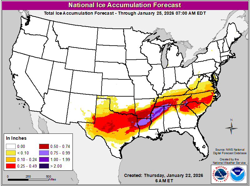
Horrendous outlook—over an area that isn’t used to such icing.
-
To take things out of our backyards for a moment, I get the feeling an impending disaster awaits a good portion of the south. Those ice totals = very much not good
-
Waking this morning to already find WSWatch hoisted at ~72h lead time.
-
Liking what today has brought for Sunday-Monday potential. I’m feeling a push over 40” for the season in my future.
-
Closing on 30” for the season after this weekend’s 1-2 punch, MSV airport approaching 3 feet for the season. Hoping for an answer as to what might unfold this weekend soonish.
-
Another surprise 1-2”, and I should be around 25-26” for the season.
-
Gearing up for between .1-.25 of ZR before any rain, well up north might be in for a legitimate ice storm. Doubt we see 50 tomorrow but 40s sounds more realistic
-
Looks like a general 4-6”. Busted low but I get over 2’ for the season.
-
Main thread degenerating as usual, so either way still look good for a reasonable snow event. The warmer models (NAM) popping up the suggestion of sleet bombs scares me. Sleet is up the totem pole from snow for how much I despise clearing it away.
-
I might even say winter month like this, period, probably not since February 2021. 50” that month alone for me.
-
New watch for 5-10” for Friday-Saturday. Can take the “just pushed over 20” and change it to “can push close to 30””. And again, not even January yet.


