

ORH_wxman
-
Posts
93,092 -
Joined
-
Last visited
Content Type
Profiles
Blogs
Forums
American Weather
Media Demo
Store
Gallery
Everything posted by ORH_wxman
-
CT does fine, but they don't get the brunt...the low rejuvenates further east and hammers E MA up into E NH/S ME
-
Wow, that thing stalls for E MA and up into ME.
-
That is a really impressive firehose on the Euro.
-
12z Euro will be east of 00z
-
Most volatile medium range model by far. It likes to have 300-400 mile swings.
-
Ukie is a Cape scraper....whiff for most of the forum.
-
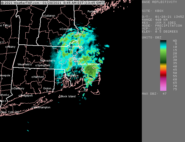
New rap loves you over the next few hours....prob 2-3" or so it's trying to spit out there on the upper cape.
-
Been getting nice fatties here for like an hour now. Nice thick coating on the previously cleared surfaces....hoping to scrub an inch out of this stuff if we can get it to blossom up a little more in the next hour or two.
-
Boxing day?
-
Flakes increased all of the sudden in the last 15 min...previously were small most of the morning....nice steady snow here accumulating on previously cleared roads/walkways
-
Someone might pick up a couple inches in these
-
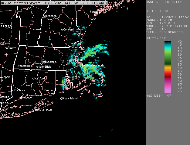
Trying to blossom over E MA and SE NH. A lot of guidance tries to drop and inch or two this morning over that area
-
The map Ray used from NWS wasn’t the full event. Looked like it was through 10pm on 1/26.
-
TT of 66 and 400 joules of sfc CAPE.
-
Are we thinking 48 hours of moderate to heavy snow still or maybe scale back to 40?
-
Look at the TTs.....LOL. Frequent and dangerous lightning to go with 6-10" per hour?
-
Yes....definitely a chance of a surprise there. I'd think they are in good shape to get at least an inch or two...but hopefully they exceed that.
-
That’s always been a threat for you on Cape Ann. Hopefully it pans out and someone gets a 6 spot or something. I love following those little meso-bombs when they happen. I’d prob keep expectations low there but hope for a surprise.
-
Yes....that is empirically true. A number of reasons....cryospheric maturation up north, SSTs much colder in Feb than Dec, etc.
-
There's some surface CAD in front of that system, so it's unlikely to be like the Xmas storm. I suppose there's always a chanc,e but that one was pretty unique in how unimpeded it was.
-
Lol...it's not nearly as bad as it was back in early January....but it's not like this really strong gradient ala Feb 2013. The fact we achieve deep layer easterly flow mitigates a lot of the "worry" over something really hideous anyway. That's a really impressive look. But it just is unlikely to be this more compact classic looking storm with a commahead/deformation over central or western New England while the dryslot is over the Cape....it won't be like that. It will probably have a deformation back over NY State while we are getting firehosed....that happened in March 2001 for example.
-
The short answer is weaker thermal gradients cause the geopotential heights to be further apart. Not a surprise in this setup though because we have the big omega-ish block up in Quebec/Ontario in front of the system. That said, the entire H5 low could trend stronger and more compact as we get closer...we're still 6 days out.
-
Yeah it's very broad...tighten it up and we'd have a really high end potentially historic storm rather than simply a "very good" storm that croaks us for 12-16 hours. Not that I wouldn't sign up for the latter right now if offered....
-
I don't see the moderate to heavy stuff lasting longer than that really anywhere including NNE.
-
The deformation stuff this run is back across central/upsate NY....this is a huge circulation....this is really about a 12-18 hour storm for SNE with a really powerful firehose coming off the atlantic. Then it would prob be another 18-24 hours of garbage off and on flakes/crapola. It's a really good storm....but my guess is it wouldn't match our true top dogs if we're trying to compare here. Get that H5 low to tighten up a little bit and then it might be.

