ORH_wxman
-
Posts
93,092 -
Joined
-
Last visited
Content Type
Profiles
Blogs
Forums
American Weather
Media Demo
Store
Gallery
Everything posted by ORH_wxman
-
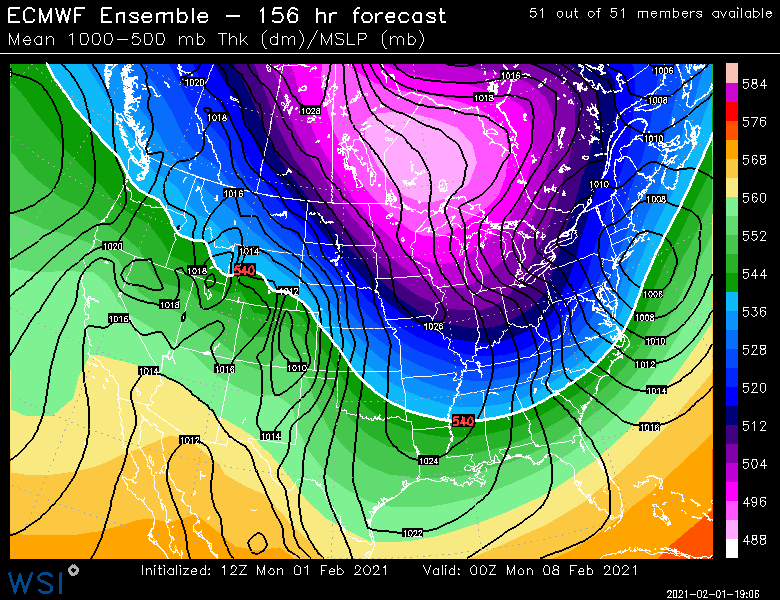
Feb looks pretty cold on weeklies....no surprise based on what the ensembles are showing,.
-
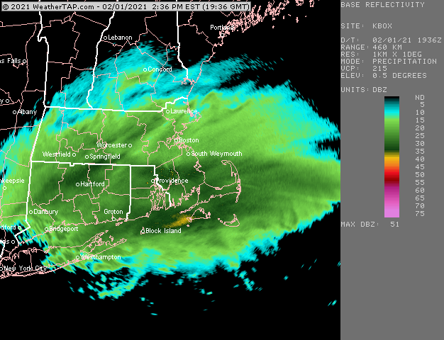
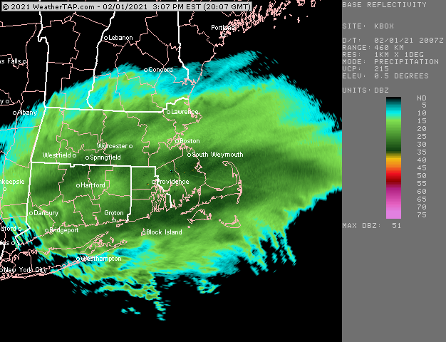
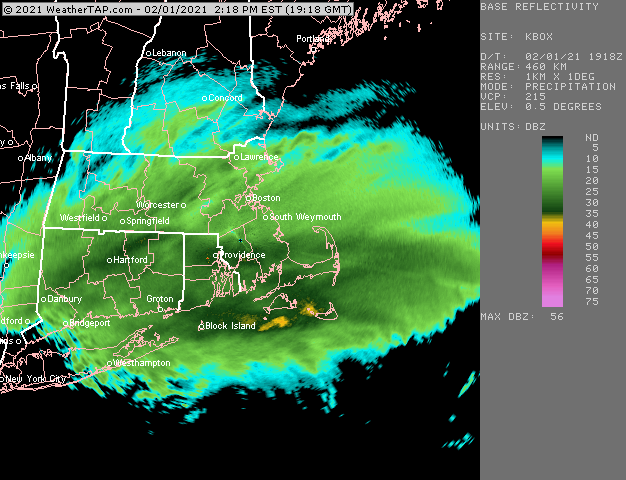
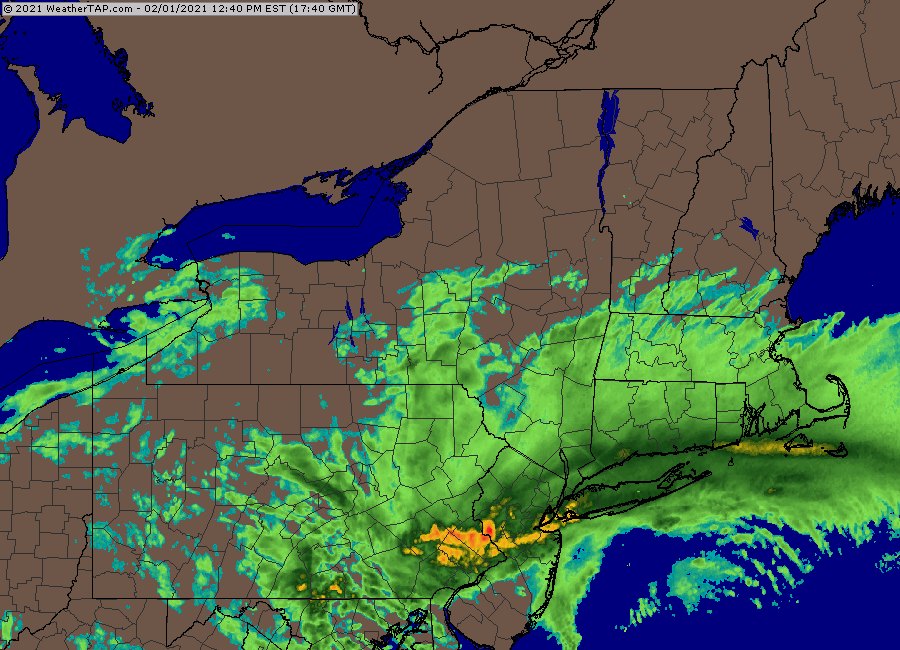
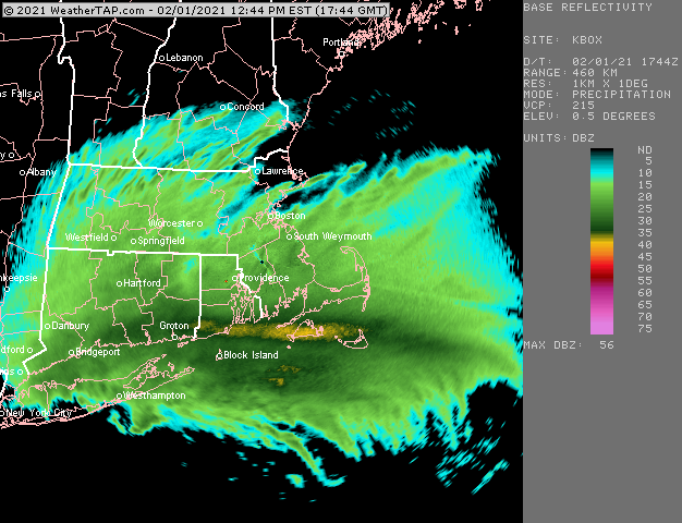
The really intense lift is still down south offshore....prob some moderately intense lift just starting to enter SE MA and trying to light up the radar there a bit. But the max lift even for like KTAN isn't until about 00z.
-
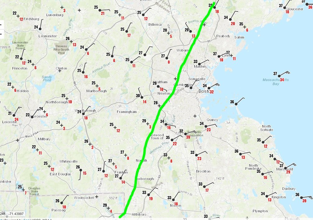
Stuff is 20 to 1 Ron Washington blower right now. Snow globe out there....if this keeps up for a few hours, we're definitely going to be on the high end of accumulations due to ratios alone. We'll see how quickly the CF moves west. Doubt it reaches you, but could get pretty close to Ray and maybe down 495.
-
Yeah it should....it will be a slow process, but it should keep inching west throughout the remainder of the evening.
-
CF update....hasn't moved a ton in the last hour or two...maybe a tick or two west.
-
Yeah it should.
-
Dendrites are back....starting to pound SN...temp continues to creep up. 25.8F now. 2" new on the dot
-
Do or die time on the coast there is about 4-5pm or so onward....that's when the really good lift with the cross-hair sig moves in.
-
Lol, NAM drops a 20-burger here in about 15 hours.
-
We had some decent flakes here for a while, but have had baking powder for the past 30 min or so. It's been pretty low vis though...like 1/2 to 3/4. Eyeballing 1.5-2 inches new.
-
Don't worry, we've never accused you of doing that.
-
That's the METAR code for the Blue Hill station.
-
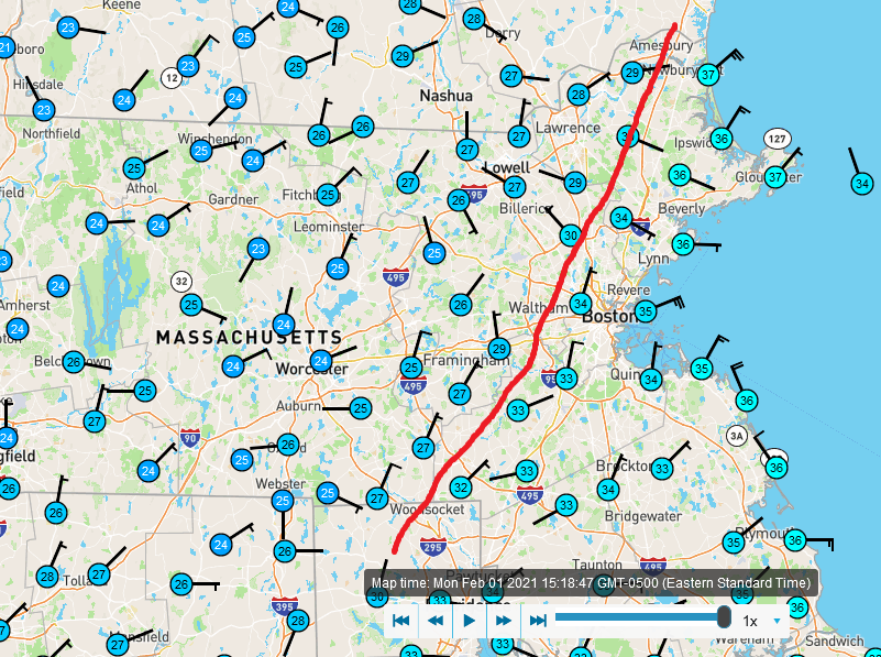
Nowhere in SNE....it will just keep moving NW at this latitude...prob in E NY somewhere.
-
MQE is 31F....amazing what even just a few hundred feet does that close to the coast. That has to be a really steep LL lapse there since the sfc mesonets are like 34F.
-
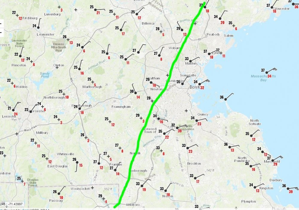
That mesoband is several hundred miles long
-
Yeah not bad for an ensemble mean at 156 hours
-
It's been trending colder, so even if we could grab a couple sloppy inches out of it. At the very least, it looks like we can put the cutter idea to rest.
-
Hopefully you manage 4-6 hours of absolute pounding birch bending paste. Bring a few trees down if you aren't going to get 15".
-
Not on the Euro...cold rain until maybe N Litchfield county to N ORH county.
-
Has a 2/13/14 vibe where you are....maybe a little better than that one, but similar type of gradient. I remember working in Copley for that one we had like 5" of slime during the day....went west back home and it went to about 12" once you got to Wellesley/128.
-
2/10 almost gets us too...scraper.
-
And just like that, we went from mostly baking powder to nice dendrites, coming down a lot harder now.
-
Yeah it will continue to inch NW throughout the afternoon/evening...it might go very slow or almost halt at times, but I don't expect it to collapse back SE until tomorrow.
-
You'll know in about 90 min to 2 hours.