ORH_wxman
-
Posts
93,092 -
Joined
-
Last visited
Content Type
Profiles
Blogs
Forums
American Weather
Media Demo
Store
Gallery
Everything posted by ORH_wxman
-
Outside of the GFS, not much supporting precip for 12/9-10. Id expect GFS to come considerably more suppressed today with that one. Still a chance there’s a compromise on models where we thread the needle and get a bit of snow but I’m expecting a whiff at this point. Sig for 12/13-14 is pretty solid on ensemble guidance so we’ll just have to wait and see how that one evolves.
-
That’s even more suppressed. South of DC.
-
GFS is def an outlier with the Dec 9-10-11 system. Even compared to NAM. You can see how much more suppressed the flow is even on that model near the end.
-
The 1.7 on 12/8 looks good. No idea where the 8.5 on 12/7 came from.
-
Doubt it.
-
Middle finger into YBY In all seriousness. There are going to be multiple shots at something as has been mentioned previously.

-
Get a little more cold press ahead of that system and it could be a pretty big deal in interior SNE. It does eventually change over there but if it can do it 12 hours earlier…watch out. Still might end up getting squashed though.
-
Next system was run out of your basement.
-
One of those is Jan 1969. That was tough luck. edit: I was 30 seconds too late. Lol
-
I think more than that have committed. Aren’t you already in? I know Ray, Scooter and I are in too. I am pretty sure a few others committed too.
-
Looks like Feb ‘69. So like 39 and change?
-
I actually noticed this too thougj I looked more at individual members. Even GEFS we’re pretty snowy. Just not as snowy as EPS. EPS had a LOT of snowy members…and we’re more snowy for 12/12-13. GEFS really ramped it up after that threat.
-
I’d say GEFS overall have been better at diagnosing the pacific. But that’s for the Dec 6-10 period. It remains to be seen if they continue to do better beyond that. I think you could make a case for either way. The EPS caught onto the magnitude of the Atlantic blocking before the GEFS did.
-
Still a sizable difference in EPS vs GEFS. EPS looks a lot better both for 12/12 threat and then beyond that. GEFS eventually looks good but it’s taking a solid 3-4 days longer than EPS and even when it does get more favorable, it’s still not quite a good looking at EPS. GEPS (if we actually care about that suite) does look more like EPS than GEFS. So that’s a minor piece of support. The difference between EPS and GEFS def seems to be tropical forcing. GEFS brings it around MJO phases 4/5/6 before curling back into COD and maybe re-emerging near phase 7/8 (when the looks gets favorable again) while EPS basically keeps it in COD.
-
Western trough is giving everyone PTSD….definitely from last December. Patterns aren’t the same though. If the western trough decides to dig to Baja through Xmas, then maybe but I don’t see that and guidance isn’t showing it either. Lots of emotional hedging going on I think. The pattern should produce plenty of threats imho.
-
That is way different than saying they have no skill. I would drain all of your money quite quickly if you kept giving me even money odds on something that has a 0.4 correlation. Like if you said “I’ll take the coin flip solution and you take the EPS at day 14-15”….you’d get annihilated pretty fast. Nobody should ever take long range ensembles as very high confidence. But they are useful and have skill.
-
Yeah like the NAO has a temp correlation of 0.4 here during peak winter months…it loosely means colder but it has a ton of wiggle room so I don’t place a lot of value on it. It gets to like 0.6 once you are down in Dc and VA and those types of areas so it’s a bigger deal. But the main point is that you cannot be “worse than a coin flip” without being an inverse (negative) correlation. Coin flip would be exactly 0.0 correlation since they are completely independent random trials.
-
There’s enough cold air up here but it doesn’t get precip into New England.
-
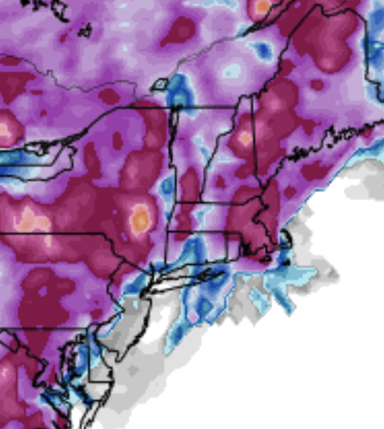
Reminds me a little of Dec 5, 2020…hammered ORH hills and monads with warning level paste but was a sloppy 1-4” for the rest of the region.
-
That is not statistically worse than a coin flip. A coin flip means something is not correlated at all. We’re talking independent trials. It would be a 0 on that graph. A correlation of 0.4 is not ironclad but it is statistically significant. If you started getting “opposite” results of what you expect, then your correlation is negative.
-
There is definitely an emerging consensus in longer range guidance that things could go from decent/good to very good as we get closer to the final week before holidays.
-
They made the dance…but the run is coming to an end.
-
He opened his kitchen closet this morning and Juan Valdez handed him a fresh batch
-
Yeah I wouldn’t be sweating at elevation in Vermont. Dec 7-8 may come in mild/rainy but I’d be pretty pumped for the look beyond that. Never any guarantees (remember the monster cutter on 12/12/10?), but someone or many will probably do pretty well this month.
-
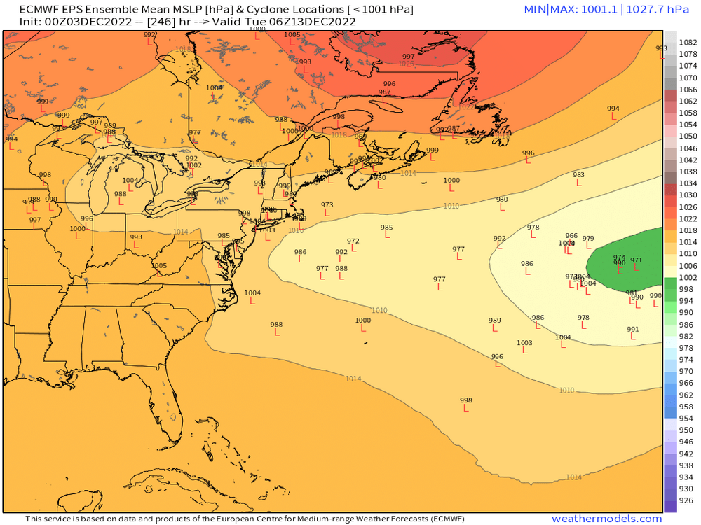
Here’s EPS for 12/12-13. You can see plenty of members hanging out in decent spots.