ORH_wxman
-
Posts
93,092 -
Joined
-
Last visited
Content Type
Profiles
Blogs
Forums
American Weather
Media Demo
Store
Gallery
Everything posted by ORH_wxman
-
Feb 10-11 Mid Week Minor Event - Ride the hot hand?
ORH_wxman replied to HoarfrostHubb's topic in New England
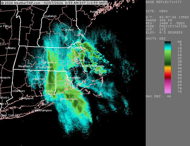
Euro rotates an IVT down too over the Cape…but the main event is pretty paltry. Maybe an inch. -
Friday February 6 FROPA / WINDEX small event
ORH_wxman replied to HoarfrostHubb's topic in New England
Yep not quite done yet on south shore and cape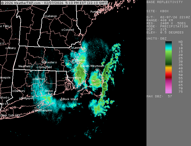
-
Friday February 6 FROPA / WINDEX small event
ORH_wxman replied to HoarfrostHubb's topic in New England
4.5” but this is without clearing. Might have maybe squeaked 4.8-5” if I cleared after the midnight-6am batch.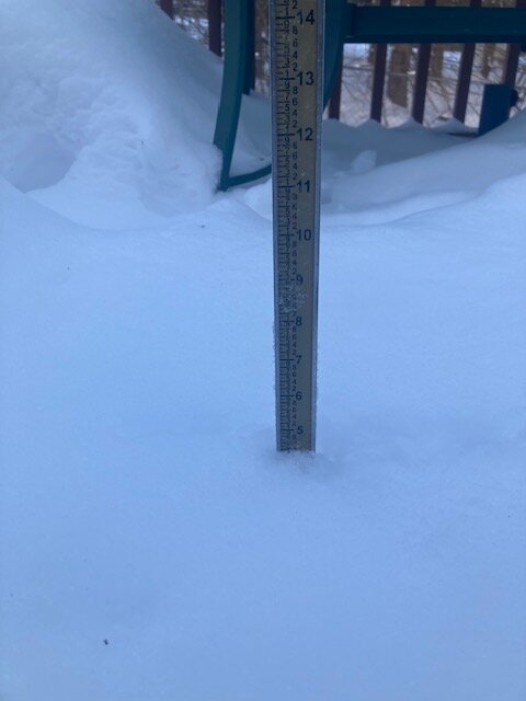
-
Friday February 6 FROPA / WINDEX small event
ORH_wxman replied to HoarfrostHubb's topic in New England
Upper Cape about to get it. Tblizz too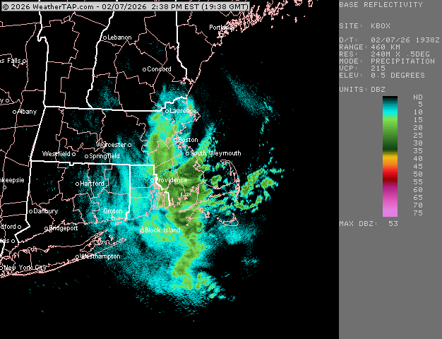
-
Friday February 6 FROPA / WINDEX small event
ORH_wxman replied to HoarfrostHubb's topic in New England
Absolutely nuking still but about to slip east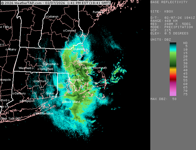
-
Friday February 6 FROPA / WINDEX small event
ORH_wxman replied to HoarfrostHubb's topic in New England
Absolutely nuking in this 495 band (just inside 495). Best rates of the day. Should blow past 4” soon if we haven’t already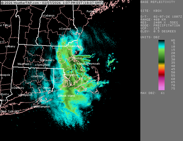
-
Friday February 6 FROPA / WINDEX small event
ORH_wxman replied to HoarfrostHubb's topic in New England
This band back by 495 is pounding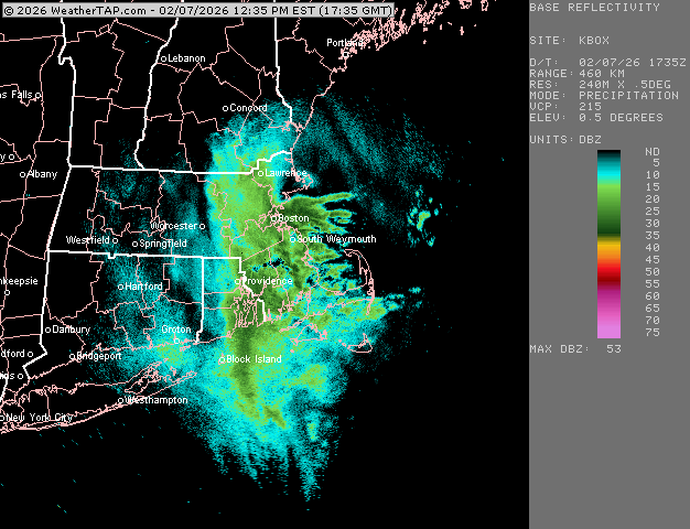
-
Friday February 6 FROPA / WINDEX small event
ORH_wxman replied to HoarfrostHubb's topic in New England
Weymouth walloper -
Friday February 6 FROPA / WINDEX small event
ORH_wxman replied to HoarfrostHubb's topic in New England
2/15/15 look on the radar there. Kind of convective like that system. -
Friday February 6 FROPA / WINDEX small event
ORH_wxman replied to HoarfrostHubb's topic in New England
Scooter gonna get 5-6” in 90 minutes out of that. Lol Nice band ramping back up for 495. Snowing really good back at home here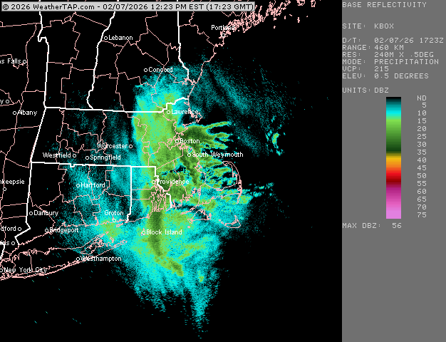
-
Has a bunch of threats in clown range…what a cold pattern in the 11-15.
-
Friday February 6 FROPA / WINDEX small event
ORH_wxman replied to HoarfrostHubb's topic in New England
BOS getting crushed now. Scooter will get that stuff too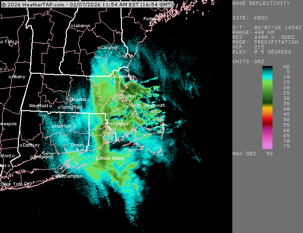
-
Friday February 6 FROPA / WINDEX small event
ORH_wxman replied to HoarfrostHubb's topic in New England
At a birthday party with my youngest in Franklin MA and it’s ripping in this band in western Norfolk county
-
Friday February 6 FROPA / WINDEX small event
ORH_wxman replied to HoarfrostHubb's topic in New England
That obscene convective blob near Cape Ann and Marblehead is trying to drift into BOS. Wonder if they can go to poundtown for an hour or two
-
Friday February 6 FROPA / WINDEX small event
ORH_wxman replied to HoarfrostHubb's topic in New England
Metrowest between 128/495 trying to light up now. @ma blizzard just east of or ORH getting destroyed Still can’t get over Cape Ann…that convective thing is not moving very fast
-
Friday February 6 FROPA / WINDEX small event
ORH_wxman replied to HoarfrostHubb's topic in New England
I think someone there will be in the 16-20” range for sure when it’s done. You already about a foot in spots. -
Friday February 6 FROPA / WINDEX small event
ORH_wxman replied to HoarfrostHubb's topic in New England
Def a convective look around Cape Ann
-
Friday February 6 FROPA / WINDEX small event
ORH_wxman replied to HoarfrostHubb's topic in New England
Some of the totals on the North Shore are gonna be crazy. Just getting annihilated. -
Friday February 6 FROPA / WINDEX small event
ORH_wxman replied to HoarfrostHubb's topic in New England
Might get enhanced a bit as the arctic front approaches. You can see all the stuff starting to fill in too in metrowest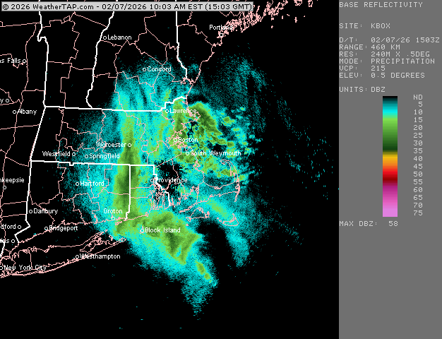
-
Friday February 6 FROPA / WINDEX small event
ORH_wxman replied to HoarfrostHubb's topic in New England
Cape Ann getting crushed now. whiteout in ORH now too.
-
Friday February 6 FROPA / WINDEX small event
ORH_wxman replied to HoarfrostHubb's topic in New England
You might get an hour or two of real good stuff here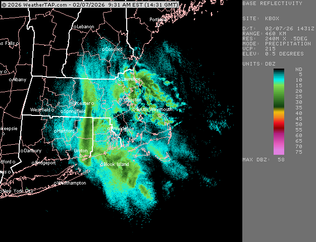
-
Friday February 6 FROPA / WINDEX small event
ORH_wxman replied to HoarfrostHubb's topic in New England
Decent shot at 10”+ there. -
Friday February 6 FROPA / WINDEX small event
ORH_wxman replied to HoarfrostHubb's topic in New England
Prob gonna be some very intense rates for a time. You’ll force a lot of air upwards when it hits the light onshore flow -
Friday February 6 FROPA / WINDEX small event
ORH_wxman replied to HoarfrostHubb's topic in New England
Someone will end up with 18”+ there I think unless it shuts off very quick. -
Friday February 6 FROPA / WINDEX small event
ORH_wxman replied to HoarfrostHubb's topic in New England
Complete crush job for Ginxy up to ORH.