

tiger_deF
-
Posts
492 -
Joined
-
Last visited
Content Type
Profiles
Blogs
Forums
American Weather
Media Demo
Store
Gallery
Posts posted by tiger_deF
-
-
How many of the EPS ensembles show effects from the storm Friday in NE? Still think that, versus Sunday, is where our bread may be buttered
Also that warm signal at the end of the GFS is no bueno.. shows a coastal storm that literally brings rain to the entire region outside of Northern Maine.
-
There is a strong OTS risk for Friday, but man that would be one hell of a storm if it did come to fruition. An intense low, blocking pattern which slows it down on approach, and sufficient arctic air would have widespread 12-18+ across NE. We hope...
-
 1
1
-
-
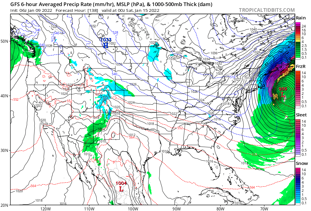
The last several GFS runs have a strong signal ~6 days out for a low pressure to form off the southeast and move northward while intensifying. Revent runs have moved it to the west and intensify the low by a greater degree. This is the 06z run for today, we watch?

-
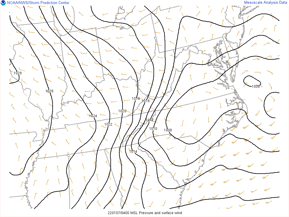
Curious to see what the latest mesoanalysis looks like
-
6 minutes ago, HIPPYVALLEY said:
A map of a 1006mb surface low and associated wind barbs, giving some indication where best forcing and lift is, I guess?
Interesting seeing that middle area of low pressure closer to the coast.
-
1 minute ago, Sn0waddict said:
What the heck is going on here?
-
 1
1
-
-
Is it just me or is the 12z and 3z NAM starting off with the eastern low significantly more east? And deeper as well
-
The past several HRRR hourglass have been continually weakening the western low and strengthening the eastern one per the same timeframe. The overall system has also been ticcing west
-
1 minute ago, NorEastermass128 said:
10” is commonplace these days. Even here, I’ve had a few 10”+ events since 2018.
I wonder why that is. Could it be part of a long-term oscillation in weather patterns, increased moisture/southern flow due to climate change, or a mix of both, or something else entirely?
-
Just now, JC-CT said:
This is what I'm watching on the nowcast...I'd be lying if I said I didn't see some interesting trends on where the low pressure is located off the SE coast right now vs modeling, and some of the short-term guidance corrections I'm watching.
Mind sharing any of your observations? Sounds fascinating
-
12z GFS seems verbatim but the right lobe is definitely more dominant, and slightly more to the West
-
Just now, moneypitmike said:
Snow maps, shmow maps. Let's look at qpf.


These are so much better than yesterday, yet there's a profoundly melancholic atmosphere here
-
The past few hourly HRRR runs appear to have the low off the coast slightly more intense, and minor shifts to the west for that feature
-
 1
1
-
-
If the convection south of Florida ends up being stronger than modeled, what would be the potential downstream effects?
-
Regardless of the outcome this is going to be a fascinating storm to nowcast, especially with the interaction of the dual lows/convection
-
Big GFS run coming up. Crossing my fingers
-
From someone still relatively new to meteorological discussion, what does H5 and H7 mean? Is it the upper level profile at varying heights, or something else
-
If we get widespread 8-12 we'll need to see models shifting uniformly as we near go time, or they'll have to bust hilariously (which is certainly less common in this day and age)
-
1 minute ago, HIPPYVALLEY said:
I’ve come to the conclusion, that this year, there is no model that anybody really likes.
Except for any given model that happens to show the biggest hit
-
What we all really need is a monster shift on the 12z GFS
-
1
-
-
Still better than the 00z.. praying to the snow gods that the next suite of models keeps on nudging west
-
NAM is seriously elongated as of hour 42, it seems it won't give up on the battling low solution
-
4 minutes ago, DotRat_Wx said:
I'm in matthews Arena watching nu play UConn in hockey, can hear the wind outside.
I'm actually a student at Northeastern! What are the chances, I literally walked by Matthews Arena less than a half-hour ago.
-
Already far, far more impressive then Mehnri in my location in BOS. Rain has been moderate all evening but the wind has been picking up throughout the afternoon and is now sustained at 25-30 mph. Almost lost my umbrella
-
1
-
 1
1
-
January 2022 Obs/Disco
in New England
Posted
What about Sunday? All the other guidance shoots it so far OTS out to the SW that I doubt we would even get cirrus. Definitely favoring Friday, but maybe Sunday-Monday whiffing will help us down down road