

tiger_deF
-
Posts
492 -
Joined
-
Last visited
Content Type
Profiles
Blogs
Forums
American Weather
Media Demo
Store
Gallery
Posts posted by tiger_deF
-
-
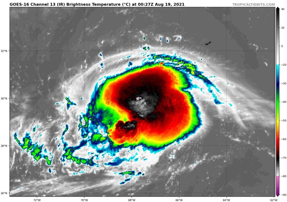
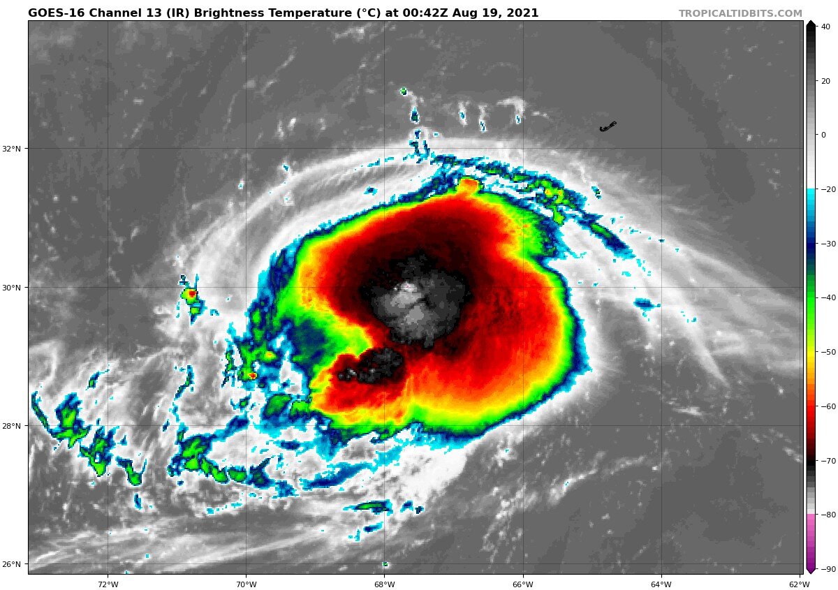
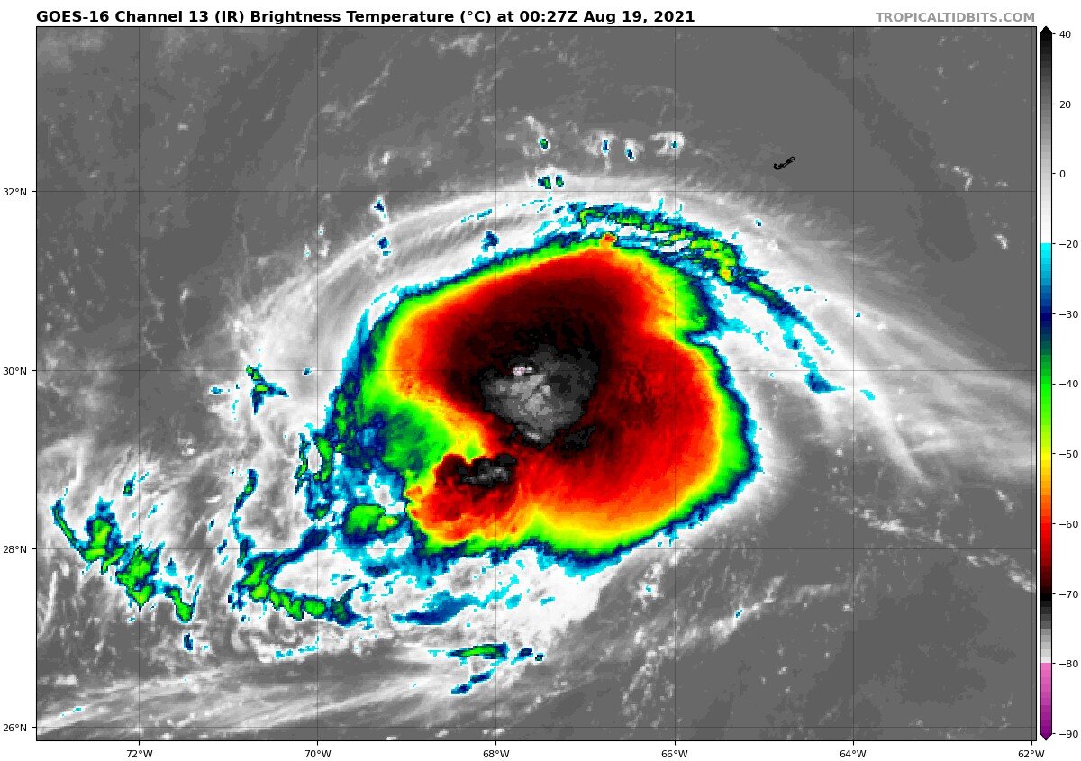
Looking forwards to what recon finds today. IMO Henri was a hurricane all of yesterday, slightly weakened to a tropical storm overnight, and is now maintaining intensity in face of shear
-
Looks to be trying to form a primative eyewall. Still not quite there, but whether it can hold off from shear and complete itself over the next 36 hours is crucial to it's eventual track.

-
Henri looks to be trying to close off an eye. Still not quite there, but certainly indicative of a low end hurricane.
-
The short-term strength of Henri will be crucial to the eventual track; will he continue to steadily intensify, or briefly weaken due to shear?
-
2 minutes ago, Sn0waddict said:
Gfs definitely weaker so far. 995mb vs 983mb at 57hrs. Interesting
I wouldn't be suprised if Henri is closing in on 995 mb right now
-
I doubt we will have a clear idea of what Henri is going to do until we start getting regular recon data fed into the models, which should be the case by Friday
-
HMON appears to split Henri into two competing systems, latching onto the southern lobe. Toss-worthy?
-
-
Smart money is on OTS, but this is the strongest, closest signal I have seen for potential TC impacts since Isaias, and the trends have been very consistently West since a few days ago
-
And we track... increasingly excited but I can't help but feel I will wake up tomorrow and it will appear to be headed definitively out to sea.
-
-
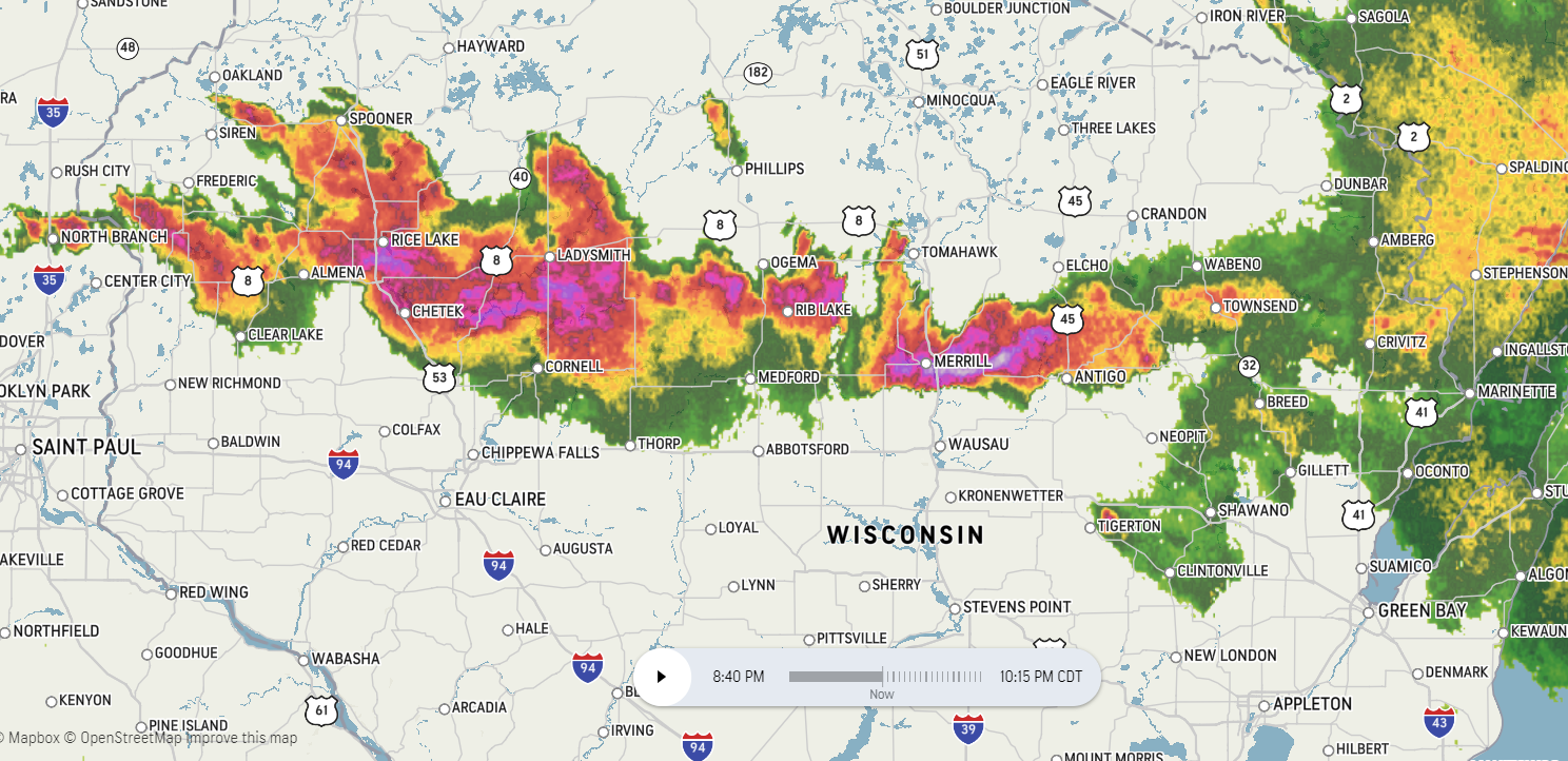
Power outages are spiking in NNE Wisconsin
-
55 minutes ago, Damage In Tolland said:
Cool temps?
Most large-scale volcanic eruptions result in so much detritus getting ejected into the air that it produces a notable decline in the average temperature due to increasing the amount of sunlight reflected. It's hypothesized that several major historical famines coincided with frosts and cold snaps from such events.
-
Elsa is looking fierce and her appearance is improving as she crawls up the South
-
 1
1
-
-
1 minute ago, weathafella said:
Appetizer for august and September
I'd bet our chances for something tropical this season are likely tied with this storm, like Isaias around a similar time last season. Not discounting a peak season threat, but it has been a looong time
-
6 minutes ago, Typhoon Tip said:
I'm not sure I understand ( Meteorologically ) what the mechanisms are these guidance are "honing in on" to maintain that type of system structure/identity/and power this far N over cold water/land interface, after already having traversed total land for some 500 miles.
wtf man -
no one is question how these guidance are doing that, - they are just programmed to discuss what it impacts the surface as though there is not other option? I guess that's what we've become.
wholly reliant
But you know, if they're right they're right... But then I have to question if that disk of wind is anywhere less than 1500 meters
I hope that the models are picking up on some kind of baroclinic transition, as I can see those winds being probable in a transitioning hybrid system, certainly not anything fully tropical.
-
Looks like it's go time folks
-
1
-
-
Southern part of the line is beefing up pretty quickly
-
Seems to be outperforming last week's outbreak despite having far less hype
-
1
-
-
So far is this busting above, below, or right around what was forecast? I have a great deal of family in GA anxiously watching these developments and any insight would be very helpful
-
Looking ugly near Selma, hopefully they have warnings up
-
Based on live weather reports there are currently two tornadoes on the ground, one in clark county and one crossing highway 84. Pretty impressive debris signature on radar considering the timeframe
EDIT- Crossed highway 84, is now in Wayne county
-
No snow so far in Nahant but the wind is going nuts, pushing white caps out in the open ocean of 2 feet plus easy
-
As someone still fairly new to weather how come this event and its setup is considered more unusual?
.jpg.25f1d0eeb28c27af958bfa267c7706df.jpg)

Tropical Storm Henri
in New England
Posted
It's worth pointing out that the SST's off the coast are running 2-3+ degrees Celsius above normal, which could potentially be lifting the relative latitude where a cyclone is able to maintain tropical characteristics.