Weather Will
-
Posts
7,313 -
Joined
-
Last visited
Content Type
Profiles
Blogs
Forums
American Weather
Media Demo
Store
Gallery
Everything posted by Weather Will
-
If Dr. No gives us a flush hit, the board will crash!
-
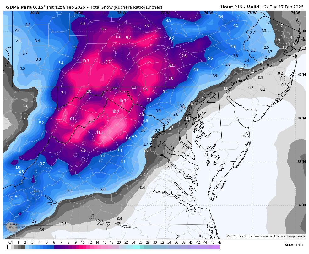
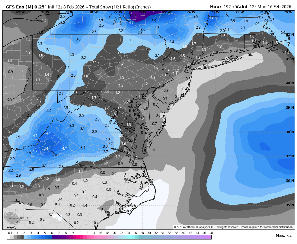
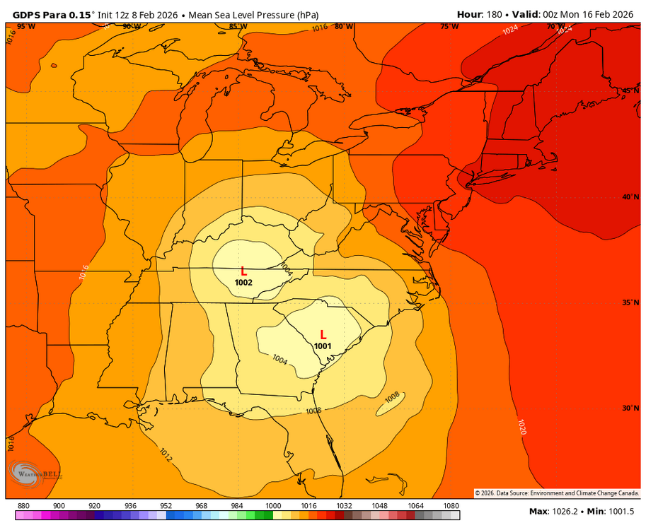
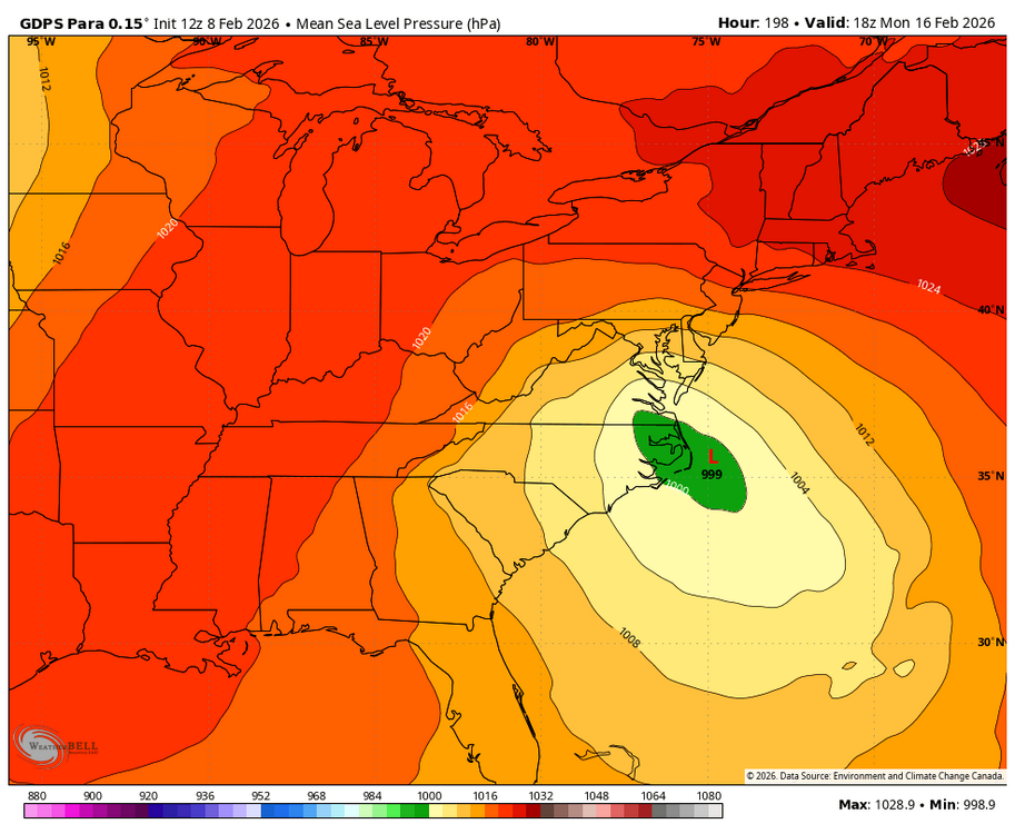
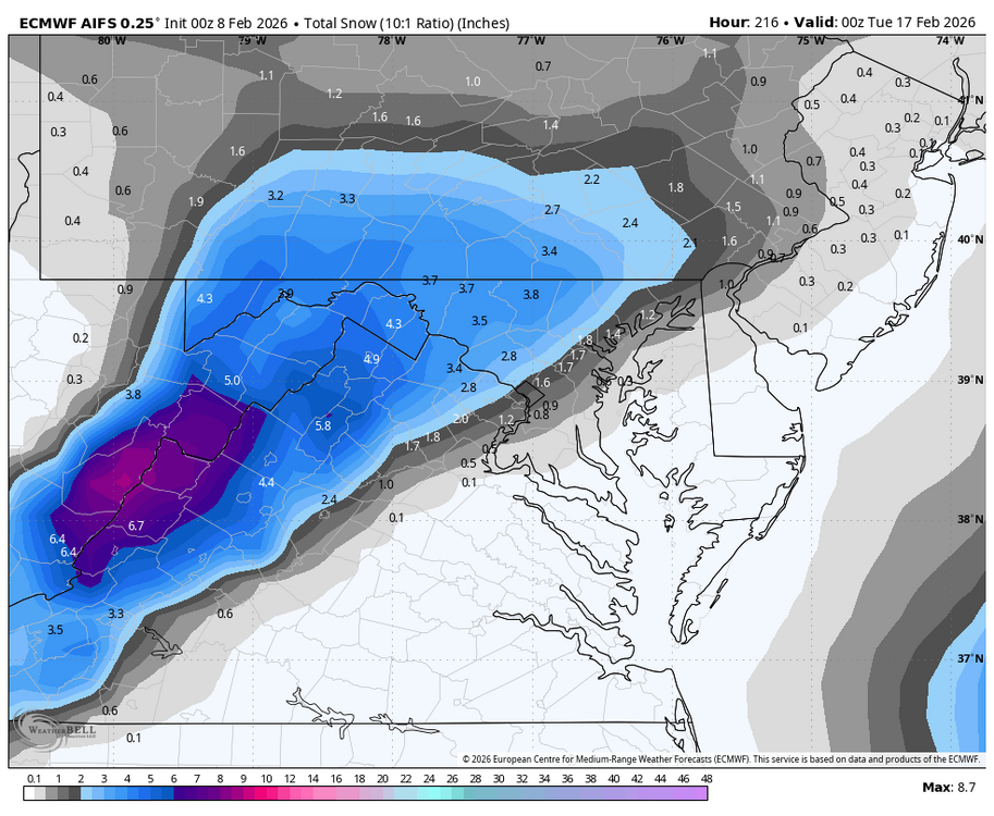
Add the WB GDPS Para to the snowy side at 12Z. Low track positions 0Z and 18Z Mon.

-
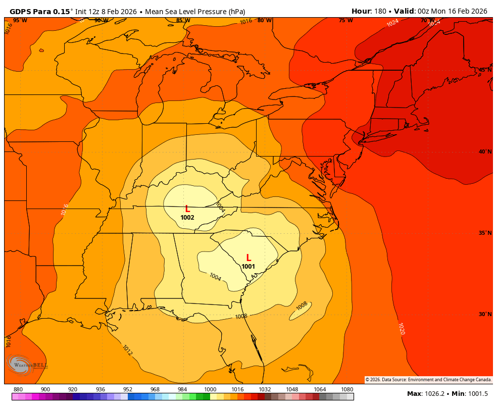
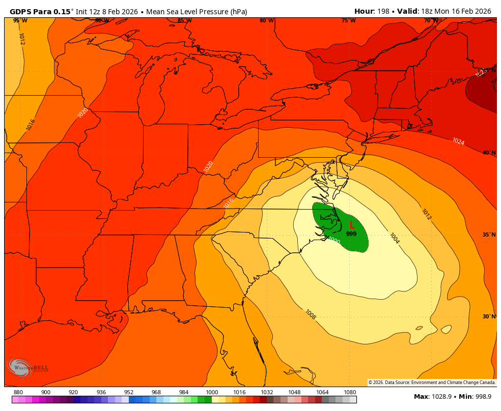
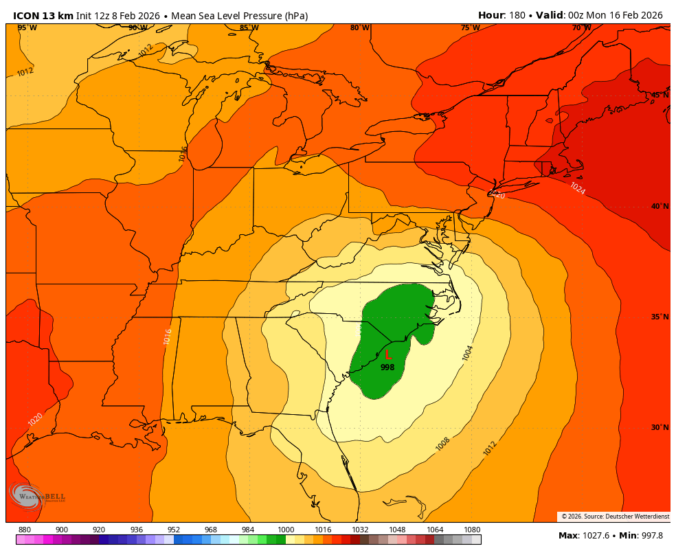
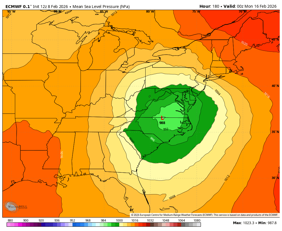
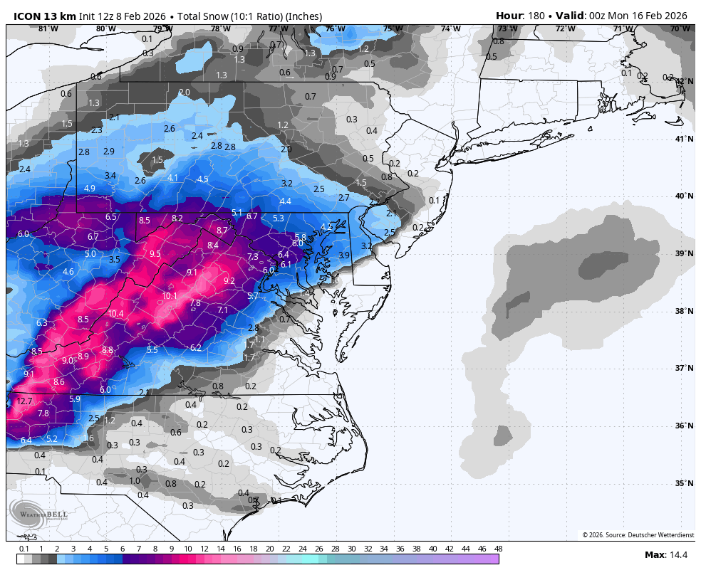
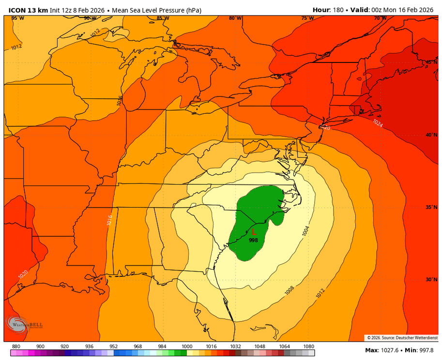
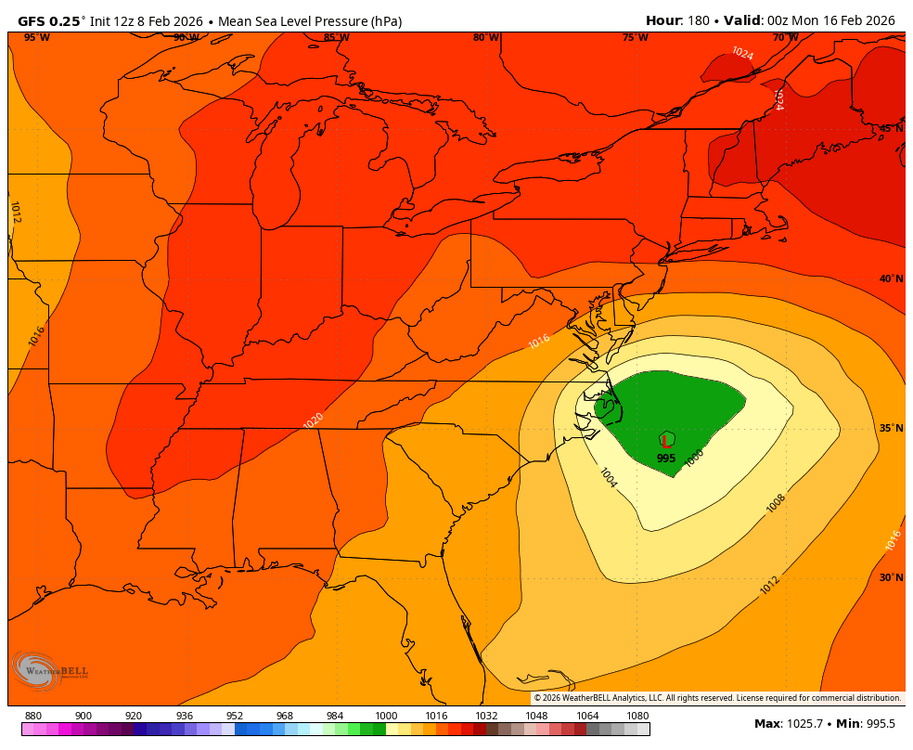
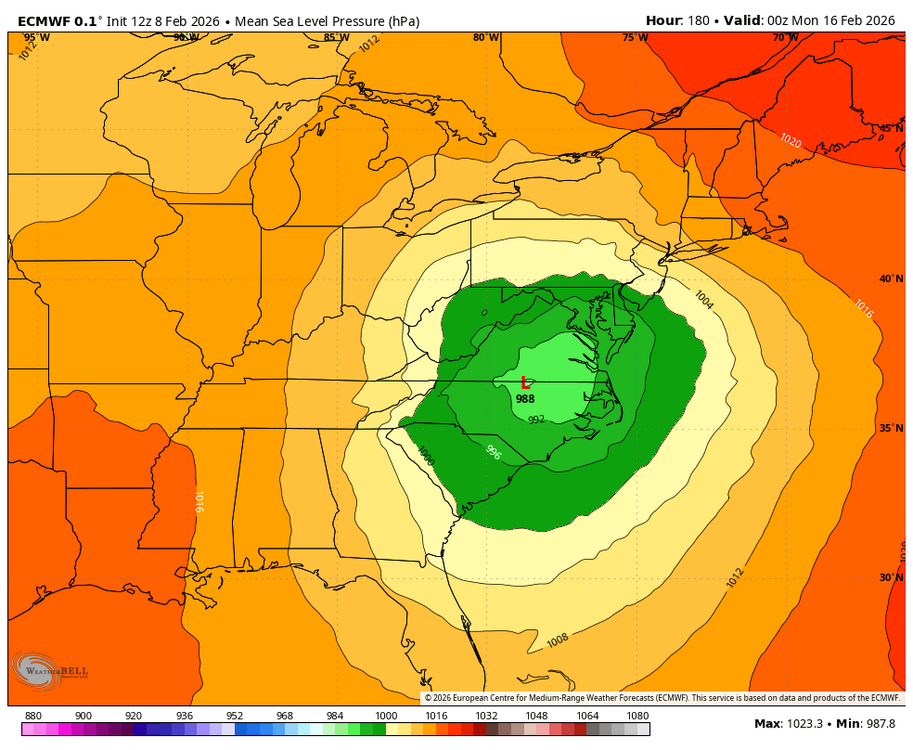
With marginal temps, we will need a near perfect track. Compare low positions for the snowy ICON and GFS compared to the rainy EURO and Can. WB 0Z Mon.

-
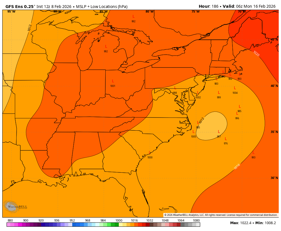
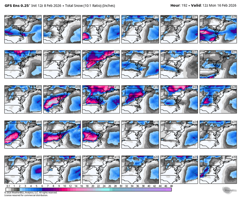
WB 12Z GEFS: most members still a miss but we hang out for another run!


-
Completely agree. See my comments in their thread. Before 12Z most of them with all their technical skill were dismissing the threat. We will see what the experts think now.
-
Being 7 plus days out, we really need to see what the ensembles say at 12Z. We gotta keep up with the technical people in the expert thread since they really know what the hell is going on....
-
At least this is the third model to have a storm and not a sheered out weak, southern slider.
-
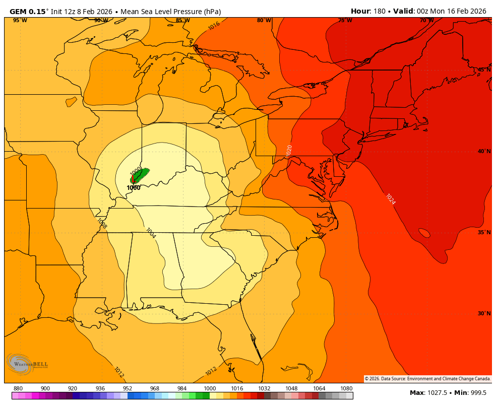
The 12Z Canadian is not snow for most of us; perfect track rain storm.
-
The only thing we know about the next system is that No One except the Almighty knows the final outcome yet!!!!
-
WB 12Z ICON and not done!!!!!

-
Winter Storm Threat *Technical* Discussion. No Op Run PBP or Snow maps
Weather Will replied to CAPE's topic in Mid Atlantic
I do appreciate that you are posting a lot of your analysis in both threads. Maybe that is an approach that everyone could take. -
Winter Storm Threat *Technical* Discussion. No Op Run PBP or Snow maps
Weather Will replied to CAPE's topic in Mid Atlantic
General comment: the way non experts like myself learn is for these posts to be integrated into the broader discussion. Having expert analysis is great only if it is easily accessible. The ivory tower approach taken here has a chilling effect on the entire forum. -
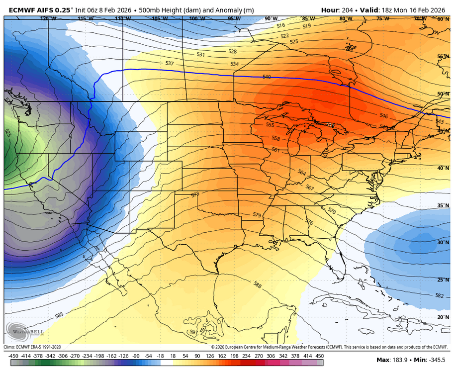
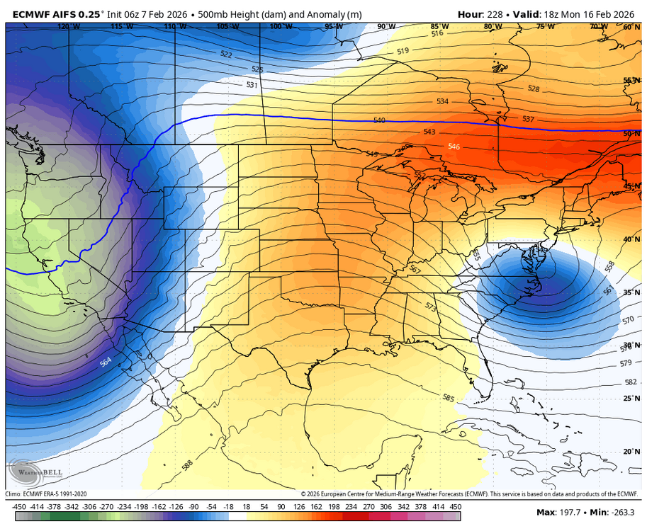
The EURO AI went from an intense low to nothing in a day. True rug pull. WB 6Z EURO AI compared to 6Z yesterday.

-
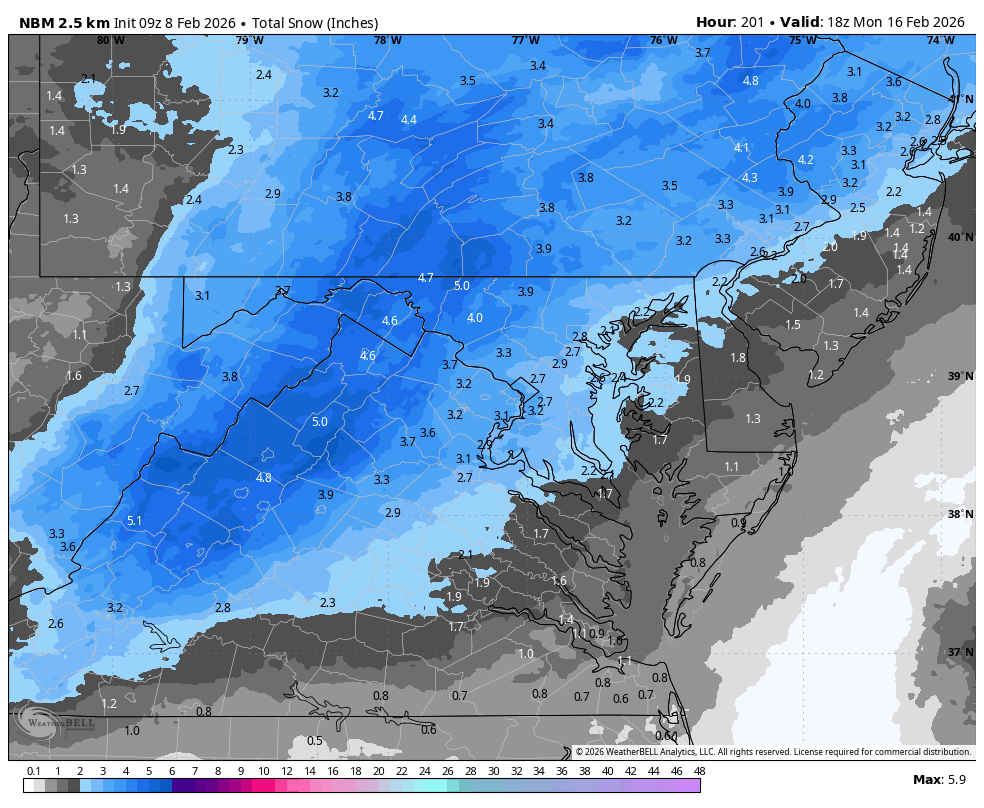
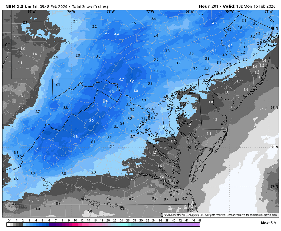
WB 9Z NBM
-
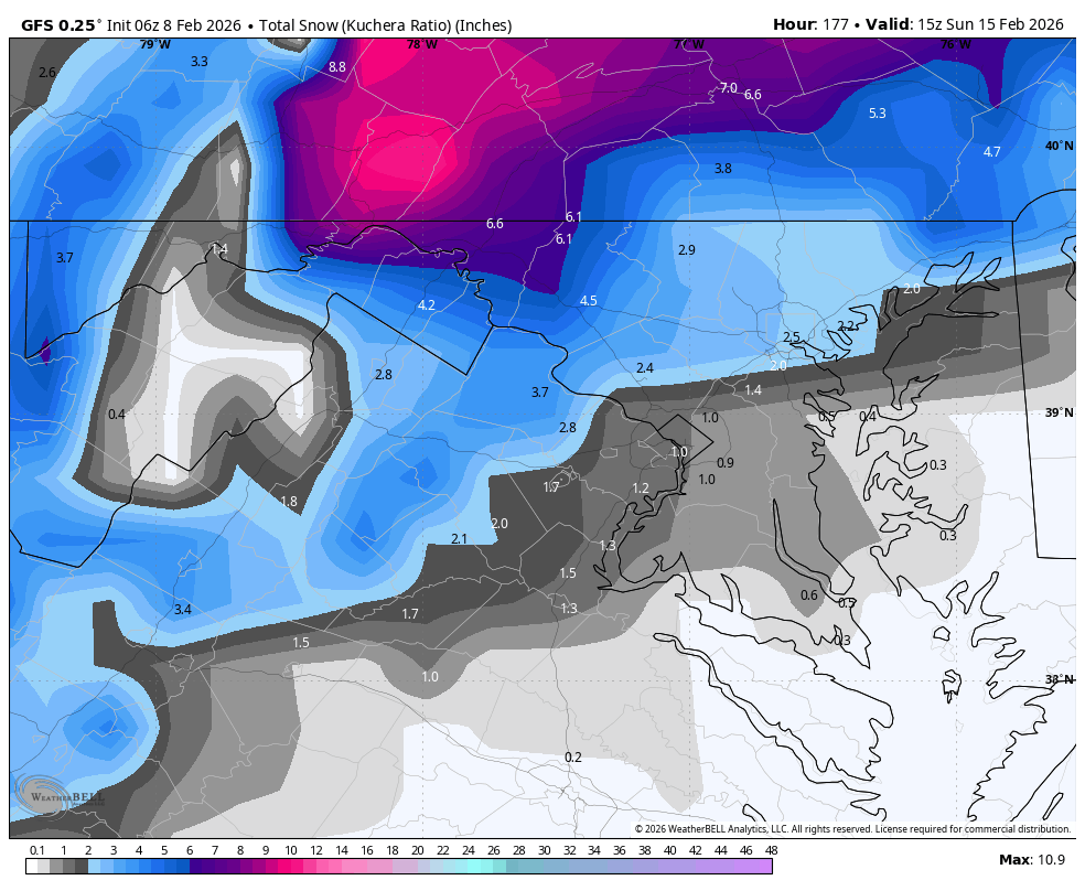
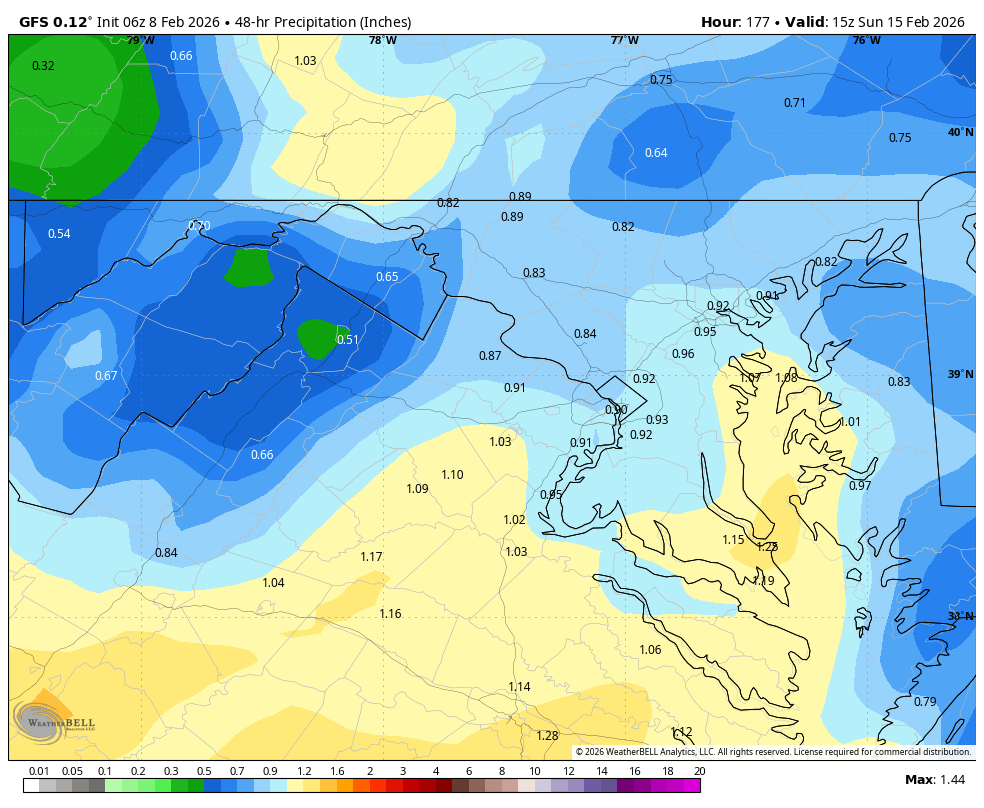
WB 6Z GFS

-
It is a red flag that the EURO AI never got above 30-40% with big hits and EURO is the usual Dr. No. Agree that we are still a few days from knowing....and there is always our March miracle blizzard Hail Mary to pad our totals.
-
It is just one run but agree very disappointing.
-
WB 0Z EURO AI and temps are in the 40s now on Sunday so this accumulation is overdone.
-
Weak sauce. WB 0Z Can. Looks like most of the energy does not come out east. Heads to the upper Midwest.
-
WB 0Z GFS compared to 18Z GFS: future runs see if the coastal low strengthens faster/ its exact track.
-
Turns to rain by 7am Sunday,
-
4am Sun.
-
WB 0Z GFS 10 pm Sat. Compared to 18Z.
-
WB AI GFS is still way north. Amazing how different from ICON at Day 7.
-
WB 0Z ICON storm track stays to our south with both the late week and the Sunday system. Brings a few inches to SW and central VA.