cptcatz
-
Posts
1,077 -
Joined
-
Last visited
Content Type
Profiles
Blogs
Forums
American Weather
Media Demo
Store
Gallery
Everything posted by cptcatz
-
We've got 2 weeks left of October. I wouldn't count any of those things out until we're closer to the end of the month.
-
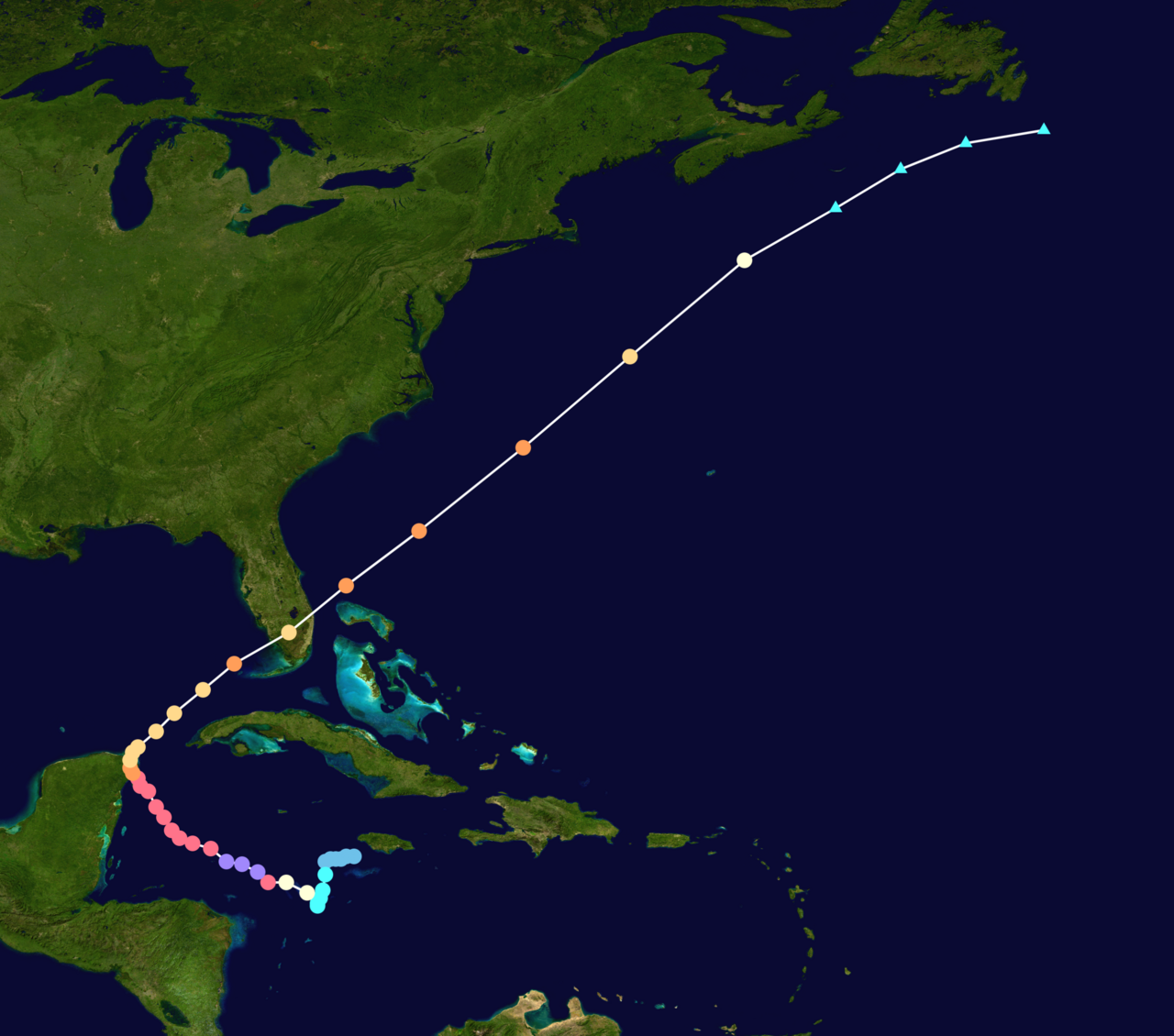
Major Hurricane Melissa - 892mb - 185mph Jamaica landfall
cptcatz replied to GaWx's topic in Tropical Headquarters
True but we also had two category 5's this year, two category 5's last year, and the boiling caribbean hasn't been remotely touched this year. So it's entirely safe to say that if atmospheric conditions allow, something could easily blow up in caribbean in late October. -
Major Hurricane Melissa - 892mb - 185mph Jamaica landfall
cptcatz replied to GaWx's topic in Tropical Headquarters
20 years ago today Hurricane Wilma formed and became the most intense hurricane ever in the atlantic basin. Just saying...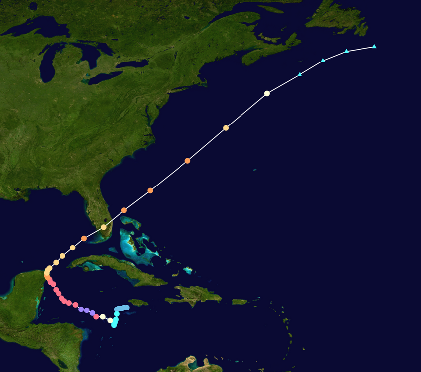
-
Not sure it's a tropical cyclone anymore lol. Where did the center go?
-
Is it really october if the long range gfs doesn't show a catastrophe for south florida?

-
September 20 Euro and GFS runs: no tropical development through October 6. lol at all the people saying the lid was gonna come off in the second half of September and early October. After Gabrielle that MDR is closed for the season, could still see a Caribbean/Gulf storm in October but this season will be a massive forecast bust.
-
Euro and GFS both showing nothing through September 20. Time to start bringing 2013 into conversation...
-
00z Euro and 06z GFS are amazingly almost identical in the 240-360 hour range. Both crush the bahamas and then ride up the southeast coast.
-
18z euro ensembles are quite interesting

-
18z Euro: significantly weaker, slower, and further south than 12z. Maybe a trend?
-
Yeah, last year Beryl skyrocketed ACE in early July but then it pretty much flatlined until late September when Helene showed up.
-
No. Anywhere from Atlantic Canada to the Mexican Gulf coast should be on alert for this potential storm that hasn't even splashed down from Africa yet. No one location should be on any higher alert than another.
-
Euro hour 360, just saying that crazy GFS hour 384 image has model support...
-
51 knots a little closer to the center. Should be an upgrade to at least 45 mph, maybe 50? Seems to be overperforming since the beginning. Wouldnt be surprised to see it become a high end TS, maybe 70 mph.
-
Impressive area of convection formed this morning. This looks a lot more like a tropical storm than most other early season slop I've seen. If it holds up it can easily overperform the models.
-
We've got like 4 straight days of GFS runs showing a storm forming next weekend in the Caribbean with no other model support. This will be a huge win or a huge fail for the GFS.
-
I'm just gonna use my non-scientific mind and say you guys are arguing over something that has very little to do with the overall season. Yeah, I am truly on the side of thinking that the SST has minimal impacts on the overall season. I've learned over the last handful of years that bigger atmospheric things matter so much more... dust, wind shear, stability, latitude of the african waves, etc. You can have burning hot ocean temps but if those other things aren't there, you're not gonna get hurricanes. I think we just look at SST because it's so easy to measure while those other things are not. But whether we're talking about average SST, just above average, or well above average, I don't think that matters as much as you guys think it does. Just my opinion...
-
Just gonna chime in to this conversation and point out that talking about the number of named storms is kinda stupid when discussing hurricane season in terms of both impacts to the general public and interest to us for tracking purposes. It's like when a tree falls in the forest and no one's around. Does anyone really care about a weak tropical storm that never makes landfall? Take 2017 for example... it had 17 named storms, higher than average but nothing too crazy, yet it was the most impactful year on record and had some of the most interesting storms ever to track (looking at you Irma). Then you have 2020 which had 30 storms and even though it was impactful because basically every hurricane hit land, it still didn't even crack the top 10 ACE seasons. Just seems a little futile to be arguing about the number of named storms.
-
Seems like modeling at this point is pointless. We know it's gonna head west towards the Honduras coast. Whether it hangs out just off shore or just on shore will make all the difference with the rest of the track, and I don't think there's any way to know for sure until it gets there. It's kinda pointless to say GFS shows nada (after getting shredded by the Honduras mountains) or Euro shows a hurricane in Florida (after barely staying off shore), since those scenarios are entirely dependent on the miniscule track errors of land interaction.
-
So 2024 already has the earliest cat 5 on record. Anyone know what the latest cat 5 is of now? Edit: nevermind, it was easy to look up. There's only been one cat 5 ever in November on record. 1932 Cuba hurricane was a cat 5 on November 6. So this could break that record if it does reach that intensity.
-
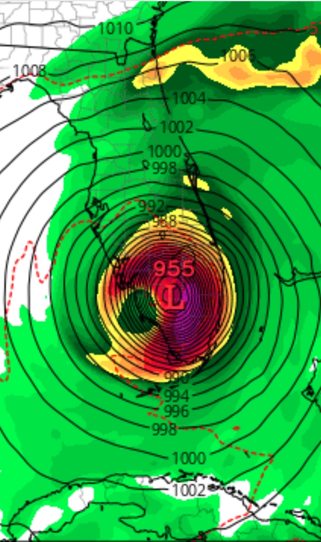
If that were to verify it would still bring a 980 mb eye over downtown Miami. That would cause quite a mess.
-
2024 Atlantic Hurricane Season
cptcatz replied to Stormchaserchuck1's topic in Tropical Headquarters
GFS isn't on an island with this next possible one. Today's 12z CMC shows a banafide storm and EPS shows a solid signal. -
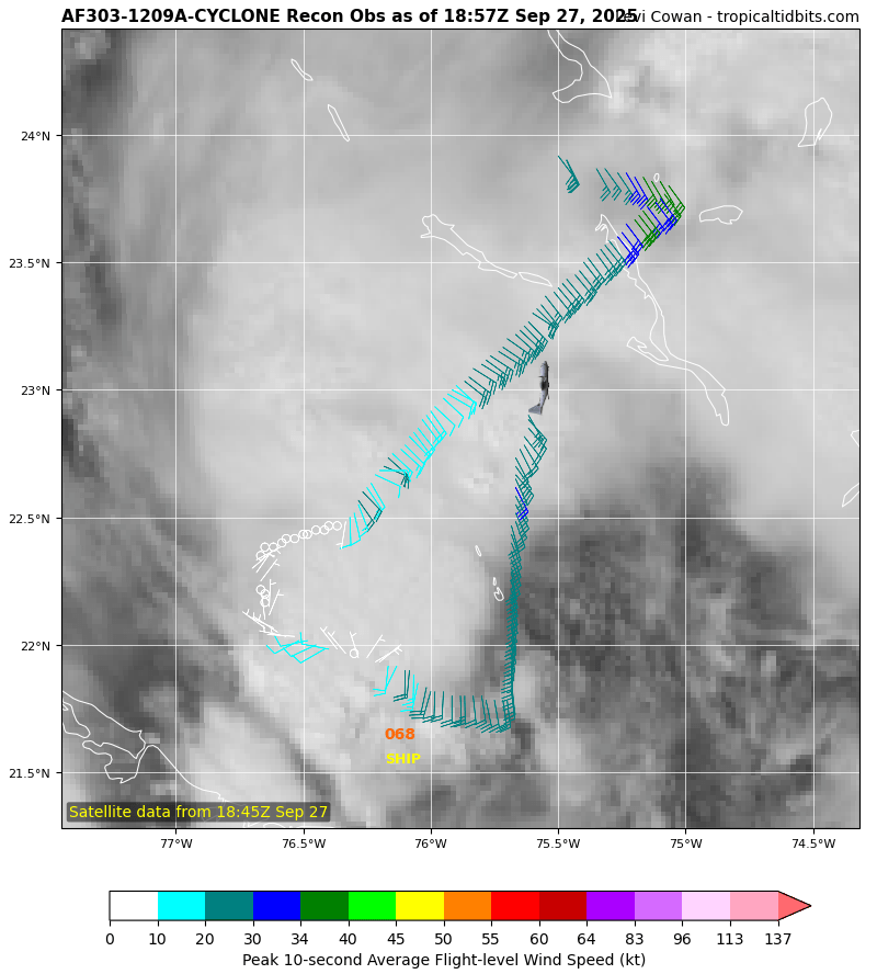
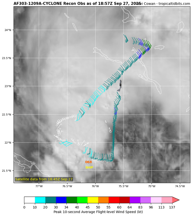
Recon just got 956 mb. Waiting for that new east side winds. Thinking cat 3 after it makes the pass.
-
2024 Atlantic Hurricane Season
cptcatz replied to Stormchaserchuck1's topic in Tropical Headquarters
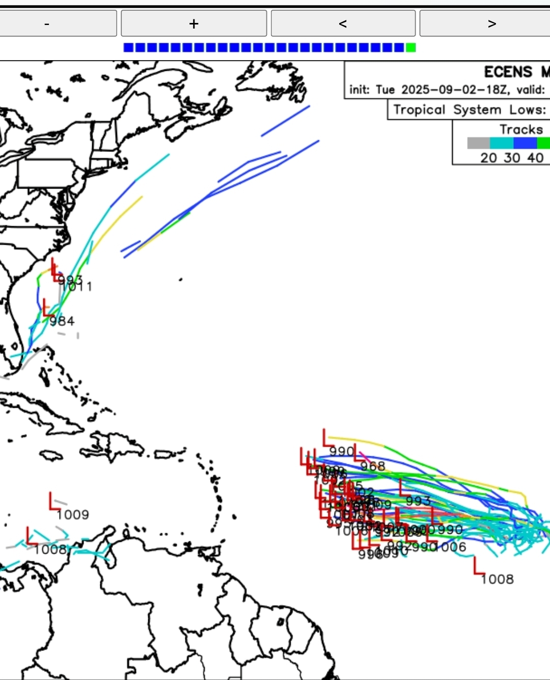
Crazy lack of certainty with this system. Looks like it's between either getting strung out and heading straight northeast through the Greater Antilles and out to sea, or it moves northwest through the Caribbean, into the GoM, and then cuts back across Florida. GFS has been showing the strung out northeast, GEFS seems to have a lot of members going into the GoM, Euro shows just a broad gyre, while many EPS members also show going into the GoM. Looks like Canadian and its ensembles also support the GoM track. Quite a significant difference in tracks with an already battered Florida in the path of one of them. -
I agree with NHC in that convection is not organized. Looks to be puffing some convection which then fades away and then puffs another.