largetornado
Members-
Posts
151 -
Joined
-
Last visited
Content Type
Profiles
Blogs
Forums
American Weather
Media Demo
Store
Gallery
Everything posted by largetornado
-
I really think they need an office for the northern plains, central plains, Midwest, and Dixie. All have those areas have their nuances with tornado forecasting
-
Did damage west of oakwood.
-
The daytime portion definitely busted. The nighttime portion still has time but we will see. Ohio warm fronts are bad news.
-
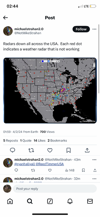
TDAY is down until further notice. Anyone chasing in that area will be critical to the early warning process as the lowest WSD88 beam is 5-7k ft in parts of Ohio.
-
Slight risk for D2. Little surprising
-
-
I definitely got ahead of myself. Runs today have significantly downtrended the northern end of the threat.
-
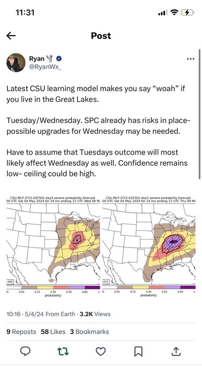
https://x.com/ryanwx_/status/1786761871485219061?s=46 Tuesday and Wednesday continue to look impressive With a decent EML advecting in, morning convection shouldn’t really pose that much of an issue. Per the nam, fairly discrete storms could be expected
-
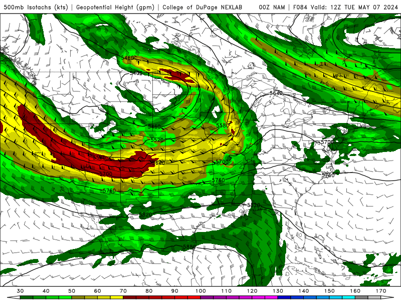
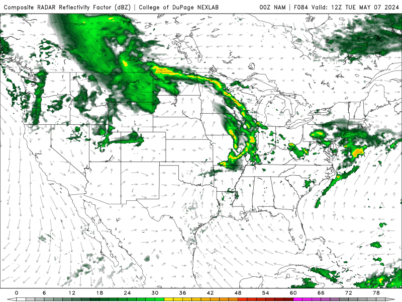
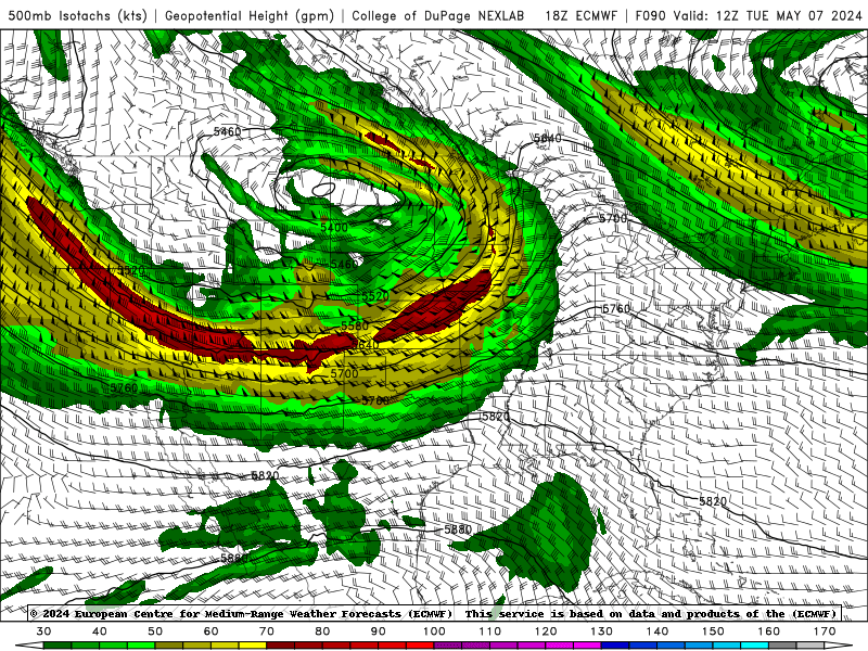
Tuesday is now coming into range of the nam. Looks like a stout MCS forms in the evening on Monday and rapidly moves east. Based on trends, I expect illinois to be rain free by 15z Tuesday. Also seems like a faster solution is more likely pushing the threat further east on Tuesday. 18z euro is a little bit more amplified and a little slower.
-
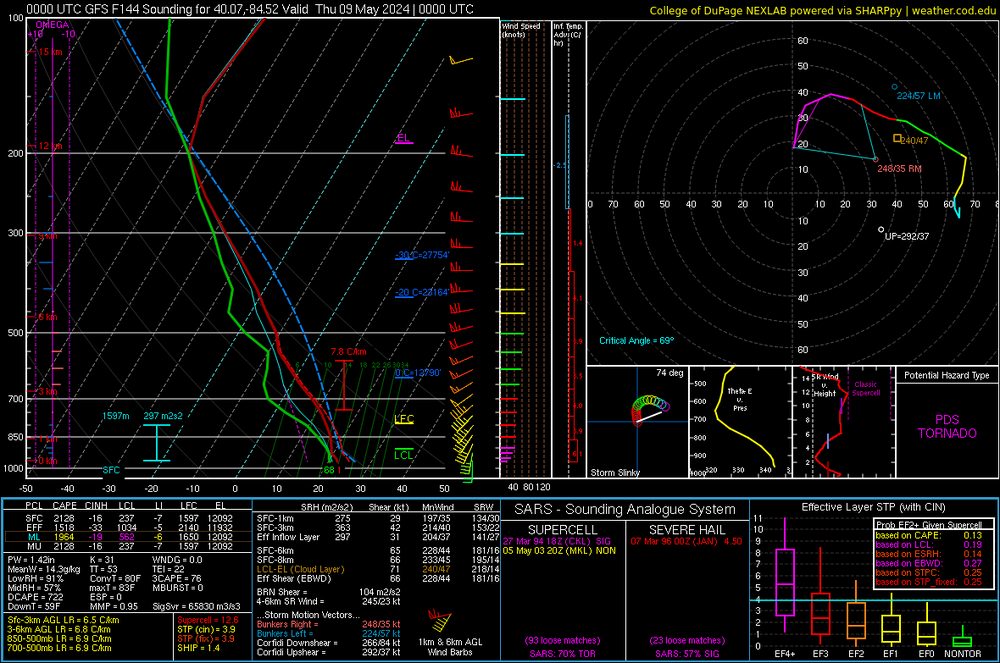
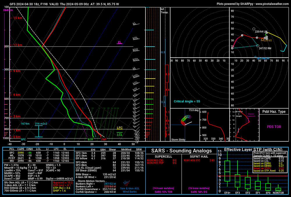
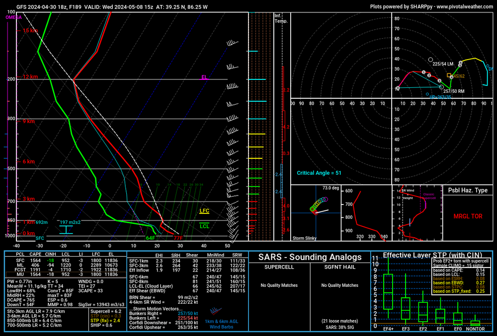
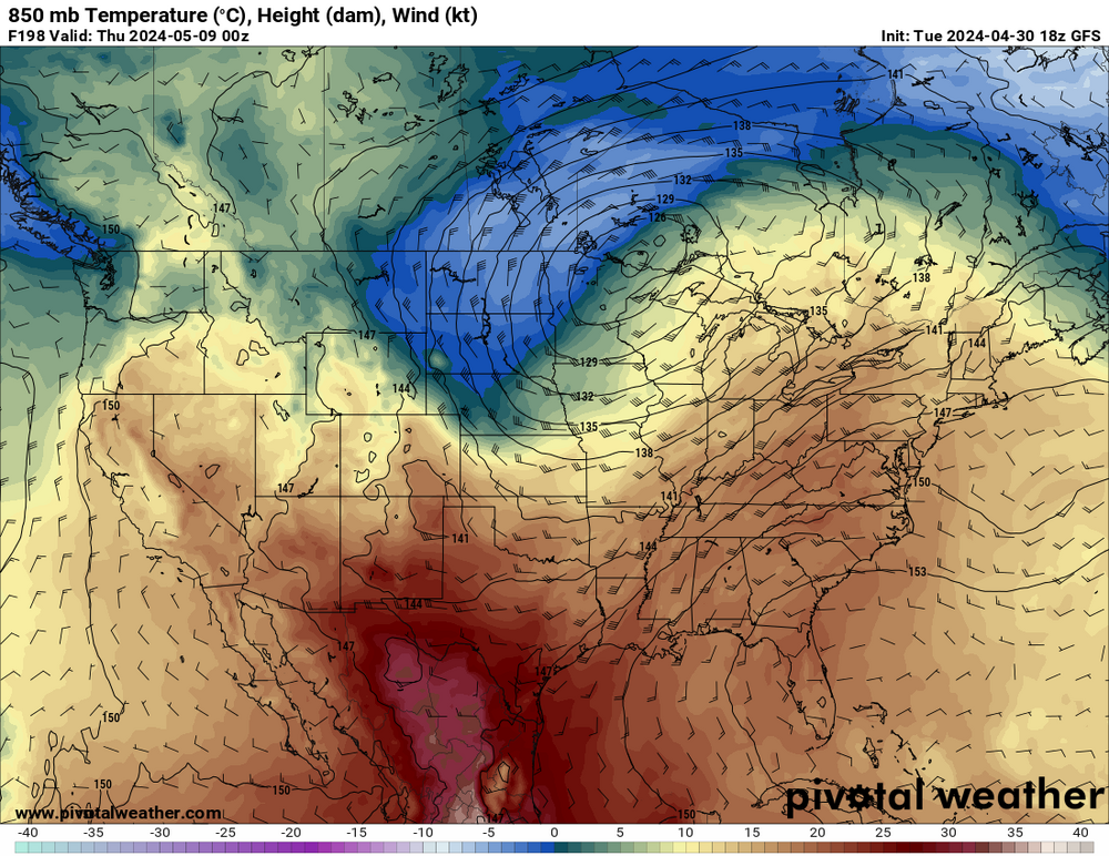
So there has been a consistent signal of severe weather for various portions of the subforum next week. Right now, Wednesday looks to be the day but Monday-thursday all show some potential. With multiple waves, it is going to be a complicated week. The only thing that we know at this point is that there will be more the sufficient upper level flow over a very favorable parameter space. Selected sounding is from west central ohio on wednesday. If this thread is premature, feel free to delete it.
-
2024 Short/Medium Range Severe Weather Discussion
largetornado replied to Chicago Storm's topic in Lakes/Ohio Valley
Surface winds look fairly backed. Care to post a sounding or two from the euro? -
2024 Short/Medium Range Severe Weather Discussion
largetornado replied to Chicago Storm's topic in Lakes/Ohio Valley
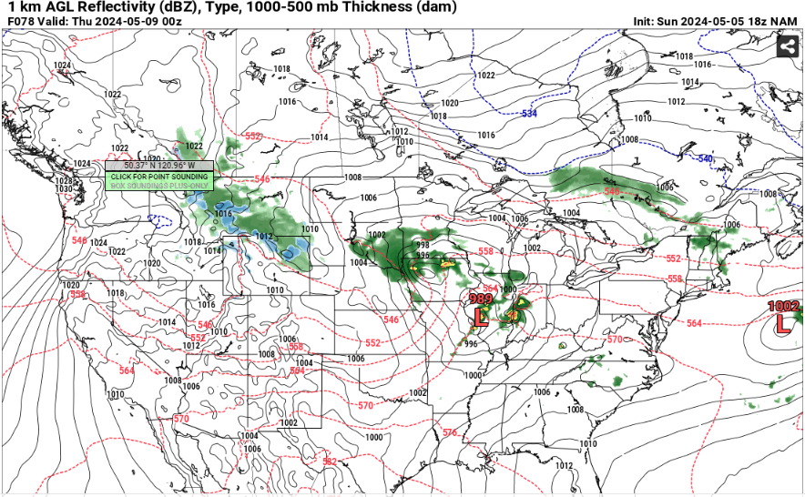
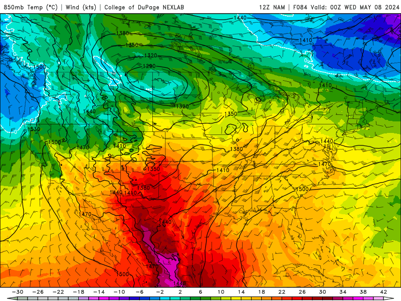
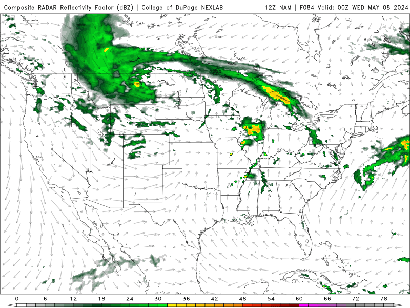
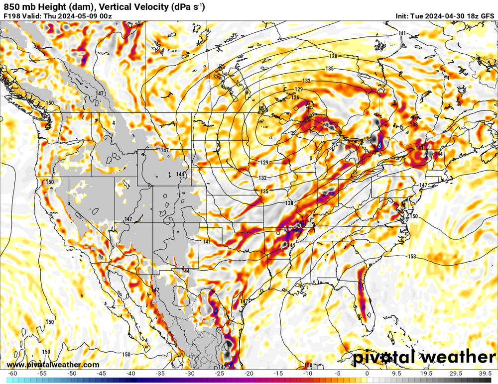
Next wednesday, 5/8 is worth keeping an eye. GFS is spitting out PDS soundings with limited precip in the morning. With an EML present at 15z and 850 temps remaining around 15-16c, storms would be fairly discrete. A little shortwave over Indy and plenty of forcing, could be a big day. The winds are a little more veered than i would like to see but with WSW flow at 500 mb, there is still some good directional shear present. -
There is a dry slot right out in front of these storms. Wonder how much that plays into it. Nothing to the east or south of existing storms has been able to sustain
-
4/1-4/2 severe threat (southern portion of subforum)
largetornado replied to largetornado's topic in Lakes/Ohio Valley
-
4/1-4/2 severe threat (southern portion of subforum)
largetornado replied to largetornado's topic in Lakes/Ohio Valley
Anyone know if the radars being down affect model inputs? (From my understanding, NWS offices can still see their radars but the feed is down.) -
4/1-4/2 severe threat (southern portion of subforum)
largetornado replied to largetornado's topic in Lakes/Ohio Valley
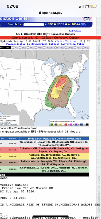
SPC sticking with the moderate with a massive hatched tornado risk Spc basically said ignore the nam . -
4/1-4/2 severe threat (southern portion of subforum)
largetornado replied to largetornado's topic in Lakes/Ohio Valley
-
4/1-4/2 severe threat (southern portion of subforum)
largetornado replied to largetornado's topic in Lakes/Ohio Valley
At this point, will the EML in Arkansas/Southern MO/TN be eroded by that ongoing convection or will it inhibit it? -
4/1-4/2 severe threat (southern portion of subforum)
largetornado replied to largetornado's topic in Lakes/Ohio Valley
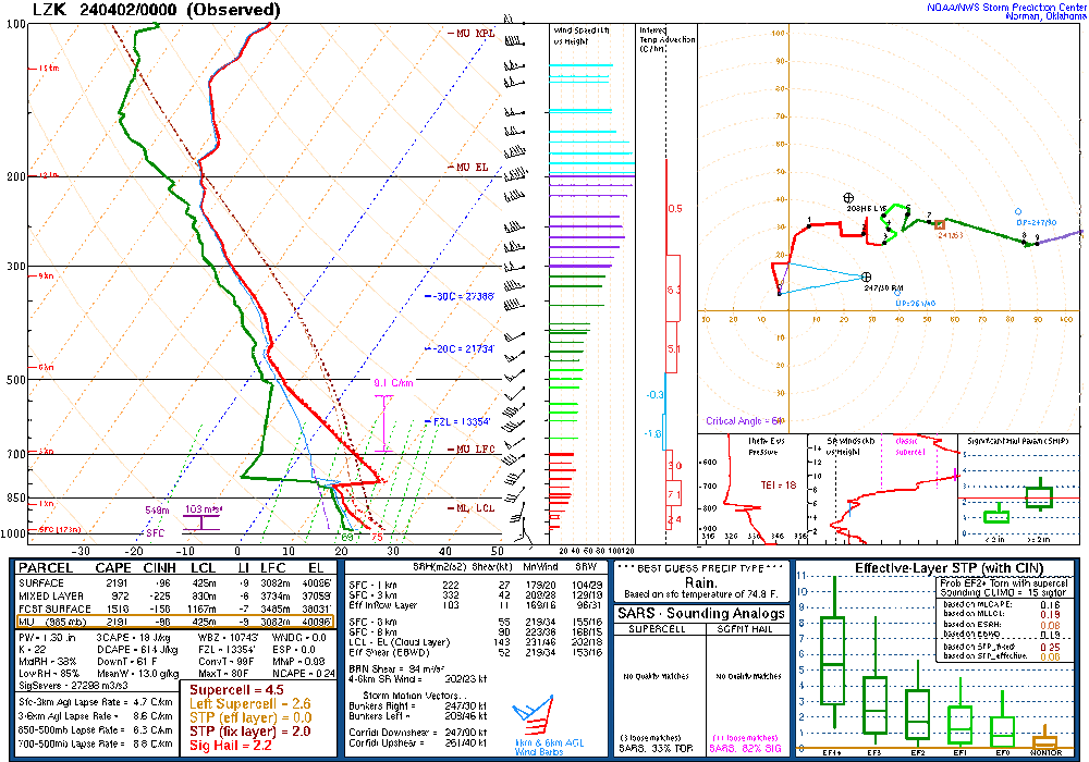
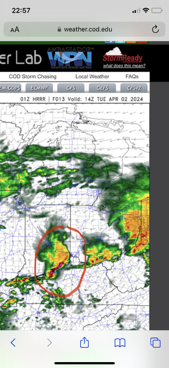
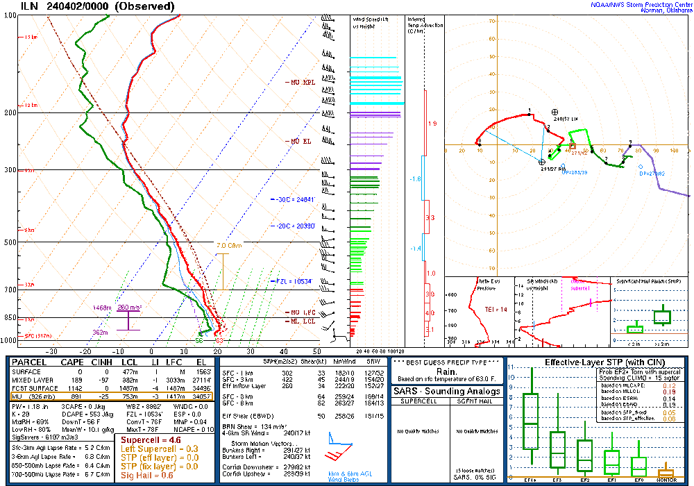
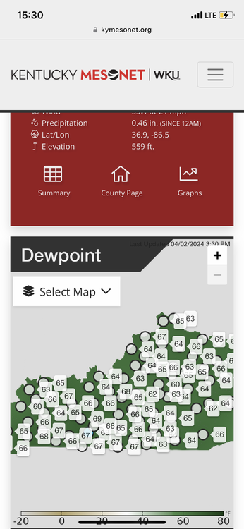
Yes from a messaging standpoint, this could be a mess. The miss earlier this month may or may not have played a part with the 15%. I would assume the afternoon outlook was late because there was a significant amount of discussion around the 15%. Realistically I think it’s a good forecast if the area circled in red does not materialize. If it does, the threat for Ohio would likely be significantly degraded. 0z sounding from ILN shows a minor inversion. Might prohibit some early morning convection? -
4/1-4/2 severe threat (southern portion of subforum)
largetornado replied to largetornado's topic in Lakes/Ohio Valley
Some disagreement between rap, hrrr, nam, and nam3k. It’s a wake up and see kind oF a day which is typical for the OV. -
4/1-4/2 severe threat (southern portion of subforum)
largetornado replied to largetornado's topic in Lakes/Ohio Valley
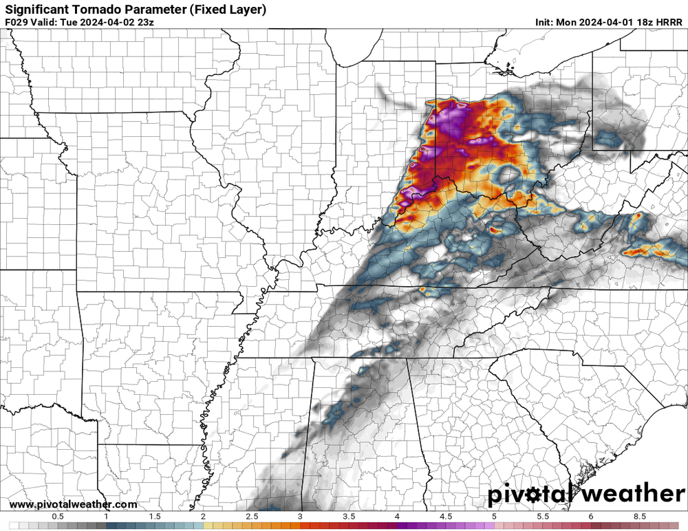
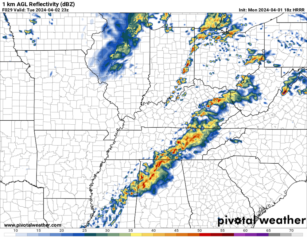
18z HRRR isnt backing down. Brings the threat more towards indy and reflectivity is showing a more discrete environment, with cells starting to grow upscale after crossing into ohio. -
4/1-4/2 severe threat (southern portion of subforum)
largetornado replied to largetornado's topic in Lakes/Ohio Valley
11/17/13 is only event i recall but the tor risk only extended into western ohio. 3/2/12 was mainly kentucky and SW ohio. For the entirety of ohio, nothing comes to mind.



.thumb.png.e8dac992c2652e532f5f0eeaead9c334.png)
