

Jrlg1181
-
Posts
290 -
Joined
-
Last visited
Content Type
Profiles
Blogs
Forums
American Weather
Media Demo
Store
Gallery
Posts posted by Jrlg1181
-
-
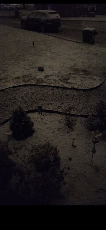
Snowing hard enough to overcome the wet asphalt...
-
 3
3
-
-
Snowing nicely temp at exactly 32.... 0.25 inch so far
-
3
-
-
Pretty obvious that the front just came through Waynesboro ... Quick gust of wind with a fast 3 degree temp drop in less than 5 min... down to 51
-
1
-
-
1.04 last couple days -- only the 9th inch plus event of the year... year to date total up to 26.80 now.... nice improvement over the last 10 days..
-
Finally a extreme drought designation for most of the Shenandoah Valley , centered over (surprise surprise)Augusta County & the central Blue Ridge... Was wondering when they were going to upgrade the drought status here... Just over 23.30 inches here in 10.3 months is wild or absurd for basically any locale in the eastern US...
-
 1
1
-
-
8 minutes ago, TSSN+ said:
Just the way winters have been trending. Also just get the feeling it’s not going to be amazing. Should be better than last year but, that’s not a high mark to beat lol. 2” would be 100% higher
If this does morph into a drier than expected winter following this year long severe drought we are in over here , with the corresponding large drop in ground water levels - The Shenandoah Valley and over toward Culpepper will be a massive agricultural disaster area going into the next growing season...
-
1
-
-
Down to 23 here , thought the jeep temp was wrong driving home from work , but no it really has reached 23 already - thermometer confirmed it..
-
Dropped to 18 here...
-
2 hours ago, stormy said:
You were very lucky! I received .53". 16% of normal.
0.49 right down the highway from you.... 23.28 year to date.... drought drought and more drought.!!
-
1
-
-
23.28 total for the year in my backyard - really does seem like western Kansas type of totals....
14.53 of that fell in 7 events which means about 62% of my yearly precip fell in about roughly 20 days with the late June cutoff low accounting for a full week of that....
Truly a spectacular year for drought here... !!!!!!!!!!!!!!!!!!!!!
-
0.15 here for a monthly total so far of 0.49..... Likely or almost certainly at this point will be the 2nd of the past 3 months with basically a half inch following August with 0.56....
-
0.08 for the event
0.34 for the month
May challenge August for the driest month
-
Looks like the central valley down here where the severe drought is raging will indeed be dry slotted for most of this event.... had hopes earlier in the week for some nice rain in this area but probably won't even get 0.10 if that...
-
36 degrees , damp and foggy - it's downright chilly out tonight...
-
1
-
-
11 hours ago, stormy said:
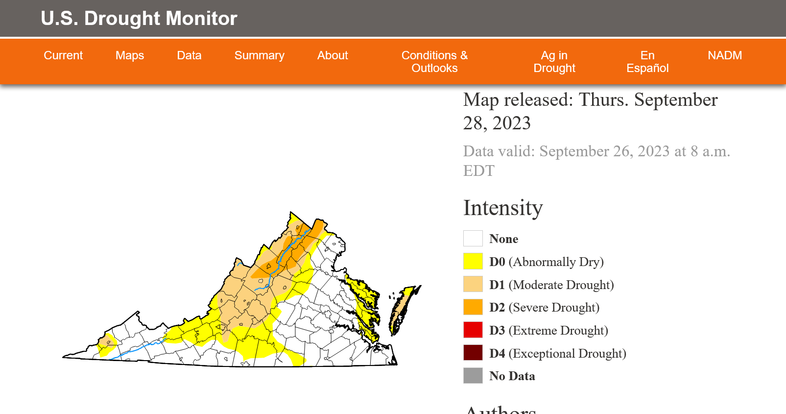
Severe drought expanded in the Valley last Thursday:
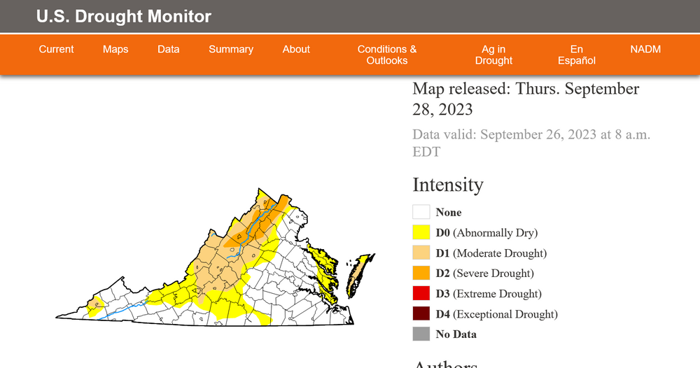
Grass may be greener , thanks to last weekends tropical moisture... But it's clear this area is in a serious drought.. Without knowing the 6 month or calender year precip totals a visitor to the area would quickly realize the drought by just looking at the stream levels... I have only measured 22.8 for the year.... The ground water level has to be extremely low...
-
2.02 yesterday..... That gets September up to 3.27 .... The wettest month for us by far since June..
-
2
-
-
3 hours ago, Jebman said:
If you squint your eyes and try real hard, you could almost imagine that it is wind blown heavy snow.
Absolutely was thinking the same thing, it was nearly whiteout conditions without much or any wind within that bowling ball core , but man the rain was intense....and accidents every mile or so on both 64 and 95.... bad day to be a trooper or tow driver.... Back home here in the desert in northern Waynesboro- just about to 2 inches. Which is more than the last 60 days combined and that includes a nice soaking earlier this month....
-
1
-
-
Now this is torrential rainfall , west bound out of Richmond on 64

-
8
-
-
35 minutes ago, Jebman said:
That pinwheel in central VA is gonna baste some communities with a good amount of rain. It's spinnin' like a buzzsaw and loaded with torrential tropical rain. Someone is gonna get demolished.
Leaving Cville in the company truck for a quick trip to our Richmond center like every Saturday. . Guess I will get to see what that pinwheel core is all about...
-
18 minutes ago, Roger Smith said:
About to become Ophelia, TS could approach cat-1 intensity by 18z before landfall e NC, an over performer can be expected, I believe, in terms of rain, wind and surge, especially rain. Parts of VA and central MD, even se PA, n/c NJ could see flooding rainfalls of 6-10 inches. Axis of heavy rain RIC to IAD to 50eCXY to 30nw EWR ahead of and to west of advancing low center. Model QPF seems a bit displaced to east of where climatology suggests, along and just west of track of low. Slight tornadic risk Delmarva and s NJ on Saturday as storm becomes extratropical and fronts rotate around it.
Don't want no damage path of any type with this storm system , but we desperately need a steady soaking in the central Shenandoah Valley of VA .... 1.81 in my backyard since August 1st.... severe drought designation now by Noaa...
-
On 9/19/2023 at 7:48 PM, stormy said:
You and I both! It has been 2 months since I received 1 inch from one system.
I received 7.39" from Fran on Sept. 6, 1996. Big Meadows up on the Skyline Drive received 15.61 inches in 24 hours.
That's about what I picked up in western Albemarle from Fran, received more from Fran than Isabel 7 years later... although I think there was a 20 inch total somewhere near Montebello Blue Ridge Parkway during Isabel ...
-
This weekend for us in the central valley will likely be the ultimate suckerpunch as we watch tropical rains move up I95....
Jan 1.53
Feb 3.09
Mar 1.39
Apr 3.63
May 1.48
Jun 5.10
Jul 2.73
Aug 0.56
Sep 1.25
Ytd. 20.76
-
With the northern valley now getting more consistent rainfall , the drought bullseye seems to focusing on Augusta and Rockingham.... heavy rain to our west that won't move east , rain to our north and now heavy rain developing to our east and moving up 29 toward cville....
-
Looks like another wet forecast down here that dosent materialize....Still have the afternoon to go but rain just seems to disappear just before it gets here... 0.03 and breezy here... Thankfully we got 1.25 last weekend ... 2.20 since July 20th...


12/10-11 Disco / Obs - Rain/Snow/Wind Event
in Mid Atlantic
Posted
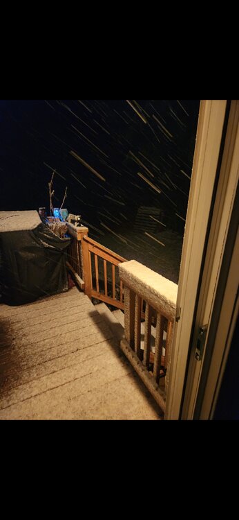
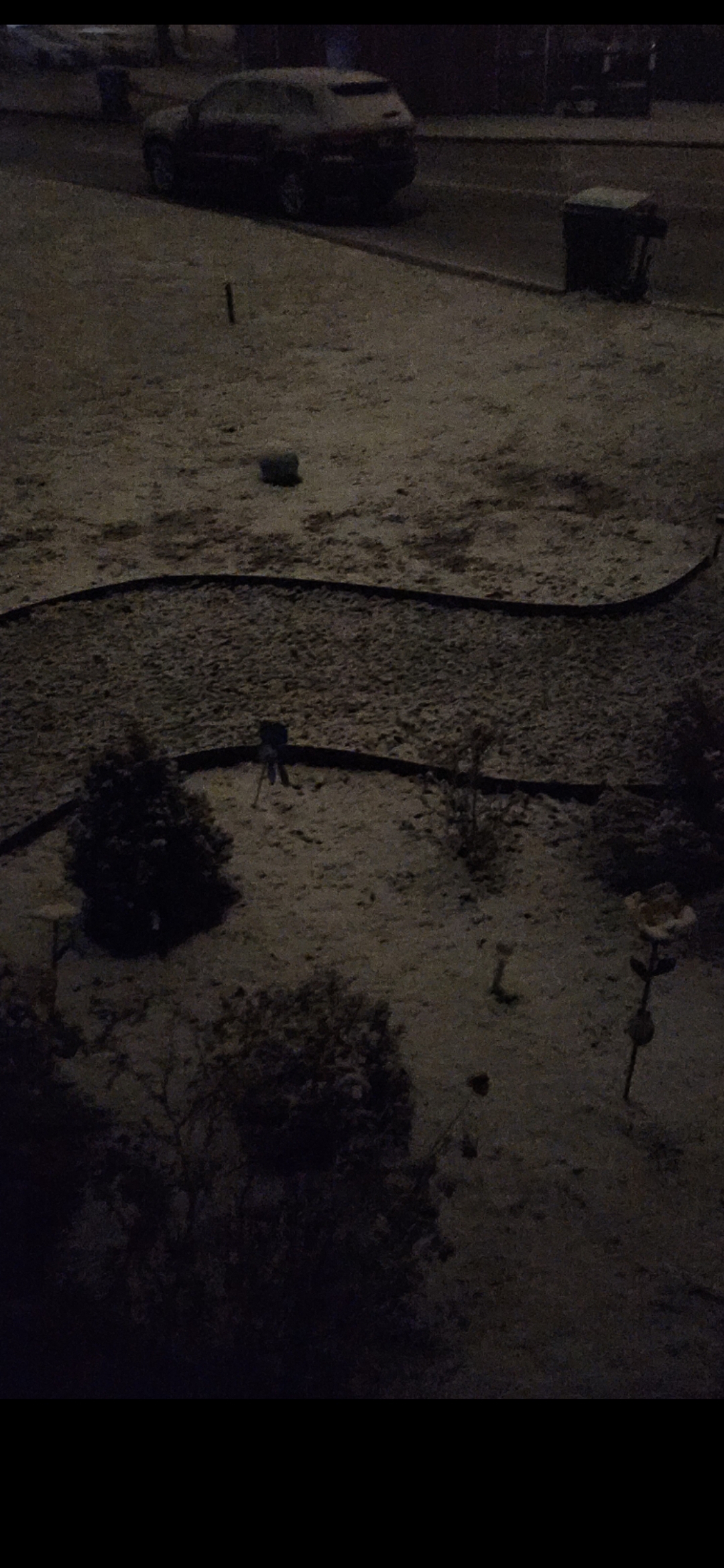
Not bad, real pretty out tonight.... Very large flakes..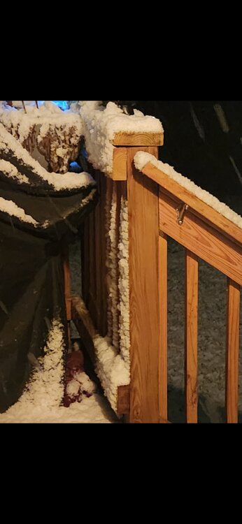
Just passed the 1 inch mark...