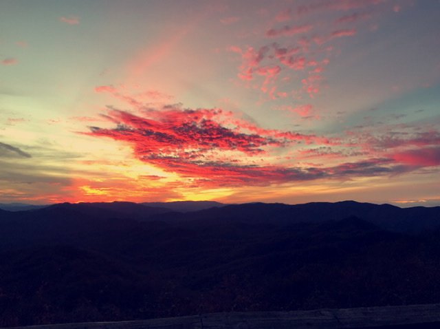
Sw NC weather
-
Posts
523 -
Joined
-
Last visited
Content Type
Profiles
Blogs
Forums
American Weather
Media Demo
Store
Gallery
Posts posted by Sw NC weather
-
-
26 minutes ago, franklin NCwx said:
As we pickup 5 plus inches of rain over the next week
Rain comes easy in these parts, snow not so much. What part of the county are you in? I’m in the upper part of Cowee.
-
24 minutes ago, franklin NCwx said:
Still a dry slot showing up on the 12z models for the southern mtns. Amazing we can have 80-100" of rain fall almost every year, but it's a struggle for 1" of that to fall as snow
Models seem to struggle with deform bands / dry slots. So who knows we definitely still have a chance for a 2-4” event to happen down this way. With that being said it’s probably dead right and will be lucky to get a dusting.
-
 2
2
-
-
Winter storm watch hoisted for 4-10” and a glaze of ice. Kinda surprised Gsp went that high.
-
1
-
-
1 minute ago, franklin NCwx said:
I don't believe the ice, most likely rain to snow
Totally agree, Ice is very rare down this way. Usually rain or snow like you said.
-
1 minute ago, franklin NCwx said:
Looks similar to its 12z run. Fun just starting at 60 with the negative tilt
Still turns into a good back end snow. 1/2” of ice to start with for us.
-
1 minute ago, Sw NC weather said:
Looks like Nam is gonna be similar to the Euro
Maybe not looks like a lot of mixing early on.
-
Looks like Nam is gonna be similar to the Euro
-
Hopefully the Eps will follow the Op and it should be game on.
-
Just now, wncsnow said:
Yep it bloomed late
I could be wrong but I don’t think qpf is gonna be a problem with this system. Now temps could become a issue.
-
Just now, wncsnow said:
It doesn't have as much qpf though. If you lose moisture you lose dynamic cooling
Plenty enough if all snow this run is gonna be 8”+ for the mountains
-
Just now, Met1985 said:
Yeah euro has trended weaker and further east a bit.
Looks like we’re gonna get a good walloping on this run. All snow.
-
Euro is looking better so far. Starting out as snow at hour 66.
-
Nam with a different solution but still ends up being 4-8” for all the Mnts.
-
Here’s to a fun day of tracking. Remember we’re gonna have wobbles back and forth, just enjoy the ride.
-
3
-
-
24 minutes ago, Met1985 said:
Yeah by this for sure but im very suspect of any great snowfall outside the mountains.
CMCE look a lot more realistic more of just a mountain camp with totals similar to gefs in the 2-5” range.
-
2
-
-
CMC is another solid hit for most of WNC
-
2
-
-
Gonna be a solid hit from Balsam east this run.
-
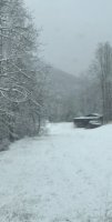
Had around 1/4” on elevated surfaces in Northern Macon County, with a skift on the ground around 7:30. Nothing but off and on flurries in Franklin.
-
Reached 46 here, with quite a bit of melting today. North sides are still holding a good bit of snow though.
-
47 minutes ago, wncsnow said:
The way the long range keeps moving to warm, this could be the areas biggest snow of the season.
Very well may be, but we still have around 3 months of possible winter here in the mnts. Just be patient I’d still bet on a board wide hit before the end of the season.
-
1
-
-
Measured a few different spots and ranged from 4.5” - 5”. Not bad at all considering no forecast was more than 2” here.
-
8
-
-
Seems like intensity might be picking up again. Hopefully it’ll last into the morning.
-
2
-
-
19 minutes ago, WxKnurd said:
You are piling it up down there! Makes me wonder what I’m gonna be coming home to. Where are we at @Met1985
Really come down from 4-7 this evening. Didn’t have any accumulation before then.
-
4
-
-
Right at 4” now should make a run for 6-8”.
-
5
-
2022-2023 Fall/Winter Mountains Thread
in Southeastern States
Posted
Light sleet falling in Northern Macon.