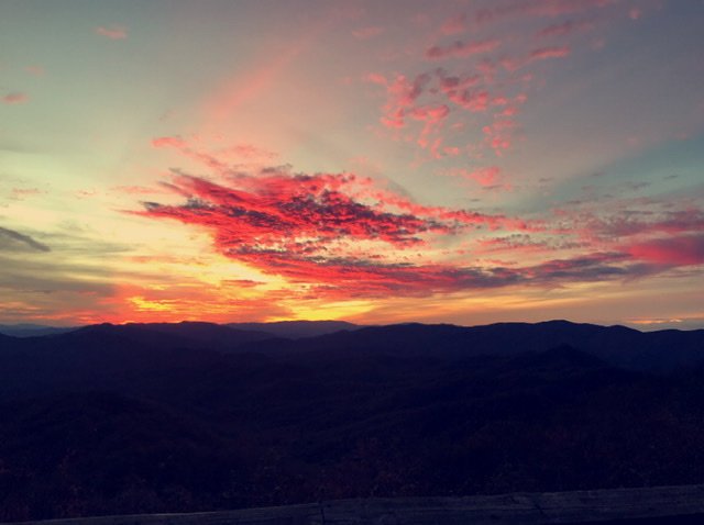
Sw NC weather
-
Posts
523 -
Joined
-
Last visited
Content Type
Profiles
Blogs
Forums
American Weather
Media Demo
Store
Gallery
Posts posted by Sw NC weather
-
-
Icon made a south shift as well at 0z. Hopefully the gfs and euro hold steady here shortly.
-
Not quite where we want it. But a clear trend tonight so far.
-
 1
1
-
-
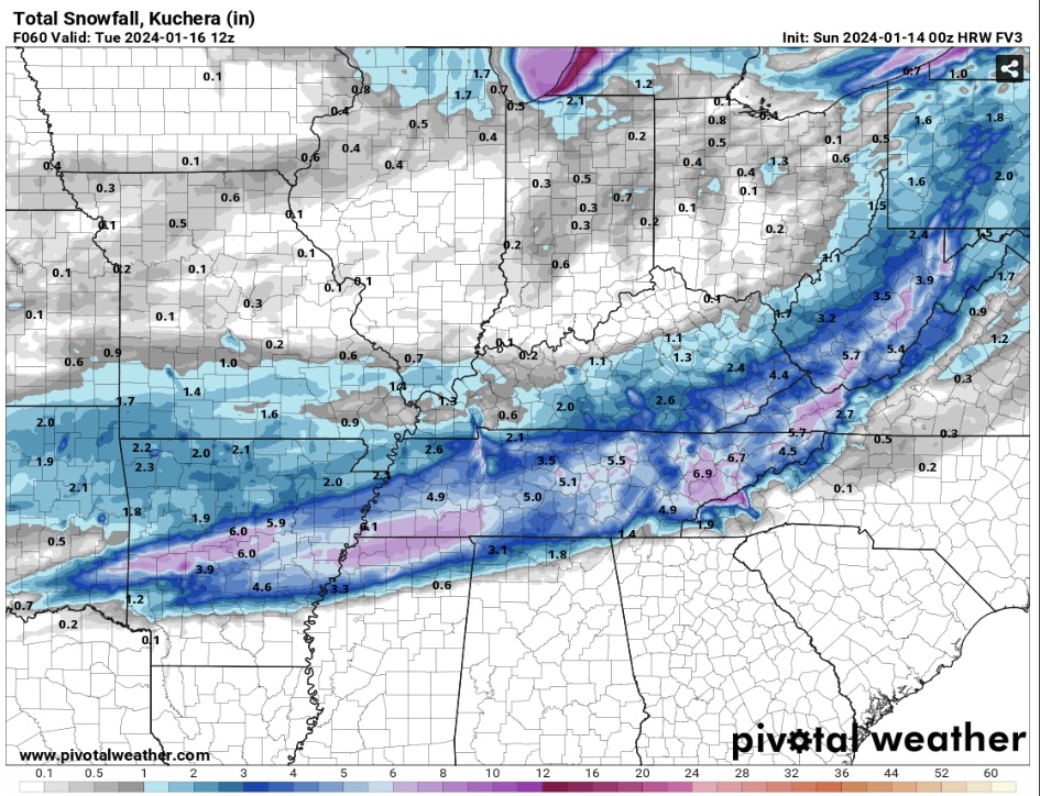
FV3 took a decent shift south as well. I’ll post snow map when it’s done running.
-
2
-
-
3 minutes ago, wncsnow said:
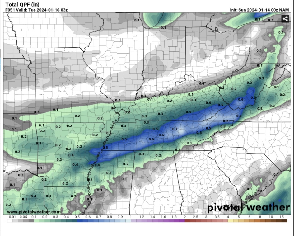
Hi Res NAM didn't come south at all really
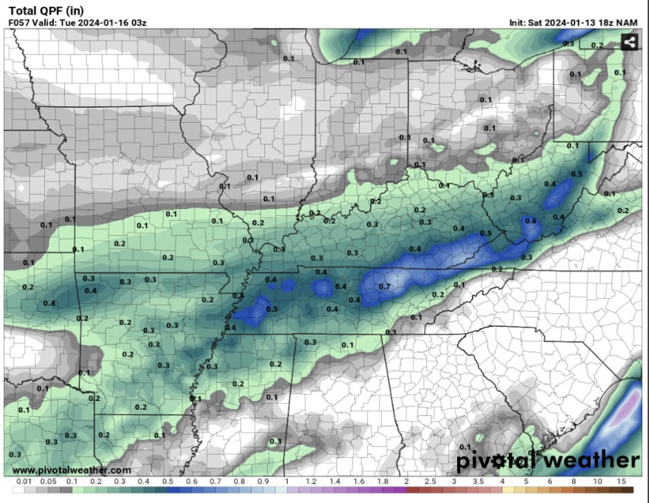
Looks like a small shift with precipitation maps, but not much. Getting late in the game one sides gonna have to start moving toward the other soon.
-
Ended up not being as big of a shift as shown early on. But still a decent south shift.

-
 1
1
-
-
1 minute ago, Met1985 said:
Honestly the hell with the NAM. It has sucked big time for our area recently. Just this week it was only showing like 2.2 inches for the area. A good 1.5 inches below what the gfs was showing. It's output for us has been very poor...
we may end up missing out, but I’m with you on the Nam. Heck at hour 30 it just made a 75 mile shift south. One more shift like that and it’s in line with the gfs and euro and will be looking good for 2-6” hopefully.
-
1
-
-
2 minutes ago, Met1985 said:
The NAM is going to be north again.
Still North but a sizable shift south from previous runs. I’m liking the trends of short range models coming more towards the globals.
-
Encouraging to see the HRRR shift south. Here’s total precipitation through hr 48. Moisture is still streaming through.
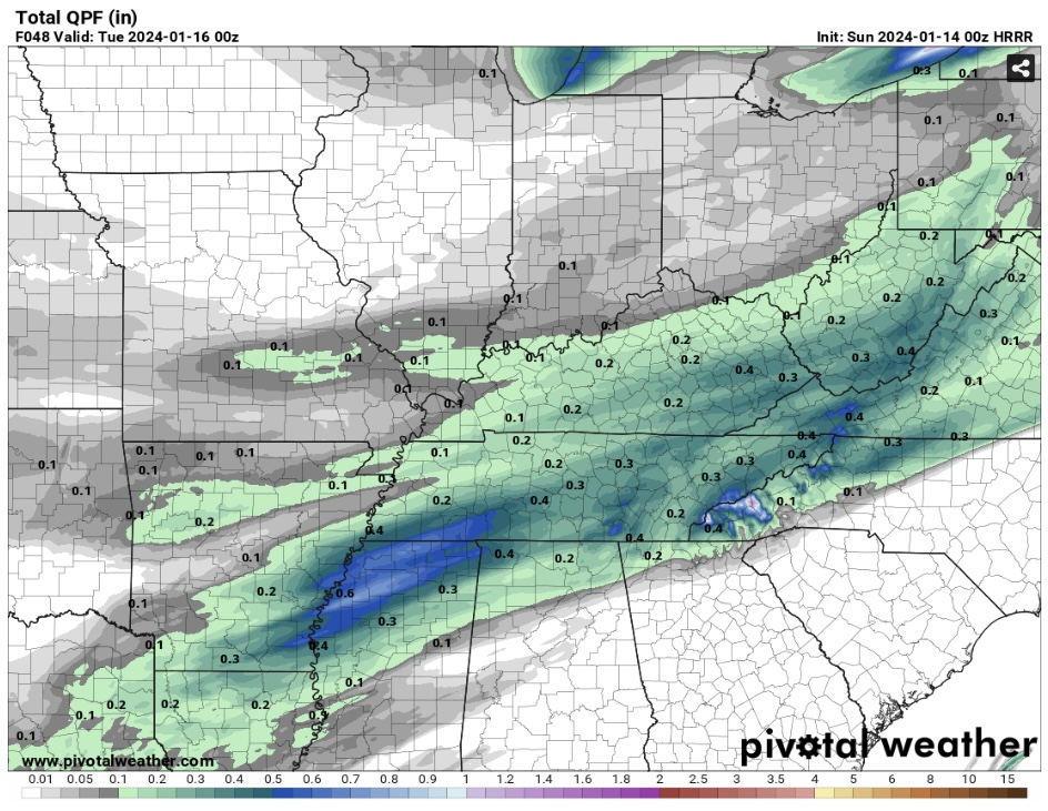
-
HRRR trended south. Shows mainly rain for WNC but I’m not worried about thermals at this time. Let’s get the moisture here.
-
1
-
-
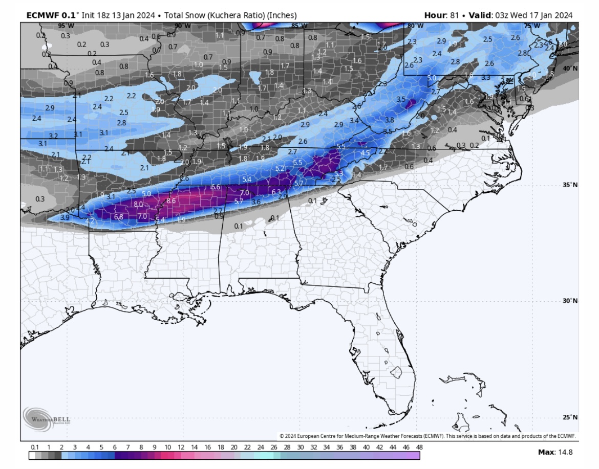
18z Euro is still good for most of us. Hard to believe we’re only 48 hrs out and there’s still so much uncertainty.

-
2
-
-
GFS ever so slightly north but not much through 48 hrs.
-
Does the Nam still have the bias of amping systems way to much?
-
Just now, wncsnow said:
Post it my friend
Are we allowed to post WB images on here?
-
1
-
-
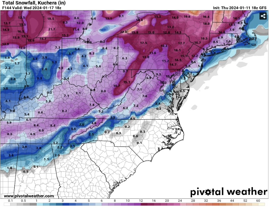
EPS with a nice uptick at 12z. Haywood west looks like a solid 3-5”. Let’s get the Nam on board and reel this thing in!
-
3
-
-
GFS keeps the good vibes going. 4”-8” for the southern mountains.
-
4
-
-
12z Nam didn’t get all the way to us, but definitely trended in the right direction. I don’t see GSP putting anything up till tomorrow morning unless things are looking great this afternoon.
-
25 minutes ago, BooneWX said:
@Hvward, I can’t remember how the models progressed during that Dec 2017 storm but do I recall it being basically a non-event until the short range came into view?
I believe that one trended back NW to us, but could be wrong. No need to get worried at this point we’re one 50 mile shift away from a 4-8” event for us.
-
3
-
-
No need to stress the wobbles guys. We’re only 30-50 miles from still being in the bullseye. I don’t wanna be there 5 days out anyways.
-
3
-
-
Trend has been our friend today! Hopefully we can keep it going.
-
5
-
-
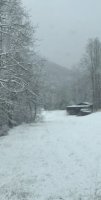
First dusting of the year down this way. About 1/2” on elevated surfaces.
-
4
-
-
Rain/Snow mix falling in Northern Macon County at 37 degrees. Maybe will drop below freezing and get our first dusting of the year.
-
4
-
-
Highlands Gorge just got shut down. Assuming a land slide. Water is out everywhere.
-
1
-
-
Minor flooding already occurring here in Macon county. Lots of rain still to come.
-
GFS took a step in the right direction for next weeks event. Still aways to go but it’s something to track atleast.
-
2
-
2023-2024 Fall/Winter Mountain Thread
in Southeastern States
Posted
Nam is still North. Crazy to see so much difference only 24 hrs out. Globals vs. short range models, let’s see who wins out. On a side note Hrrr has got close, one more shift and we would be looking good.