rockchalk83
-
Posts
400 -
Joined
-
Last visited
Content Type
Profiles
Blogs
Forums
American Weather
Media Demo
Store
Gallery
Everything posted by rockchalk83
-

"Don’t do it" 2026 Blizzard obs, updates and pictures.
rockchalk83 replied to Ginx snewx's topic in New England
Lurking here, but according to NWS Boston, it sounds like Providence has bested the Blizzard of ‘78 with 32.8”! 16.5” coming in the last 6 hours!
-
MO/KS/AR/OK 2025-2026 Winter Discussion
rockchalk83 replied to stormdragonwx's topic in Central/Western States
It does look like we'll get back to a stormier period once we get past the 10th of the month. Still TBD on the degree of cold air, but the Euro has been driving the bus on the potential for a stratospheric warming event mid-month. Been following Brian Bledsoe, who is a retired chief met from a TV station in Colorado Springs, and he has a podcast that discusses the upcoming pattern and the change to El Niňo. It's a very interesting watch/listen: -
MO/KS/AR/OK 2025-2026 Winter Discussion
rockchalk83 replied to stormdragonwx's topic in Central/Western States
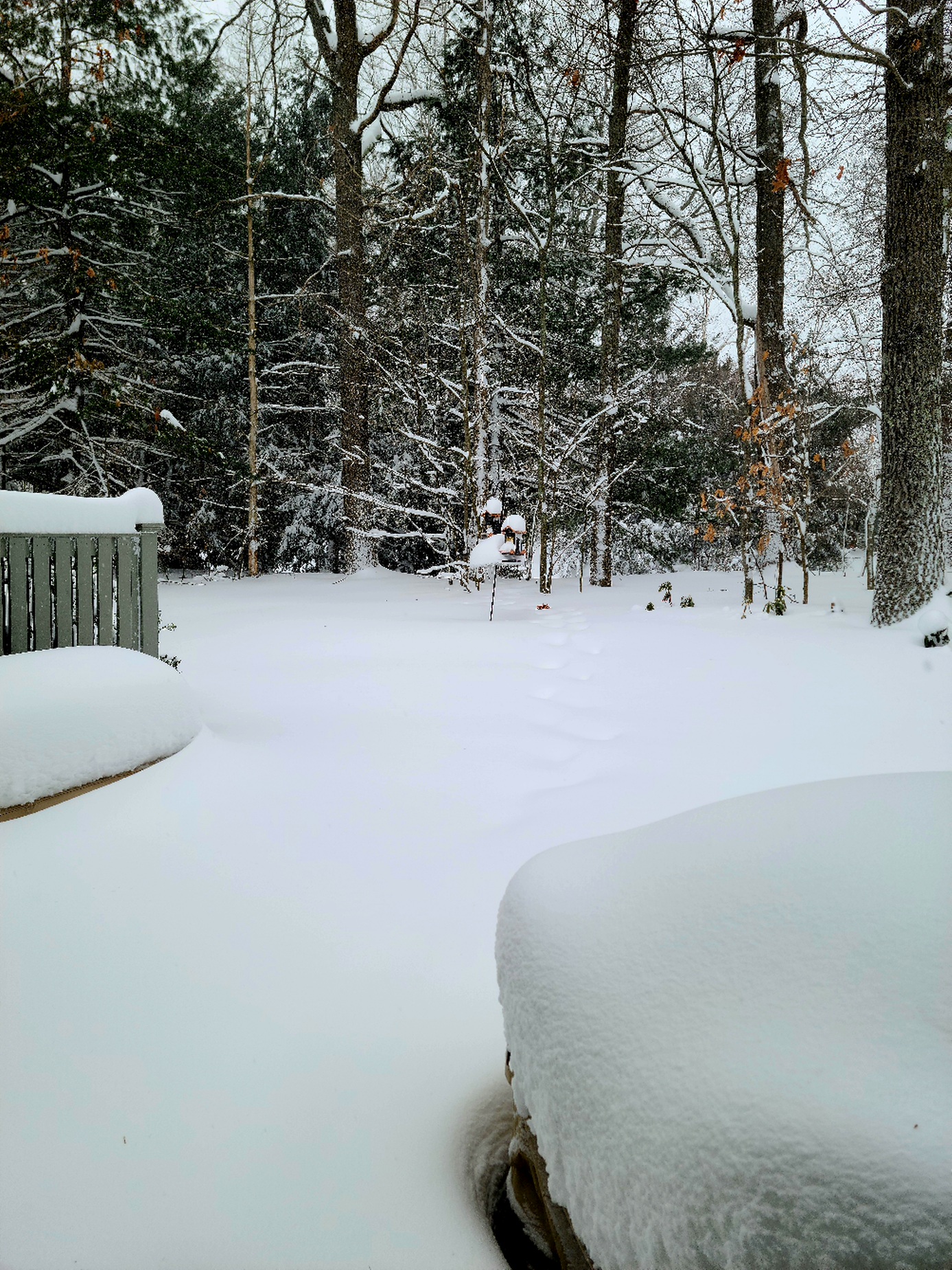
We finished with 7" officially at Eisenhower National Airport (ICT). I measured 7.5" outside of my house. Not the 12-20" that were progged Thursday night, but still a solid storm system with about 1/2 inch (liquid equivalent) of much needed moisture. -
MO/KS/AR/OK 2025-2026 Winter Discussion
rockchalk83 replied to stormdragonwx's topic in Central/Western States
I will say, the HRRR has been absolute trash this whole time. -
MO/KS/AR/OK 2025-2026 Winter Discussion
rockchalk83 replied to stormdragonwx's topic in Central/Western States
Farther west in SC KS, the snow has persisted most of the day, when models had shown a period of dryness. Call me crazy, but I think that bodes well for us when the main energy emerges later this evening and into Sunday morning. -
MO/KS/AR/OK 2025-2026 Winter Discussion
rockchalk83 replied to stormdragonwx's topic in Central/Western States
Feels like Lucy pulled the football back on us in S KS overnight. We went from sharing in the big totals with you guys to the southeast, to having 6-8 inches. Hoping for a slight northward trend, but I think the models finally have a good grasp on the Arctic air and track of the second wave, so it probably won't happen. Bummer. -
MO/KS/AR/OK 2025-2026 Winter Discussion
rockchalk83 replied to stormdragonwx's topic in Central/Western States
That's the million dollar question. I wonder if @andyhbor @JoMowould be able to shed some light on this? -
MO/KS/AR/OK 2025-2026 Winter Discussion
rockchalk83 replied to stormdragonwx's topic in Central/Western States
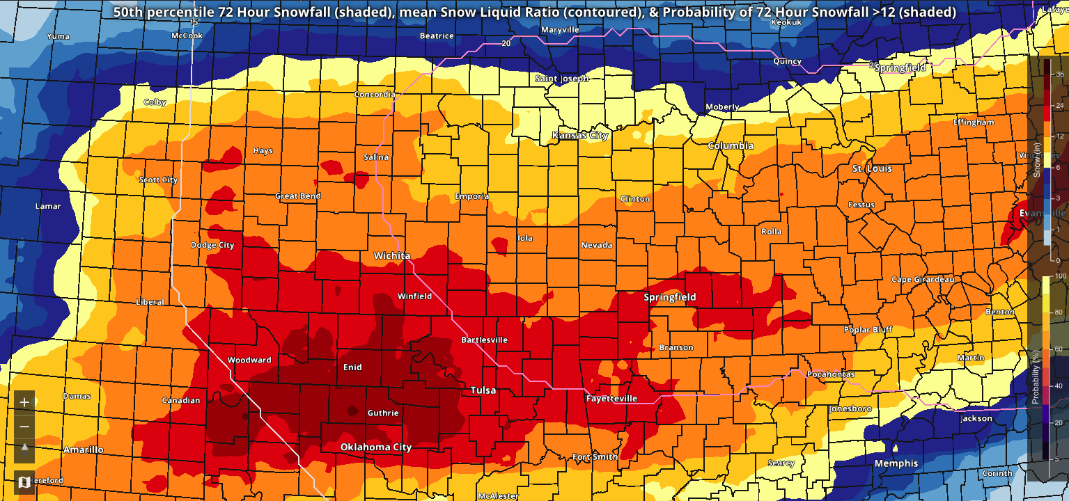
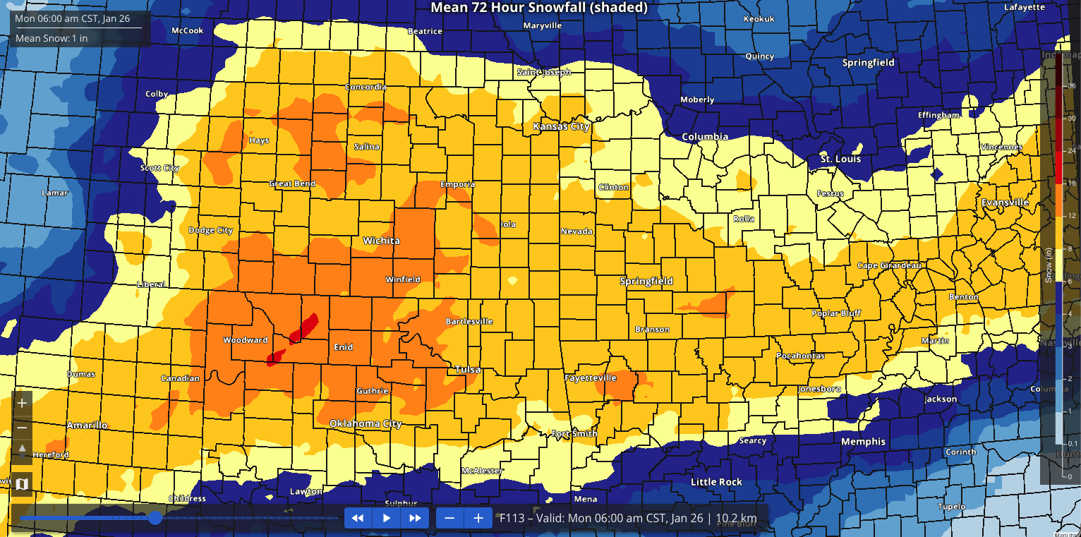
This is the 01z 72-hour 50th percentile snowfall off the National Blend of Models. This is a significant bump up from the 19z run. The red area is 24-30 inches NW of OKC, the reddish orange area is snow totals of 18-24 inches, orange is 12-18. Goodness.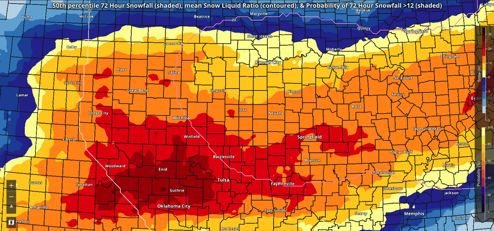
-
MO/KS/AR/OK 2025-2026 Winter Discussion
rockchalk83 replied to stormdragonwx's topic in Central/Western States
The huge upshot to all this is that there will be some significant drought relief. -
MO/KS/AR/OK 2025-2026 Winter Discussion
rockchalk83 replied to stormdragonwx's topic in Central/Western States
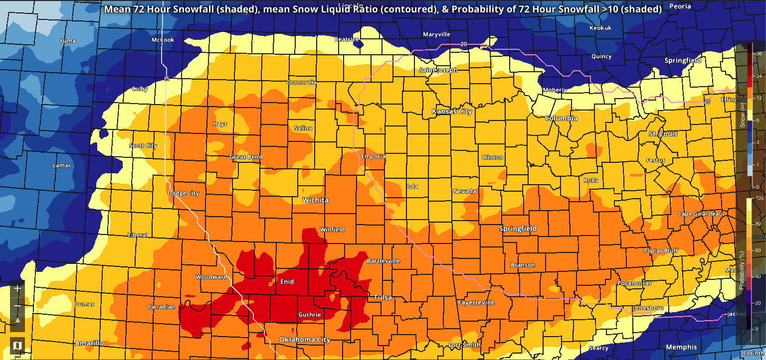
This is the 19z 72-hour mean snowfall off the National Blend of Models. There has been a bump up of this as we've gone through the day. The red area is snow totals of 18-22 inches, orange is 12-18.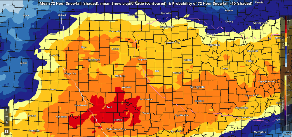
-
MO/KS/AR/OK 2025-2026 Winter Discussion
rockchalk83 replied to stormdragonwx's topic in Central/Western States
That's fair. Forgive me, but I haven't been looking up there. I've been too busy rooting for the NAM. Haha -
MO/KS/AR/OK 2025-2026 Winter Discussion
rockchalk83 replied to stormdragonwx's topic in Central/Western States
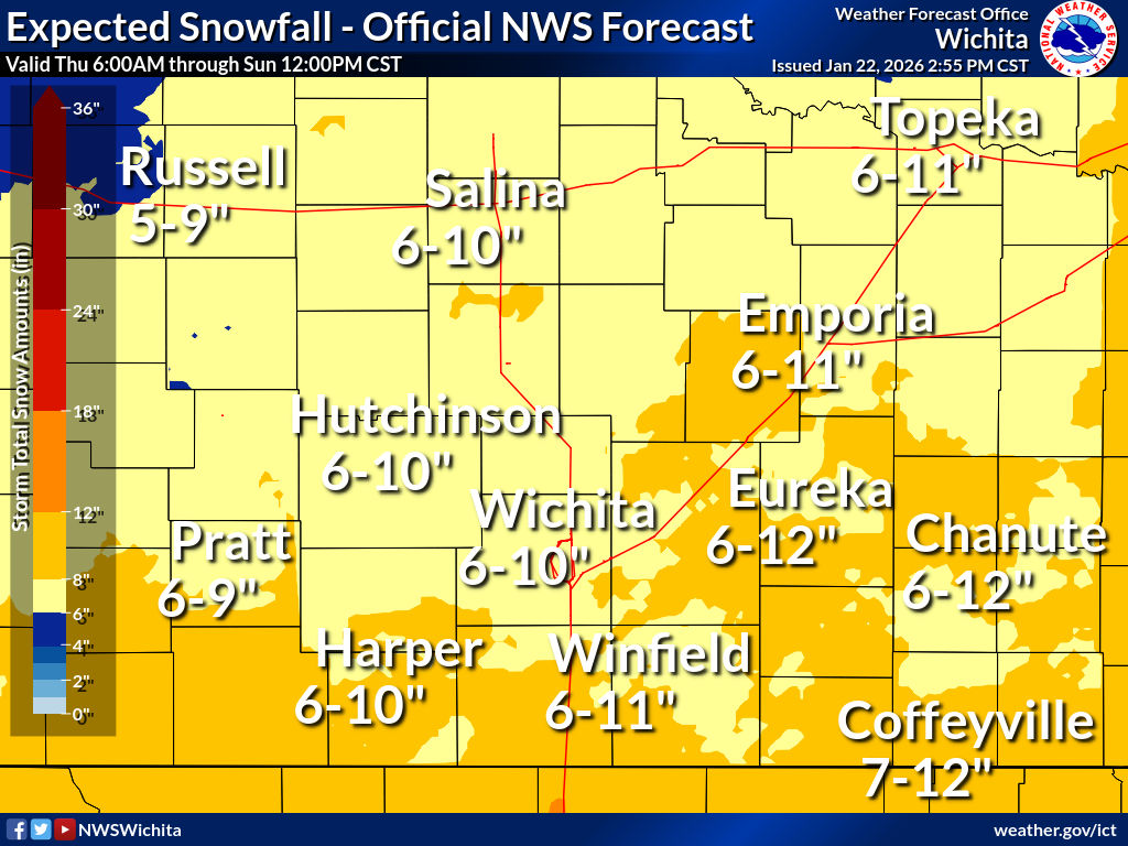
Here is the Wichita NWS office's forecast:
-
MO/KS/AR/OK 2025-2026 Winter Discussion
rockchalk83 replied to stormdragonwx's topic in Central/Western States
There was? The 18z still pumped out close to one foot here in Kansas:
-
MO/KS/AR/OK 2025-2026 Winter Discussion
rockchalk83 replied to stormdragonwx's topic in Central/Western States
-
MO/KS/AR/OK 2025-2026 Winter Discussion
rockchalk83 replied to stormdragonwx's topic in Central/Western States
That's a CYA forecast if I've ever seen one.... -
MO/KS/AR/OK 2025-2026 Winter Discussion
rockchalk83 replied to stormdragonwx's topic in Central/Western States
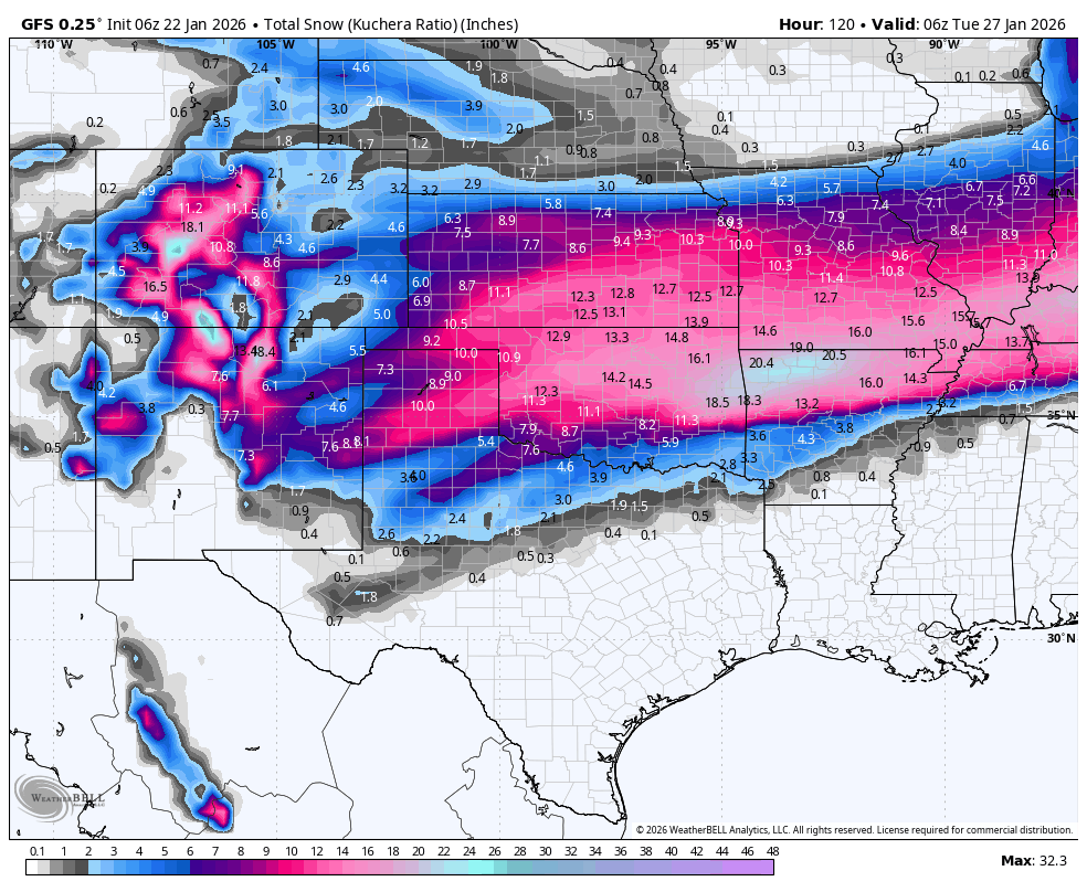
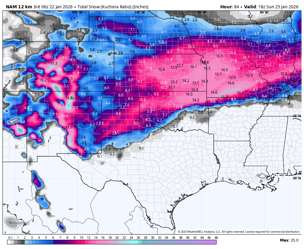
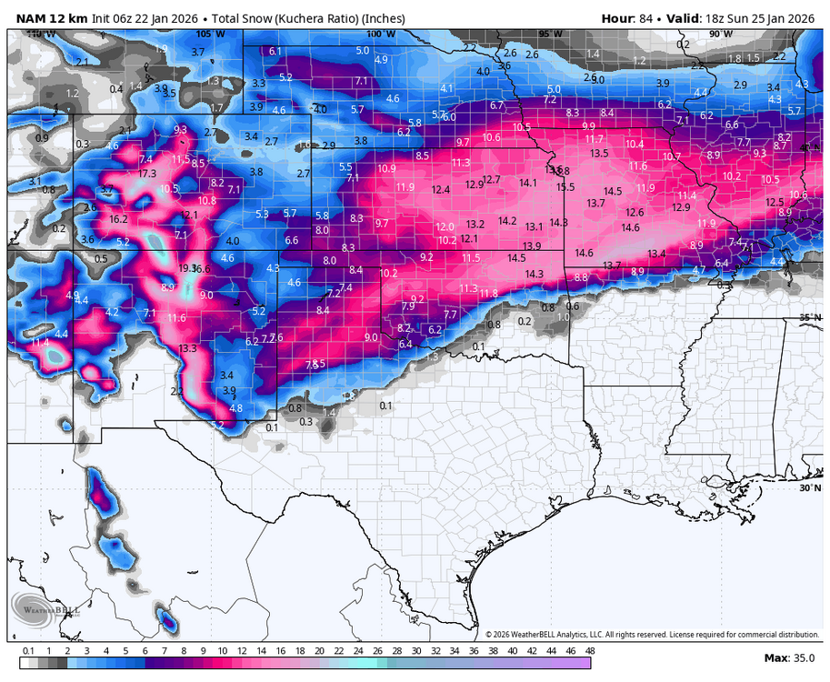
Good morning! The GFS took all of the dropsonde data from the Hurricane Hunters and finally caught up to the Euro. GFS AI & Ensembles also support liquid equivalent moisture over 1/2 inch for most of the area. Here is the 06z operational output: Here is the 06z NAM, too.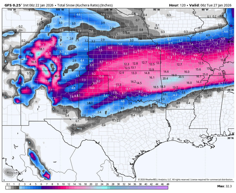
-
MO/KS/AR/OK 2025-2026 Winter Discussion
rockchalk83 replied to stormdragonwx's topic in Central/Western States
This is the 50th percentile 72-hour snowfall off the 19z National Blend of Models. It takes into account the entire non-AI model suite and is what forecasters with the NWS have been using as part of their watch/warning decision process.
-
MO/KS/AR/OK 2025-2026 Winter Discussion
rockchalk83 replied to stormdragonwx's topic in Central/Western States

-
MO/KS/AR/OK 2025-2026 Winter Discussion
rockchalk83 replied to stormdragonwx's topic in Central/Western States
Should be with 00z data, unless I'm mistaken -
MO/KS/AR/OK 2025-2026 Winter Discussion
rockchalk83 replied to stormdragonwx's topic in Central/Western States
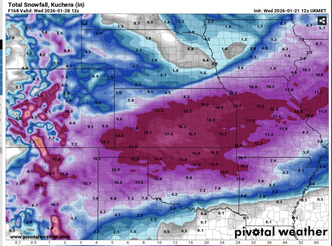
It’s the UKMET, so proceed with caution: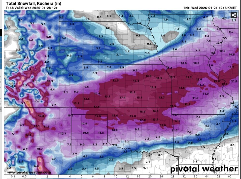
-
MO/KS/AR/OK 2025-2026 Winter Discussion
rockchalk83 replied to stormdragonwx's topic in Central/Western States
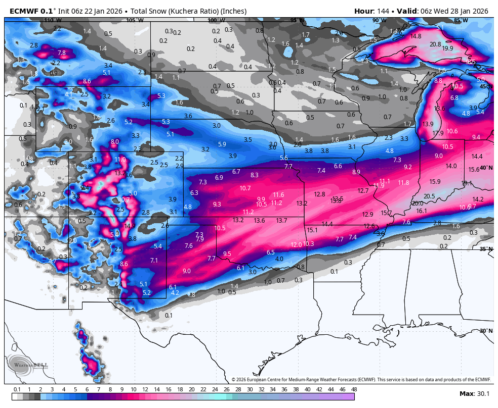
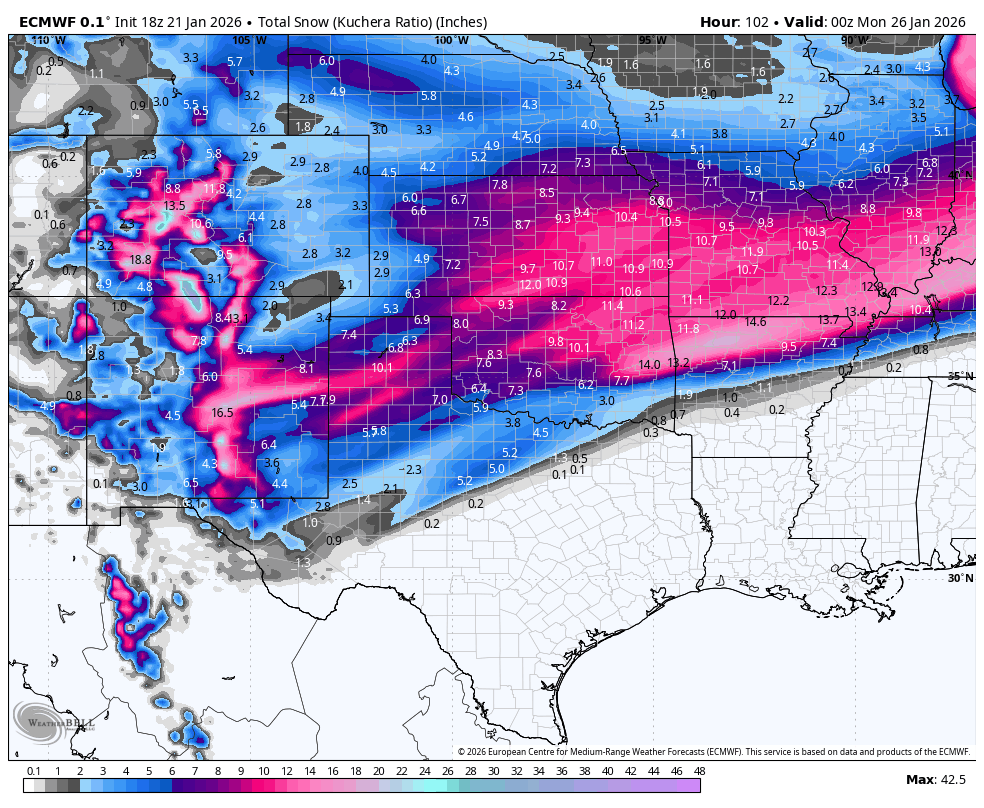
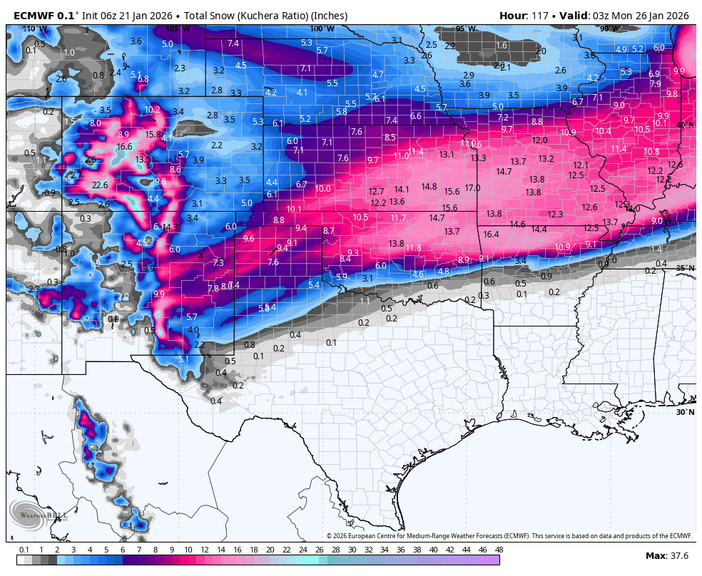
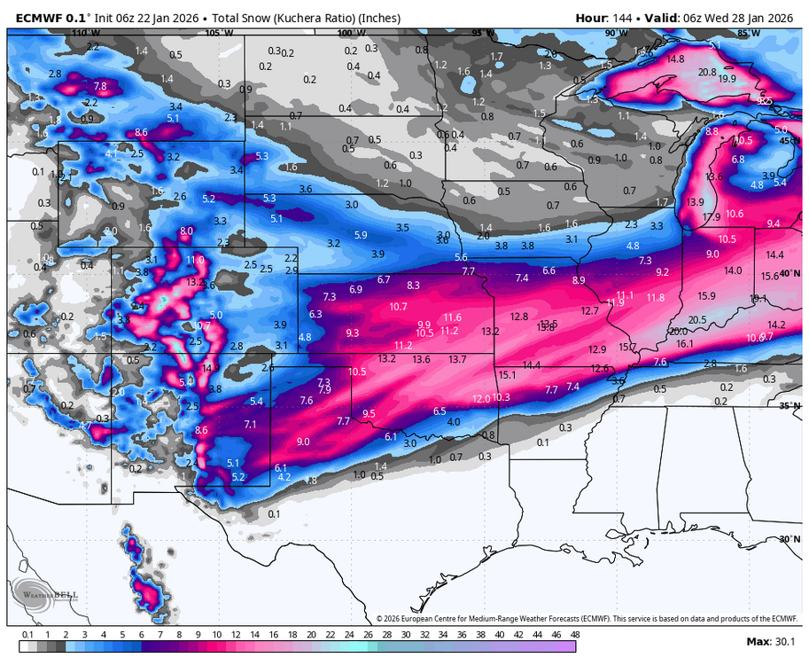
Another banger from the Euro:
-
MO/KS/AR/OK 2025-2026 Winter Discussion
rockchalk83 replied to stormdragonwx's topic in Central/Western States
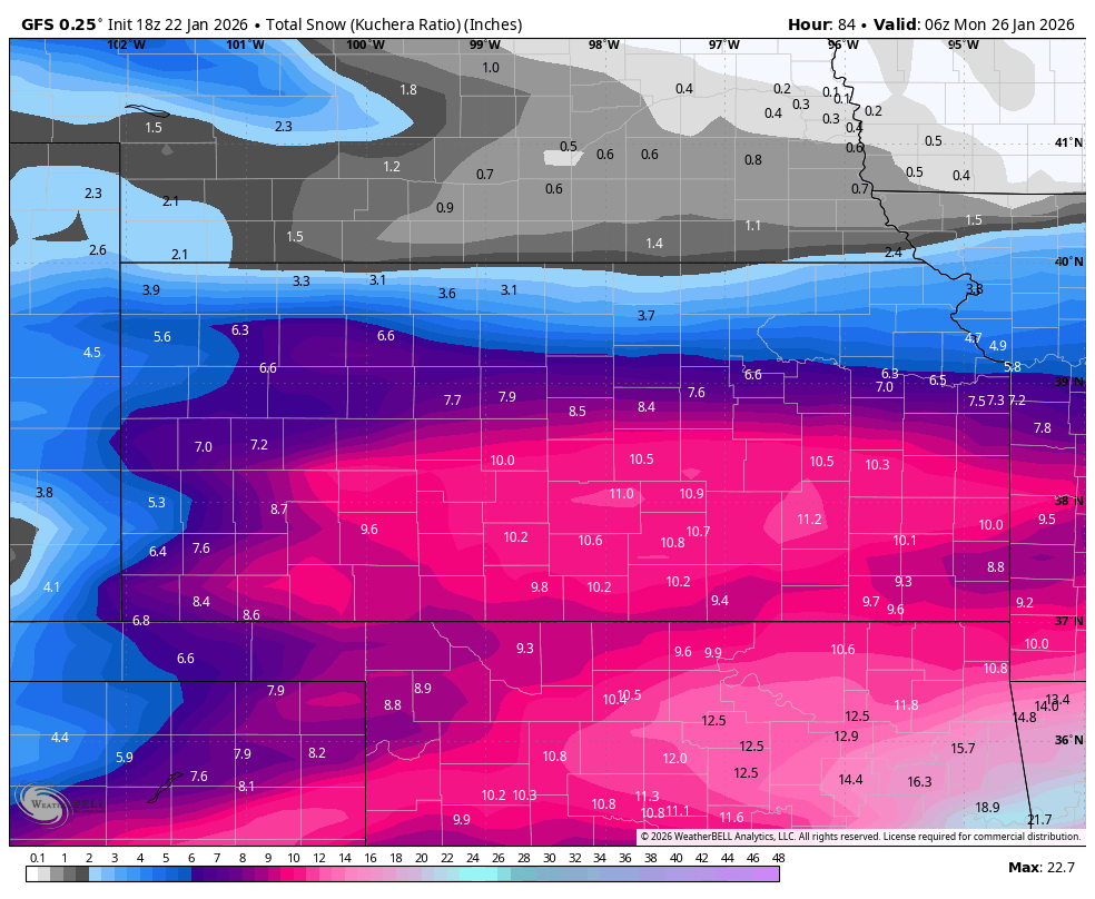
Not the whopper the 00z was, but the 06z GFS is still a good hit for most, with warning criteria snows along and S of US 54: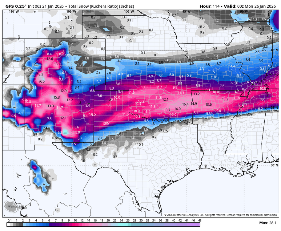
-
MO/KS/AR/OK 2025-2026 Winter Discussion
rockchalk83 replied to stormdragonwx's topic in Central/Western States
The GFS has been trash with this. It's inconsistent within itself and its ensembles. -
MO/KS/AR/OK 2025-2026 Winter Discussion
rockchalk83 replied to stormdragonwx's topic in Central/Western States
For the first time in recorded history, Wichita has achieved 3 straight 70+ degree days in December. This pattern sucks. FWIW, the GFS and Euro both look pretty dry for the next 7-10 days. Ensembles may be picking up on something after that, but variability is extremely high. Looking at 30 days and counting without moisture (for Wichita and southern Kansas)... -
MO/KS/AR/OK 2025-2026 Winter Discussion
rockchalk83 replied to stormdragonwx's topic in Central/Western States
Heady seems insistent that the pattern will turn wetter after the first of the year.