Thinksnow18
-
Posts
4,144 -
Joined
-
Last visited
Content Type
Profiles
Blogs
Forums
American Weather
Media Demo
Store
Gallery
Everything posted by Thinksnow18
-
Upstate/Eastern New York
Thinksnow18 replied to BuffaloWeather's topic in Upstate New York/Pennsylvania
BW be honest that 1 to 3 was QPF driven in your accumulation forecast because no one had this much warn air getting this entrenched into the system...wer3 going to see between .5 and .7 QPF on the Niagara frontier and half of that is being washed down the drain. -
Upstate/Eastern New York
Thinksnow18 replied to BuffaloWeather's topic in Upstate New York/Pennsylvania
Yeah we're getting shafted with no grease...oh well the freezing rain is making for some awesome looking icicles...oh who am I kidding this blows -
Upstate/Eastern New York
Thinksnow18 replied to BuffaloWeather's topic in Upstate New York/Pennsylvania
So some nowcasting...teansit and wehrle in Williamsville/Clarence...rain, sleet, snow...just slop...my early guess as to why they are forecasting 2-4 now is clear...its not a QPF problem but a problem with the type of precip during the beginning part of the storm. -
Upstate/Eastern New York
Thinksnow18 replied to BuffaloWeather's topic in Upstate New York/Pennsylvania
Where's here??? Snowing moderately in Lackawanna and per the wife back in Williamsville. -
Upstate/Eastern New York
Thinksnow18 replied to BuffaloWeather's topic in Upstate New York/Pennsylvania
That's a really big bust Genesee Valley westward -
Upstate/Eastern New York
Thinksnow18 replied to BuffaloWeather's topic in Upstate New York/Pennsylvania
So in other words west of the Genesee River picks up a trace if snow??? This I have to see... -
Upstate/Eastern New York
Thinksnow18 replied to BuffaloWeather's topic in Upstate New York/Pennsylvania
Wow that expanded considerably from yesterday's probabilities. -
Upstate/Eastern New York
Thinksnow18 replied to BuffaloWeather's topic in Upstate New York/Pennsylvania
I've noticed a precipitous drop in the forecasting on WIVB in the past few years, to the point where I question more than I believe. The model showed a clear 4.1 at KBUF and yet he goes lower even though he mentions it will remain all snow and there's been a bump in QPF... -
Upstate/Eastern New York
Thinksnow18 replied to BuffaloWeather's topic in Upstate New York/Pennsylvania
This has become a very exciting start to the winter (were still 36 days away from the solstice) and all the indications are pointing to a blockbuster winter that could be talked about with some of the top analogs like 77 or 03...looks good for a white Thanksgiving for most and that hasn't been the case for years. Game on. -
Upstate/Eastern New York
Thinksnow18 replied to BuffaloWeather's topic in Upstate New York/Pennsylvania
Why so low? And if im not mistaken doesntvthat above map show heavy LES over buffalo??? -
Upstate/Eastern New York
Thinksnow18 replied to BuffaloWeather's topic in Upstate New York/Pennsylvania
Kbuf 4.5" Roc 5.7" Syr. 8.2 Bgm 11.8 -
Upstate/Eastern New York
Thinksnow18 replied to BuffaloWeather's topic in Upstate New York/Pennsylvania
Nice band that formed over Amherst and Williamsville as I was leaving for work -
Upstate/Eastern New York
Thinksnow18 replied to BuffaloWeather's topic in Upstate New York/Pennsylvania
My attention is definitely on Thursday night...already winter storm watches for the interior western southern tier and it looks to be coming in with more QPF giving even KBUF 3 or 4 inches through Friday am. -
Upstate/Eastern New York
Thinksnow18 replied to BuffaloWeather's topic in Upstate New York/Pennsylvania
Yeah im not worried at all. Plus 41 or 42 degrees lake temperature isn't end all especially when I believe sufficient cold air will be around for some time...it will all work out. -
Upstate/Eastern New York
Thinksnow18 replied to BuffaloWeather's topic in Upstate New York/Pennsylvania
Gotta think that if these temp trends continue we are going to have a very BN month temperature wise for November...in fact I'd be willing to bet that from about the 15th of October to now has been very below average and there are only good signs ahead as previously posted above. -
Upstate/Eastern New York
Thinksnow18 replied to BuffaloWeather's topic in Upstate New York/Pennsylvania
Probably just like tomorrow's system...an illusion that Copperfield would be proud of. -
Upstate/Eastern New York
Thinksnow18 replied to BuffaloWeather's topic in Upstate New York/Pennsylvania
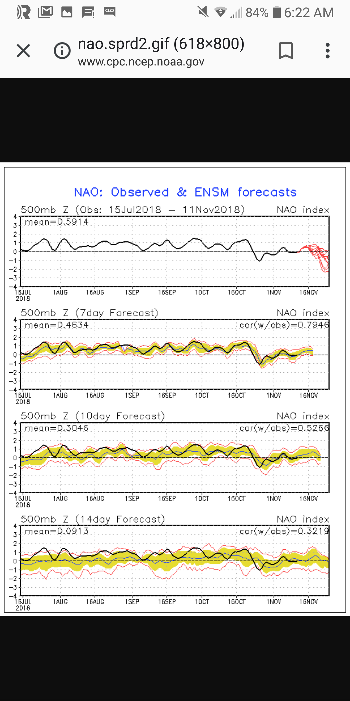
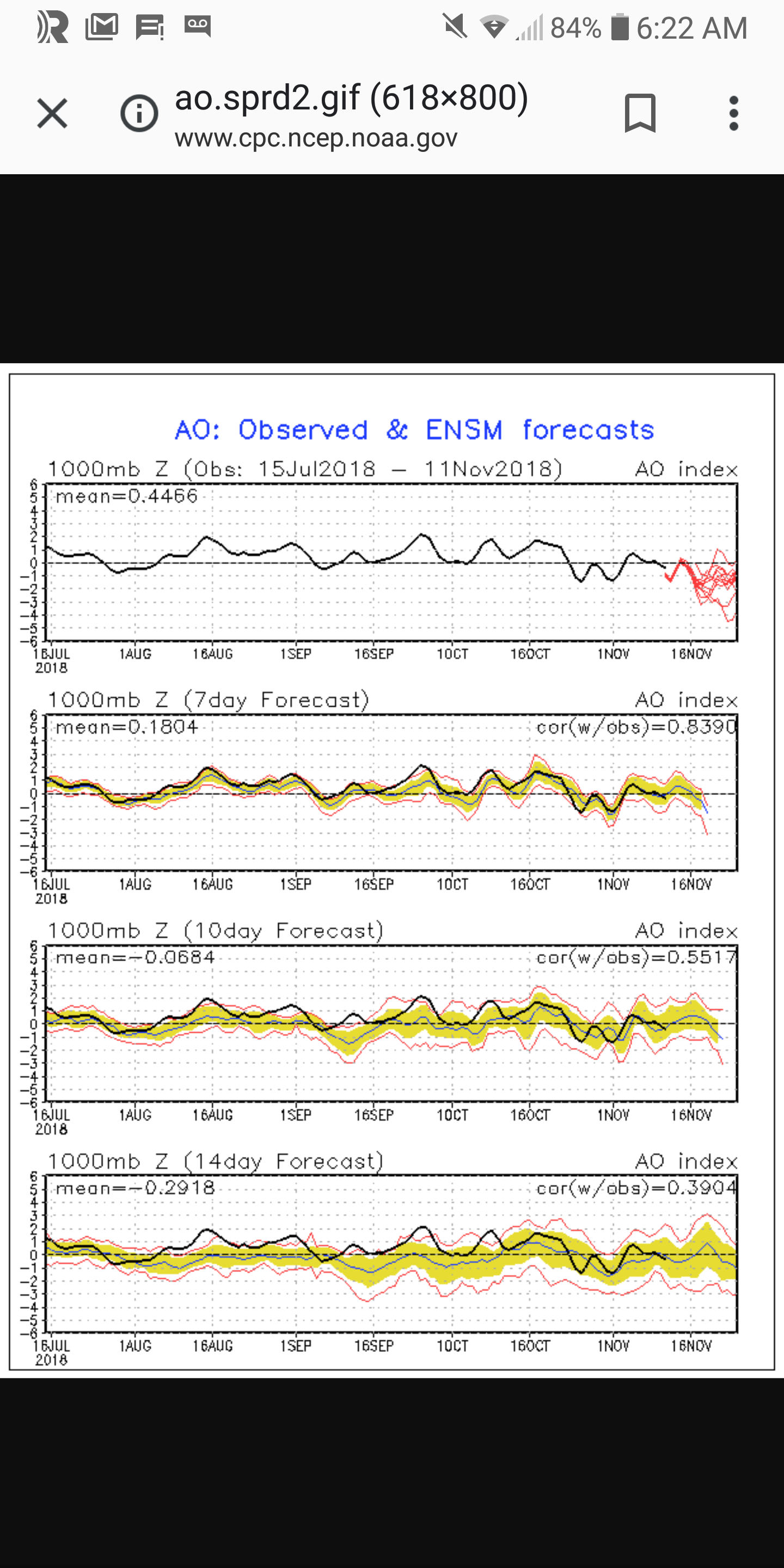
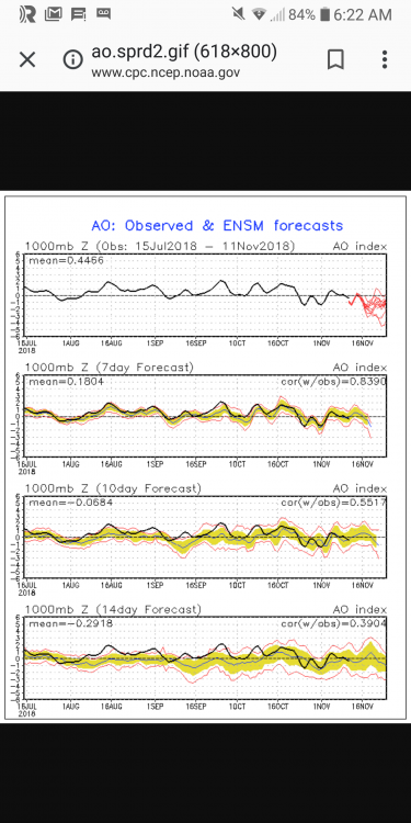
Liking the look of the indices towards the end of the month...definitely trending in the right direction as we head towards meteorological winter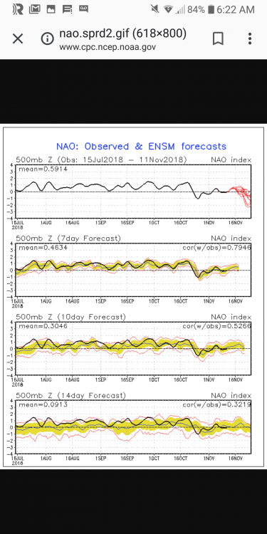
-
Upstate/Eastern New York
Thinksnow18 replied to BuffaloWeather's topic in Upstate New York/Pennsylvania
It does appear that as we approached this storm thermal profiles trended warmer than forecast just 48 hours ago. It does appear likely that it will just be sloppy and a bit slushy at lower levels through Tuesday afternoon when the cold air deepens. Might squeak and inch or two Tuesday evening but I think that's up in the air as well. Looks like November will be below normal when all is said and done but without any great accumulating snows at the lower levels to write home about. Bring on December!!! -
Upstate/Eastern New York
Thinksnow18 replied to BuffaloWeather's topic in Upstate New York/Pennsylvania
Is that, to my untrained eye, a lake response already forming at the eastern end of Lake Erie and out over the eastern Niagara Peninsula??? -
Upstate/Eastern New York
Thinksnow18 replied to BuffaloWeather's topic in Upstate New York/Pennsylvania
18z??? If so just saw the snow forecast 10 to 1 ratio kbuf was 4" ksyr 10"...this has been incredibly consistent the last 24 hours. I'm liking what im seeing...also a bit surprised the WWA is still in effect for northern Erie as latest AFD states most potential for more than 4" is southern Erie and Northwestern Chautauqua. -
Upstate/Eastern New York
Thinksnow18 replied to BuffaloWeather's topic in Upstate New York/Pennsylvania
While I agree about the lake snows being all but dead for metro tomorrow the easterly track of the storm actually takes away any possibility of mixing or even rain at lower elevations Tuesday...AFD out of buffalo just mentioned that while the main storm will be hugging the coast it is the upper trough which will help drag the moisture back and create snow for Monday night and Tuesday...i still think Tuesday is 2 to 4 with a Genesee bonus of 5 in there but it's nit picky honestly -
Upstate/Eastern New York
Thinksnow18 replied to BuffaloWeather's topic in Upstate New York/Pennsylvania
Gotta be honest the temp in Williamsville is still 33 and the radar and observations are showing moderate snow with the back edge of the precip almost upon us...not sure we ever see rain today and im curious about the warm wedge that's supposed to be here by 3 to 4pm. -
Upstate/Eastern New York
Thinksnow18 replied to BuffaloWeather's topic in Upstate New York/Pennsylvania
That track would give WNY about 6 inches of snow...definitely as interesting to me as tomorrow morning is. -
Upstate/Eastern New York
Thinksnow18 replied to BuffaloWeather's topic in Upstate New York/Pennsylvania
I don't have the privilege of seeing the euro...is that mix in CNY or all NY??? -
Upstate/Eastern New York
Thinksnow18 replied to BuffaloWeather's topic in Upstate New York/Pennsylvania
I think where you live is a slam dunk for 3 to 6...where I live in Williamsville a couple at best is my hope.