

Henry's Weather
-
Posts
1,479 -
Joined
-
Last visited
Content Type
Profiles
Blogs
Forums
American Weather
Media Demo
Store
Gallery
Posts posted by Henry's Weather
-
-
2 minutes ago, 40/70 Benchmark said:
That would mean timing the phase perfectly because it tends to elongate during the phasing process, when that inverted trough results form the conduit of energy feeding in from the N stream.
Also would mean that the southern s/w needs to take some primacy and stretch this thing?
-
1 minute ago, 40/70 Benchmark said:
This is the most difficult one I have had...the phasing is so nuanced.
Compound that with pessimistic seasonal memory and terrible BL conditions... big uncertainty. Gives you a sense of why Fisher hasn't tweeted in 3 days, hah
-
Just now, 40/70 Benchmark said:
Working on it now...I had to scrap everything after 12z.
Such a finicky and explosive set-up, would be cool to see you pull a coup
-
4 minutes ago, ORH_wxman said:
Yeah maybe…certainly close. Something like the NAM just a little further south would be pretty epic too.
Essentially what you’re going for if we’re trying for the unicorn is to get that midlevel flow out of the east before it warms above 0C and at the same time we’re turning the lower levels more NE with a stall somewhere south of the islands. You need an entirely closed upper level going underneath LI elongated east-west.
Interesting that the low needs to be elongated for best results, why?
-
1 minute ago, 40/70 Benchmark said:
I think its related to scooter's appendage becoming less prominent.
Think you'll have enough for a first outlook after EPS tonight?
-
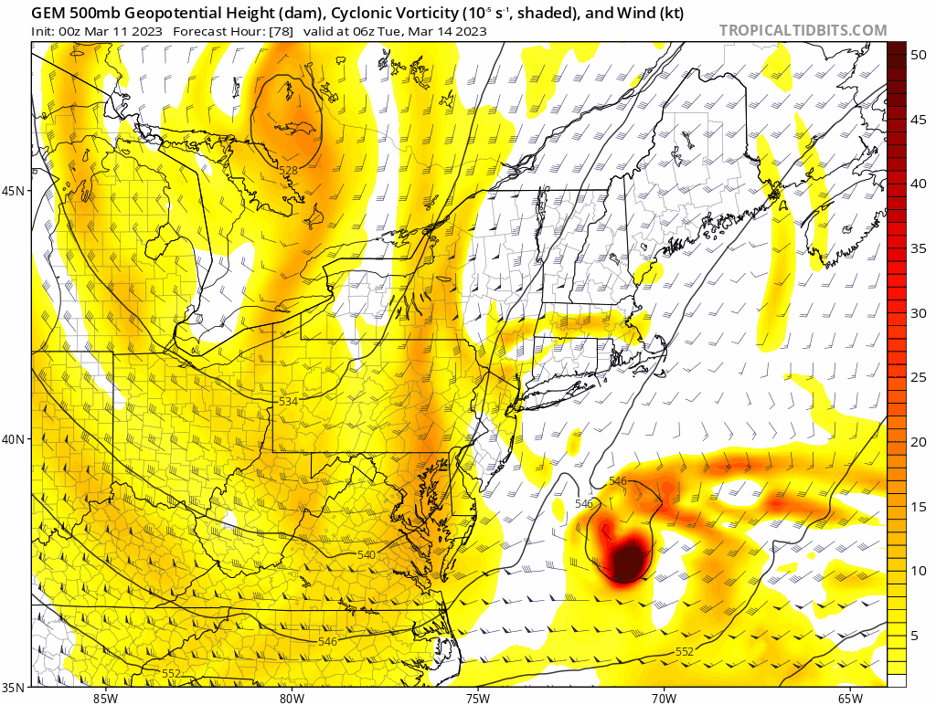
15 minutes ago, ORH_wxman said:
You guys look at clown maps way too much. The GGEM was about as classic as it gets for a pretty widespread heavy snow impact. The H5 was awesome, the midlevels were awesome. I certainly wouldn’t trust the GGEM’s lowest level thermals…prob one of the worst models for that (long with Ukie)
It seems like the GGEM H5 evolution is the best case scenario for most of SNE, bar none. Do you agree?
-
Just now, JoeSnowBOS said:
Lol - it’s called watching every meteo saying the same thing. So it’s this forum vs those that forecast for a living
So, in other words, parroting the forecasts of the knowledgeable?
-
Ukie midlevel are improved
-
2 minutes ago, JoeSnowBOS said:
Rain bomb incoming for coast. Going to be very heavy rain and strong winds at coast and high elevations and inland some heavy snow. Impressive storm for sure
Why are you so certain
-
It's kinda nice that because this year has been so bad, I'm still subconsciously expecting the storm to not materialize
-
1 minute ago, 40/70 Benchmark said:
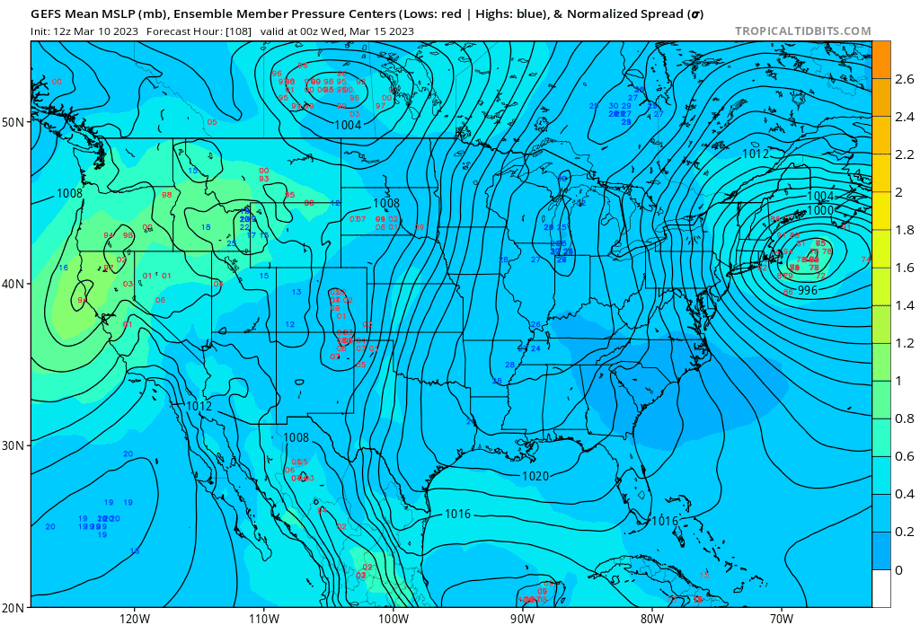
WOW...GEFS improved

Do you think is has to do with approach angle?
-
1 minute ago, 40/70 Benchmark said:
WOW...GEFS improved
Doesn't look like it...

-
 1
1
-
 1
1
-
-
Just now, RUNNAWAYICEBERG said:
I couldn’t care less about the post melt. It’s all about the event.
Not a Pack guy either, I prefer the Vikings
-
 1
1
-
 1
1
-
-
1 minute ago, Typhoon Tip said:
pos run actually.
What do you mean?
-
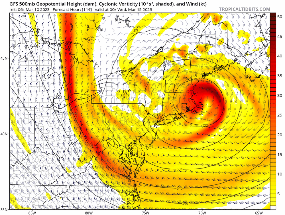
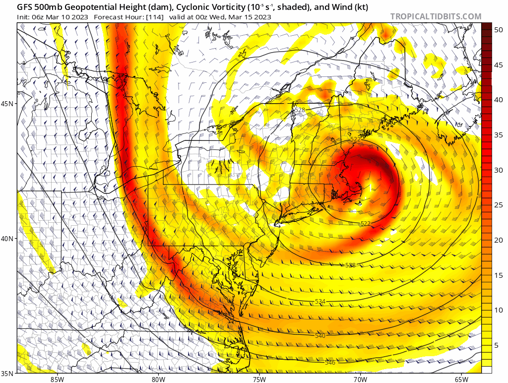
@ORH_wxman Is this what you mean about southern-stream interaction? That little node circling the through
-
-
Ignore P-type at the surface which such a beast
-
1
-
-
High impact event

-
1
-
-
High, high impact event on the CMC. Huge change
-
1 minute ago, weathafella said:
Cmc also. Complete annihilation of just about all of sne. Tonight the low swings we’ll east before slinging back and that’s the difference.
CMC is a CRUSHER.
-
Weaker, further SE
-
9 minutes ago, weathafella said:
We used to have the Dgest or something like that which extended the NAM to 192 hours at 18z. That was kind of nuts.
It shouldn't take you 192 hours to digest something, might wanna get that checked out
-
1
-
-
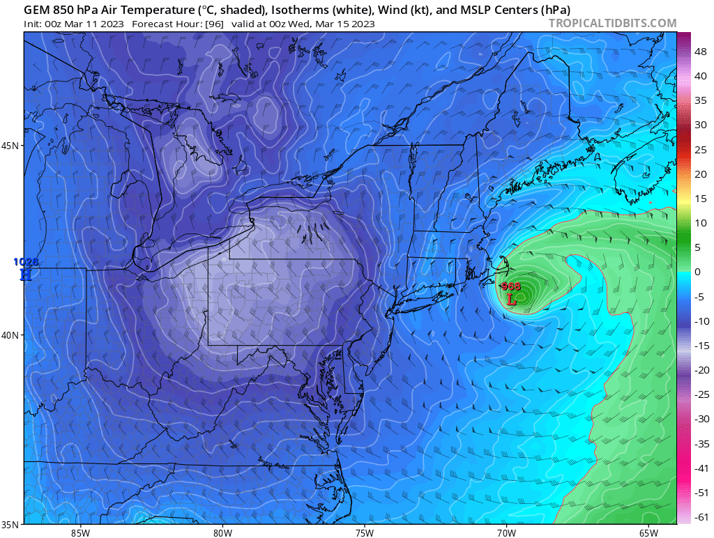
1 minute ago, ORH_wxman said:
Eventually it would but it’s prob going to redevelop somewhere out east when that intense vortmax down in VA keeps pressing eastward. Dec ‘92 did that too…initially captured near Delmarva but then redeveloped east and pinwheeled up to a position south of MVY where it rotted for a bit before finally drifting off E or ESE.
Fascinating
-
2 minutes ago, ORH_wxman said:
I mean, if we start capturing this off the coast of SE NJ, then all of the sudden the parallels become a bit more striking. When we’re flinging the low way east before capture, it wasn’t all that similar…but if you start capturing down there and driving the ULL into MD or VA, then you quickly have a different beast.
Dumb question but wouldn't that situation be a decaying low slowly drifting SE?

The last hurrah? Putting all the eggs in the Tuesday 3/14 basket
in New England
Posted
EC initialized