Henry's Weather
-
Posts
1,726 -
Joined
-
Last visited
Content Type
Profiles
Blogs
Forums
American Weather
Media Demo
Store
Gallery
Everything posted by Henry's Weather
-

The last hurrah? Putting all the eggs in the Tuesday 3/14 basket
Henry's Weather replied to Ginx snewx's topic in New England
Cheap! Just gotta BYOG. Bring your own gat. -
The last hurrah? Putting all the eggs in the Tuesday 3/14 basket
Henry's Weather replied to Ginx snewx's topic in New England
Is the mechanic such that a slower phase would ultimately be what SNE wants? Eg. If N stream is slower, that matters because phase will happen later and therefore more east? Makes me wonder if 1/25 really is a good synoptic-scale analog (for stream interaction). I don't mean to have weenie-goggles here, I just remember the storm movement was S->N and stalling because of a similar interaction -
The last hurrah? Putting all the eggs in the Tuesday 3/14 basket
Henry's Weather replied to Ginx snewx's topic in New England
What specific features should we hope for? A larger western ridge? -
The last hurrah? Putting all the eggs in the Tuesday 3/14 basket
Henry's Weather replied to Ginx snewx's topic in New England
Airbnb in Newburg looking real good... -
The last hurrah? Putting all the eggs in the Tuesday 3/14 basket
Henry's Weather replied to Ginx snewx's topic in New England
Ew -
The last hurrah? Putting all the eggs in the Tuesday 3/14 basket
Henry's Weather replied to Ginx snewx's topic in New England
Listening to a weenie through the walls of a hotel room? -
The last hurrah? Putting all the eggs in the Tuesday 3/14 basket
Henry's Weather replied to Ginx snewx's topic in New England
Wonder if that gets slung back NW -
The last hurrah? Putting all the eggs in the Tuesday 3/14 basket
Henry's Weather replied to Ginx snewx's topic in New England
...Send the eye candy! -
The last hurrah? Putting all the eggs in the Tuesday 3/14 basket
Henry's Weather replied to Ginx snewx's topic in New England
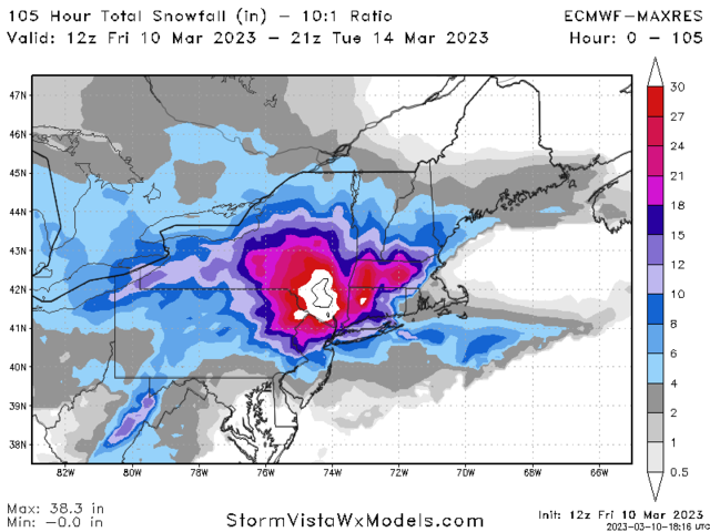
God, looking at the past runs of ECMWF, this is just such a beast of a storm. 48 hour precip, hanging, all occluded and sh*t. Just awesome. -
Ah, so greater intraseasonal variability can anecdotally mask itself as seasonal shift? I could understand that if SD for "severe weather index" increases alongside with mean temperature increases, the window in which significant winter events may occur will expand even if it's an evenly-distributed warming. That said, I've read a few papers which predict that even in the next 50 years, N/S jet orientation is not predicted to move northward in spring, while it is for other seasons.
-
Wonder if this is some little bit of evidence for the seasonal delay theory for CC
-
The last hurrah? Putting all the eggs in the Tuesday 3/14 basket
Henry's Weather replied to Ginx snewx's topic in New England
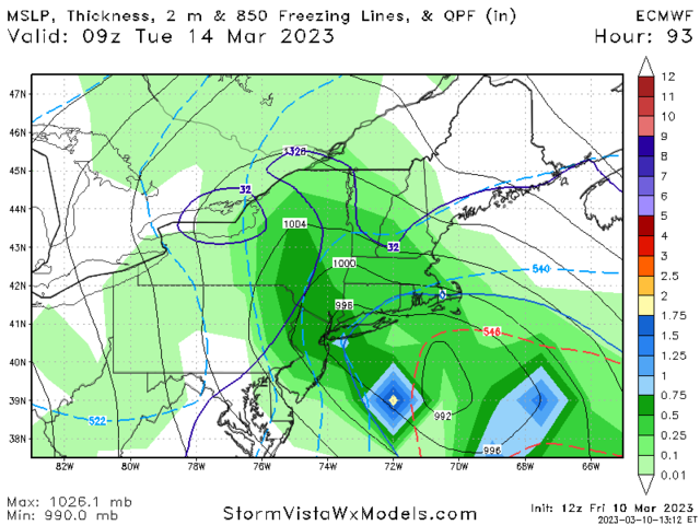
Midlevels seem tucked on ukie. Inland H7 track -
The last hurrah? Putting all the eggs in the Tuesday 3/14 basket
Henry's Weather replied to Ginx snewx's topic in New England
1997? -
The last hurrah? Putting all the eggs in the Tuesday 3/14 basket
Henry's Weather replied to Ginx snewx's topic in New England
Lock it -
The last hurrah? Putting all the eggs in the Tuesday 3/14 basket
Henry's Weather replied to Ginx snewx's topic in New England
There remain two goal posts, spread wide. -
The last hurrah? Putting all the eggs in the Tuesday 3/14 basket
Henry's Weather replied to Ginx snewx's topic in New England
I think I'd be legitimately interested in that. Buying like 40 eggs -
Damn
-
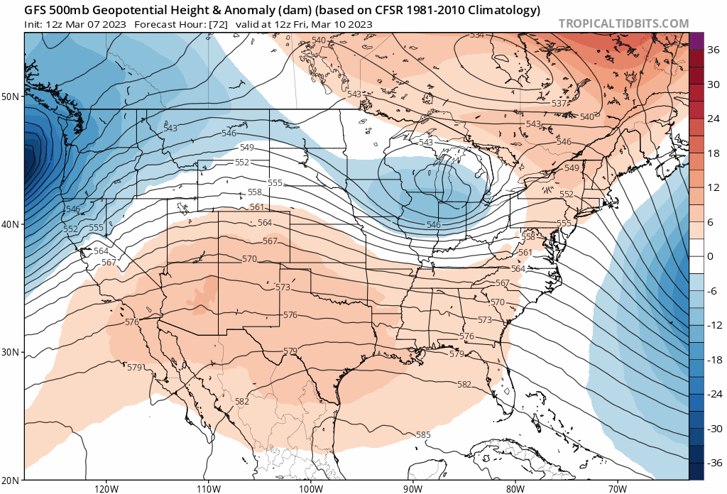
+delta for Omega Block index

-
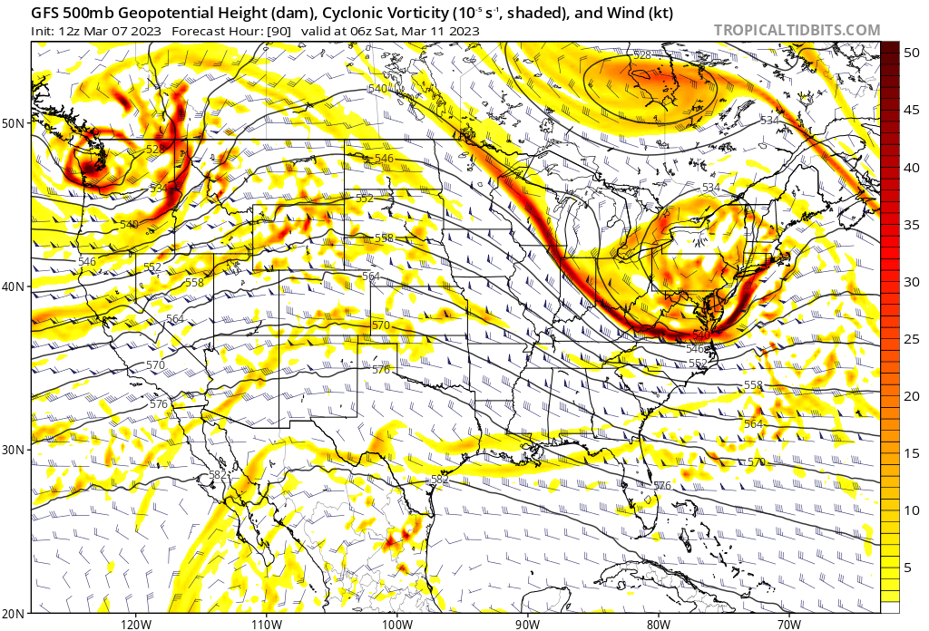
Look at the dance between polar and mid-level lobes

-
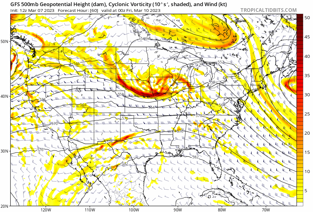
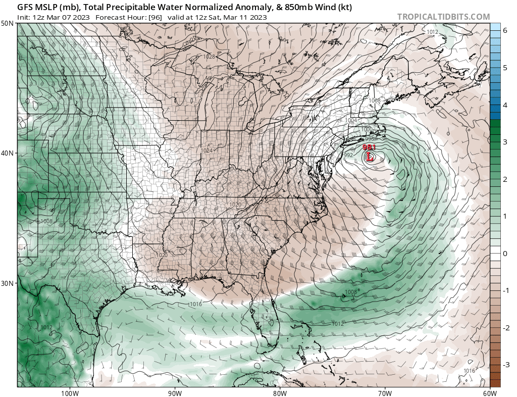
Check out this fetch... I mean, this looks quite good for significant weather.
-
While taking this into consideration of course
-
Notice the difference in presence of polar lobe. Could make a large sensible WX difference


-
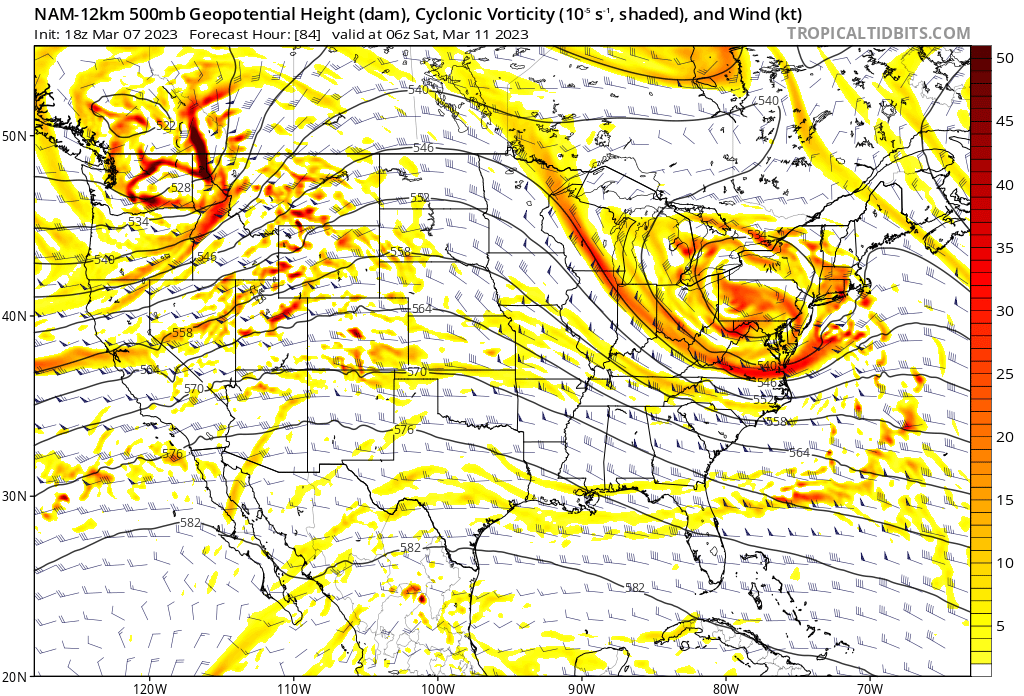
18z NAM has a far healthier H5 shortwave and downstream heights structure (peeling upward) than 12z GFS does, whose paltry QPF printout still leaves me quite stumped.